
Where Flight Simulation Enthusiasts Gather from Around the World!
AVSIM Library - Search Results

| Category: Flight Simulator X - AFCAD Files | |
| SOCA - Felix Eboue Airport - Cayenne (Matoury), French Guiana |

|
Images related to this file:
File Description:
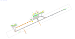
Cayenne - Felix Eboue Airport (French: Aeroport de Cayenne - Felix Eboue) (IATA: CAY, ICAO: SOCA) is French Guiana's main international airport. It is located in the commune of Matoury, 13 km (8 mi) southwest of French Guiana's capital city of Cayenne. Air Guyane Express has its head office on the airport property. The airport currently has service domestically and internationally to points in South America, the Caribbean and Paris via Air Caraibes, Air France, Air Guyane Express and Surinam Airways
Features:
*Expanded parking apron
*Taxiways properly desginated and aligned (included the closing off of most of taxiway Alpha per real world charts)
*Runway markings and lighting corrected
*Parking spots for commercial traffic
*Seperate parking areaa for GA traffic
*Misc airport buildings added
*Airport vehicles and objects throughout the airport
*Fuel service vehicles
*Palm trees added
*Military parking area on the west side of the airport
*Service roads leading to proper navaids
*Parking lot with static vehicles
*Static aircraft
*New control tower
| Filename: | SOCA__Felix_Eboue_Airport__Cayenne_Matoury_French_.zip |
| License: | Freeware |
| Added: | 30th July 2013, 05:37:44 |
| Downloads: | 1,817 |
| Author: | Jaison Diaz / Endeavour AI |
| Size: | 433.26 KB |
| Category: Flight Simulator 2004 - Aircraft Repaints, Textures and Modifications | |
| Fly Pro Boeing 747-281BSF (ER-BAT) |
|
Images related to this file:
File Description:
I bring you the texture I put together of the 747-200BSF from the company FLY PRO (ER-BAT).
FLY PRO is a cargo airline from Moldova and owns a Boeing 747-281BSF with GE CF6-50E2 engines with ER-BAT registration which is used for freight services on several routes in the Middle East and Asia. Fly Pro leased this aircraft from Company Global Service Solutions, based in Dubai.
This aircraft became known worldwide on 14th June 2020 when making a beautiful and exciting landing in the city of Florianopolis (Brazil) coming from Guangzhou (China), with stopovers in Bahrain and Accra, this charter flight brought a load of masks from China. It is not common to see a 747-200 in activity nowadays, there are just over 20 specimens still flying in the world, this ER-BAT is 33 years old.
This texture was assembled from the texture of the Southern Air Cargo 747-200FSCD aircraft that was painted by Chris Takahashi and is to be used with the Project Opensky model by Hiroshi Igami.
| Filename: | Fly_Pro_Boeing_747281BSF_ERBAT.zip |
| License: | Freeware |
| Added: | 21st June 2020, 19:57:47 |
| Downloads: | 161 |
| Author: | Claudio Luiz |
| Size: | 4.15 MB |
| Category: Prepar3D V1-4 - Scenery | |
| Loreto Marche Italy N 43.26.27 E 13.36.36 |
|
File Description:
Loreto Marche Italy (N 43.26.27 E 13.36.36) Loreto is an Italian town in the province of Ancona in the Marche region
and is famous for being the headquarters of the Basilica of the Santa Casa, one of the most important and ancient places
of Marian pilgrimage in the Catholic world. The city rises on the top of a gentle hill, with a wide countryside around
characterized by the cultivation of the olive tree. The shape of the dome and the bell tower of the Basilica, whose
top is the figure of the Madonna, stands out for its height and majesty. The Basilica houses the famous relic of the
"Holy House" of Nazareth where, according to tradition, the Virgin Mary was born and lived where he received the
announcement of the miraculous birth of Jesus. The panorama that can be enjoyed ranges from the Adriatic Sea to Monte
Conero, up to the Umbrian-Marche Apennines. Important VFR point for approaching airport Ancona Falconara. Within the
downloaded package you will find readme files for scenery installation. Good fly VFR. Pasquale Marrulli.
| Filename: | Loreto_Marche_Italy_N_432627_E_133636.zip |
| License: | Freeware |
| Added: | 4th May 2018, 04:42:54 |
| Downloads: | 163 |
| Author: | Pasquale Marrulli |
| Size: | 19.22 KB |
| Category: Prepar3D V1-4 - Scenery | |
| Valdez Alaska USA N61.06.53 W146.19.52 and Tatitlek Alaska USA N6052.00 W146.41.37 |
|
File Description:
Valdez Alaska USA N61.06.53 W146.19.52 The town is positioned at the head of a fjord on the eastern side of the Prince William Strait (at the end of the Valdez bay). It is surrounded by the Chugach mountains with many glaciers and peaks up to 2100 m above sea level. Although the northernmost port in North America is free of ice all year round. It is also the northernmost point of the Pacific coastal forest located in the 107-meter hill southwest of the town called Blueberry Hill. Valdez has an ICAO PAVD airport that in the scenario in addition to the city of Valdez you will also find a small village called Tatitlek Alaska USA N6052.00 W146.41.37 with related ICAO 7KA airport airports infrastructures have been improved with the addition of a port for landing ships and seaplanes on Valdez and Tatitlek. Important VFR point for approaching airport and seairport PAVD and 7KA.
Within the downloaded package you will find readme files for scenery installation. Good fly VFR. Pasquale Marrulli.
| Filename: | Valdez_Alaska_USA_N610653_W1461952_and_Tatitlek_Al.zip |
| License: | Freeware |
| Added: | 21st May 2018, 22:35:56 |
| Downloads: | 230 |
| Author: | Pasquale Marrulli |
| Size: | 3.27 MB |
| Category: Flight Simulator X - Aircraft Repaints, Textures and Modifications | |
| Lufthansa "Precious Cargo" Embraer EMB-505 Phenom 300 (D-ILHF) |
|
Images related to this file:
File Description:

I don't think Lufthansa Cargo actually flies a Phenom 300 with the "Precious Cargo" repaint but, if they did, I bet it would be similar to this one. This is intended for those special flights that are more than urgent, and the cargo is more special than normal, hence the "Precious Cargo". D-ILHF would be used for those downtown or city center airports that the Gulfstreams or Falcons can't get into and out of. I made this repaint with the modern cargo haulers in mind, not necessarily the 'cargo dogs' with the mid-night and red eye runs and using aircraft with questionable maintenance and those that never seem to get washed and waxed. Not this one, it is kept in the hangar when not in use and is always in pristine condition. It come with a small red square of carpet for those times that the "Precious Cargo" can walk to the cabin door. Use only with the payware version of the Carenado EMB-505 Phenom 300 for FSX, P3D, and FSX:Steam. Hope you enjoy the repaint.
| Filename: | Lufthansa_Precious_Cargo_Embraer_EMB505_Phenom_300.zip |
| License: | Freeware |
| Added: | 12th November 2015, 16:18:50 |
| Downloads: | 687 |
| Author: | Ray Marshall |
| Size: | 26.56 MB |
| Category: X-Plane - Scenery | |
| BR GO SDXF - Alto Paraiso Airfield v1.0.0 |
|
Images related to this file:
File Description:
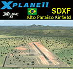
This is an X-Plane 11 and X-Plane 10 scenery package for Alto Paraiso de Goias Airfield (ICAO: SDXF), which is the airfield serving Alto Paraiso, Goias, in Brazil. It includes corrected aprons, ramps, gates, taxiways, lighting system, city buildings, ortho-photoscenery for the airfield area, and (XP11 only) airport ground services (like push back). Alto ParaÃso de Goiás (usually referred to as Alto ParaÃso) is a municipality in northeastern Goiás state, Brazil. It has become known for its ecological and New Age tourism. Alto ParaÃso is part of Chapada dos Veadeiros. It lies 230 km northeast of the federal capital BrasÃlia/SBBR and 423 from the state capital Goiania/SBGO. This scenery was tested and is operational (as of May 21, 2017) in "X-Plane 11.01 64 bit", Windows 10 Home. It was also tested and is also operational (as of May 21, 2017) in "X-Plane 10.51 64 bit", Windows 10 Home. Only the default X-Plane 11 libraries, by Laminar Research, are needed. No third party libraries are used.
| Filename: | BR_GO_SDXF__Alto_Paraiso_Airfield_v100.zip |
| License: | Freeware |
| Added: | 21st May 2017, 16:41:16 |
| Downloads: | 79 |
| Author: | Rui Mesquita |
| Size: | 14.76 MB |
| Category: X-Plane - Scenery | |
| BR RJ SBBZ - Buzios Airport v1.0.0 |
|
Images related to this file:
File Description:
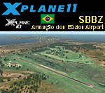
This is an X-Plane 11 and X-Plane 10 scenery package for Umberto Modiano Airport (IATA: BZC, ICAO: SBBZ), which is the airport serving Armacao dos Buzios, Brazil. It is named after Umberto Modiano, a local businessman who financially supported the emancipation movement of Armação dos Búzios as an independent municipality, which was completed in 1995.
It includes corrected aprons, ramps, gates, taxiways, lighting system, city buildings, ortho-photoscenery for the airfield area, and (XP11 only) airport ground services (like push back).
The airport was inaugurated in 2003 and it is dedicated to general aviation. On July 11, 2012 the facility was temporarily closed to conduct renovation works demanded by the National Civil Aviation Agency of Brazil. However, on May 28, 2016, after completing the renovations and legal procedures, the airport was again opened for general aviation.
This scenery was tested and is operational (as of January 16, 2018) in "X-Plane 11.11 64 bit", Windows 10 Home. It was also tested and is also operational (as of January 16, 2018) in "X-Plane 10.51 64 bit", Windows 10 Home.
| Filename: | BR_RJ_SBBZ__Buzios_Airport_v100.zip |
| License: | Freeware |
| Added: | 2nd February 2018, 00:12:38 |
| Downloads: | 61 |
| Author: | Rui Mesquita |
| Size: | 8.35 MB |
| Category: X-Plane - Scenery | |
| BR PA SBCJ - Carajas Airport v1.0.0 |
|
Images related to this file:
File Description:
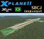
This is an X-Plane 11 and X-Plane 10 scenery package for Carajás Airport (IATA: CKS, ICAO: SBCJ), which is the airport serving Carajás and Parauapebas, Pará, in Brazil.
It includes corrected aprons, ramps, gates, taxiways, lighting system, city buildings, ortho-photoscenery for the airfield area, and (XP11 only) airport ground services (like push back).
It is located in the Carajás Mining Complex. The airport was built by Companhia Vale do Rio Doce as a support the mining activities of Carajás Mine. It was inaugurated on September 23, 1982. Since 1985 it is administrated by Infraero. Airlines and destinations include:
- Azul Brazilian Airlines to/from: Belo Horizonte/SBCF, Marabá/SBMA.
- Gol Airlines to/from: Belém/SBBE, Belo Horizonte/SBCF.
This scenery was tested and is operational (as of January 17, 2018) in "X-Plane 11.11 64 bit", Windows 10 Home. It was also tested and is also operational (as of January 17, 2018) in "X-Plane 10.51 64 bit", Windows 10 Home.
| Filename: | BR_PA_SBCJ__Carajas_Airport_v100.zip |
| License: | Freeware |
| Added: | 2nd February 2018, 00:13:46 |
| Downloads: | 65 |
| Author: | Rui Mesquita |
| Size: | 11.76 MB |
| Category: Flight Simulator X - AFCAD Files | |
| LYUZ - Ponikve airport - Uzice, Serbia |
|
File Description:
Uzice Ponikve Airport (Serbian: Aerodrom Uzice Ponikve) (IATA: UZC, ICAO: LYUZ); also known as Lepa Glava (literally: Beautiful Head) is an airport in the western part of Serbia. The airport is located at Ponikve (literally: Sinkholes) plateau: 8 km (5 mi) southwest from the Jelova Gora, 11 km (7 mi) east from the Mount Tara, 12 km (7.5 mi) northwest from the city of Uzice, 13 km (8 mi) southeast from the town of Bajina Basta, 19 km (12 mi) northeast from the popular tourist center with unique attractions of the Mokra Gora, 20 km (12.5 mi) north from the Mount Zlatibor, 20 km (12.5 mi) southwest from the town of Kosjeric, 27 km (17 mi) northwest from the town of Pozega, 32 km (20 mi) southwest from the Mountain resort Divcibare, 35 km (22 mi) northeast from the town of Visegrad in Republic of Srpska (BiH), 50 km (31 mi) northwest from the Mount Zlatar. The airport is partially reconstructed in order to become an international airport. Charts included
| Filename: | LYUZ__Ponikve_airport__Uzice_Serbia.zip |
| License: | Freeware |
| Added: | 18th August 2016, 03:56:56 |
| Downloads: | 245 |
| Author: | Danilo Jankovic |
| Size: | 3.56 MB |
| Category: Flight Simulator 2002 - Scenery | |
| Alaska Bush Scenery: Stony River Bend & Old Stony |
|
File Description:
Here's your big chance to take-off and land using a curved airstrip. Stony River Bend is located just west of Merrill Pass, very close to Tom Fica's cabin at Two Lakes (part of his 'Merrill Pass' scenery add-on). The bumpy dirt runway - becoming slightly overgrown and prone to waterlogging - is marked out with wooden posts (lit at night) and presents a unique challenge: one that I haven't really sorted out just yet! There's a small settlement just up a log-lined trail from the airfield with a gravel service track connecting with a basic NDB/DME facility to help out with night or low visibility approaches. Although Stony River Bend is fictional, it has been based loosely on a real life runway at Elk City in Idaho. Three miles downstream is another simple backwoods strip called Old Stony - the narrow gravel runway here is conventional, but it's probably in an even worse state of repair. Designed for use with Eddie Denney's FS2002 mesh of Alaska, but the scenery is usable without it.
| Filename: | Alaska_Bush_Scenery_Stony_River_Bend__Old_Stony.zip |
| License: | Freeware, limited distribution |
| Added: | 31st March 2003, 13:09:28 |
| Downloads: | 1,873 |
| Author: | James Belk |
| Size: | 2.04 MB |
© 2001-2026 AVSIM Online
All Rights Reserved
Privacy Policy |