
Where Flight Simulation Enthusiasts Gather from Around the World!
AVSIM Library - Search Results

| Category: Flight Simulator 2002 - Adventures | |
| NDB/VOR Approach to Moorabbin |

|
File Description:
This GA adventure provides 3 starting points for the
approach to Moorabbin as shown on the provided
approach chart. One from overhead the Melbourne VOR,
Cowes VOR & the Moorabbin NDB respectively.
Includes: Background ATC, on-board co-pilot and
custom-made pre-flight briefing application.
By Fermin Fernandez (fsadventures.net)
| Filename: | NDBVOR_Approach_to_Moorabbin.zip |
| License: | Freeware, limited distribution |
| Added: | 12th April 2003, 00:02:56 |
| Downloads: | 984 |
| Author: | Fermin Fernandez |
| Size: | 4.55 MB |
| Category: Flight Simulator 2002 - Adventures | |
| Approach to Sydney RWY16R |
|
File Description:
Virgin 805 dusk approach to Sydney using the actual procedures in the busy Sydney airspace. Expect radar vectors for RWY16R. Features: Real background ATC specific to each frequency, on-board first officer reads out approach & final checklists, pre-flight briefing documentation & approach chart included. By Fermin Fernandez (fsadventures.net).
| Filename: | Approach_to_Sydney_RWY16R.zip |
| License: | Freeware, limited distribution |
| Added: | 21st November 2002, 20:54:46 |
| Downloads: | 4,564 |
| Author: | Fermin Fernandez |
| Size: | 2.36 MB |
| Category: Flight Simulator X - AFCAD Files | |
| CYXX Abbotsfor Intl - British Columbia, Canada. |
|
File Description:
This airport has been completely reworked using ADE v1.39 and satellite images from Google Earth and Microsoft Virtual Earth. Both runways have been extended to correct length: 01/19 from 5260ft to 5328ft and 07/25 from 7988ft to 9600ft (see attach airport chart). Thesholds have been corrected. VASI updated on both runwaysw. Xwind runways activated. Roads, buildings and apron areas updated. Static aircraft, vehicles, vegetation, fuel truck and automated jetways added. I have added flood lights to cover ramp and parking areas also red obstruction lights have been added to some taller buildings. These lights are visibled between the hours of dusk and dawn. For these light to be visible the included folder - FSX_LTS - must be placed in your Addon Scenery folder and activated.
| Filename: | CYXX_Abbotsfor_Intl__British_Columbia_Canada.zip |
| License: | Freeware |
| Added: | 5th November 2009, 02:16:29 |
| Downloads: | 661 |
| Author: | Robert Catherall |
| Size: | 936.14 KB |
| Category: Flight Simulator 2002 - Panels | |
| Douglas DC-3 Buffalo Airways Panel Update |
|
File Description:
Requires DC3BUFFA.ZIP to be installed first. Corrects erroneous bitmap bleedthrough and disappearing overhead switches in certain resolutions, enables standby radios, replaces VOR2 and ADF with RMI ADF/VOR2, replaces Altimeter with standard gauge enabling manual altimeter setting, adds Radio Altimeter and pop-up chart of the Hay River/Yellowknife area.
| Filename: | Douglas_DC3_Buffalo_Airways_Panel_Update.zip |
| License: | Freeware |
| Added: | 24th July 2003, 17:50:47 |
| Downloads: | 1,792 |
| Author: | Mark Beaumont |
| Size: | 990.13 KB |
| Category: X-Plane - Utilities | |
| X-Plane 10 Keys (all default keys) |
|
Images related to this file:
File Description:
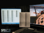
X-Plane 10 Keys (all default keys)
This is a complete listing of all default Keys for X-Plane 10
This package includes:
Printable PDF version ( print and laminate your own chart )
Keys-list in PNG (photo) format to be used on a second monitor .
Enjoy
Leen de Jager
www.flybike-paints.nl
| Filename: | XPlane_10_Keys_all_default_keys.zip |
| License: | Freeware, limited distribution |
| Added: | 26th June 2013, 12:53:09 |
| Downloads: | 508 |
| Author: | Leen "Flybike" de Jager |
| Size: | 1.75 MB |
| Category: Flight Simulator X - Aircraft Repaints, Textures and Modifications | |
| Corsair Airbus A330-200 (F-HBIL) |
|
Images related to this file:
File Description:
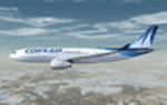
Corsair texture for the payware BlackBox A330 Prologue model. Only for FSX. Engine R.R. Registration F-HBIL, serial number Airbus A320 release for first flight 21/3/2000. Textures made in HD4098 with night and specular ready. Corsair new paint color design with shadow layers and color code graph chart respected.
| Filename: | Corsair_Airbus_A330200_FHBIL.zip |
| License: | Freeware, limited distribution |
| Added: | 14th December 2013, 19:32:34 |
| Downloads: | 1,045 |
| Author: | Bigot Manuel |
| Size: | 7.61 MB |
| Category: Flight Simulator 2002 - Scenery | |
| Add-On 2 for Suisse 2002 |
|
File Description:
This archive will add a lot of boats and sailing boats on the biggest lakes of Switzerland. It will add also some harbours. The biggest boats have night texture and the sailing boats are only visible during spring and summer. It includes also the missing VAC (Visual approach chart) for LSGY.
| Filename: | AddOn_2_for_Suisse_2002.zip |
| License: | Freeware |
| Added: | 20th February 2003, 12:59:23 |
| Downloads: | 3,991 |
| Author: | Daniel Gauthier |
| Size: | 4.58 MB |
| Category: Navigation and ATC - Navigation | |
| Lake Huron Chart Chunks Optimized For Moving Map Application |
|
File Description:
Sectional chart chunks made from the August 2009 Sectional charts at the original scale, formatted in the WGS84 lat/lon geographic coordinate system for GPS, moving map application for flight simulation use.
These chart chunks were converted to the JPEG format for compatibility and size. Coverage is the full Sectional area North and South divided into 8 JPEG tiles. They are about 3k x 3k pixels at 2.5mb with coverage of 90nm x 130nm per tile. Included is also the projection files and world files.
Note: This type of map is a equal grid and no further calibration is needed, only the two points referenced in the world file. Example: for users of FSM Moving Map, just mass import, done.
| Filename: | Lake_Huron_Chart_Chunks_Optimized_For_Moving_Map_A.zip |
| License: | Freeware |
| Added: | 20th February 2010, 22:08:53 |
| Downloads: | 129 |
| Author: | David Myers |
| Size: | 20.82 MB |
| Category: Navigation and ATC - Navigation | |
| Kansas City Chart Chunks Optimized For Moving Map Application |
|
File Description:
Sectional chart chunks made from the August 2009 Sectional charts at the original scale, formatted in the WGS84 lat/lon geographic coordinate system for GPS, moving map application for flight simulation use.
These chart chunks were converted to the JPEG format for compatibility and size. Coverage is the full Sectional area North and South divided into 8 JPEG tiles. They are about 3k x 3k pixels at 2.5mb with coverage of 90nm x 130nm per tile. Included is also the projection files and world files.
Note: This type of map is a equal grid and no further calibration is needed, only the two points referenced in the world file. Example: for users of FSM Moving Map, just mass import, done.
| Filename: | Kansas_City_Chart_Chunks_Optimized_For_Moving_Map_.zip |
| License: | Freeware |
| Added: | 20th February 2010, 23:07:30 |
| Downloads: | 116 |
| Author: | David Myers |
| Size: | 18.54 MB |
| Category: Navigation and ATC - Navigation | |
| Green Bay Chart Chunks Optimized For Moving Map Application |
|
File Description:
Sectional chart chunks made from the August 2009 Sectional charts at the original scale, formatted in the WGS84 lat/lon geographic coordinate system for GPS, moving map application for flight simulation use.
These chart chunks were converted to the JPEG format for compatibility and size. Coverage is the full Sectional area North and South divided into 8 JPEG tiles. They are about 3k x 3k pixels at 2.5mb with coverage of 90nm x 130nm per tile. Included is also the projection files and world files.
Note: This type of map is a equal grid and no further calibration is needed, only the two points referenced in the world file. Example: for users of FSM Moving Map, just mass import, done.
| Filename: | Green_Bay_Chart_Chunks_Optimized_For_Moving_Map_Ap.zip |
| License: | Freeware |
| Added: | 20th February 2010, 23:41:23 |
| Downloads: | 109 |
| Author: | David Myers |
| Size: | 18.82 MB |
© 2001-2026 AVSIM Online
All Rights Reserved
Privacy Policy |