
Where Flight Simulation Enthusiasts Gather from Around the World!
AVSIM Library - Search Results

| Category: Flight Simulator 2004 - Scenery | |
| Himalayas LOD9 Base Mesh, Volume 3 - Southwestern Ranges |

|
Images related to this file:
File Description:
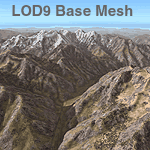
Detailed terrain mesh of the Southwestern Himalayan Ranges, N28-37 E78-82. The files in this package are based on Shuttle Radar (SRTM) Version 2 data but with many of the void areas, especially the most significant sections, filled with elevation data generated from topographic maps by Jonathan de Ferranti. While Jonathan's work is unrelated to flight simulation he kindly gave me permission to compile his data for use in FS. The result is a wonderful improvement in detail and accuracy over any existing mesh file, freeware or commercial, based on SRTM or DTED data alone.
Due to the large area of the Himalayas I've compiled the source data as two separate series: the "Himalayan Peaks" series covers prominent mountains and ranges in higher detail and locally overrides any existing LOD9 terrain mesh. In addition, the LOD9 "base mesh" series, with LOD8 and LOD7 "buffer" mesh files, covering the entire Himalayas, is meant for those who do not yet have an add-on terrain mesh of these beautiful mountains.
| Filename: | Himalayas_LOD9_Base_Mesh_Volume_3__Southwestern_Ra.zip |
| License: | Freeware, limited distribution |
| Added: | 30th May 2010, 10:00:26 |
| Downloads: | 155,808 |
| Author: | Holger Sandmann, Jonathan de Ferranti |
| Size: | 62.16 MB |
| Category: Flight Simulator 2004 - AI Aircraft | |
| RAF Leeming 1990 - Tornado F3s |
|
Images related to this file:
File Description:
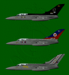
This is the last of the three bases that I have covered with the Tornado F3. RAF leeming was the second base to receive the F3 after RAF Coningsby, with the formation of No. 11 Sqn in July 1988.
No. 23 Sqn followed in the November and No. 25 Sqn was the last in February of 1989.
These paints represent the aircraft as they were in 1990. I have included the 11 Sqn boss bird of David Hamilton, 11 Sqn's first Commanding Officer on the F3, and the two 75th Anniversary aircraft of 23 & 25 Sqns. They are all DXT3 and mipped, with customized alpha channels to represent different payloads.
There are flightplans included, but these are what I would call station-heavy, none of the aircraft stay away overnight and all need spots. How you resolve this is up to you but I won't be providing any other plans for these......just yet......
You will need to download or have in your system, the Panavia Tornado F3 by Fernando Martinez (ai_tornado.zip)
| Filename: | RAF_Leeming_1990__Tornado_F3s.zip |
| License: | Freeware, limited distribution |
| Added: | 1st February 2013, 21:05:25 |
| Downloads: | 429 |
| Author: | Daryl Payne, Fernando Martinez |
| Size: | 8.39 MB |
| Category: Flight Simulator 2004 - Scenery | |
| Himalayas LOD9 Base Mesh, Volume 4 - Kashmir and Jammu |
|
File Description:
Detailed terrain mesh of the Kashmir and Jammu Ranges, N30-39 E76-78. The files in this package are based on Shuttle Radar (SRTM) Version 2 data but with many of the void areas, especially the most significant sections, filled with elevation data generated from topographic maps by Jonathan de Ferranti. While Jonathan's work is unrelated to flight simulation he kindly gave me permission to compile his data for use in FS. The result is a wonderful improvement in detail and accuracy over any existing mesh file, freeware or commercial, based on SRTM or DTED data alone.
Due to the large area of the Himalayas I've compiled the source data as two separate series: the "Himalayan Peaks" series covers prominent mountains and ranges in higher detail and locally overrides any existing LOD9 terrain mesh. In addition, the LOD9 "base mesh" series, with LOD8 and LOD7 "buffer" mesh files, covering the entire Himalayas, is meant for those who do not yet have an add-on terrain mesh of these beautiful mountains.
| Filename: | Himalayas_LOD9_Base_Mesh_Volume_4__Kashmir_and_Jam.zip |
| License: | Freeware, limited distribution |
| Added: | 22nd February 2006, 20:32:50 |
| Downloads: | 7,504 |
| Author: | Holger Sandmann, Jonathan de Ferranti |
| Size: | 29.24 MB |
| Category: Flight Simulator 2004 - Scenery | |
| Himalayas LOD9 Base Mesh, Volume 5 - Hindu Kush and Pamir |
|
Images related to this file:
File Description:
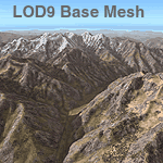
Detailed terrain mesh of the Hindu Kush and Pamir Ranges, N32-40 E70-76. The files in this package are based on Shuttle Radar (SRTM) Version 2 data but with many of the void areas, especially the most significant sections, filled with elevation data generated from topographic maps by Jonathan de Ferranti. While Jonathan's work is unrelated to flight simulation he kindly gave me permission to compile his data for use in FS. The result is a wonderful improvement in detail and accuracy over any existing mesh file, freeware or commercial, based on SRTM or DTED data alone.
Due to the large area of the Himalayas I've compiled the source data as two separate series: the "Himalayan Peaks" series covers prominent mountains and ranges in higher detail and locally overrides any existing LOD9 terrain mesh. In addition, the LOD9 "base mesh" series, with LOD8 and LOD7 "buffer" mesh files, covering the entire Himalayas, is meant for those who do not yet have an add-on terrain mesh of these beautiful mountains.
| Filename: | Himalayas_LOD9_Base_Mesh_Volume_5__Hindu_Kush_and_.zip |
| License: | Freeware, limited distribution |
| Added: | 29th May 2010, 08:57:29 |
| Downloads: | 7,604 |
| Author: | Holger Sandmann, Jonathan de Ferranti |
| Size: | 85.72 MB |
| Category: Flight Simulator 2004 - Scenery | |
| Himalayas LOD9 Base Mesh, Volume 2 - Southcentral Ranges |
|
Images related to this file:
File Description:
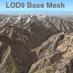
Detailed terrain mesh of the Southcentral Himalayan Ranges, N26-32 E82-90. The files in this package are based on Shuttle Radar (SRTM) Version 2 data but with many of the void areas, especially the most significant sections, filled with elevation data generated from topographic maps by Jonathan de Ferranti. While Jonathan's work is unrelated to flight simulation he kindly gave me permission to compile his data for use in FS. The result is a wonderful improvement in detail and accuracy over any existing mesh file, freeware or commercial, based on SRTM or DTED data alone.
Due to the large area of the Himalayas I've compiled the source data as two separate series: the "Himalayan Peaks" series covers prominent mountains and ranges in higher detail and locally overrides any existing LOD9 terrain mesh. In addition, a LOD9 "base mesh" series, with LOD8 and LOD7 "buffer" mesh files, covering the entire Himalayas, is meant for those who do not yet have an add-on terrain mesh of these beautiful mountains.
| Filename: | Himalayas_LOD9_Base_Mesh_Volume_2__Southcentral_Ra.zip |
| License: | Freeware, limited distribution |
| Added: | 29th May 2010, 09:05:56 |
| Downloads: | 9,450 |
| Author: | Holger Sandmann, Jonathan de Ferranti |
| Size: | 90.25 MB |
| Category: Flight Simulator X - Scenery | |
| LEMG-Xv4 |
|
Images related to this file:
File Description:

Shortly after the release of LEMG-Xv3 I've noticed it contained too many errors..A complete redo of the RWY 13+31 entrances. It's a little more complicated then FSX made it look like. Yet after finishing v4 I discovered a picture of the building of a second runway. I've tried to include this in my scenery. As in the pictures,it's under construction. This is the 2011situation. Includes D gates [T3 terminal] Jetways at the "D" gates now working. Removed buildings in the area, near the north side of the airport to make room for the new Runway. Adjusted Apron A1 for small aircraft. Added several parking spaces [A2 an A1 platform] Added some static planes on request. After some trial and error actions I was finally able to make some transitions plus missed approaches. You'll now have a proper RWY 13 - MAR transition [ILS13 in the GPS] A GDA Transition to [BLN2B / VIBAS1K] plus VJF1B STAR] Freeware scenery for FSX, just for fun.Made with ADE 1.47.07 Happy Landings!
| Filename: | LEMGXv4.zip |
| License: | Freeware, limited distribution |
| Added: | 30th April 2011, 00:16:20 |
| Downloads: | 2,325 |
| Author: | Joost Visser |
| Size: | 13.35 MB |
| Category: Prepar3D V1-4 - Scenery | |
| LRTR Traian Vuia P3D v4 |
|
Images related to this file:
File Description:
Timisoara RO LRTR V-4 (Released October 2017) for P3D v4- This scenery is an update of the stock Airport (ICAO code: LRTR).
What to expect? The entire airport has been updated with correct RWY, taxiways, aprons, COMM's (ATIS, GND, TWR), markings, parkings, roads, some buildings, lights and vegetation. All objects are from stock ADE! Entire work and object placing has been done using a photo overlay image from Google Earth, yet don't expect a photoreal scenery. The used background image has been removed due to Google's copyright policy. Due to using stock objects from library, don't expect perfect shape and colors of objects. I tried to customize the objects so that they look like the real ones. Basic shape and colors should match the real word buildings. NOTE: Some 3rd party addon's might change ground textures or building textures. I have also generated some own ground textures to match those of the airports. Unfortunately there is a problem with those textures not casting shadows. If you still want to see the shadows, you will have to turn on "Buildings" receieve shadows.
| Filename: | LRTR_Traian_Vuia_P3D_v4.zip |
| License: | Freeware |
| Added: | 8th October 2017, 01:15:58 |
| Downloads: | 902 |
| Author: | Gerald Krutsch |
| Size: | 1.07 MB |
| Category: Flight Simulator 2004 - Scenery | |
| Alaska South Slope 8; Shishmaref PASH |
|
Images related to this file:
File Description:
There are four main northwestern Alaska towns which are serviced by Alaska Airlines, and from which local flights spread out. The northernmost is Barrow. Southwest of Barrow is Kotzebue, then Nome, and the furthest south is Bethel (not yet made). This is the first in a series for flights from Nome, and it is Shishmaref, 125 miles north of Nome on the far side of the Seward Peninsula.
Shishmaref is a village on one of a string of islands off the northern shore of the Seward Peninsula, with a population of around 560. Like other similarly-sited villages (Kivalina, for instance) it is feeling the effects of coastal erosion and there are plans for a relocation, eventually. The airfield is just beside the village, with a runway of just under 5,000 feet of lit asphalt aligned 05-23, with PAPI on both ends. There are scheduled flights by Era (now renamed Ravn) and by Bering Air, both of them originating in Nome. The AI includes these flights along with Everts Air and GA.
| Filename: | Alaska_South_Slope_8_Shishmaref_PASH.zip |
| License: | Freeware, limited distribution |
| Added: | 20th October 2016, 04:37:02 |
| Downloads: | 213 |
| Author: | Roger Wensley |
| Size: | 2.32 MB |
| Category: Flight Simulator X - Original Aircraft | |
| Antonov AN-225 |
|
Images related to this file:
File Description:

This version of the AN-225 is almost too accurate, yet as easy to fly as the real "Dream" it was designed to be. Everything has been incorportated in this version in order to make this the best of the best AN-225 versions for FSX ever produced. This work required well over 50 flight test hours and thousands of dollars worth of research and skill. It's all free, and offered for educational use. Anyone who has flown the previous versions will see a huge improvement in all aspects now offered in this fully refurbished model, based entirely on modern design data and aerodynamic details offered only recently. This model includes all factual performance, weight/balance, and aerodynamic details, and realistic thrust points with high turn radius wheel design. This model is absolutely realist in ever aspect. Originally Created by: Thomas Ruth & Alexander Kvitta (2009), Sounds by: Mike Maarse, Panel by Philippe Wallaert, Real World Flight Aero/Engine Dynamics, Effects and Data by: Douglas E. Trapp, [email protected] April 2018. FOR EDUCATIONAL USE ONLY! Read the enclosed text file named Readme1st.txt
| Filename: | Antonov_AN225.zip |
| License: | Freeware |
| Added: | 8th April 2018, 01:37:50 |
| Downloads: | 1,850 |
| Author: | Douglas E. Trapp |
| Size: | 30.28 MB |
| Category: Flight Simulator 2004 - Scenery | |
| "Himalayan Peaks" LOD10 Mesh, Volume 8 - Tirich Mir and Pamir |
|
Images related to this file:
File Description:
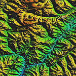
Highly detailed terrain mesh of the Tirich Mir and Pamir areas, N36-39 E71-74. The files in this package are based on Shuttle Radar (SRTM) Version 2 data but with many of the void areas, especially the most significant sections, filled with elevation data generated from topographic maps by Jonathan de Ferranti. While Jonathan's work is unrelated to flight simulation he kindly gave me permission to compile his data for use in FS. The result is a wonderful improvement in detail and accuracy over any existing mesh file, freeware or commercial, based on SRTM or DTED data alone.
Due to the large area of the Himalayas I've compiled the source data as two separate series: the "Himalayan Peaks" series covers prominent mountains and ranges in higher detail and locally overrides any existing LOD9 terrain mesh. In addition, a LOD9 "base mesh" series covering the entire Himalayas will be available for those who do not yet have an add-on terrain mesh of these beautiful mountains.
| Filename: | Himalayan_Peaks_LOD10_Mesh_Volume_8__Tirich_Mir_an.zip |
| License: | Freeware, limited distribution |
| Added: | 29th May 2010, 08:52:47 |
| Downloads: | 9,105 |
| Author: | Holger Sandmann, Jonathan de Ferranti |
| Size: | 47.94 MB |


© 2001-2026 AVSIM Online
All Rights Reserved
Privacy Policy |