
Where Flight Simulation Enthusiasts Gather from Around the World!
AVSIM Library - Search Results

| Category: Navigation and ATC - Navigation | |
| Detroit Chart Chunks Optimized For Moving Map Application |

|
File Description:
Sectional chart chunks made from the August 2009 Sectional charts at the original scale, formatted in the WGS84 lat/lon geographic coordinate system for GPS, moving map application for flight simulation use.
These chart chunks were converted to the JPEG format for compatibility and size. Coverage is the full Sectional area North and South divided into 8 JPEG tiles. They are about 3k x 3k pixels at 2.5mb with coverage of 90nm x 130nm per tile. Included is also the projection files and world files.
Note: This type of map is a equal grid and no further calibration is needed, only the two points referenced in the world file. Example: for users of FSM Moving Map, just mass import, done.
| Filename: | Detroit_Chart_Chunks_Optimized_For_Moving_Map_Appl.zip |
| License: | Freeware |
| Added: | 21st February 2010, 01:41:18 |
| Downloads: | 150 |
| Author: | David Myers |
| Size: | 21.43 MB |
| Category: Navigation and ATC - Navigation | |
| Charlotte Chart Chunks Optimized For Moving Map Application |
|
File Description:
Sectional chart chunks made from the August 2009 Sectional charts at the original scale, formatted in the WGS84 lat/lon geographic coordinate system for GPS, moving map application for flight simulation use.
These chart chunks were converted to the JPEG format for compatibility and size. Coverage is the full Sectional area North and South divided into 8 JPEG tiles. They are about 3k x 3k pixels at 2.5mb with coverage of 90nm x 130nm per tile. Included is also the projection files and world files.
Note: This type of map is a equal grid and no further calibration is needed, only the two points referenced in the world file. Example: for users of FSM Moving Map, just mass import, done.
| Filename: | Charlotte_Chart_Chunks_Optimized_For_Moving_Map_Ap.zip |
| License: | Freeware |
| Added: | 21st February 2010, 01:41:38 |
| Downloads: | 263 |
| Author: | David Myers |
| Size: | 16.04 MB |
| Category: Navigation and ATC - Navigation | |
| Brownsville Chart Chunks Optimized |
|
File Description:
Sectional chart chunks made from the August 2009 Sectional charts at the original scale, formatted in the WGS84 lat/lon geographic coordinate system for GPS, moving map application for flight simulation use.
These chart chunks were converted to the JPEG format for compatibility and size. Coverage is the full Sectional area North and South divided into 8 JPEG tiles. They are about 3k x 3k pixels at 2.5mb with coverage of 90nm x 130nm per tile. Included is also the projection files and world files.
Note: This type of map is a equal grid and no further calibration is needed, only the two points referenced in the world file. Example: for users of FSM Moving Map, just mass import, done.
| Filename: | Brownsville_Chart_Chunks_Optimized.zip |
| License: | Freeware |
| Added: | 21st February 2010, 06:57:34 |
| Downloads: | 129 |
| Author: | David Myers |
| Size: | 14.07 MB |
| Category: Navigation and ATC - Navigation | |
| Billings Chart Chunks |
|
File Description:
Sectional chart chunks made from the August 2009 Sectional charts at the original scale, formatted in the WGS84 lat/lon geographic coordinate system for GPS, moving map application for flight simulation use.
These chart chunks were converted to the JPEG format for compatibility and size. Coverage is the full Sectional area North and South divided into 8 JPEG tiles. They are about 3k x 3k pixels at 2.5mb with coverage of 90nm x 130nm per tile. Included is also the projection files and world files.
Note: This type of map is a equal grid and no further calibration is needed, only the two points referenced in the world file. Example: for users of FSM Moving Map, just mass import, done.
| Filename: | Billings_Chart_Chunks.zip |
| License: | Freeware |
| Added: | 21st February 2010, 06:57:42 |
| Downloads: | 171 |
| Author: | David Myers |
| Size: | 20.47 MB |
| Category: Navigation and ATC - Navigation | |
| Atlanta Chart Chunks Optimized |
|
File Description:
Sectional chart chunks made from the August 2009 Sectional charts at the original scale, formatted in the WGS84 lat/lon geographic coordinate system for GPS, moving map application for flight simulation use.
These chart chunks were converted to the JPEG format for compatibility and size. Coverage is the full Sectional area North and South divided into 8 JPEG tiles. They are about 3k x 3k pixels at 2.5mb with coverage of 90nm x 130nm per tile. Included is also the projection files and world files.
Note: This type of map is a equal grid and no further calibration is needed, only the two points referenced in the world file. Example: for users of FSM Moving Map, just mass import, done.
| Filename: | Atlanta_Chart_Chunks_Optimized.zip |
| License: | Freeware |
| Added: | 21st February 2010, 06:57:51 |
| Downloads: | 220 |
| Author: | David Myers |
| Size: | 21.25 MB |
| Category: Navigation and ATC - Navigation | |
| Albuquerque Chart Chunks |
|
File Description:
Sectional chart chunks made from the August 2009 Sectional charts at the original scale, formatted in the WGS84 lat/lon geographic coordinate system for GPS, moving map application for flight simulation use.
These chart chunks were converted to the JPEG format for compatibility and size. Coverage is the full Sectional area North and South divided into 8 JPEG tiles. They are about 3k x 3k pixels at 2.5mb with coverage of 90nm x 130nm per tile. Included is also the projection files and world files.
Note: This type of map is a equal grid and no further calibration is needed, only the two points referenced in the world file. Example: for users of FSM Moving Map, just mass import, done.
| Filename: | Albuquerque_Chart_Chunks.zip |
| License: | Freeware |
| Added: | 21st February 2010, 06:57:59 |
| Downloads: | 302 |
| Author: | David Myers |
| Size: | 16.78 MB |
| Category: Navigation and ATC - Navigation | |
| Klamath Falls Chart Chunks Optimized For Moving Map Application |
|
File Description:
Sectional chart chunks made from the August 2009 Sectional charts at the original scale, formatted in the WGS84 lat/lon geographic coordinate system for GPS, moving map application for flight simulation use.
These chart chunks were converted to the JPEG format for compatibility and size. Coverage is the full Sectional area North and South divided into 8 JPEG tiles. They are about 3k x 3k pixels at 2.5mb with coverage of 90nm x 130nm per tile. Included is also the projection files and world files.
Note: This type of map is a equal grid and no further calibration is needed, only the two points referenced in the world file. Example: for users of FSM Moving Map, just mass import, done.
| Filename: | Klamath_Falls_Chart_Chunks_Optimized_For_Moving_Ma.zip |
| License: | Freeware |
| Added: | 20th February 2010, 23:07:41 |
| Downloads: | 107 |
| Author: | David Myers |
| Size: | 21.37 MB |
| Category: Flight Simulator 2004 - Flight Plans | |
| La Guardia Emergency |
|
File Description:
FS2004 Adventure - La Guardia Emergency:- You are a WTA captain based at Heathrow. You were flying home on a Boeing 747-400 when you developed a major fuel leak. Originally hoping to divert to JFK, you figured you wouldnt make it. Realising that La Guardia was closer, you opted to divert there instead. The Situation:- You are 8 miles out from La Guardia, headed inbound for rwy 13. You have only 200lbs of fuel remaining. Number 4 engine has already cut out. You have to land on 3 engines. Your already too high on the approach but must land no matter what. Will you make it??.... This adventure requires that you download the LaGuardia airport scenery LGA2004.zip and also the AFCAD2 file lb_klga.zip - Without that AFCAD2, this adventure will not work properly (adventure requires multiple runway use).
| Filename: | La_Guardia_Emergency.zip |
| License: | Freeware |
| Added: | 1st February 2005, 04:52:55 |
| Downloads: | 672 |
| Author: | Lee Brompton |
| Size: | 431.53 KB |
| Category: Flight Simulator X - Aircraft Repaints, Textures and Modifications | |
| Arado Ar-196 |
|
File Description:
The purpose of this package is to make the Alphasim Arado Ar-196, now freeware, usable in FSX. What needs to be done? First, we need to replace the gauges; the old ones don't work. I have done this for the virtual cockpit, but the 2D cockpit needs some work (which I am leaving to someone else). Second, we need to use some different sounds; the old ones don't exist in FSX. Third, we need a thumbnail image for the Aircraft selection menu. These three items are provided here: new panel.cfg, new sound.cfg, and a thumbnail. In addition, you'll also need the original package for FS2004 (ar196_fs9.zip) and a freeware gauge set by Hauke Keitel (kedigau_ud2.zip). Instructions for putting it all together are provided here in readme.txt.Also requires:
1. ar196_fs9.zip
2. kedigau_ud2.zip
| Filename: | Arado_Ar196.zip |
| License: | Freeware |
| Added: | 13th July 2008, 03:48:21 |
| Downloads: | 1,735 |
| Author: | David Wilson-Okamura |
| Size: | 17.62 KB |
| Category: Flight Simulator 2004 - Aircraft Repaints, Textures and Modifications | |
| Military Compilation Boeing 737-700 (1 of 3) |
|
Images related to this file:
File Description:
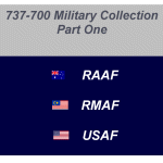
This file is a compilation of Military 737-700's for FS9 (FS2004). It is a complete file and no other files are required for its use. The file contains the complete Project OpenSky (POSky) base aircraft and textures for the Royal Australian Air Force (RAAF), Royal Malaysian Air Force (RMAF) and the United States Air Force (USAF). All textures have been completed in 32 bit format and have been tested in FS9 Only. They may work in FSX; however, installing them in FSX is done at your own risk. This is the first of possibly 3 files covering various countries 737-700 Military aircraft. To see what other countries are on the list take a look in the ReadMe file. Installation instructions and Distribution limitations are also contained in the ReadMe file along with contact details for myself.
| Filename: | Military_Compilation_Boeing_737700_1_of_3.zip |
| License: | Freeware, limited distribution |
| Added: | 26th December 2011, 05:04:11 |
| Downloads: | 641 |
| Author: | Tony Cannon, Project OpenSky |
| Size: | 14.51 MB |


© 2001-2026 AVSIM Online
All Rights Reserved
Privacy Policy |