
Where Flight Simulation Enthusiasts Gather from Around the World!
AVSIM Library - Search Results

| Category: Flight Simulator 2004 - Aircraft Repaints, Textures and Modifications | |
| Channel Airways (ex BEA) DH Comet 4B G-APMB |

|
File Description:
Channel Airways bought five Comet 4B aircraft from BEA to operate inclusive tours out of Stansted. This was the only ex BEA machine, the other four had been in service with Olympic Airways. None of the aircraft were painted in Channel colours, remaining in the basic livery of their former operators left G-APMB as the odd one out in the fleet. The first to arrive in January 1970 was one of the former Greek aircraft and the type made it debut on the 25th February with G-APYC flying from Stansted to Palma. The Comet proved a disaster for the airline and a spares shortage and technical difficulties forced it to buy an Mexicana Comet 4 in June 1971 which was immediately broken up to provide spares. The airline as a whole was in serious trouble and with fortunes continuing to decline all jet operations were suspended in January 1972. The airline ceased flying at the end of the following month. Requires the DH 106 Comet 4B model by David Maltby
| Filename: | Channel_Airways_ex_BEA_DH_Comet_4B_GAPMB.zip |
| License: | Freeware |
| Added: | 10th June 2005, 12:07:43 |
| Downloads: | 304 |
| Author: | Garry Russell |
| Size: | 546.5 KB |
| Category: Flight Simulator 2004 - Utilities | |
| Fly By utility v2.0 |
|
File Description:
FS2004 Fly By v2.0. This utility enables fly by view when FS is in tower view mode.
New:
AI aircraft fly by view is now available. AI aircraft can be selected from the list and shown in fly by or spot plane view. Next/previous AI aircraft can also be selected with the key commands. Cycle AI aircraft fly by / spot plane view is available too.
Random options for horizontal (left-right) and vertical (up-down) viewpoint positions are added. There are two types of random: with constant and variable distance to the plane.
Parameters range now can be assigned. Therefore fly by period, relative lateral and altitude positions can be increased significantly.
Utility is provided with the keyboard commands.
Limitation of Functionality:
For user aircraft it is full-functional version which does not require any registration.
AI aircraft options are time-limited for the unregistered version of utility. Every time FS starts, you have one minute summary to select and view AI aircraft fly by.
By Valery Stenin.
| Filename: | Fly_By_utility_v20.zip |
| License: | Check within download |
| Added: | 5th September 2005, 10:35:57 |
| Downloads: | 2,559 |
| Author: | Valery Stenin |
| Size: | 290 KB |
| Category: Civil Flight Simulators - Looking Glass Flight Unlimited 3 | |
| New Elevation data GeoTiles.tag for FU3 Seattle Region |
|
File Description:
The test elevation meshes for Switzerland and UK Region using the data from
NASA SRTM_V2 program ( 3 arc second resolution, about 90m grid ) was so successful that I have tried to do a new elevation file for the Seattle Region using the 1 arc second elevation from the same source ( US area only ) 30m grid resolution. Each elevation point ( 64m grid in FU3 ) is now converted from the UTM coordinate to the exact Lat/Long WGS84 coordinate and for this point the elevation data are picked up and stored.
The Geotiles.tag file residing in the /region/seattle/geos/ folder contains this data.
To benefit from this new elevation experience FIRST RENAME YOUR ORIGINAL GEOTILES.DAT FILE INTO XGEOTILES.DAT then copy the geotiles.tag from this zip into the geos folder of the Seattle region. Start FU3 and enjoy the new perfect fitted landscape. Best way is to start directly from the air and not from an airport then all airport are no more flat, have hills and holes. Models and runways are floating over the ground or are into the ground.
| Filename: | New_Elevation_data_GeoTilestag_for_FU3_Seattle_Reg.zip |
| License: | Freeware, limited distribution |
| Added: | 26th September 2006, 23:37:55 |
| Downloads: | 168 |
| Author: | Andre Meystre |
| Size: | 19.28 MB |
| Category: Flight Simulator X - Scenery | |
| FSX_MeSA_G08 |
|
File Description:
FSX Mesh South America Project:
This terrain mesh file is a part of a whole project covering all the Continent
of South America and some islands, divided in tiles identified in a map by its
column (letters) and rows (numbers).
Those files were multi-LOD compiled from 90m SRTM2 source data, reprocessed
with 3DEM to remove voids and spikes, providing a 76.4m (LOD9) horizontal
resolution topography intended for use only in FSX updated with SP1.
Although not well documented, to improve performance, the updated FSX loads DEM
files in threads and only the closer terrain (about 5-10 NM from the point of view)
is rendered in high detail, while at far distances FSX shows up its default low
resolution mesh, when there is not a third part terrain mesh compiled in all
others intermediate level of details (multi-LOD).
THIS FILE:
FSX_MeSA_G08 (Column G x Row 08)
covers the area inside the boundaries:
N = 22º 30' S; S = 28º 7.5' S;
W = 45º 0' W; E = 37º 30' W;
AUTHORS:
Hely Heck Junior - Magrao ( [email protected] )
and Jose Lobo ( [email protected] )
| Filename: | FSX_MeSA_G08.zip |
| License: | Freeware |
| Added: | 15th June 2007, 15:04:47 |
| Downloads: | 1,132 |
| Author: | Hely Heck Jr. and José Lôbo |
| Size: | 12 MB |
| Category: Flight Simulator X - Scenery | |
| FSX_MeSA_H04 |
|
File Description:
FSX Mesh South America Project:
This terrain mesh file is a part of a whole project covering all the Continent
of South America and some islands, divided in tiles identified in a map by its
column (letters) and rows (numbers).
Those files were multi-LOD compiled from 90m SRTM2 source data, reprocessed
with 3DEM to remove voids and spikes, providing a 76.4m (LOD9) horizontal
resolution topography intended for use only in FSX updated with SP1.
Although not well documented, to improve performance, the updated FSX loads DEM
files in threads and only the closer terrain (about 5-10 NM from the point of view)
is rendered in high detail, while at far distances FSX shows up its default low
resolution mesh, when there is not a third part terrain mesh compiled in all
others intermediate level of details (multi-LOD).
THIS FILE:
FSX_MeSA_H04 (Column H x Row 04)
covers the area inside the boundaries:
N = 0º 0' S; S = 5º 37.5' S;
W = 37º 30' W; E = 30º 0' W;
AUTHORS:
Hely Heck Junior - Magrao ( [email protected] )
and Jose Lobo ( [email protected] )
| Filename: | FSX_MeSA_H04.zip |
| License: | Freeware |
| Added: | 15th June 2007, 15:07:51 |
| Downloads: | 944 |
| Author: | Hely Heck Jr. and José Lôbo |
| Size: | 3.56 MB |
| Category: Flight Simulator X - Scenery | |
| FSX_MeSA_H05 |
|
File Description:
FSX Mesh South America Project:
This terrain mesh file is a part of a whole project covering all the Continent
of South America and some islands, divided in tiles identified in a map by its
column (letters) and rows (numbers).
Those files were multi-LOD compiled from 90m SRTM2 source data, reprocessed
with 3DEM to remove voids and spikes, providing a 76.4m (LOD9) horizontal
resolution topography intended for use only in FSX updated with SP1.
Although not well documented, to improve performance, the updated FSX loads DEM
files in threads and only the closer terrain (about 5-10 NM from the point of view)
is rendered in high detail, while at far distances FSX shows up its default low
resolution mesh, when there is not a third part terrain mesh compiled in all
others intermediate level of details (multi-LOD).
THIS FILE:
FSX_MeSA_H05 (Column H x Row 05)
covers the area inside the boundaries:
N = 5º 37.5' S; S = 11º 15' S;
W = 37º 30' W; E = 30º 0' W;
AUTHORS:
Hely Heck Junior - Magrao ( [email protected] )
and Jose Lobo ( [email protected] )
| Filename: | FSX_MeSA_H05.zip |
| License: | Freeware |
| Added: | 15th June 2007, 15:08:10 |
| Downloads: | 943 |
| Author: | Hely Heck Jr. and José Lôbo |
| Size: | 22.93 MB |
| Category: Flight Simulator X - Scenery | |
| FSX_MeSA_H06 |
|
File Description:
FSX Mesh South America Project:
This terrain mesh file is a part of a whole project covering all the Continent
of South America and some islands, divided in tiles identified in a map by its
column (letters) and rows (numbers).
Those files were multi-LOD compiled from 90m SRTM2 source data, reprocessed
with 3DEM to remove voids and spikes, providing a 76.4m (LOD9) horizontal
resolution topography intended for use only in FSX updated with SP1.
Although not well documented, to improve performance, the updated FSX loads DEM
files in threads and only the closer terrain (about 5-10 NM from the point of view)
is rendered in high detail, while at far distances FSX shows up its default low
resolution mesh, when there is not a third part terrain mesh compiled in all
others intermediate level of details (multi-LOD).
THIS FILE:
FSX_MeSA_H06 (Column H x Row 06)
covers the area inside the boundaries:
N = 11º 15' S; S = 16º 52.5' S;
W = 37º 30' W; E = 30º 0' W;
AUTHORS:
Hely Heck Junior - Magrao ( [email protected] )
and Jose Lobo ( [email protected] )
| Filename: | FSX_MeSA_H06.zip |
| License: | Freeware |
| Added: | 15th June 2007, 15:19:51 |
| Downloads: | 997 |
| Author: | Hely Heck Jr. and José Lôbo |
| Size: | 1.61 MB |
| Category: Flight Simulator 2004 - AFCAD Files | |
| Mumbai (VABB) with Active Crosswind Runways (v3) |
|
File Description:
A high quality AFCAD2 for Chhatrapati Shivaji Int'l Airport, Mumbai, India. This AFCAD file is for the default FS2004 airport and has been built from scratch. The airport has concrete taxiways, remodelled aprons and full night lighting, including approach lights on all runways. All gates and cargo ramps have airline assignments. Using the crosswing runway technique, both runways can be used at the same time for take-offs and landings. Runway 14 features a holding area/turning loop, making aircraft turn arounds easier on that runway. The domestic terminal features 35 aircraft stands, the international terminal has 24 stands (18 for 747 sized aircraft) and the cargo ramp has 9 stands (all capable of holding cargo 747s). If you have lots of traffic flowing through Mumbai, this file will bring your airport to life. New in this release, Taxiways updated slightly to avoid AI jams, and now aircraft landing on runway 14 will no longer halt eastbound takeoff operations by taxying along runway 09 to get to the terminal. Thanks to Jerel Hayes for the heads up. Enjoy!!
| Filename: | Mumbai_VABB_with_Active_Crosswind_Runways_v3.zip |
| License: | Freeware |
| Added: | 1st June 2007, 19:16:15 |
| Downloads: | 1,811 |
| Author: | Lee Brompton |
| Size: | 59.88 KB |
| Category: Flight Simulator X - AFCAD Files | |
| Woodbine Municipal Airport (1N4), NJ |
|
File Description:
Located 02 miles SE of Woodbine, New Jersey on 700 acres of land, Woodbine Municipal Airport serves small to large GA craft as well as gliders and ultralights. Tie downs are the only option for transient aircraft. The main parking area of the airport is located in the center tarmac area near the fuel station. The parking spots can accomodate aircraft with wingspans up to 50 feet. Anything larger should park off the side of the taxiway. Fuel is available by stopping near the fuel tank. It should be noted that this airport's real ICAO is KOBI.
Scenery constructed with use of satellite images/streetview, the author has not been there in person.
This scenery is meant to be used in conjunction with MegaScenery Earth New Jersey/Delaware 005. It is not required, but apron use is minimized to allow satellite scenery to show through as much as possible, and objects are placed based on the MSE textures - lack of it may make scenery look out of place.
| Filename: | Woodbine_Municipal_Airport_1N4_NJ.zip |
| License: | Freeware |
| Added: | 22nd October 2010, 06:03:35 |
| Downloads: | 202 |
| Author: | Drew Sikora |
| Size: | 352.7 KB |
| Category: Flight Simulator 2004 - Aircraft Repaints, Textures and Modifications | |
| Airborne Express Boeing 767-281 SF Fleet |
|
Images related to this file:
File Description:
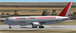
This started out a simple project, and has ended up in fleet production. Thanks go out to Allen at AIG for the tail numbers.
Thanks to Stuart for pointing out the typo in the flight sim entry file. This typo pertained to the yellow rudder Airborne paint, so for new guys, use it.
This pack contains the red and gray tail Airborne Express SF version with large side cargo door.
I do not know if all these have been converted, and I am not going looking to find out. Allen at AIG thinks they have, so, those guys would know.
I have included a new voice mod so the entry will read ABEX.
And that is all it will say.
One semi custom light map for all paints, borrowed from Boris.
Not really, it was made by me.
I hope someone would throw out some flight plans.
Please look at the readmes, just brief over them, please.
Questions and comments are welcome.
Thanks Allen for all the information provided.
| Filename: | Airborne_Express_Boeing_767281_SF_Fleet.zip |
| License: | Freeware |
| Added: | 3rd March 2010, 15:07:49 |
| Downloads: | 282 |
| Author: | Roger Martin |
| Size: | 977.93 KB |


© 2001-2026 AVSIM Online
All Rights Reserved
Privacy Policy |