
Where Flight Simulation Enthusiasts Gather from Around the World!
AVSIM Library - Search Results

| Category: Prepar3D V5 - Scenery | |
| VIJP_P3Dv5 |

|
File Description:
Jaipur International Airport (IATA: JAI, ICAO: VIJP) is the primary airport serving Jaipur, the capital of the Indian state of Rajasthan. Jaipur International Airport has been declared as the World's Best Airport in the category of 2 to 5 million passengers per annum for 2015 & 2016 according to Airports Council International.[4][5] Jaipur Airport is the 11th busiest airport in India in daily scheduled flight operations.[6]
It is located in the southern suburb of Sanganer, 13 km (8.1 mi) from Jaipur.[7] The airport was granted the status of international airport on 29 December 2005.[8] The civil apron can accommodate 14 aircraft and the new terminal building can handle up to 1,000 passengers at a time.[9]
| Filename: | VIJP_P3Dv5.zip |
| License: | Freeware |
| Added: | 26th October 2020, 18:22:27 |
| Downloads: | 598 |
| Author: | Abhishek Banerjee |
| Size: | 42.75 MB |
| Category: Flight Simulator 2004 - AI Flight Plans | |
| American Airlines - Summer 2013 |
|
Images related to this file:
File Description:

Include Optimize speed version,Season-Summer 2013,Callsign-AMERICAN,ICAO-AAL,IATA-AA,Weekly flights-13895,Hubs-Dallas/Fort Worth International Airport-John F. Kennedy International Airport-Los Angeles International Airport-Miami International Airport-O'Hare International Airport
| Filename: | American_Airlines__Summer_2013.zip |
| License: | Freeware, limited distribution |
| Added: | 13th August 2013, 13:25:52 |
| Downloads: | 1,674 |
| Author: | Michael 'Pushen' Babitskiy.UTT |
| Size: | 8.79 MB |
| Category: Flight Simulator 2004 - Scenery | |
| Cache Creek CAZ5 in British Columbia Canada |
|
Images related to this file:
File Description:
Cache Creek is a small village of around 1,000 folks on the eastern side of the Coast Mountains of British Columbia, around 70 miles northeast of Pemberton and 40 miles west of Kamloops. The village is in a valley bottom and recently suffered from severe flooding due to the overflow of the river. The airfield is high above the town, with a runway aligned 15-33 and 3,280 feet of asphalt, without runway or taxiway lighting; hence "airfield" as opposed to "airport". I have posted it as Cache Creek CAZ5, but I suggest that you revise the name to perhaps "BC airfields" and just load my future airfield posts into the same scenery and texture folders to avoid the inevitable doubling up of common textures etc. Plus that way you will have just one FS9 library post to do and new airfields will not need yet another posting. Up to you. If you find a defect, email me.
| Filename: | Cache_Creek_CAZ5_in_British_Columbia_Canada.zip |
| License: | Freeware, limited distribution |
| Added: | 18th November 2020, 01:21:22 |
| Downloads: | 96 |
| Author: | Roger Wensley |
| Size: | 9.27 MB |
| Category: Flight Simulator 2004 - Scenery | |
| Wabush CYWK in Labrador Newfoundland Canada |
|
Images related to this file:
File Description:
Wabush is a small town close to Labrador City, 200 miles north of the Gulf of St Lawrence coast and close to the border with Quebec. The area is known for it's iron mining activity which started in the 1960's. The airport that serves the area is located close to Wabush and there is also a float base on the lake that abutts Labrador. This version is from around 2014. The single runway is aligned 01-19 and is 6,000 feet long, with PAPI on 19 and ILS on 01. Flights by Pascan Aviation, Air Inuit, and Provincial Airlines are included in the AI provided, along with GA flights. I also have WOA ai that provides Air Canada Jazz flights (not included here but worth downloading for Canada). There is also AI for the float base on the lake, which connects to River Deep Lodge for trout fishing on Atikonak Lake around 100 miles to the east and also included here.
| Filename: | Wabush_CYWK_in_Labrador_Newfoundland_Canada.zip |
| License: | Freeware, limited distribution |
| Added: | 24th August 2020, 23:15:16 |
| Downloads: | 216 |
| Author: | Roger Wensley |
| Size: | 16.1 MB |
| Category: Flight Simulator 2004 - Scenery | |
| VAGO Goa/Dabolim Navy, India |
|
File Description:
Googly scenery for Dabolim Navy Airport, Goa - a busy Indian military airport also used for
civilian flights which is poorly provided for in Flight Simulator 2004. These scenery
files add taxiways, aprons, buildings and other airport features, so that you and
your "AI" traffic can land, taxi, park and take off in a realistic manner.
Today Goa is a popular tourist destination, but it does not have its own civilian
airport. Instead the ever-increasing number of charter flights use the Indian
Navy's airport. But they may only land when the Navy's novice pilots are not
pretending the runway is a 11,000 foot aircraft carrier deck so civilian flights
have to be packed into short periods (before 9 am and 1 pm to 6 pm) and this leads
to the small terminal ramp being literally packed with aircraft at times. All kinds
of jets from around the world up to Boeing 747s call here, flown by European and
Asian operators like Air Deccan, Air India, Air Sahara, Arkefly, Condor Thomas Cook,
Go Air, Indian Airlines, Jet Airways, Kingfisher Airlines, Monarch Airlines,
Spicejet, SriLankan Airlines, Thomsonfly, Tiger Airways, Transaero and XL Airways
along with ATR turboprops on shorter flights with Air Deccan. The
Indian Coast Guard has a base here for its aircraft, and the Indian Air Force
carry out exercises from time to time with their fighter bombers. The Navy's
three-aircraft aerobatic team is also based here.
To cope with the increasing traffic, the airport is currently under development
and enlargement but details of this are not currently available so this scenery has
been created showing the existing arrangements. This, combined with the limitations
of Flight Simulator and its parking and taxying arrangements, means that it isn't
possible to realistically pack the aircraft all in at busy times. Any overflow of traffic will
find itself diverted to the Navy's parking area or even the aircraft museum.
However, my observations are that many of the schedules prepared for Flight
Simulator do not recognise the limited landing times and the traffic is spread
fairly evenly throughout the day, so such overflows should be infrequent.
The scenery does not purport to be ultra-accurate. Based on high-detail satellite
imagery from Google Earth, the layout is proportionally correct but the added
airport features, such as buildings, are built from default Microsoft objects
and add-on libraries so will not look like the real thing.
You are not obliged to download and install any additional scenery libraries,
but to enjoy this scenery in its entirety, you may wish to. It will work fine,
with or without.
| Filename: | VAGO_GoaDabolim_Navy_India.zip |
| License: | Freeware |
| Added: | 8th August 2007, 23:14:21 |
| Downloads: | 3,959 |
| Author: | John Hinson |
| Size: | 78.48 KB |
| Category: Flight Simulator 2004 - AFCAD Files | |
| Savannah/Hilton Head International Airport, Savannah, Georgia (KSAV) |
|
File Description:
This is a AFCAD2 file for the Savannah/Hilton Head International Airport. I tried to make the airport as realistic as possable with what is given to me with FS9. Gates 1 and 3 is Delta Connection from Cincinnatti, New York-LGA, and Dallas/Ft. Worth. Gates 5 and 7 are Delta from Atlanta, Gate 2 &2a are Continental Express (Expressjet) From Houston-Bush, and Newark, Gate 4 is Northwest (Mesaba and Pinnacle) from Detroit, Memphis, and Minneapolis, Gate 6 is Independence Air flights from Washington-Dulles (Make sure you have your Independence Air planes coded to BLR. That is what I have the gate coded to which is correct in real life.). Gate 8 is AirTran flights from Atlanta (I also have TRSX AirTran Jet Connect. They no longer fly, but I have them on my AI so I left it in.). Gates 9 and 11 are USAir (Gate 9 being USAir mainline and CRJ-200 flights from Charlotte, Philly and Pittsburgh and Gate 11 being CRJ-200 flights and Dash 8 flights Charlotte, Boston and New York-LGA.). And finally Gate 10 is United Express (Air Wisconsin) flights from Washington-Dulles and Chicago-O'Hare. At the old terminal I have the FedEx, and Airbourne Express/DHL areas, as well as the GA "terminal". North of that is the 165th Airlift Wing National Guard area with parking for their C130's, F-16's, F15's, and their F-18's. I do not have the jetways on yet, however they are done except for the Delta gates....look for them soon. I hope this is a better representation of the airport. I believe it is. All lights on the Taxiways, Runways, as well as landing lights are REAL TO LIFE. They are taken from the airport digrams themselfs as well as from the website www.fltplan.com. Please, let me know what you think as I am using you as an unofficial beta tester for this file.
| Filename: | SavannahHilton_Head_International_Airport_Savannah.zip |
| License: | Freeware |
| Added: | 6th January 2005, 15:12:51 |
| Downloads: | 1,616 |
| Author: | Jason Landuyt |
| Size: | 6.63 KB |
| Category: Flight Simulator 2004 - Sounds | |
| Pratt & Whitney PW2000 Series |
|
File Description:
Here's another one for you guys. Im uploading these soundsets like rapid fire. The PW2000 is a medium range power plant that powers the 757-200, 757-300, and that awesome hunk of metal known as the C-17 Globemaster III. Technically this would be V2 of the PW2000 but I dont like to give my sets versions. Every time I go to revamp a soundset I basically tear it apart and rebuild it from scratch. I have a feeling you all will enjoy this set. ALOT. All files are recorded off of 757 aircraft in 22.050kHz Stereo for optimal quality. Files have also been compressed to Microsoft APCDM format to reduce size. Recommended for use with 757s from Project Opensky, IFDG, Captain Sim, and the FSD C-17. Please Enjoy
| Filename: | Pratt__Whitney_PW2000_Series.zip |
| License: | Freeware |
| Added: | 25th August 2006, 14:33:59 |
| Downloads: | 18,318 |
| Author: | Devyn Silverstein |
| Size: | 10.9 MB |
| Category: Flight Simulator X - Scenery | |
| NZOP- Opotiki Aerodrome (VectorLandClass, New Zealand) |
|
Images related to this file:
File Description:
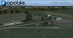
Opotiki aerodrome (ICAO: NZOP) is a small airstrip outside the township of of Opotiki, the gateway to the beautiful East coast of the North Island of New Zealand. Opotiki itself sits at the confluence of the Waioeka and Otara rivers and is surrounded by dairy farmland and Kiwifruit orchards with large areas of native bush to the south and east.
This scenery accompanies Tim Barnes'�� series of other small Bay of Plenty aerodromes (Whakatane,
Galatea, Waihi Beach) for use with VectorLandClass- It features custom modelled and textured buildings, large coverage of beautiful 0.5m aerial photography (fully auto-genned and including seasonal and night variations) and extensive use of high quality objects from the free VLC library. Installation of the library V1.1+ is required for this scenery to work properly and can be downloaded from the VectorLandClass website (www.vectorlandclass.co.nz)
This release, although not requiring it, works best with VectorLandClass topographic mesh and landclass addon covering all 268676 square kilometers of New Zealand. If you'��re not a VLC customer, you'��ll notice when the photoreal coverage runs out!
| Filename: | NZOP_Opotiki_Aerodrome_VectorLandClass_New_Zealand.zip |
| License: | Freeware, limited distribution |
| Added: | 21st February 2013, 13:52:47 |
| Downloads: | 969 |
| Author: | Tim Barnes |
| Size: | 146.68 MB |
| Category: X-Plane - Scenery | |
| BR MS SBPP - Ponta Pora Airport v1.0.0 |
|
Images related to this file:
File Description:
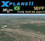
This is an X-Plane 11 and X-Plane 10 scenery package for Ponta Porã International Airport (IATA: PMG, ICAO: SBPP) is the airport serving Ponta Porã, Brazil. It is operated by Infraero.
It includes corrected aprons, ramps, gates, taxiways, lighting system, city buildings, ortho-photoscenery for the airfield area, and (XP11 only) airport ground services (like push back).
The airport is located 4 km (2 mi) from downtown Ponta Porã, as well as from dowtown Pedro Juan Caballeros (in Praguay). The airport was opened on March 11, 1955, and it is dedicated to general aviation. No scheduled flights operate at this airport. It is located right in the border between Brazil and Paraguay.
This scenery was tested and is operational (as of January 21, 2018) in "X-Plane 11.11 64 bit", Windows 10 Home. It was also tested and is also operational (as of January 21, 2018) in "X-Plane 10.51 64 bit", Windows 10 Home.
| Filename: | BR_MS_SBPP__Ponta_Pora_Airport_v100.zip |
| License: | Freeware |
| Added: | 2nd February 2018, 00:18:31 |
| Downloads: | 42 |
| Author: | Rui Mesquita |
| Size: | 10.43 MB |
| Category: Flight Simulator 2004 - AFCAD Files | |
| KGSO |
|
File Description:
I've tried to make this as realistic as possible, and get the small
amount of parking right. I've included all gates, and airlines.
I've also included some overflow at TIMCO. I have GA trafic at
Piedmont Hawthorne FBO and some heavy GA parking at the
Cessna Citation Center. Also have FedEx, UPS, and
Airborne Express at the cargo ramp, and Tradewinds over
by the Tradewinds ramp, by runway 32. I've tried to correct
Taxiway placement for Juliet.
| Filename: | KGSO.zip |
| License: | Freeware |
| Added: | 22nd November 2003, 21:29:39 |
| Downloads: | 1,252 |
| Author: | Dave Hall |
| Size: | 8.92 KB |


© 2001-2026 AVSIM Online
All Rights Reserved
Privacy Policy |