
Where Flight Simulation Enthusiasts Gather from Around the World!
AVSIM Library - Search Results

| Category: Prepar3D V1-4 - Scenery | |
| KRIC - Richmond International Airport, Virginia, USA |

|
Images related to this file:
File Description:
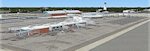
Prepar3D version of the detailed scenery of Richmond International Airport, Virginia, USA uploaded earlier. This airport serves as the main airport for the capital city of the state of Virginia and is served by all the major US airlines.
| Filename: | KRIC__Richmond_International_Airport_Virginia_USA.zip |
| License: | Freeware, limited distribution |
| Added: | 6th December 2016, 03:50:04 |
| Downloads: | 2,598 |
| Author: | Shehryar Ansari |
| Size: | 164.36 MB |
| Category: Fly! II - Scenery | |
| Merle K Smith Airport |
|
File Description:
TerraModels Scenery Development System by Allen Kriesman and Biber Salsa models were used to create the scenery for Merle K (Mudhole) Smith Airport (PACV) - Cordova, Alaska. The FlyII airport designator for this airport is CDV. The taxiways were added using the program by Peter Jacobson. No custom models were created for this airport.
| Filename: | Merle_K_Smith_Airport.zip |
| License: | Freeware |
| Added: | 1st November 2003, 16:41:46 |
| Downloads: | 91 |
| Author: | Wayne Roberts |
| Size: | 49.51 KB |
| Category: Prepar3D V1-4 - Scenery | |
| VOKN Kannur International Airport |
|
File Description:
Kannur International Airport (IATA: CNN, ICAO: VOKN) is an international airport serving the district of Kannur, one of the northern districts in the state of Kerala, India. It is owned and operated by Kannur International Airport Limited (KIAL), a public–private consortium. The airport opened for commercial operations on 9 December 2018.
| Filename: | VOKN_Kannur_International_Airport.zip |
| License: | Freeware |
| Added: | 3rd January 2019, 20:09:23 |
| Downloads: | 1,176 |
| Author: | Sachin Gnath |
| Size: | 16.73 MB |
| Category: Flight Simulator X - Scenery | |
| NZNP - New Plymouth Airport |
|
Images related to this file:
File Description:

New Plymouth Airport serves the city of New Plymouth, and the surrounding region of Taranaki. This Scenery is only designed for Flight Simulator X (FSX) and is a custom, highly accurate version of New Plymouth Airport. Containing 33 Custom buildings, Ground Polygons, Fully modeled Terminal interior, photo-real airport ground background, custom AFCAD and more. Works with ORBX NZNI and VLC.
| Filename: | NZNP__New_Plymouth_Airport.zip |
| License: | Freeware |
| Added: | 31st July 2013, 06:19:23 |
| Downloads: | 5,574 |
| Author: | Che Ridland |
| Size: | 150.8 MB |
| Category: Flight Simulator X - Scenery | |
| MSLP - El Salvador International Airport - San Salvador, El Salvador |
|
File Description:
El Salvador International Airport (IATA: SAL, ICAO: MSLP) is a joint use Militrary and Public airport located approximately 50 km from San Salavador. It is the third busiest airport in Central America. The scenery includes relocated taxiways, new and enlarged aprons, rebuilt terminals and air-bridges, and other buildings.
This scenery was designed to be used with the default FSX scenery.
| Filename: | MSLP__El_Salvador_International_Airport__San_Salva.zip |
| License: | Freeware |
| Added: | 21st March 2016, 09:46:53 |
| Downloads: | 1,494 |
| Author: | Bill Bridges |
| Size: | 16.25 KB |
| Category: Flight Simulator X - Scenery | |
| SKRG |
|
File Description:
SKRG
Jose Maria Cordova International Airport (IATA: MDE, ICAO: SKRG) is the main airport serving the Colombian city of MedellÃ�ÂÂn and its surrounding metropolitan area and it si located in Antioquia department of Colombia.
This file has the right coordenates, with the apron and characteristics of the airport. The runways were resized the gates placed on correct location and number.
| Filename: | SKRG.zip |
| License: | Freeware |
| Added: | 14th February 2011, 10:24:10 |
| Downloads: | 5,222 |
| Author: | Anwar Gonzalez |
| Size: | 33.16 KB |
| Category: Flight Simulator 2004 - Scenery | |
| PAEN, PAEX, 3AK4, 30AK, 52AK - Alaska, USA |
|
Images related to this file:
File Description:
The town of Kenai is on the east coast of Cook Inlet, 60 miles southwest of Anchorage. The airport is in the northern part of the town, with a runway aligned 1-19, 7,550 feet long and 150 feet wide (with an ILS on 19). A second runway is gravel, 2,000 feet long and for winter use by ski planes. There is also a water runway, and all three are aligned the same and called "1 left-19 right" (the main runway) "1 right-19 left" (gravel) and "1 water-19 water". The taxiways are extensive and designed for a far larger traffic than the airport has today, though even now the airport is fairly busy. In FS9 a water runway for AI cannot work with an ATC control tower; the water part of PAEN has therefore been separated into another call sign PAEX which has ONLY the water runway; the tower will therefore direct the plane that makes contact to use the water runway. The PAEN airport runway has taxiway connections at each end and also two intermediates; at the northern end there are in fact two so a total of 5; B, C, D, E, and F; there is an airport diagram included. GA traffic goes to one of two parking aprons, both at the southern end, and at the far southern end there is the hangar for the Civil Air Patrol. The AI includes aircraft from my previous Alaska posts, as Kenai is where I sent them when they departed from, for instance, Palmer. Airlines and cargo companies that operate from and to Kenai are included in the AI: ERA (which has recently changed it's name), Grant Aviation, Air North, Wings of Alaska, North Star Air, and a small local company Air Supply Alaska, along with Fedex, UPS, Everts, and Northern Air Cargo. There is also GA and float AI. Nearby smaller airfields are included, partly because one of them was dramatically misaligned in FS9.
| Filename: | PAEN_PAEX_3AK4_30AK_52AK___Alaska_USA.zip |
| License: | Freeware, limited distribution |
| Added: | 26th December 2015, 15:33:19 |
| Downloads: | 485 |
| Author: | Roger Wensley |
| Size: | 23.08 MB |
| Category: Flight Simulator X - AFCAD Files | |
| FEFF - M`Poko Intl - Bangui, Central African Republic |
|
File Description:
Bangui MPoko International Airport (IATA: BGF, ICAO: FEFF) is an airport located 7 km (4 miles) northwest of Bangui, the capital of the Central African Republic.In 2004, the airport served 53,862 passengers. In 2012, the airport has an average attendance of about 120,000 passengers, despite a maximum capacity of 10,000 passengers. Airport runways were corrected also the aprons and buildinds. Airport charts cortesy of www.ais-asecna.org/en/ad/ad2.htm
This work is dedicated to West Wind Airlines.
| Filename: | FEFF__MPoko_Intl__Bangui_Central_African_Republic.zip |
| License: | Freeware |
| Added: | 27th May 2013, 23:07:09 |
| Downloads: | 2,125 |
| Author: | Anwar Gonzalez |
| Size: | 1001.68 KB |
| Category: Flight Simulator 2004 - Scenery | |
| Woodward Field Airport KCDN |
|
Images related to this file:
File Description:

Woodward Field Airport is a county-owned public-use general aviation airport. It is sometimes called Kershaw County Airport, and many people also know it as the Camden Airport. It is located approx. 6.9 miles northeast of the historical city of Camden, South Carolina and currently does not serve scheduled airline flights. It is host to several vintage aircraft events and fly-in's annually. Scenery was designed with ADE9X v1.47 and Google Maps.(for placement references) Requires EZ-Scenery and RWY12 library collections for proper display of scenery objects. ez_1.zip and rwy12_1.zip
| Filename: | Woodward_Field_Airport_KCDN.zip |
| License: | Freeware |
| Added: | 20th November 2011, 00:02:58 |
| Downloads: | 482 |
| Author: | Glenn Mullis |
| Size: | 3.22 MB |
| Category: Prepar3D V1-4 - Scenery | |
| OZx YBWW Toowoomba Wellcamp Airport FSX/P3Dv4 |
|
Images related to this file:
File Description:
Toowoomba Wellcamp Airport is an airport in Wellcamp, 15.6 km west from the CBD of Toowoomba, Queensland, Australia. It was known as Brisbane West Wellcamp Airport until November 2017. The airport is rated at Code E and with its 2,870-metre (9,416 ft) long by 45-metre (148 ft) wide runway can handle aircraft the size and weight of the Boeing 747-400 and Boeing 747-8 and currently see's services from Airnorth, Qantaslink and Regional Express Airlines to/from Sydney, Melbourne, Brisbane, Cairns, Townsville, Mt Isa and many remote regional towns in Western QLD.
| Filename: | OZx_YBWW_Toowoomba_Wellcamp_Airport_FSXP3Dv4.zip |
| License: | Freeware, limited distribution |
| Added: | 13th July 2019, 17:03:22 |
| Downloads: | 1,712 |
| Author: | Robert Fluke |
| Size: | 210.2 MB |


© 2001-2026 AVSIM Online
All Rights Reserved
Privacy Policy |