
Where Flight Simulation Enthusiasts Gather from Around the World!
AVSIM Library - Search Results

| Category: Flight Simulator X - Scenery | |
| South America Mesh Scenery, MeshX_F6 |

|
File Description:
Mesh terrain scenery for the whole continental South America, based on SRTM 90m
dem geotiff files (at: ftp://ftp.glcf.umiacs.umd.edu/glcf/SRTM/Degree_Tiles/),
resampled to 76 meter of horizontal resolution (LOD 9). The new files have
improved the vertical resolution from 16m to 10m, resulting in more details
and accuracy over previous versions. There are 50 files, compatible with FS 9
and FS X, identified in a map by column letter and line number, covering the
contiguous countries and states. Boundaries: N = 16º 52.5' S; S = 22º 30' S;
E = 33º 45' W; W = 41º 15' W;
| Filename: | South_America_Mesh_Scenery_MeshX_F6.zip |
| License: | Freeware |
| Added: | 28th October 2006, 15:07:29 |
| Downloads: | 1,511 |
| Author: | Oséas Dourado and José Lôbo |
| Size: | 9.8 MB |
| Category: Flight Simulator X - Scenery | |
| South America Mesh Scenery, MeshX_D9 |
|
File Description:
Mesh terrain scenery for the whole continental South America, based on SRTM 90m
dem geotiff files (at: ftp://ftp.glcf.umiacs.umd.edu/glcf/SRTM/Degree_Tiles/),
resampled to 76 meter of horizontal resolution (LOD 9). The new files have
improved the vertical resolution from 16m to 10m, resulting in more details
and accuracy over previous versions. There are 50 files, compatible with FS 9
and FS X, identified in a map by column letter and line number, covering the
contiguous countries and states. Boundaries: N = 33º 45' S; S = 39º 22.5' S;
E = 48º 45' W; W = 56º 15' W.
| Filename: | South_America_Mesh_Scenery_MeshX_D9.zip |
| License: | Freeware |
| Added: | 28th October 2006, 15:08:16 |
| Downloads: | 1,878 |
| Author: | Oséas Dourado and José Lôbo |
| Size: | 4.69 MB |
| Category: Flight Simulator X - Scenery | |
| South America Mesh Scenery, MeshX_E7 |
|
File Description:
Mesh terrain scenery for the whole continental South America, based on SRTM 90m
dem geotiff files (at: ftp://ftp.glcf.umiacs.umd.edu/glcf/SRTM/Degree_Tiles/),
resampled to 76 meter of horizontal resolution (LOD 9). The new files have
improved the vertical resolution from 16m to 10m, resulting in more details
and accuracy over previous versions. There are 50 files, compatible with FS 9
and FS X, identified in a map by column letter and line number, covering the
contiguous countries and states. Boundaries: N = 22º 30' S; S = 28º 7.5' S;
E = 41º 15' W; W = 48º 45' W.
| Filename: | South_America_Mesh_Scenery_MeshX_E7.zip |
| License: | Freeware |
| Added: | 28th October 2006, 15:08:43 |
| Downloads: | 1,805 |
| Author: | Oséas Dourado and José Lôbo |
| Size: | 12.69 MB |
| Category: Flight Simulator X - Scenery | |
| South America Mesh Scenery, MeshX_C9 |
|
File Description:
Mesh terrain scenery for the whole continental South America, based on SRTM 90m
dem geotiff files (at: ftp://ftp.glcf.umiacs.umd.edu/glcf/SRTM/Degree_Tiles/),
resampled to 76 meter of horizontal resolution (LOD 9). The new files have
improved the vertical resolution from 16m to 10m, resulting in more details
and accuracy over previous versions. There are 50 files, compatible with FS 9
and FS X, identified in a map by column letter and line number, covering the
contiguous countries and states. Boundaries: N = 33º 45' S; S = 39º 22.5' S;
E = 56º 15' W; W = 63º 45' W.
| Filename: | South_America_Mesh_Scenery_MeshX_C9.zip |
| License: | Freeware |
| Added: | 29th October 2006, 03:13:28 |
| Downloads: | 3,582 |
| Author: | Oséas Dourado and José Lôbo |
| Size: | 19.76 MB |
| Category: Flight Simulator X - Scenery | |
| South America Mesh Scenery, MeshX_C10 |
|
File Description:
Mesh terrain scenery for the whole continental South America, based on SRTM 90m
dem geotiff files (at: ftp://ftp.glcf.umiacs.umd.edu/glcf/SRTM/Degree_Tiles/),
resampled to 76 meter of horizontal resolution (LOD 9). The new files have
improved the vertical resolution from 16m to 10m, resulting in more details
and accuracy over previous versions. There are 50 files, compatible with FS 9
and FS X, identified in a map by column letter and line number, covering the
contiguous countries and states. Boundaries: N = 39º 22.5' S; S = 45º 0' S;
E = 56º 15' W; W = 63º 45' W.
| Filename: | South_America_Mesh_Scenery_MeshX_C10.zip |
| License: | Freeware |
| Added: | 29th October 2006, 03:14:25 |
| Downloads: | 1,724 |
| Author: | Oséas Dourado and José Lôbo |
| Size: | 3.74 MB |
| Category: Flight Simulator X - Scenery | |
| South America Mesh Scenery, MeshX_A3 |
|
File Description:
Mesh terrain scenery for the whole continental South America, based on SRTM 90m
dem geotiff files (at: ftp://ftp.glcf.umiacs.umd.edu/glcf/SRTM/Degree_Tiles/),
resampled to 76 meter of horizontal resolution (LOD 9). The new files have
improved the vertical resolution from 16m to 10m, resulting in more details
and accuracy over previous versions. There are 50 files, compatible with FS 9
and FS X, identified in a map by column letter and line number, covering the
contiguous countries and states. Boundaries: N = 0º 0' S; S = 5º 37.5' S;
E = 71º 15' W; W = 78º 45' W.
| Filename: | South_America_Mesh_Scenery_MeshX_A3.zip |
| License: | Freeware |
| Added: | 29th October 2006, 15:43:18 |
| Downloads: | 1,980 |
| Author: | Oséas Dourado and José Lôbo |
| Size: | 37.85 MB |
| Category: Flight Simulator X - Scenery | |
| South America Mesh Scenery, MeshX_B11 |
|
File Description:
Mesh terrain scenery for the whole continental South America, based on SRTM 90m
dem geotiff files (at: ftp://ftp.glcf.umiacs.umd.edu/glcf/SRTM/Degree_Tiles/),
resampled to 76 meter of horizontal resolution (LOD 9). The new files have
improved the vertical resolution from 16m to 10m, resulting in more details
and accuracy over previous versions. There are 50 files, compatible with FS 9
and FS X, identified in a map by column letter and line number, covering the
contiguous countries and states. Boundaries: N = 45º 0' S; S = 50º 37.5' S;
E = 63º 45' W; W = 71º 15' W.
| Filename: | South_America_Mesh_Scenery_MeshX_B11.zip |
| License: | Freeware |
| Added: | 30th October 2006, 05:44:41 |
| Downloads: | 1,843 |
| Author: | Oséas Dourado, José Lôbo |
| Size: | 19.15 MB |
| Category: Flight Simulator 2004 - Aircraft Repaints, Textures and Modifications | |
| Aurigny Air ATR 72-200 ISDT |
|
File Description:
FS2004 Aurigny Air Services 72-200 , registration G-BXTN. Textures for the ISDT ATR72-200 Version 2. You will need the model from ISDT. Repaint by G.Wulk. The repainted airplane represents the ATR 72-202 CN/MSN: 483 and was originally delivered to CityFlyer Express on 1997-10-25. Since 2004-02-18 the plane is operated by Aurigny Air Services.
Aurigny Air Services Limited is an airline based in Guernsey, Channel Islands, and is wholly owned by the States of Guernsey. It operates passenger and freight services between the Channel Islands, western France and England.
| Filename: | Aurigny_Air__ATR_72200_ISDT.zip |
| License: | Freeware, limited distribution |
| Added: | 16th October 2008, 21:57:30 |
| Downloads: | 1,025 |
| Author: | Gerd Wulk |
| Size: | 2.46 MB |
| Category: Flight Simulator X - Scenery | |
| South America Mesh Scenery, MeshX_A12 |
|
File Description:
Mesh terrain scenery for the whole continental South America, based on SRTM 90m
dem geotiff files (at: ftp://ftp.glcf.umiacs.umd.edu/glcf/SRTM/Degree_Tiles/),
resampled to 76 meter of horizontal resolution (LOD 9). The new files have
improved the vertical resolution from 16m to 10m, resulting in more details
and accuracy over previous versions. There are 50 files, compatible with FS 9
and FS X, identified in a map by column letter and line number, covering the
contiguous countries and states. Boundaries: N = 50º 37.5' S; S = 56º 15' S;
E = 71º 15' W; W = 78º 45' W.
| Filename: | South_America_Mesh_Scenery_MeshX_A12.zip |
| License: | Freeware |
| Added: | 30th October 2006, 05:45:01 |
| Downloads: | 1,956 |
| Author: | Oséas Dourado and José Lôbo |
| Size: | 13.36 MB |
| Category: Flight Simulator 2004 - Original Aircraft | |
| de Havilland of Canada C-7A Caribou |
|
Images related to this file:
File Description:
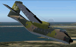
The de Havilland Canada DHC-4 Caribou (known in the U.S. military as CV-2 and C-7 Caribou) is a Canadian-designed and produced specialized cargo aircraft with short takeoff and landing (STOL) capability. The Caribou was first flown in 1958 and although mainly retired from military operations, is still in use in small numbers as a rugged "bush" aircraft.
| Filename: | de_Havilland_of_Canada_C7A_Caribou.zip |
| License: | Freeware |
| Added: | 31st July 2010, 22:35:08 |
| Downloads: | 1,689 |
| Author: | Peter Mercy / Mike Stone |
| Size: | 21.11 MB |


© 2001-2026 AVSIM Online
All Rights Reserved
Privacy Policy |