
Where Flight Simulation Enthusiasts Gather from Around the World!
AVSIM Library - Search Results

| Category: Flight Simulator X - Aircraft Repaints, Textures and Modifications | |
| CelebAir (Monarch) Airbus A321 |

|
File Description:
A CelebAir (Monarch Airlines) Airbus A321.
Textures only for the Overland SMS model.
CelebAir is an upcoming reality TV series, which will see twelve celebrities doing the jobs of cabin crew and check-in attendants. The series is to be presented by Angelica Bell and will air in autumn 2008 on ITV2.
Zeppotron have subchartered an Airbus A321 from Monarch Airlines, registration G-OZBI, which has been repainted into CelebAir colours.
[Source: Wikipedia]
| Filename: | CelebAir_Monarch_Airbus_A321.zip |
| License: | Freeware |
| Added: | 12th July 2008, 03:05:02 |
| Downloads: | 846 |
| Author: | Gareth Thomas |
| Size: | 2.14 MB |
| Category: Flight Simulator 2004 - Sounds | |
| Callsign Astra Airlines Greece |
|
File Description:
Missing Callsigns Astra Airlines Greece:
Included are the following vcpmod files!
Astra Airlines.vcpmod
I miss it by the World of AI "Astra Airlines Greece Complete AI Package"
Just import the vcpmod files into editvoicepack
save and update.
Best Regards,
Thomas
| Filename: | Callsign__Astra_Airlines_Greece.zip |
| License: | Freeware |
| Added: | 27th October 2008, 19:07:10 |
| Downloads: | 565 |
| Author: | Thomas Hermann |
| Size: | 1.11 KB |
| Category: Flight Simulator 2004 - Aircraft Repaints, Textures and Modifications | |
| Air France Boeing 777-200LR |
|
File Description:
772 PSS Air France. Reg : F-GSPY
Required 777 Professional
| Filename: | Air_France_Boeing_777200LR.zip |
| License: | Freeware |
| Added: | 19th November 2008, 23:52:28 |
| Downloads: | 4,121 |
| Author: | Brosson Thomas |
| Size: | 413.14 KB |
| Category: Flight Simulator 2004 - Aircraft Repaints, Textures and Modifications | |
| Air France Boeing 777-200LR |
|
File Description:
772 PSS. Reg : F-GSPY.
| Filename: | Air_France_Boeing_777200LR.zip |
| License: | Freeware |
| Added: | 23rd November 2008, 11:27:33 |
| Downloads: | 552 |
| Author: | Brosson Thomas |
| Size: | 413.14 KB |
| Category: Flight Simulator 2004 - Aircraft Repaints, Textures and Modifications | |
| Aeroflot (Fictional Livery), McDonnell Douglas MD-82 |
|
Images related to this file:
File Description:

Fictional Aeroflot Livery for the MD-82, inspired by Finnair's new Livery and Russia's frosty winter days. Texture for FS9/FSX only, requires the payware "Leonardo Maddog 2006/08/10".
| Filename: | Aeroflot_Fictional_Livery_McDonnell_Douglas_MD82.zip |
| License: | Freeware |
| Added: | 24th December 2010, 18:49:25 |
| Downloads: | 237 |
| Author: | Thomas Sappl |
| Size: | 9.3 MB |
| Category: Flight Simulator 2004 - AI Aircraft | |
| Challenger 600S (N2105) |
|
File Description:
Challenger 600S N2105 for the UGA_JBAI Challenger. Flightplans can be found in the UGA_JBAI Challenger pack.
| Filename: | Challenger_600S_N2105.zip |
| License: | Freeware, limited distribution |
| Added: | 21st February 2009, 14:08:16 |
| Downloads: | 559 |
| Author: | Thomas Ernst |
| Size: | 204.04 KB |
| Category: Flight Simulator 2004 - Sounds | |
| Vietnam Air Services Callsign |
|
File Description:
This voicepack file adds the VASCO callsign to your airlines list recognized by ATC.
Needed for the recently released Vietnam Air Services package from 'World of AI'. Also needed is woavfcv1.zip
| Filename: | Vietnam_Air_Services_Callsign.zip |
| License: | Freeware |
| Added: | 9th November 2009, 18:21:01 |
| Downloads: | 524 |
| Author: | Thomas Hermann |
| Size: | 3.77 KB |
| Category: Flight Simulator 2004 - Aircraft Repaints, Textures and Modifications | |
| XL Airways Germany Airbus A320-200 |
|
Images related to this file:
File Description:
XL Airways Germany A320-200 hybrid livery to use with the Airsimmer A320 CFM model.
| Filename: | XL_Airways_Germany_Airbus_A320200.zip |
| License: | Freeware, limited distribution |
| Added: | 16th January 2010, 12:07:46 |
| Downloads: | 150 |
| Author: | Thomas Pujoulet |
| Size: | 3.5 MB |
| Category: Flight Simulator 2004 - Aircraft Repaints, Textures and Modifications | |
| Aigle Azur Airbus A320-200 |
|
Images related to this file:
File Description:

Aigle Azur A320-200 livery to use with the Airsimmer A320 CFM model.
| Filename: | Aigle_Azur_Airbus_A320200.zip |
| License: | Freeware, limited distribution |
| Added: | 16th January 2010, 18:34:59 |
| Downloads: | 548 |
| Author: | Thomas Pujoulet |
| Size: | 3 MB |
| Category: Flight Simulator 2004 - Aircraft Repaints, Textures and Modifications | |
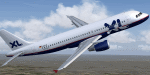
| XL Airways Airbus 320-200 |
|
Images related to this file:
File Description:

XL Airways A320-200 texture for use with the Airsimmer A320 CFM model.
| Filename: | XL_Airways_Airbus_320200.zip |
| License: | Freeware, limited distribution |
| Added: | 9th January 2010, 02:13:57 |
| Downloads: | 305 |
| Author: | Thomas Pujoulet |
| Size: | 1.77 MB |
© 2001-2026 AVSIM Online
All Rights Reserved
Privacy Policy |