
Where Flight Simulation Enthusiasts Gather from Around the World!
AVSIM Library - Search Results

| Category: Flight Simulator X - Aircraft Repaints, Textures and Modifications | |
| FS2004/FSX Air Canada 'rouge' Boeing 737MAX8 C-GMIW |

|
Images related to this file:
File Description:

FS2004/FSX Air Canada 'rouge' Boeing 737MAX8. Registration C-GMIW Fin#540 - Air Canada 'rouge' Boeing 737MAX8 livery on the TDS Boeing 737 MAX8 V3 paint kit. Air Canada's 737 MAX aircraft are being moved from its mainline operations to its subsidiary Rouge over the next few years. The 737 MAXs are expected to enhance Rouge's leisure competitiveness, including by allowing it to fly to new destinations. Textures only; you will need to add to your existing TDS 737 MAX8 V3 file or download the latest version from TDS. The model does not include a VC. The detailed textures include full night lighting and ground vehicles. Repaint by Phillip Hughes.
| Filename: | FS2004FSX_Air_Canada_rouge_Boeing_737MAX8_CGMIW.zip |
| License: | Freeware |
| Added: | 4th February 2025, 20:01:34 |
| Downloads: | 169 |
| Author: | TDS MAX8 v3 | Phillip Hughes |
| Size: | 12.35 MB |
| Category: Flight Simulator X - Scenery | |
| KFRR - Front Royal-Warren County Airport - Front Royal - Virginia, USA |
|
Images related to this file:
File Description:
Front Royal-Warren County Airport (IATA: FRR[2], ICAO: KFRR, FAA LID: FRR) is a county owned, public use airport located three nautical miles (6 km) west of the central business district of Front Royal, a town in Warren County, Virginia, United States. It is included in the National Plan of Integrated Airport Systems for 2011-2015, which categorized it as a general aviation facility.
This is a complete re-work of the airport based on Google Maps. Created with Airport Design Editor by ScruffyDuck Software using current FAA documentation and Google Earth measurements, this package offers a replacement for FSX's stock airport. All these enhancements are as close to the real airport as I can get with stock library objects and custom buildings.
| Filename: | KFRR__Front_RoyalWarren_County_Airport__Front_Roya.zip |
| License: | Freeware |
| Added: | 1st October 2014, 14:01:40 |
| Downloads: | 366 |
| Author: | Wayne Roberts |
| Size: | 232.02 KB |
| Category: Flight Simulator X - Scenery | |
| IGT - Nightmute Airport - Alaska, USA |
|
Images related to this file:
File Description:
The airport islocated southeast of the central business district of the vellage of Nightmute.Nightmute is located on Nelson Island near Toksook Bay. The two villages connect by snowmachine trail in winter.
Runway 2/20 was changed to 3/21. Changed the length of Runway 3/21 from 50 feet wide and a legth of 1,600 feet to 75 feet wide and 3,200 feet long.Added Runway 11/29 along with custom models.Changes are based on construction plans dated 2005.
Created with Airport Design Editor by ScruffyDuck Software using current FAA documentation and Google Earth's measurements, this package offers a replacement for FSX's stock airport. All these enhancements are as close to the real airport as I can get with stock library objects and custom buildings.
| Filename: | IGT__Nightmute_Airport__Alaska_USA.zip |
| License: | Freeware |
| Added: | 3rd February 2015, 09:12:14 |
| Downloads: | 669 |
| Author: | Wayne Roberts |
| Size: | 197.17 KB |
| Category: Flight Simulator X - Scenery | |
| KLUA - Luray Caverns Airport - Luray, Virgina, USA |
|
Images related to this file:
File Description:
Luray Caverns Airport (ICAO: KLUA, FAA LID: LUA, formerly W45) is a public use airport located two nautical miles (4 km) west of the central business district of Luray, a town in Page County, Virginia, United States. The airport is owned by the Town of Luray and Page County.It is included in the National Plan of Integrated Airport Systems for 2011-2015, which categorized it as a general aviation airport.
Added taxiways and aircraft parkng along with custom buildings. Created with Airport Design Editor by ScruffyDuck Software using current FAA documentation and Google Earth measurements, this package offers a replacement for FSX's stock airport. All these enhancements are as close to the real airport as I can get with stock library objects and custom buildings.
| Filename: | KLUA__Luray_Caverns_Airport__Luray_Virgina_USA.zip |
| License: | Freeware |
| Added: | 29th November 2014, 14:11:35 |
| Downloads: | 314 |
| Author: | Wayne Roberts |
| Size: | 339.07 KB |
| Category: Prepar3D V1-4 - Scenery | |
| Flying M Ranch - 7TA7 (Reklaw, TX) |
|
Images related to this file:
File Description:
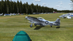
This scenery represents the Flying M Ranch which is a private airfield located in Reklaw, Texas about 123 NM ESE of the Dallas/Fort Worth area. The airfield is known for its annual Fall fly-in and campout and its challenging approaches due to the proximity of trees around the airport. The fly-in has attracted hundreds of aircraft each year and continues to gain popularity. This scenery is not an exact copy of the airport but it does it justice compared to the default scenery which is just a grass strip in the middle of a large blank airfield landclass. The scenery was created with the fantastic Airport Design Editor (ADE) and all objects used are from the default library.
| Filename: | Flying_M_Ranch__7TA7_Reklaw_TX.zip |
| License: | Freeware |
| Added: | 28th May 2020, 19:37:53 |
| Downloads: | 133 |
| Author: | Dylan Phelps |
| Size: | 9.32 MB |
| Category: Flight Simulator X - Scenery | |
| KWT - Kwethluk Airport - Alaska, USA |
|
Images related to this file:
File Description:
Kwethluk Airport has one gravel surfaced runway (18/36) measuring 3,198 by 75 ft. (975 by 23 m). The airport was relocated from its former site at coordinates 60°48.26'N 161°26.72'W which had a 1,750 by 35 ft runway (6/24) and a 5,000 x 500 ft seaplane landing area. The construction plans for 2005 moved the aircraft parking area to Runway 18/36 and removed runway 6/24.
Created with Airport Design Editor 9x by ScruffyDuck Software using current FAA documentation and Google Earth measurements, this package offers a replacement for FSX's stock airport. All these enhancements are as close to the real airport as I can get with stock library objects and custom buildings.
| Filename: | KWT__Kwethluk_Airport__Alaska_USA.zip |
| License: | Freeware |
| Added: | 31st December 2014, 01:32:07 |
| Downloads: | 594 |
| Author: | Wayne Roberts |
| Size: | 248.57 KB |
| Category: Flight Simulator X - Scenery | |
| Chatham Islands: Updated Airports, Landclass, Water Data, and Flight Plans |
|
Images related to this file:
File Description:
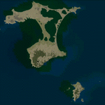
This project significantly updates New Zealand's Chatham Islands and includes more accurate coastlines, lakes, road and river data, as well as corrected landclass and a fully updated Chatham Islands/Tuuta Airport (NZCI). Napier (NZNR) aprons and terminal are also updated to more closely reflect the actual airport and accommodate Air Chathams, and the Pitt Island Airstrip (NZPI) is added to FSX. All updates were done in a manner which carefully aligned airport data with current satellite imagery. These airports are served by Air Chathams. Scenery was created using Airport Design Editor X v1.47.07, SBuilderX 3.13, and the FSX Object Placement Tool. Scenery objects were added and modified from stock FSX scenery to resemble as closely as possible the actual airports.
| Filename: | Chatham_Islands_Updated_Airports_Landclass_Water_D.zip |
| License: | Freeware |
| Added: | 8th July 2011, 21:44:02 |
| Downloads: | 1,674 |
| Author: | Carlyle Sharpe |
| Size: | 17.78 MB |
| Category: Flight Simulator X - Scenery | |
| KSRQ Sarasota-Bradenton FL International Airport |
|
Images related to this file:
File Description:
Several improvements have been made to the default airport, including replacing the default terminal with buildings modelled in FSDS, correctly numbering and coding gates using Airport Design Editor 1.50.4402, drawing new vehicle paths so as to prevent airport vehicles from accessing the taxiways (except in specific instances, explained in the installation.txt file), adding ample GA parking, changing the tower view to the roof of the control tower, including the option of having both runways open to AI traffic, and reworking the approaches to reflect those in the latest Jeppesen charts. There is also an option available to have static aircraft placed in the GA areas. Please read the README FIRST.txt and installation.txt files to insure proper installation of all files.
| Filename: | KSRQ_SarasotaBradenton_FL_International_Airport.zip |
| License: | Freeware |
| Added: | 20th January 2013, 20:26:16 |
| Downloads: | 1,619 |
| Author: | Patrick Finch |
| Size: | 1.77 MB |
| Category: Flight Simulator X - Scenery | |
| EPKS Poznan-Krzesiny AB Poland Scenery Package with AI Blk52+ CFT F-16s |
|
Images related to this file:
File Description:
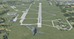
This is a complete "plug and play" scenery package for EPKS Poznan-Krzesiny AB that includes two squadrons of "custom painted" Poland AF AI Block 52+ CFT F-16's!
Using Airport Design Editor, MAIW's Scenery Objects, and Google Earth for reference, I did my best to re-create EPKS Poznan-Krzesiny AB for FSX. Since info online about the base is limited, I had to guess about a few things, like taxiway designations and the frequency for the ILS, so apologies for any errors due to that. The 3-ELT and 6-ELT F-16s both have assigned parking in aircraft shelters, but I also created several other "assigned parking areas" around the base for you to add other AI aircraft as you wish.
| Filename: | EPKS_PoznanKrzesiny_AB_Poland_Scenery_Package_with.zip |
| License: | Freeware |
| Added: | 10th April 2022, 16:45:51 |
| Downloads: | 543 |
| Author: | Daniel W Gregory |
| Size: | 54.4 MB |
| Category: Flight Simulator X - Scenery | |
| Rodrigues Island, Mauritius |
|
Images related to this file:
File Description:
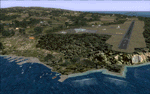
This project rebuilds Rodrigues Island, Mauritius. Deenesh Suddoo's Sir Gaetan Duval Airport (FIMR) is included with permission from the author, and is updated slightly for alignment and full AI traffic compatibility. Landclass polygons and coastlines were hand-drawn directly from satellite imagery to provide the most detailed and accurate scenery currently available for this island. AI road and boat traffic is activated for the region. Accurate coastlines and road data, as well as corrected land and waterclass are provided based on the latest available satellite imagery. Scenery was created using Airport Design Editor X v1.61.5298, SBuilderX 3.13, and the FSX Object Placement Tool. Scenery objects were added and modified from stock FSX scenery to resemble as closely as possible the real-life images.
| Filename: | Rodrigues_Island_Mauritius.zip |
| License: | Freeware |
| Added: | 1st November 2014, 00:52:44 |
| Downloads: | 2,174 |
| Author: | Carlyle Sharpe |
| Size: | 2.63 MB |


© 2001-2026 AVSIM Online
All Rights Reserved
Privacy Policy |