
Where Flight Simulation Enthusiasts Gather from Around the World!
AVSIM Library - Search Results

| Category: Flight Simulator X - Scenery | |
| South America Mesh Scenery MeshX_A9 |

|
File Description:
Mesh terrain scenery for the whole continental South America, based on SRTM 90m
dem geotiff files resampled to 76 meter of horizontal resolution (LOD 9). The new files have
improved the vertical resolution from 16m to 10m, resulting in more details
and accuracy over previous versions. There are 50 files, compatible with FS 9
and FS X, identified in a map by column letter and line number, covering the
contiguous countries and states. Boundaries: N = 33º 45' S; S = 39º 22.5' S;
E = 71º 15' W; W = 78º 45' W.
| Filename: | meshx_a9.zip |
| License: | Freeware |
| Added: | 30th October 2006, 00:33:36 |
| Downloads: | 2,131 |
| Author: | Oséas Dourado and José Lôbo |
| Size: | 12.6 MB |
| Category: Flight Simulator X - Scenery | |
| South America Mesh Scenery MeshX_A10 |
|
File Description:
Mesh terrain scenery for the whole continental South America, based on SRTM 90m
dem geotiff files resampled to 76 meter of horizontal resolution (LOD 9). The new files have
improved the vertical resolution from 16m to 10m, resulting in more details
and accuracy over previous versions. There are 50 files, compatible with FS 9
and FS X, identified in a map by column letter and line number, covering the
contiguous countries and states. Boundaries: N = 39º 22.5' S; S = 45º 0' S;
E = 71º 15' W; W = 78º 45' W.
| Filename: | meshx_a10.zip |
| License: | Freeware |
| Added: | 30th October 2006, 00:49:28 |
| Downloads: | 2,801 |
| Author: | Oséas Dourado and José Lôbo |
| Size: | 17.38 MB |
| Category: Flight Simulator X - Scenery | |
| South America Mesh Scenery, MeshX_B11 |
|
File Description:
Mesh terrain scenery for the whole continental South America, based on SRTM 90m
dem geotiff files (at: ftp://ftp.glcf.umiacs.umd.edu/glcf/SRTM/Degree_Tiles/),
resampled to 76 meter of horizontal resolution (LOD 9). The new files have
improved the vertical resolution from 16m to 10m, resulting in more details
and accuracy over previous versions. There are 50 files, compatible with FS 9
and FS X, identified in a map by column letter and line number, covering the
contiguous countries and states. Boundaries: N = 45º 0' S; S = 50º 37.5' S;
E = 63º 45' W; W = 71º 15' W.
| Filename: | meshx_b11.zip |
| License: | Freeware |
| Added: | 30th October 2006, 05:44:41 |
| Downloads: | 1,841 |
| Author: | Oséas Dourado, José Lôbo |
| Size: | 19.15 MB |
| Category: Flight Simulator X - Scenery | |
| South America Mesh Scenery, MeshX_A12 |
|
File Description:
Mesh terrain scenery for the whole continental South America, based on SRTM 90m
dem geotiff files (at: ftp://ftp.glcf.umiacs.umd.edu/glcf/SRTM/Degree_Tiles/),
resampled to 76 meter of horizontal resolution (LOD 9). The new files have
improved the vertical resolution from 16m to 10m, resulting in more details
and accuracy over previous versions. There are 50 files, compatible with FS 9
and FS X, identified in a map by column letter and line number, covering the
contiguous countries and states. Boundaries: N = 50º 37.5' S; S = 56º 15' S;
E = 71º 15' W; W = 78º 45' W.
| Filename: | meshx_a12.zip |
| License: | Freeware |
| Added: | 30th October 2006, 05:45:01 |
| Downloads: | 1,954 |
| Author: | Oséas Dourado and José Lôbo |
| Size: | 13.36 MB |
| Category: Flight Simulator 2004 - Flight Plans | |
| Around Central and South America |
|
File Description:
Nice adventure around Central and
South America in small planes.
This package contains legs definitions,
planes used and thumbnails from them
and also FSNav and FS9 Flightplans.
Have good flights and lot of pleasure.
Creator : Francois Meyer
| Filename: | Around_Central_and_South_America.zip |
| License: | Freeware |
| Added: | 29th July 2004, 17:20:36 |
| Downloads: | 2,553 |
| Author: | Francois Meyer |
| Size: | 589.77 KB |
| Category: Flight Simulator X - Miscellaneous Files | |
| FS X Airports in South America |
|
File Description:
Catalogue of FS X airports in South America. The catalogue lists name, identifier, location, runways, ILS, approaches and filename of every South American airport in the original MS sceneries.
| Filename: | fsxairportssouthamerica.zip |
| License: | Freeware |
| Added: | 10th November 2006, 16:18:11 |
| Downloads: | 2,168 |
| Author: | Winfried Orthmann |
| Size: | 1.51 MB |
| Category: Flight Simulator 2004 - Scenery | |
| MESH 2010 SurAmerica - Peru |
|
Images related to this file:
File Description:
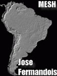
MESH FERMANDOIS 2010 V1.0 / Peru (index PE1,PE2,PE3) / A highly detailed 30m SRTM mesh for South America
| Filename: | mesh_fermandois004.zip |
| License: | Freeware |
| Added: | 7th December 2009, 10:12:19 |
| Downloads: | 2,631 |
| Author: | Jose Fermandois |
| Size: | 93.24 MB |
| Category: Flight Simulator 2004 - Scenery | |
| MESH 2010 SurAmerica - Brasil 10 |
|
Images related to this file:
File Description:

MESH FERMANDOIS 2010 V1.0 / Brasil / index(BR19) / A highly detailed 30m SRTM mesh for South America (FS2004 and FSX)
| Filename: | mesh_fermandoisbr10.zip |
| License: | Freeware |
| Added: | 2nd December 2009, 14:59:17 |
| Downloads: | 1,747 |
| Author: | Jose Fermandois |
| Size: | 38.47 MB |
| Category: Online ATC - Software | |
| Servinfo 2.0 - Correction for South America |
|
File Description:
This file replaces original serinfo.dat to include all Servinfo Database file as well as missing airports in South America.
| Filename: | servinfo_2.0_dat_revised.zip |
| License: | Freeware |
| Added: | 18th January 2003, 19:31:31 |
| Downloads: | 1,292 |
| Author: | Wills Damasio |
| Size: | 143 KB |
| Category: Flight Simulator 2004 - Scenery | |
| MESH 2010 SurAmerica - Argentina 1 |
|
Images related to this file:
File Description:

MESH FERMANDOIS 2010 V1.0 / Argentina Norte (index AR01,AR02,AR03a,AR04) / A highly detailed 30m SRTM mesh for South America
| Filename: | mesh_fermandois001.zip |
| License: | Freeware |
| Added: | 2nd December 2009, 01:04:14 |
| Downloads: | 3,233 |
| Author: | Jose Fermandois |
| Size: | 89.69 MB |
© 2001-2025 AVSIM Online
All Rights Reserved