
Where Flight Simulation Enthusiasts Gather from Around the World!
AVSIM Library - Search Results

| Category: Flight Simulator X - Aircraft Repaints, Textures and Modifications | |
| FSX/P3D TAI DC-3 1962 |

|
Images related to this file:
File Description:
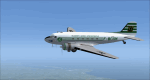
This is a repaint of the DC-3 in TAI (Transports Aeriens Intercontinentaux) colors. The freeware DC-3/C-47 v3 by Manfred Jahn is needed for this repaint. In 1946 the French government allowed the creation of some independent air carriers. On June 1 of that year TAI (Transports Aeriens Internationaux) was formed, and was based in Orly, France. Flights began on July 1, with a Junkers Ju-52. The following year they purchased 7 ex KLM DC-4s, along with 3 Bristol 170 freighters. In 1954 DC-6Bs started to replace the DC-4s. Their route network serviced mainly Africa, the Far East, the French Pacific territories, and Australasia. Prior to 1956 their network wa mainly in Africa, and Asia. On May 6, 1960, a partnership was formed with Air France, whereby TAI flew the South Pacific leg of the state carrier’s around the world service via New Caledonia and Tahiti. Later, on September 4 1960, TAI began a Douglas DC-8-32 service from Paris to Darwin via Athens, Teheran, Karachi, Bangkok, Phnom Penh, and Saigon, and on September 12, it inaugurated a route from Sydney to Los Angeles via Noumea, Nandi, Papeete, and Honolulu with the DC-8. On September 14 1961, TAI agreed, in principle, to a future merger with Union Aeromaritime de Transport (UAT). The two airlines integrated their schedules in 1962 and the amalgamation of TAI and UAT was completed on October 1, 1963, resulting in a new airline: UTA (Union de Transports Aeriens). This DC-3, F-BGXN, flew for TAI from 1956 to 1959. Textures are DXT5. This repaint was tested on FSX-SE and should work on FSX & P3D v1-3.
| Filename: | FSXP3D_TAI_DC3_1962.zip |
| License: | Freeware |
| Added: | 19th March 2019, 17:01:24 |
| Downloads: | 189 |
| Author: | Ted Giana |
| Size: | 8.29 MB |
| Category: Flight Simulator 2004 - Aircraft Repaints, Textures and Modifications | |
| South African Airways Boeing 737-244 (ZS-SIH) |
|
Images related to this file:
File Description:

South African Airways (SAA) is South Africa's largest domestic and international airline company with hubs in Cape Town and Johannesburg. It was formed in 1934 as Union Airways which was subsequently taken over by the South African government and later took on its current name. In 1968 SAA entered the jet-age with the introduction of the Boeing 737 replacing older piston-engine aircraft. This is one of 8 passenger 737-200's still operated by SAA, a 244 model wearing registration ZS-SIH. If you want to light up your 'mouse' at night, I recommend Matthew Lue's Tinmouse II lighting effects (AVSIM DLID 89742).
This is a textures only package; you must have the Tinmouse 737-200adv v2 base package and updates available here at AVSIM (tinmouse_ii_v1_25.zip). The textures in this repaint are 32-bit with no mips. I want to dedicate this repaint to a former South African Airways Captain and current Nationwide Airlines First Officer, Mr. Martin Sons. NOTE: This is a re-upload due to the AVSIM site compromise.
| Filename: | South_African_Airways_Boeing_737244_ZSSIH.zip |
| License: | Freeware, limited distribution |
| Added: | 5th June 2010, 19:53:24 |
| Downloads: | 1,197 |
| Author: | Jeffrey S. Bryner, Tinmouse II Project |
| Size: | 5.01 MB |
| Category: Flight Simulator 2004 - Aircraft Repaints, Textures and Modifications | |
| F-86E Sabre of the 51st FIW |
|
File Description:
This re-paint represents the F-86E Sabre of the 51st Fighter Intercept Wing as flown by Lt. Jim Thompson. This is one of the most recognizable paints of the Korean War. He has this paint done after shooting down a Mig-15 that had a dragon on the side. These textures are for the Section 8 Developement Team's awesome freeware F-86 EF. I have re-painted them according to historical photos. Please read the readme, for info and download of the SF86EF.
| Filename: | F86E_Sabre_of_the_51st_FIW.zip |
| License: | Freeware |
| Added: | 3rd December 2008, 18:36:04 |
| Downloads: | 1,567 |
| Author: | Mike Puckett |
| Size: | 6.04 MB |
| Category: Navigation and ATC - Navigation | |
| Wichita Chart Chunks Optimized For Moving Map Application |
|
File Description:
Sectional chart chunks made from the August 2009 Sectional charts at the original scale, formatted in the WGS84 lat/lon geographic coordinate system for GPS, moving map application for flight simulation use.
These chart chunks were converted to the JPEG format for compatibility and size. Coverage is the full Sectional area North and South divided into 8 JPEG tiles. They are about 3k x 3k pixels at 7mb with coverage of 90nm x 130nm per tile. Included is also the projection files and world files.
| Filename: | Wichita_Chart_Chunks_Optimized_For_Moving_Map_Appl.zip |
| License: | Freeware |
| Added: | 20th February 2010, 14:47:57 |
| Downloads: | 114 |
| Author: | David Myers |
| Size: | 15.38 MB |
| Category: Navigation and ATC - Navigation | |
| Washington Chart Chunks Optimized For Moving Map Application |
|
File Description:
Sectional chart chunks made from the August 2009 Sectional charts at the original scale, formatted in the WGS84 lat/lon geographic coordinate system for GPS, moving map application for flight simulation use.
These chart chunks were converted to the JPEG format for compatibility and size. Coverage is the full Sectional area North and South divided into 8 JPEG tiles. They are about 3k x 3k pixels at 7mb with coverage of 90nm x 130nm per tile. Included is also the projection files and world files.
| Filename: | Washington_Chart_Chunks_Optimized_For_Moving_Map_A.zip |
| License: | Freeware |
| Added: | 20th February 2010, 14:48:05 |
| Downloads: | 138 |
| Author: | David Myers |
| Size: | 15.09 MB |
| Category: Navigation and ATC - Navigation | |
| Twin Cities Chart Chunks Optimized For Moving Map Application |
|
File Description:
Sectional chart chunks made from the August 2009 Sectional charts at the original scale, formatted in the WGS84 lat/lon geographic coordinate system for GPS, moving map application for flight simulation use.
These chart chunks were converted to the JPEG format for compatibility and size. Coverage is the full Sectional area North and South divided into 8 JPEG tiles. They are about 3k x 3k pixels at 7mb with coverage of 90nm x 130nm per tile. Included is also the projection files and world files.
| Filename: | Twin_Cities_Chart_Chunks_Optimized_For_Moving_Map_.zip |
| License: | Freeware |
| Added: | 20th February 2010, 14:48:13 |
| Downloads: | 99 |
| Author: | David Myers |
| Size: | 21.71 MB |
| Category: Navigation and ATC - Navigation | |
| St Louis Chart Chunks Optimized For Moving Map Application |
|
File Description:
Sectional chart chunks made from the August 2009 Sectional charts at the original scale, formatted in the WGS84 lat/lon geographic coordinate system for GPS, moving map application for flight simulation use.
These chart chunks were converted to the JPEG format for compatibility and size. Coverage is the full Sectional area North and South divided into 8 JPEG tiles. They are about 3k x 3k pixels at 7mb with coverage of 90nm x 130nm per tile. Included is also the projection files and world files.
| Filename: | St_Louis_Chart_Chunks_Optimized_For_Moving_Map_App.zip |
| License: | Freeware |
| Added: | 20th February 2010, 14:48:20 |
| Downloads: | 111 |
| Author: | David Myers |
| Size: | 19.38 MB |
| Category: Navigation and ATC - Navigation | |
| Seattle Chart Chunks Optimized For Moving Map Application |
|
File Description:
Sectional chart chunks made from the August 2009 Sectional charts at the original scale, formatted in the WGS84 lat/lon geographic coordinate system for GPS, moving map application for flight simulation use.
These chart chunks were converted to the JPEG format for compatibility and size. Coverage is the full Sectional area North and South divided into 8 JPEG tiles. They are about 3k x 3k pixels at 7mb with coverage of 90nm x 130nm per tile. Included is also the projection files and world files.
| Filename: | Seattle_Chart_Chunks_Optimized_For_Moving_Map_Appl.zip |
| License: | Freeware |
| Added: | 20th February 2010, 14:48:29 |
| Downloads: | 218 |
| Author: | David Myers |
| Size: | 25.79 MB |
| Category: Navigation and ATC - Navigation | |
| San Francisco Chart Chunks Optimized For Moving Map Application |
|
File Description:
Sectional chart chunks made from the August 2009 Sectional charts at the original scale, formatted in the WGS84 lat/lon geographic coordinate system for GPS, moving map application for flight simulation use.
These chart chunks were converted to the JPEG format for compatibility and size. Coverage is the full Sectional area North and South divided into 8 JPEG tiles. They are about 3k x 3k pixels at 7mb with coverage of 90nm x 130nm per tile. Included is also the projection files and world files.
| Filename: | San_Francisco_Chart_Chunks_Optimized_For_Moving_Ma.zip |
| License: | Freeware |
| Added: | 20th February 2010, 14:48:36 |
| Downloads: | 189 |
| Author: | David Myers |
| Size: | 17.6 MB |
| Category: Navigation and ATC - Navigation | |
| San Antonio Chart Chunks Optimized For Moving Map Application |
|
File Description:
Sectional chart chunks made from the August 2009 Sectional charts at the original scale, formatted in the WGS84 lat/lon geographic coordinate system for GPS, moving map application for flight simulation use.
These chart chunks were converted to the JPEG format for compatibility and size. Coverage is the full Sectional area North and South divided into 8 JPEG tiles. They are about 3k x 3k pixels at 7mb with coverage of 90nm x 130nm per tile. Included is also the projection files and world files.
| Filename: | San_Antonio_Chart_Chunks_Optimized_For_Moving_Map_.zip |
| License: | Freeware |
| Added: | 20th February 2010, 14:48:44 |
| Downloads: | 121 |
| Author: | David Myers |
| Size: | 15.78 MB |


© 2001-2026 AVSIM Online
All Rights Reserved
Privacy Policy |