
Where Flight Simulation Enthusiasts Gather from Around the World!
AVSIM Library - Search Results

| Category: Fly! II - Scenery | |
| São Paulo Congonhas - Version 2003 |

|
File Description:
This is the new version of São Paulo Congonhas Airport. It was missing in the Avsim forum and I noticed it today.
| Filename: | So_Paulo_Congonhas__Version_2003.zip |
| License: | Freeware |
| Added: | 7th November 2003, 16:43:02 |
| Downloads: | 195 |
| Author: | João José Cesar Lobo |
| Size: | 3.29 MB |
| Category: Flight Simulator X - Scenery | |
| South America Mesh Scenery MeshX_A9 |
|
File Description:
Mesh terrain scenery for the whole continental South America, based on SRTM 90m
dem geotiff files resampled to 76 meter of horizontal resolution (LOD 9). The new files have
improved the vertical resolution from 16m to 10m, resulting in more details
and accuracy over previous versions. There are 50 files, compatible with FS 9
and FS X, identified in a map by column letter and line number, covering the
contiguous countries and states. Boundaries: N = 33º 45' S; S = 39º 22.5' S;
E = 71º 15' W; W = 78º 45' W.
| Filename: | South_America_Mesh_Scenery_MeshX_A9.zip |
| License: | Freeware |
| Added: | 30th October 2006, 00:33:36 |
| Downloads: | 2,132 |
| Author: | Oséas Dourado and José Lôbo |
| Size: | 12.6 MB |
| Category: Flight Simulator X - Scenery | |
| South America Mesh Scenery MeshX_A10 |
|
File Description:
Mesh terrain scenery for the whole continental South America, based on SRTM 90m
dem geotiff files resampled to 76 meter of horizontal resolution (LOD 9). The new files have
improved the vertical resolution from 16m to 10m, resulting in more details
and accuracy over previous versions. There are 50 files, compatible with FS 9
and FS X, identified in a map by column letter and line number, covering the
contiguous countries and states. Boundaries: N = 39º 22.5' S; S = 45º 0' S;
E = 71º 15' W; W = 78º 45' W.
| Filename: | South_America_Mesh_Scenery_MeshX_A10.zip |
| License: | Freeware |
| Added: | 30th October 2006, 00:49:28 |
| Downloads: | 2,803 |
| Author: | Oséas Dourado and José Lôbo |
| Size: | 17.38 MB |
| Category: Flight Simulator X - Scenery | |
| South America Mesh Scenery, MeshX_F3 |
|
File Description:
Mesh terrain scenery for the whole continental South America, based on SRTM 90m
dem geotiff files resampled to 76 meter of horizontal resolution (LOD 9).
The new files have improved the vertical resolution from 16m to 10m, resulting
in more details and accuracy over previous versions. There are 50 files, compatible
with FS9 and FS X, identified in a map by column letter and line number, covering the
contiguous countries and states. Boundaries: N = 0º 0' S; S = 5º 37.5' S;
E = 33º 45' W; W = 41º 15' W;
| Filename: | South_America_Mesh_Scenery_MeshX_F3.zip |
| License: | Freeware |
| Added: | 28th October 2006, 10:09:48 |
| Downloads: | 1,416 |
| Author: | Oséas Dourado and José Lôbo |
| Size: | 10.96 MB |
| Category: Flight Simulator X - Scenery | |
| South America Mesh Scenery, MeshX_D3 |
|
File Description:
Mesh terrain scenery for the whole continental South America, based on SRTM 90m
dem geotiff files resampled to 76 meter of horizontal resolution (LOD 9). The new files have
improved the vertical resolution from 16m to 10m, resulting in more details
and accuracy over previous versions. There are 50 files, compatible with FS 9
and FS X, identified in a map by column letter and line number, covering the
contiguous countries and states. Boundaries: N = 0º 0' S; S = 5º 37.5' S;
E = 48º 45' W; W = 56º 15' W.
| Filename: | South_America_Mesh_Scenery_MeshX_D3.zip |
| License: | Freeware |
| Added: | 28th October 2006, 19:50:25 |
| Downloads: | 1,478 |
| Author: | Oséas Dourado and José Lôbo |
| Size: | 38.77 MB |
| Category: Flight Simulator X - Scenery | |
| South America Mesh, MeshX_B10 |
|
File Description:
Mesh terrain scenery for the whole continental South America, based on SRTM 90m
dem geotiff files,
resampled to 76 meter of horizontal resolution (LOD 9). The new files have
improved the vertical resolution from 16m to 10m, resulting in more details
and accuracy over previous versions. There are 50 files, compatible with FS 9
and FS X, identified in a map by column letter and line number, covering the
contiguous countries and states. Boundaries: N = 39º 22.5' S; S = 45º 0' S;
E = 63º 45' W; W = 71º 15' W.
| Filename: | South_America_Mesh_MeshX_B10.zip |
| License: | Freeware |
| Added: | 30th October 2006, 01:47:45 |
| Downloads: | 2,208 |
| Author: | Oséas Dourado, José Lôbo |
| Size: | 32.13 MB |
| Category: Flight Simulator X - Scenery | |
| South America Mesh Scenery, MeshX_C5 |
|
File Description:
Mesh terrain scenery for the whole continental South America, based on SRTM 90m
dem geotiff files resampled to 76 meter of horizontal resolution (LOD 9). The new files have
improved the vertical resolution from 16m to 10m, resulting in more details
and accuracy over previous versions. There are 50 files, compatible with FS 9
and FS X, identified in a map by column letter and line number, covering the
contiguous countries and states. Boundaries: N = 11º 15' S; S = 16º 52.5' S;
E = 56º 15' W; W = 63º 45' W.
| Filename: | South_America_Mesh_Scenery_MeshX_C5.zip |
| License: | Freeware |
| Added: | 28th October 2006, 23:27:21 |
| Downloads: | 1,457 |
| Author: | Oséas Dourado and José Lôbo |
| Size: | 35.44 MB |
| Category: Flight Simulator X - Scenery | |
| South America Mesh Scenery, MeshX_C4 |
|
File Description:
Mesh terrain scenery for the whole continental South America, based on SRTM 90m
dem geotiff files resampled to 76 meter of horizontal resolution (LOD 9). The new files have
improved the vertical resolution from 16m to 10m, resulting in more details
and accuracy over previous versions. There are 50 files, compatible with FS 9
and FS X, identified in a map by column letter and line number, covering the
contiguous countries and states. Boundaries: N = 5º 37.5' S; S = 11º 15' S;
E = 56º 15' W; W = 63º 45' W.
| Filename: | South_America_Mesh_Scenery_MeshX_C4.zip |
| License: | Freeware |
| Added: | 28th October 2006, 23:27:57 |
| Downloads: | 1,442 |
| Author: | Oséas Dourado and José Lôbo |
| Size: | 39.66 MB |
| Category: Flight Simulator 2004 - Aircraft Repaints, Textures and Modifications | |
| Cessna 195 / LC-126 Bush Flying Unlimited - HI-RES 32-bit |
|
File Description:
These are textures only and require filename: shakey_jake.zip which can be found here in the AVSIM library.
It has been a great pleasure working with the gang in providing this aircraft for your pleasure. This paintjob is for Bush Flying Unlimited and the external textures are saved in a hi-resolution 32-bit format with no mip-maps. Enjoy! Heather Sherman
| Filename: | Cessna_195__LC126_Bush_Flying_Unlimited__HIRES_32b.zip |
| License: | Freeware, limited distribution |
| Added: | 26th November 2003, 01:41:25 |
| Downloads: | 1,738 |
| Author: | Heather Sherman |
| Size: | 3.12 MB |
| Category: Flight Simulator X - Aircraft Repaints, Textures and Modifications | |
| Aerosoft F-16C HO 88-0454 8th FS 'Black Sheep' Repaint Textures |
|
Images related to this file:
File Description:
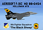
This is a repaint for the payware FSX Aerosoft F-16 depicting Holloman AFB F-16C 88-0454 from the 8th Fighter Squadron in the special 'Black Sheep' paint scheme. Just like on the "49 WG" jet, I pulled out all the stops for this repaint and gave it the kind of attention to detail a CO's jet should get!
To give these textures a sharp "Hi-Def" look, I painted them in 2048 resolution, reduced them to Aerosoft's "native" 1024 resolution, then saved them with DXT5 and no mip maps. For those of you with high-end systems, I've included those 2048 textures for you to try!
I repainted all the grey markings/decals from nose to tail so they now have a sharp, "Hi-Def" look to them, as well as the pilot, ejection seat, engine, weapons, and more!
| Filename: | Aerosoft_F16C_HO_880454_8th_FS_Black_Sheep_Repaint.zip |
| License: | Freeware |
| Added: | 12th May 2024, 17:00:34 |
| Downloads: | 59 |
| Author: | Daniel Gregory |
| Size: | 30.86 MB |


© 2001-2026 AVSIM Online
All Rights Reserved
Privacy Policy |