
Where Flight Simulation Enthusiasts Gather from Around the World!
AVSIM Library - Search Results

| Category: X-Plane - Scenery | |
| BR PA SBCJ - Carajas Airport v1.0.0 |

|
Images related to this file:
File Description:

This is an X-Plane 11 and X-Plane 10 scenery package for Carajás Airport (IATA: CKS, ICAO: SBCJ), which is the airport serving Carajás and Parauapebas, Pará, in Brazil.
It includes corrected aprons, ramps, gates, taxiways, lighting system, city buildings, ortho-photoscenery for the airfield area, and (XP11 only) airport ground services (like push back).
It is located in the Carajás Mining Complex. The airport was built by Companhia Vale do Rio Doce as a support the mining activities of Carajás Mine. It was inaugurated on September 23, 1982. Since 1985 it is administrated by Infraero. Airlines and destinations include:
- Azul Brazilian Airlines to/from: Belo Horizonte/SBCF, Marabá/SBMA.
- Gol Airlines to/from: Belém/SBBE, Belo Horizonte/SBCF.
This scenery was tested and is operational (as of January 17, 2018) in "X-Plane 11.11 64 bit", Windows 10 Home. It was also tested and is also operational (as of January 17, 2018) in "X-Plane 10.51 64 bit", Windows 10 Home.
| Filename: | BR_PA_SBCJ__Carajas_Airport_v100.zip |
| License: | Freeware |
| Added: | 2nd February 2018, 00:13:46 |
| Downloads: | 65 |
| Author: | Rui Mesquita |
| Size: | 11.76 MB |
| Category: X-Plane - Scenery | |
| BR AP SBAM - Amapa Airport v1.0.0 |
|
Images related to this file:
File Description:
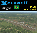
This is an X-Plane 11 and X-Plane 10 scenery package for Amapá Airport (ICAO: SBAM, no IATA code), which is the airport servining the city of Amapá, state Amapá, in Brazil.
It includes corrected aprons, ramps, gates, taxiways, lighting system, ortho-photoscenery for the airfield area, and (XP11 only) airport ground services (like push back).
This is a general aviation airport in the north of the Amazon Rainforest, close to the Brazilian-Frenchg Guyana border. It belongs to the municipality of Amapá, and it is at a distance of 8 km from the city center and 229 km from the state capital, Macapá.
This scenery was tested and is operational (as of January 20, 2018) in "X-Plane 11.11 64 bit", Windows 10 Home. It was also tested and is also operational (as of January 20, 2018) in "X-Plane 10.51 64 bit", Windows 10 Home.
| Filename: | BR_AP_SBAM__Amapa_Airport_v100.zip |
| License: | Freeware |
| Added: | 2nd February 2018, 00:18:13 |
| Downloads: | 56 |
| Author: | Rui Mesquita |
| Size: | 6.55 MB |
| Category: Flight Simulator X - Scenery | |
| 6I2 - Lebanon-Springfield Airport - Kentucky, USA |
|
Images related to this file:
File Description:
Lebanon-Springfield Airport (FAA LID: 6I2), a public use airport in Washington County, Kentucky (KY), USA. It is located three nautical miles (6 km) south of Springfield in Washington County) and north of Lebanon (in Marion County). The airport is owned by Marion and Washington Counties. The scenery contains seasonal ground textures for winter, spring, summer, autumn and night; autogen and default scenery objects of FSX plus a modified AFCAD file. Tested with FSX: SE on Windows 10. Version 1.1 contains fixes for the terrain aswell as corrected scenery objects.
** Do not use this version with FreeMesh X - USA; use 6I2_FMX.zip instead **
By Peregrine Simulations
| Filename: | 6I2__LebanonSpringfield_Airport__Kentucky_USA.zip |
| License: | Freeware, limited distribution |
| Added: | 21st February 2018, 23:36:38 |
| Downloads: | 250 |
| Author: | Peregrine Simulations |
| Size: | 104.1 MB |
| Category: Flight Simulator X - AFCAD Files | |
| SERB - Riobamba/Chimborazo Airport, Chimborazo, Ecuador. |
|
File Description:
This is a redesign of SERB - Riobamba/Chimborazo Airport, Chimborazo, Ecuador. Google Maps has been used to provide the correct (as physically possible within FSX and ADE) position, size and type of runway, aprons and buildings. The immediate surrounding scenery has been included. ADE used to compile the design.
| Filename: | SERB__RiobambaChimborazo_Airport_Chimborazo_Ecuado.zip |
| License: | Freeware |
| Added: | 23rd March 2018, 00:04:47 |
| Downloads: | 504 |
| Author: | Matthew Ward |
| Size: | 1.44 MB |
| Category: Flight Simulator X - AFCAD Files | |
| LSZC (LSMU) - Buochs Airport, Nidwalden, Switzerland. |
|
File Description:
This is a redesign of LSZC (LSMU) - Buochs Airport, Nidwalden, Switzerland. Google Maps has been used to provide the correct (as physically possible within FSX and ADE) position, size and type of runway, aprons and buildings. The immediate surrounding scenery has been included. ADE used to compile the design.
| Filename: | LSZC_LSMU__Buochs_Airport_Nidwalden_Switzerland.zip |
| License: | Freeware |
| Added: | 15th April 2018, 21:03:19 |
| Downloads: | 1,276 |
| Author: | Matthew Ward |
| Size: | 1.32 MB |
| Category: Prepar3D V1-4 - Scenery | |
| KSAT - San Antonio Intl Airport, Texas |
|
Images related to this file:
File Description:
This is Ray Smith's FSX file. Ray has given me permission to modify his file for P3Dv4. This update is made with two operational files. One version with the Crosswind runways operating where all 3 runways will be used for takeoff/landing and one version as the default runway operation. Assigned parking as per their website with extra parking added, which are now numbered in their correct order. Runway 4/22 now at its new length. The other two parallel runways numbering correct to 13L/31R and 13R/31L. Taxiways and taxi signs updated to the latest charts. Additional roads and ramps areas added.
| Filename: | KSAT__San_Antonio_Intl_Airport_Texas.zip |
| License: | Freeware |
| Added: | 22nd April 2018, 01:55:53 |
| Downloads: | 13,773 |
| Author: | Robert Catherall |
| Size: | 2.63 MB |
| Category: Flight Simulator X - Scenery | |
| Monroe County Airport - KBMG - Bloomington, Indiana |
|
Images related to this file:
File Description:
This scenery replaces the FSX default airport and brings the Monroe County Airport - KBMG in Bloomington, Indiana, USA, up to date with it's current Airport Diagram with added buildings, taxiways, and as much true-life character as I could find in available 3rd party freeware scenery object libraries. This scenery was specifically created to overcome the issue of appearing/disappearing buildings and scenery objects when using on top of photoreal scenery, such as Megascenery Earth Indiana V2 & V3 sceneries. This scenery does require that you have two addon scenery libraries installed and activated. Refer to the readme.txt file for more information.
"ga_hangers_ss_v3.zip" Sidney Schwartz's GA Hangers V3, available in Avsim's Flight Simulator 2004 - Scenery Design section.
"mao_js.zip" John Stinstrom's FS2004 Military Cargo Objects, available as: In Avsim's Flight Simulator 2004 - Scenery section
| Filename: | Monroe_County_Airport__KBMG__Bloomington_Indiana.zip |
| License: | Freeware |
| Added: | 8th May 2018, 04:13:12 |
| Downloads: | 520 |
| Author: | Frank Patton |
| Size: | 3.01 MB |
| Category: Flight Simulator X - AFCAD Files | |
| WPEC - Cakung Airport, Baucau, East Timor. |
|
File Description:
This is a redesign of WPEC - Cakung Airport, Baucau, East Timor. Google Maps has been used to provide the correct (as physically possible within FSX and ADE) position, size and type of runway, aprons and buildings. The immediate surrounding scenery has been included. ADE used to compile the design.
| Filename: | WPEC__Cakung_Airport_Baucau_East_Timor.zip |
| License: | Freeware |
| Added: | 12th May 2018, 06:45:44 |
| Downloads: | 650 |
| Author: | Matthew Ward |
| Size: | 1.2 MB |
| Category: Flight Simulator X - Scenery | |
| Kumasi Airport for FSX/P3D "UPDATE" |
|
File Description:
This is just an update for (Kumasi Airport for FSX/P3D).
The update requires the main scenery.
No more dimmed runway lighting :)
| Filename: | Kumasi_Airport_for_FSXP3D_UPDATE.zip |
| License: | Freeware |
| Added: | 3rd November 2018, 23:33:42 |
| Downloads: | 291 |
| Author: | Raheem Adeleke |
| Size: | 6.27 KB |
| Category: Flight Simulator X - AFCAD Files | |
| WAMW (WAFW) - Syukuran Aminuddin Amir Airport. |
|
File Description:
This is a redesign of WAMW (WAFW) - Syukuran Aminuddin Amir Airport. Google Maps and charts from AIP Indonesia have been used to provide the correct (as physically possible within FSX and ADE) position, size and type of runway, aprons and buildings. The immediate surrounding scenery has been included. ADE used to compile the design.
| Filename: | WAMW_WAFW__Syukuran_Aminuddin_Amir_Airport.zip |
| License: | Freeware |
| Added: | 9th November 2018, 21:43:29 |
| Downloads: | 870 |
| Author: | Matthew Ward |
| Size: | 2.99 MB |


© 2001-2026 AVSIM Online
All Rights Reserved
Privacy Policy |