
Where Flight Simulation Enthusiasts Gather from Around the World!
AVSIM Library - Search Results

| Category: Flight Simulator 2004 - Flight Plans | |
| FSNavigator - ALASKA Complete Sids/Stars AIRAC1103 |

|
Images related to this file:
File Description:

Alaska - Complete airports package SID departure and STAR arrival routes for use with FSnavigator v4.7 and FS2004/FS9. Covers all arrival and departure lateral navigational routes for all airports with published plates. Up to date with US chartage and AIRAC 1103 (March 2011). By David James
| Filename: | alaska_fsnav_airac1103.zip |
| License: | Freeware |
| Added: | 26th March 2011, 04:40:22 |
| Downloads: | 621 |
| Author: | David James |
| Size: | 58 KB |
| Category: Flight Simulator 2004 - Scenery | |
| ZLTS - Tianshui Airport |
|
Images related to this file:
File Description:
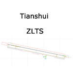
A google-earthed scenery for Tianshui airport (non FS9 stock), with basic default terminal, tower, and taxisigns.
Based on december 2009 sat imagery. Navaids valid as AIRAC 1201.
Fictionnal are: parking & taxiway designators, ILS10 approach coded for UI & AI.
Current scheduled operators at ZLTS: Tianjin Airlines.
| Filename: | zlts.zip |
| License: | Freeware, limited distribution |
| Added: | 5th February 2012, 19:31:42 |
| Downloads: | 470 |
| Author: | Yohann Baptiste |
| Size: | 446 KB |
| Category: Prepar3D V1-4 - Scenery | |
| SLCB - Jorge Wilstermann Intl - Cochabamba, Bolivia |
|
File Description:
this is an updated version of the default p3d airport
*updated runway dimensions and corrected positions, verified markings and lighting
*added taxiway F southeast of 05/23
*added ILCO localizer/gs/dme (110.5)
*reconstructed all ramps and taxiways in the correct positions
*current as of airac 2004
| Filename: | slcb_adep4_mt.zip |
| License: | Freeware |
| Added: | 9th April 2020, 18:23:08 |
| Downloads: | 308 |
| Author: | Mike Teague |
| Size: | 95 KB |
| Category: Prepar3D V1-4 - Scenery | |
| KEGE - Eagle CO Regional - Eagle, CO |
|
File Description:
this is an updated version of the default p3d airport:
*corrected runway length (9000ft), markings, lighting
*added I-ESJ localizer/gs/dme for the LDA 25 approach
*added/corrected taxiways and signage
*added national guard ramp, corrected position of other ramps
*current as of airac 2004
| Filename: | KEGE__Eagle_CO_Regional__Eagle_CO.zip |
| License: | Freeware |
| Added: | 1st April 2020, 18:42:23 |
| Downloads: | 94 |
| Author: | Mike Teague |
| Size: | 110.52 KB |
| Category: Flight Simulator 2004 - Scenery | |
| ZBER - Erenhot Airport (Non-Stock) |
|
Images related to this file:
File Description:
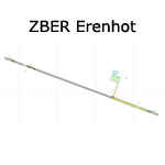
A basic google-earthed scenery for Erenhot airport which is missing in FS9 stock version.
All features accurately placed/shaped according to sat imagery. Navaids up-to-date as AIRAC cycle 1110.
Features basic default terminal & tower, and taxisigns.
Scheduled operators at ZBER: Beijing Capital Airlines, Tianjin Airlines.
| Filename: | zber.zip |
| License: | Freeware, limited distribution |
| Added: | 29th December 2011, 23:13:36 |
| Downloads: | 545 |
| Author: | Yohann Baptiste |
| Size: | 298 KB |
| Category: Prepar3D V1-4 - Scenery | |
| KLGB - Long Beach / Daugherty Field - Long Beach, CA |
|
File Description:
this is an updated version of the default p3d airport:
*removed 16R/34L and 16L/34R
*replaced 26L/8R with new version (3918 ft)
*all runways markings/lighting config updated
*new terminal and parking
*updated taxiways and signage
*updated various ramps and helipads
*current as of airac 2004
| Filename: | klgb_adep4_mt.zip |
| License: | Freeware |
| Added: | 1st April 2020, 18:42:14 |
| Downloads: | 127 |
| Author: | Mike Teague |
| Size: | 147 KB |
| Category: Flight Simulator 2004 - Scenery | |
| ZGBS - Bose Airport |
|
Images related to this file:
File Description:
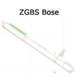
A google-earthed scenery for Bose airport (alternate spelling: Baise) which is missing in FS9 stock version, with basic default terminal & tower, and taxisigns.
All features accurately placed/shaped according to sat imagery. Navaids valid as AIRAC 1110.
No approach coded.
Current scheduled operators at ZGBS: China Express Airlines.
| Filename: | zgbs.zip |
| License: | Freeware, limited distribution |
| Added: | 13th January 2012, 00:34:03 |
| Downloads: | 591 |
| Author: | Yohann Baptiste |
| Size: | 419 KB |
| Category: Prepar3D V1-4 - Scenery | |
| DGAA - Kotoka Intl - Accra, Ghana |
|
File Description:
this is an updated version of the default p3d airport
*updated runway dimensions and corrected positions, verified markings and lighting
*reconstructed all ramps and taxiways in the correct positions
*built approximate new terminal with gates (will be updated if new aerial photos become available)
*current as of airac 2004
| Filename: | dgaa_adep4_mt.zip |
| License: | Freeware |
| Added: | 9th April 2020, 18:23:28 |
| Downloads: | 1,189 |
| Author: | Mike Teague |
| Size: | 61 KB |
| Category: Prepar3D V1-4 - Scenery | |
| LLBG - Ben Gurion - Tel Aviv, Israel - P3DV4 - airac 2006 |
|
File Description:
this is an updated version of the default p3d airport:
*airac 2006*
-orphaned the ILS at the closed airport LLJR so to not interfere with the ILS 30 at LLBG
-added apron edge lights
*airac 2005*
-corrected the general airport location (it was pretty far off)
-updated runway dimensions, verified markings and lighting
-added loc/dme/gs to rwy 8 (BC 110.9), 21 (BN 109.7) and 30 (BD 111.9)
-all new ramps and taxiways
-new terminal, gates, other parking
my intent is to have a functional and current airport, not eye candy. the idea is to pretty much
match the real charts for online use (vatsim, etc). not tested with any type of AI traffic or atc.
| Filename: | llbg_adep4_mt_383802.zip |
| License: | Freeware |
| Added: | 21st May 2020, 22:55:05 |
| Downloads: | 1,353 |
| Author: | Mike Teague |
| Size: | 435 KB |
| Category: Prepar3D V1-4 - Utilities | |
| GENav pro Navigation |
|
Images related to this file:
File Description:

Previous payware product at SimMarket, now 100% free.
With GENav pro you will view all AIRAC navigation data and terminal procedures inside Google Earth. GENav pro run under Windows and require only Google Earth for displaying. You can also edit your own routes or just copy routes into GENav to view in Google Earth. You can search for example an airport or a fix by short or long name, Google Earth will take you there.
You can connect to Microsoft Flight Simulator to view your aircraft. Moving map and heading is available.
GENav pro is highly optimized for best performance and clear views without clutter. There are smart filters to select relevant data to display, all AIRAC items are available. You will find all data such as nav-aid frequencies, airport runways with ILS frequencies by click the displayed icons in Google Earth.
You can edit routes visual direct inside Google Earth by click. The database can always be updated with Navigraph's latest AIRAC data.
With GENav you can easy build valid routes. Unlike other common autorouting program, GENav is the tool for you to build routes with correct airway direction and correct connected to SID/STAR's. You will easy draw your routes most stright and correct to destination. It is also excellent for visual and instrument navigation flights.
FEATURES:
*** Display airports, nav aids, waypoints
*** Display High/Low airways and airways direction
*** Display SID/STAR, Approaches and Transitions
*** Display ARTCC/FIR border
*** AIRAC data available by click
*** Search airport and fixes
*** AIRAC data compatible Navigraph data
*** Visual editable routes
*** VOR to VOR route navigation data
*** Display your aircraft
BASIC SYSTEM REQUIREMENTS:
*** Windows with Google Earth installed
( Notice, no flightsim program required )
OPTIONALLY REQUIREMENTS:
*** SID/STAR require the Navigraph purchase or an alternative free source
*** Airways direction & high/low info require the Navigraph purchase
*** To display aircraft, Microsoft Flight Simulator or Prepare3D v1/v2, with free FSUIPC is required.
*** To display aircraft at a separate computer, also the payware WideFS is required.
| Filename: | genav_335665.zip |
| License: | Freeware |
| Added: | 25th May 2016, 11:24:52 |
| Downloads: | 653 |
| Author: | Lennart Vedin |
| Size: | 4.5 MB |
© 2001-2025 AVSIM Online
All Rights Reserved