
Where Flight Simulation Enthusiasts Gather from Around the World!
AVSIM Library - Search Results

| Category: Flight Simulator 2002 - Scenery | |
| Canadian Rocky Mountain Parks 2 Of 9 |

|
File Description:
High resolution elevation mesh for the Rocky Mountain National Parks in Canada made from 1:50,000 NTS map sheets contour lines converted using Geographic Information System software. Resolution is 3 meters. Next phase is to build new scenery from air photos and satelite photos.
| Filename: | Canadian_Rocky_Mountain_Parks_2_Of_9.zip |
| License: | Freeware |
| Added: | 18th January 2003, 04:37:46 |
| Downloads: | 2,140 |
| Author: | Rod Thompson |
| Size: | 4.02 MB |
| Category: Flight Simulator 2002 - Scenery | |
| Canadian Rocky Mountain Parks 3 Of 9 |
|
File Description:
High resolution elevation mesh for the Rocky Mountain National Parks in Canada made from 1:50,000 NTS map sheets contour lines converted using Geographic Information System software. Resolution is 3 meters. Next phase is to build new scenery from air photos and satelite photos.
| Filename: | Canadian_Rocky_Mountain_Parks_3_Of_9.zip |
| License: | Freeware |
| Added: | 18th January 2003, 04:51:36 |
| Downloads: | 1,904 |
| Author: | Rod Thompson |
| Size: | 4.29 MB |
| Category: Flight Simulator 2002 - Scenery | |
| Canadian Rocky Mountain Parks 4 Of 9 |
|
File Description:
High resolution elevation mesh for the Rocky Mountain National Parks in Canada made from 1:50,000 NTS map sheets contour lines converted using Geographic Information System software. Resolution is 3 meters. Next phase is to build new scenery from air photos and satelite photos.
| Filename: | Canadian_Rocky_Mountain_Parks_4_Of_9.zip |
| License: | Freeware |
| Added: | 18th January 2003, 04:52:19 |
| Downloads: | 1,933 |
| Author: | Rod Thompson |
| Size: | 3.97 MB |
| Category: Flight Simulator 2002 - Scenery | |
| Canadian Rocky Mountain Parks 5 Of 9 |
|
File Description:
High resolution elevation mesh for the Rocky Mountain National Parks in Canada made from 1:50,000 NTS map sheets contour lines converted using Geographic Information System software. Resolution is 3 meters. Next phase is to build new scenery from air photos and satelite photos.
| Filename: | Canadian_Rocky_Mountain_Parks_5_Of_9.zip |
| License: | Freeware |
| Added: | 18th January 2003, 04:54:09 |
| Downloads: | 1,946 |
| Author: | Rod Thompson |
| Size: | 1.15 MB |
| Category: Flight Simulator 2002 - Scenery | |
| Canadian Rocky Mountain Parks 6 Of 9 |
|
File Description:
High resolution elevation mesh for the Rocky Mountain National Parks in Canada made from 1:50,000 NTS map sheets contour lines converted using Geographic Information System software. Resolution is 3 meters. Next phase is to build new scenery from air photos and satelite photos.
| Filename: | Canadian_Rocky_Mountain_Parks_6_Of_9.zip |
| License: | Freeware |
| Added: | 18th January 2003, 04:54:42 |
| Downloads: | 2,004 |
| Author: | Rod Thompson |
| Size: | 1.08 MB |
| Category: Flight Simulator 2002 - Scenery | |
| Canadian Rocky Mountain Parks 7 Of 9 |
|
File Description:
High resolution elevation mesh for the Rocky Mountain National Parks in Canada made from 1:50,000 NTS map sheets contour lines converted using Geographic Information System software. Resolution is 3 meters. Next phase is to build new scenery from air photos and satelite photos.
| Filename: | Canadian_Rocky_Mountain_Parks_7_Of_9.zip |
| License: | Freeware |
| Added: | 18th January 2003, 04:55:57 |
| Downloads: | 1,970 |
| Author: | Rod Thompson |
| Size: | 957.42 KB |
| Category: Flight Simulator 2002 - Scenery | |
| Canadian Rocky Mountain Parks 8 Of 9 |
|
File Description:
High resolution elevation mesh for the Rocky Mountain National Parks in Canada made from 1:50,000 NTS map sheets contour lines converted using Geographic Information System software. Resolution is 3 meters. Next phase is to build new scenery from air photos and satelite photos.
| Filename: | Canadian_Rocky_Mountain_Parks_8_Of_9.zip |
| License: | Freeware |
| Added: | 18th January 2003, 04:57:15 |
| Downloads: | 1,907 |
| Author: | Rod Thompson |
| Size: | 4.79 MB |
| Category: Flight Simulator 2002 - Scenery | |
| New Lake Elevation Corrections |
|
File Description:
The files in this package contain an update correcting some new lake elevations for Quebec terrain mesh (FS2002) created from SRTM-3 : about 100 lakes in Laurentides Park and Charlevoix regions, 80 in Bas-Saint-Laurent and 86 in Beauce, Megantic and Eastern Townships.
| Filename: | New_Lake_Elevation_Corrections.zip |
| License: | Freeware, limited distribution |
| Added: | 17th May 2003, 18:30:57 |
| Downloads: | 1,321 |
| Author: | Gilles Gauthier |
| Size: | 428.59 KB |
| Category: Flight Simulator X - Scenery | |
| Iguassu Falls - Save The Planet |
|
Images related to this file:
File Description:
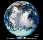
The Iguassu Falls, Itaipu Hydroelectric Power Plant, Foz do Iguassu City and Land Class Package for FSX
Save The Planet is my version of the Iguassu Falls, Itaipu Dam, bridges and landclass scenery for FSX.
Differently from my other version for MSFS 2004, I created a mesh of 5 meter resolution for Iguassu Falls area
to give me some idea how I could proceed. So, I decided to use on this addon
an image background avaliable at server (VirtualEarthSatellite). Thanks Microsoft.
Non-Airport Scenery - ICAO (SBFI). coming soon at www.Terra-Brasilis.org
Portuguese: Cataratas do Iguassu,
Spanish: Cataratas del Iguazu are waterfalls of the Iguassu River located on the border of the Brazilian state of Parana (in the Southern
Region) and the Argentinian Province of Misiones.
The Falls are shared between the Iguazu National Park (Argentina) and Iguacu
National Park (Brazil). The parks were designated UNESCO World Heritage Sites.
The Itaipu Hydroelectric Power Plant is located in the Parana River, in the stretch of the frontier between Brazil and Paraguay, 14 km north of the Friendship Bridge.
The area of the project extends from Foz do Iguassu, in Brazil, and Ciudad del Este, in Paraguay, in the south, up to Guaira (Brazil) and the Guaira Falls (Paraguay), in the north.
Enjoy FSX Iguassu Falls Scenery!
| Filename: | Iguassu_Falls__Save_The_Planet.zip |
| License: | Freeware |
| Added: | 9th December 2010, 01:57:00 |
| Downloads: | 2,850 |
| Author: | Cicero Costa |
| Size: | 31.71 MB |
| Category: Flight Simulator 2004 - Aircraft Repaints, Textures and Modifications | |
| Royal Navy De Havilland DH-114 Sea Heron |
|
File Description:
This repaint depicts Sea Heron XR441 as she was flown by the Royal Navy.
The Military and Royal Navy used the Heron (and Sea Heron) for nearly 30 years.
The Royal Navy bought G-AORG and G-AORH from Jersey Airlines and re-numbered them XR441 and XR442.
XR441 was later purchased by a group of enthusiasts and has been restored back into Jersey Airlines livery again, as G-AORG.
These are textures only.
The aircraft required is the AI DH-114-2B (Gypsy Queen engined variant) by Dee Waldron.
| Filename: | Royal_Navy_De_Havilland_DH114_Sea_Heron.zip |
| License: | Freeware |
| Added: | 15th March 2005, 00:51:08 |
| Downloads: | 503 |
| Author: | Jaap de Baare |
| Size: | 423.38 KB |


© 2001-2026 AVSIM Online
All Rights Reserved
Privacy Policy |