
Where Flight Simulation Enthusiasts Gather from Around the World!
AVSIM Library - Search Results

| Category: Microsoft Flight Simulator (2020) - Aircraft Repaints, Textures and Modifications | |
| Goodyear FG-1D Corsair N700G |

|
Images related to this file:
File Description:

This folder contains a repaint for the FG-1D Corsair by Milviz, in the colors of FG-1D N700G BuNo 88303 is part of the Flying Heritage Museum Collection. The aircraft was built in Akron, Ohio in April 1945. It is a combat veteran having been flown by the Marine aviators of VMF-115 in the southern Philippines in July and August 1945. The Marines were based at Zamboanga and flew close air support and combat air patrols during these months.
The aircraft rode out Typhoon Louise on Okinawa in October 1945 and then rotated through a number of training commands before disposal in 1958.
While under civilian ownership, it was flown at the Flying W, a western themed airpark in New Jersey, exhibited at a museum, and flown off the USS Carl Vinson in August 1995 during the celebration of the 50th anniversary of the end of World War II. The Flying Heritage & Combat Armor Museum acquired the Corsair in September 1998. Repaint by Jan Kees Blom.
| Filename: | Goodyear_FG1D_Corsair_N700G.zip |
| License: | Freeware |
| Added: | 5th April 2021, 17:14:51 |
| Downloads: | 35 |
| Author: | Jan Kees Blom |
| Size: | 49.84 MB |
| Category: Civil Flight Simulators - Looking Glass Flight Unlimited 3 | |
| Channel Islands (add on region) |
|
File Description:
This is a kit to build a new region for the Flight Unlimited 3 game. You have just to move the /channel folder into the /region folder of the game but
the /maps folder has just the blank water tiles and no texture maps due to copyright restrictions. You will have to download the maps by yourself using Maps2BGL and building the tiles using the included automated script. The region includes Jersey, Guernsey and Alderney with 3 prepared airports.
No building or trees are placed, this is left to you and I hope to see a package uploaded at avsim a bit later. To fly in the Channel region you must use a copy of FU3 without the Seattle region or temporarily move the /Seattle folder out of the game (not delete, just move !!!)
This kit also demonstrate how to build a minimal region (8x8 tiles, 131kmx131km. You must learn to handle Maps2BGL to finish the Channel region installation.
A fast Internet connection is needed to download the maps also.
Tool references:
maps2bgl.zip (DLID=120356)
maps2bgl__how_to_.zip (DLID=121257)
| Filename: | Channel_Islands_add_on_region.zip |
| License: | Freeware, limited distribution |
| Added: | 22nd May 2008, 11:31:31 |
| Downloads: | 257 |
| Author: | André Meystre |
| Size: | 22.91 MB |
| Category: X-Plane - Scenery | |
| BR GO SDXF - Alto Paraiso Airfield v1.0.0 |
|
Images related to this file:
File Description:

This is an X-Plane 11 and X-Plane 10 scenery package for Alto Paraiso de Goias Airfield (ICAO: SDXF), which is the airfield serving Alto Paraiso, Goias, in Brazil. It includes corrected aprons, ramps, gates, taxiways, lighting system, city buildings, ortho-photoscenery for the airfield area, and (XP11 only) airport ground services (like push back). Alto ParaÃso de Goiás (usually referred to as Alto ParaÃso) is a municipality in northeastern Goiás state, Brazil. It has become known for its ecological and New Age tourism. Alto ParaÃso is part of Chapada dos Veadeiros. It lies 230 km northeast of the federal capital BrasÃlia/SBBR and 423 from the state capital Goiania/SBGO. This scenery was tested and is operational (as of May 21, 2017) in "X-Plane 11.01 64 bit", Windows 10 Home. It was also tested and is also operational (as of May 21, 2017) in "X-Plane 10.51 64 bit", Windows 10 Home. Only the default X-Plane 11 libraries, by Laminar Research, are needed. No third party libraries are used.
| Filename: | BR_GO_SDXF__Alto_Paraiso_Airfield_v100.zip |
| License: | Freeware |
| Added: | 21st May 2017, 16:41:16 |
| Downloads: | 79 |
| Author: | Rui Mesquita |
| Size: | 14.76 MB |
| Category: Flight Simulator X - Scenery | |
| KFKN - Franklin Municipal / John Beverly Rose Airport - Virginia, USA |
|
File Description:
Also known as Franklin Municipal Airport or John Beverly Rose Field (IATA: FKN, ICAO: KFKN, FAA LID: FKN) is a public airport in Isle of Wight County, Virginia, United States. The airport is owned by the City of Franklin and is located at 32470 John Beverly Rose Drive, two nautical miles (4 km) northeast of the city's central business district.
Added aircraft parkng and custom buildings. Created with Airport Design Editor by ScruffyDuck Software using current FAA documentation and Google Earth measurements, this package offers a replacement for FSX's stock airport. All these enhancements are as close to the real airport as I can get with stock library objects and custom buildings.
| Filename: | KFKN__Franklin_Municipal__John_Beverly_Rose_Airpor.zip |
| License: | Freeware |
| Added: | 10th November 2014, 01:11:40 |
| Downloads: | 302 |
| Author: | Wayne Roberts |
| Size: | 344.67 KB |
| Category: Flight Simulator X - Scenery | |
| JY43 Hill Top Airport NJ |
|
Images related to this file:
File Description:
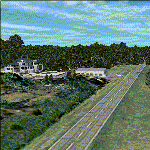
I was flying around the FSX world looking for a real world sloping airstrip just begging to be modeled with a touchdown tire squealing, smoking rubber - that kind of hardened surface sloping runway after I finally figured out how to persuade the FSX SDK to compile one. The Airfield Candidate shall have high density LiDAR elevation and high resolution Orthoimagery data available for public download. I was flying a Beechcraft Baron 58 over Wanaque Reservoir in Northeast NJ of all places when I happened upon a photo scenery runway on a sloping hill top without the usual FSX flattened airport plateau effect and FSX textured runway. They have missed this one ! Hello JY43. - Wally-Bob
| Filename: | JY43_Hill_Top_Airport_NJ.zip |
| License: | Freeware, limited distribution |
| Added: | 9th March 2011, 23:20:14 |
| Downloads: | 1,073 |
| Author: | Walter Roberts |
| Size: | 67.74 MB |
| Category: Flight Simulator X - Aircraft Repaints, Textures and Modifications | |
| AirCal Corporate-Executive Beech King Air B200 - Update |
|
File Description:
Quick update. Just place this file in your Texture.aircal folder of your Carenado_B200_King_Air aircraft. The color was very slightly off...this updates it. Also, to make the winglets show, in the cockpit, hit shift 5, and click on winglets. There they are!
| Filename: | AirCal_CorporateExecutive_Beech_King_Air_B200__Upd.zip |
| License: | Freeware |
| Added: | 13th October 2013, 13:29:45 |
| Downloads: | 271 |
| Author: | Ray Reyes |
| Size: | 669.67 KB |
| Category: Flight Simulator X - Aircraft Repaints, Textures and Modifications | |
| Tobago Express Dash 8 |
|
File Description:
Before Caribbean Airlines bought Tobago Express they operated a fleet of 5 dash 8
this is a repaint of 9Y-WIP in its white fuselage and not full colours
This repaint is for the payware virtualcol dash 8 300
Enjoy Happy Flying
| Filename: | Tobago_Express_Dash_8.zip |
| License: | Freeware |
| Added: | 2nd December 2018, 17:17:29 |
| Downloads: | 69 |
| Author: | Andre Noreiga |
| Size: | 1.12 MB |
| Category: Prepar3D V5 - AI Aircraft | |
| P3DV4-5 FSPXAI EMB190 and 195 TAP - Air Portugal |
|
Images related to this file:
File Description:
Textures only for the FSPXAI - EMBRAER E-JET FOR P3D4/5 AI-TRAFFIC payware. Fantastic model and paint kit by Mitsushi Yukata with PBR textures. Two models: 190 and 195. Paint by Joel Branchu for real traffic with the registrations. Mar 2021
| Filename: | P3DV45_FSPXAI_EMB190_and_195_TAP__Air_Portugal.zip |
| License: | Freeware |
| Added: | 22nd March 2021, 17:51:48 |
| Downloads: | 137 |
| Author: | Joel Branchu |
| Size: | 2.6 MB |
| Category: Prepar3D V5 - AI Aircraft | |
| P3DV4-5 FSPXAI Embraer E-JET Eastern Airways fleet |
|
Images related to this file:
File Description:
Textures only for the FSPXAI - EMBRAER E-JET FOR P3D4/5 AI-TRAFFIC payware. Fantastic model and paint kit by Mitsushi Yukata with PBR textures. Two variations: E170 and E190. Paint by Joel Branchu for real traffic with the registrations. Sep 2021
| Filename: | P3DV45_FSPXAI_Embraer_EJET_Eastern_Airways_fleet.zip |
| License: | Freeware |
| Added: | 22nd September 2021, 00:13:31 |
| Downloads: | 199 |
| Author: | Joel Branchu |
| Size: | 2.45 MB |
| Category: Prepar3D V5 - AI Aircraft | |
| P3DV4-5 FSPXAI Embraer E195 Great Dane Airlines fleet |
|
Images related to this file:
File Description:
Textures only for the FSPXAI - EMBRAER E-JET FOR P3D4/5 AI-TRAFFIC payware. Fantastic model and paint kit by Mitsushi Yukata with PBR textures. Two variations: standard and Bamboo livery. Paint by Joel Branchu for real traffic with the registrations. JUL 2021
| Filename: | P3DV45_FSPXAI_Embraer_E195_Great_Dane_Airlines_fle.zip |
| License: | Freeware |
| Added: | 25th July 2021, 16:21:20 |
| Downloads: | 109 |
| Author: | Joel Branchu |
| Size: | 2.6 MB |


© 2001-2026 AVSIM Online
All Rights Reserved
Privacy Policy |