
Where Flight Simulation Enthusiasts Gather from Around the World!
AVSIM Library - Search Results

| Category: Flight Simulator X - Scenery | |
| RAF Wendling - Norfolk, England |

|
File Description:
RAF Wendling is a former Royal Air Force station located 4 miles (6.4 km) north west of East Dereham, Norfolk, England. Opened in 1942, it was used by both the Royal Air Force (RAF) and United States Army Air Forces (USAAF). During the war it was used primarily as a bomber airfield, being the home of the United States Army Air Forces Eighth Air Force 392nd Bombardment Group. After the war, it was used by the RAF as a standby airfield before being finally closed in 1961 and returned to agriculture. With the end of military control the airfield has become a turkey farm.
| Filename: | RAF_Wendling___Norfolk_England.zip |
| License: | Freeware |
| Added: | 16th February 2016, 17:37:49 |
| Downloads: | 195 |
| Author: | Terry Boissel |
| Size: | 197.67 KB |
| Category: Flight Simulator X - Scenery | |
| ValparaÃso Provincia, Litoral 2016. Chile. For FSX |
|
Images related to this file:
File Description:
Scenery of ValparaÃso Province from North (Quintero) to South (Laguna Verde valley). About 2.000 km2 intervention that brings up to fsx the current urban density, neighborhoods, forests and the most important iconic 3d objects you can recognize from a real VFR flight. This project uses FTX Vector as it main complement (only for the shapes of the coast). Also uses satellite background DAY/NIGHT, SPRING/ FALL / WINTER Photoscenery for Ritoque, Aconcagua, Concon, Embalse Los Aromos, Salinas, Borde Costero de Viña del Mar, Tranque La Luz, Peñuelas. Recomended to use (as an option) with my airport projects. SCVM, SCER, SCRD, SCSN, SCCV, SCIR, SCEL.
| Filename: | Valparaso_Provincia_Litoral_2016_Chile_For_FSX.zip |
| License: | Freeware |
| Added: | 4th November 2016, 04:59:42 |
| Downloads: | 1,097 |
| Author: | Orlando Veas |
| Size: | 180.36 MB |
| Category: Flight Simulator X - Scenery | |
| VVBM - Buon Ma Thuot Airport, Daklak, Vietnam |
|
Images related to this file:
File Description:
Buon Ma Thuot Airport (IATA: BMV, ICAO: VVBM) (Vietnamese: Sân bay Buôn Ma Thuá»™t) is a public airport in Vietnam. The airport is located in Äắk Lắk Province and has one functional runway. A second incomplete runway (marked with a faded 27 R) is not in use. Two aprons are located on the south side of the airport with buildings that appeared to be used for aircraft storage. A barracks-like camp is located to the north side of the airport. This airport handled 860,000 passenger in 2016. There are Vietnam Airlines, Vietjet Air, Jetstar Pacific Airlines flying from and to here every day.
| Filename: | VVBM__Buon_Ma_Thuot_Airport_Daklak_Vietnam.zip |
| License: | Freeware |
| Added: | 1st July 2017, 07:08:23 |
| Downloads: | 988 |
| Author: | VNFS |
| Size: | 6.75 MB |
| Category: Prepar3D V1-4 - Scenery | |
| KCEY, Kyle-Oakley Field Murray KY USA (P3D) |
|
Images related to this file:
File Description:
KCEY is a public use, single runway airport located 4 miles NW of Murray KY. Runway 5/23 is an asphalt runway 6203x100 feet long. 100LL, Jet-A and MOGAS are available at this airport.
I added an area of photo real about a mile square around the airport. It blends best with Orbx Global and LC North America. All the airport objects such as hangers, fences, fuel tanks, signs, etc. are all custom made objects based on pictures obtained on-site. The runways, taxiways and aprons are all custom textures as well as runway and taxiway lights. This is an authentic recreation of the real world airport.
| Filename: | KCEY_KyleOakley_Field_Murray_KY_USA_P3D.zip |
| License: | Freeware |
| Added: | 12th March 2018, 22:15:59 |
| Downloads: | 204 |
| Author: | Shannan G Landreth |
| Size: | 66.74 MB |
| Category: Flight Simulator X - Scenery | |
| 6I2 - Lebanon-Springfield Airport - Kentucky, USA [FreeMeshX - USA-optimized] |
|
Images related to this file:
File Description:
Lebanon-Springfield Airport (FAA LID: 6I2), a public use airport in Washington County, Kentucky (KY), USA. It is located three nautical miles (6 km) south of Springfield in Washington County) and north of Lebanon (in Marion County). The airport is owned by Marion and Washington Counties. The scenery contains seasonal ground textures for winter, spring, summer, autumn and night; autogen and default scenery objects of FSX plus a modified AFCAD file. Tested with FSX: SE on Windows 10. Version 1.1 contains fixes for the terrain aswell as corrected scenery objects.
** Do not use this version with the default mesh; use 6I2_NO_FMX.zip instead **
By Peregrine Simulations
| Filename: | 6I2__LebanonSpringfield_Airport__Kentucky_USA_Free.zip |
| License: | Freeware, limited distribution |
| Added: | 21st February 2018, 23:36:13 |
| Downloads: | 415 |
| Author: | Peregrine Simulations |
| Size: | 104.1 MB |
| Category: Flight Simulator X - Scenery | |
| 6I2 - Lebanon-Springfield Airport - Kentucky, USA |
|
Images related to this file:
File Description:
Lebanon-Springfield Airport (FAA LID: 6I2), a public use airport in Washington County, Kentucky (KY), USA. It is located three nautical miles (6 km) south of Springfield in Washington County) and north of Lebanon (in Marion County). The airport is owned by Marion and Washington Counties. The scenery contains seasonal ground textures for winter, spring, summer, autumn and night; autogen and default scenery objects of FSX plus a modified AFCAD file. Tested with FSX: SE on Windows 10. Version 1.1 contains fixes for the terrain aswell as corrected scenery objects.
** Do not use this version with FreeMesh X - USA; use 6I2_FMX.zip instead **
By Peregrine Simulations
| Filename: | 6I2__LebanonSpringfield_Airport__Kentucky_USA.zip |
| License: | Freeware, limited distribution |
| Added: | 21st February 2018, 23:36:38 |
| Downloads: | 250 |
| Author: | Peregrine Simulations |
| Size: | 104.1 MB |
| Category: Prepar3D V1-4 - Aircraft Repaints, Textures and Modifications | |
| Beechcraft Staggerwing (CF-BBB) |
|
Images related to this file:
File Description:
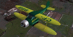
This folder contains a repaint for the Alabeo Beech Staggerwing in the colors of Staggerwing c/n 113 was built in 1936 and went to Canada as CF-BBB, where it flew with Mackenzie Air Service of Edmonton, serving the North of Canada. It was equipped with ski or wheels during wintertime, with the skies covering the extended landing gear, and floats during the summer. She was impressed into the Armed Forces during the war, and flew with several owners after the war, until being destroyed in a crash near Windigo in 1955. Repaint by Jan Kees Blom, based on the blank textures by Alabeo.
| Filename: | Beechcraft_Staggerwing_CFBBB.zip |
| License: | Freeware |
| Added: | 14th July 2018, 19:46:26 |
| Downloads: | 94 |
| Author: | Jan Kees Blom |
| Size: | 10.15 MB |
| Category: Prepar3D V5 - Scenery | |
| Gympie YGYM |
|
Images related to this file:
File Description:
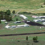
Gympie Aerodrome is located approximately 12 km south of Gympie Town Centre and approximately 75 km north of Maroochydore.
The aerodrome is owned and managed by Gympie Regional Council and serves the local area.
Whilst predominantly used for recreational purposes, there are a number of flight training and aircraft maintenance businesses based at the aerodrome, together with the Gympie Aero Club and Gympie Gliding Club.
This scenery is an adaption from OZx. It has been updated with a new ground texture, and a sloped runway to match the real world. Note this scenery only works with P3Dv5 and you must have the complete OZx scenery installed. Link in the readme.
| Filename: | Gympie_YGYM.zip |
| License: | Freeware |
| Added: | 23rd February 2021, 20:04:17 |
| Downloads: | 176 |
| Author: | Joel Richters |
| Size: | 135.46 MB |
| Category: Prepar3D V1-4 - Scenery | |
| EGKK - Gatwick Intl Airport - London, UK |
|
File Description:
This is Ray Smith's 'FSX_egkk_rs' file. Ray has given me permission modify his file for use with Prepar3Dv4. This is a reasonably accurate version of Gatwick Intl Airport to reflect today's situation and made only for P3Dv4: The North terminal buildings and its pier have been completely replaced with something better than the stock airport, new control tower, assigned parking as per their website with extra parking including Gate 110 for the A380, Runway 8L/26R closed and used as a taxiway, taxiways and taxi signs updated to the latest charts, extra fuel trucks, support vehicle roads rebuilt and many other scenery improvements and objects added.
| Filename: | EGKK__Gatwick_Intl_Airport__London_UK.zip |
| License: | Freeware |
| Added: | 10th December 2017, 07:43:22 |
| Downloads: | 34,138 |
| Author: | Robert Catherall |
| Size: | 2.56 MB |
| Category: Prepar3D V1-4 - Scenery | |
| Balikesir Koca Seyit Airport |
|
Images related to this file:
File Description:
Balıkesir Koca Seyit Airport (LTFD) scenery for Prepar3D/FSX. The airport was first opened in 1997 with the name of Edremit Körfez Airport and the name was later changed to Balıkesir Koca Seyit Airport in 2012. The airport reached to its current state in 2014 with new larger terminal, larger runway, new larger apron area and new support buildings. It is positioned near to north Egean holiday locations. The airport is named after the First World War gunner Corporal Seyit who is famous for his part in the Dardanelles War on 18 March 1915, and is orinally from a small town nearby. By Sunay KILIC.
| Filename: | Balikesir_Koca_Seyit_Airport.zip |
| License: | Freeware, limited distribution |
| Added: | 13th March 2017, 07:19:00 |
| Downloads: | 790 |
| Author: | Sunay KILIC |
| Size: | 109.89 MB |


© 2001-2026 AVSIM Online
All Rights Reserved
Privacy Policy |