
Where Flight Simulation Enthusiasts Gather from Around the World!
AVSIM Library - Search Results

| Category: Flight Simulator 2004 - Scenery | |
| Vancouver Default Object Corrections for Ultimate Terrain |

|
Images related to this file:
File Description:
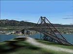
The default shorelines that come with Microsoft Flight Simulator 2004 are inaccurately placed. Consequently roads and other features are misplaced. Ultimate Terrain (R) from Flight One Software corrects this, however the Microsoft default objects are then misplaced. This software corrects the Lions Gate Bridge, Canada Place, Harbour Centre, Burrard Bridge, Science World and BC Place Stadium. Further it excludes a number of generic MS buildings that are now placed in False Creek. For developers, the XML code is included. Users may delete this file. Ultimate Terrain required. By Jon Patch
| Filename: | Vancouver_Default_Object_Corrections_for_Ultimate_.zip |
| License: | Check within download |
| Added: | 5th May 2010, 21:43:07 |
| Downloads: | 3,517 |
| Author: | Jon Patch |
| Size: | 288.76 KB |
| Category: Flight Simulator X - Aircraft Repaints, Textures and Modifications | |
| Delta Airlines Texture for Concorde-X (N716CN) |
|
Images related to this file:
File Description:
This is a Delta Airlines repaint (freeware textures only) of the Concorde-X (payware) by FlightSimLabs Ltd (http://www.flightsimlabs.com). Since paint on the Concorde was limited due to speed and altitude, only the tail and logo are painted. Night textures included. See ya at Mach 2.
| Filename: | Delta_Airlines_Texture_for_ConcordeX_N716CN.zip |
| License: | Freeware |
| Added: | 7th April 2010, 01:13:15 |
| Downloads: | 373 |
| Author: | Charan Kumar |
| Size: | 8.8 MB |
| Category: Flight Simulator 2004 - Scenery | |
| Sion Hospital for FS2004 and Suisse 2004 |
|
Images related to this file:
File Description:
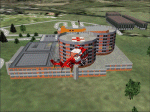
Sion Hospital (Switzerland) near the airport of Sion (LSGS). To be used with Suisse 2004 sceneries or alone. Landable deck. Reload after hack. Had more than 5000 downloads.
| Filename: | Sion_Hospital_for_FS2004_and_Suisse_2004.zip |
| License: | Freeware |
| Added: | 18th April 2010, 14:42:12 |
| Downloads: | 973 |
| Author: | Daniel Gauthier |
| Size: | 1.31 MB |
| Category: Flight Simulator 2004 - AFCAD Files | |
| AFCAD2 Files For Eastern Europe Part 3 |
|
File Description:
FS2004 AFCAD2 Files For Eastern Europe Part 3. A collection of 51 AFCAD files and 1 update to EEUafcad_part 2 for Russia, Kyrgyzstan, Ukraine, Tajikistan and other CIS states. Corrections to existing default wrong ICAO codes and/or position. New airports Microsoft left out (UEBD UHMK UHMW UIKB UNIT UNIS and more). All positions have been checked against Google earth and AIRAC docs.
| Filename: | AFCAD2_Files_For_Eastern_Europe_Part_3.zip |
| License: | Freeware |
| Added: | 26th December 2009, 21:10:58 |
| Downloads: | 1,040 |
| Author: | Fernand Verbraecken |
| Size: | 353.46 KB |
| Category: Flight Simulator X - Scenery | |
| Enhanced Shore waves for FSX and FS2004 |
|
Images related to this file:
File Description:
The default waves are too small, not random enough, they flicker like a tadpole tail, and move about 100 mph. These new ones are slower, more randon in shape and size, and move eventually into shore for a more realistic effect and not as cartoony.
| Filename: | Enhanced_Shore_waves_for_FSX_and_FS2004.zip |
| License: | Freeware |
| Added: | 29th December 2009, 14:26:37 |
| Downloads: | 4,417 |
| Author: | David Cotton |
| Size: | 76.72 KB |
| Category: Navigation and ATC - Navigation | |
| Caribbean World Aeronautical Chart Chunks for FSMap |
|
File Description:
Sectional chart chunks made from the August 2009 Sectional charts at the original scale, formatted in the WGS84 lat/long geographic coordinate system for the FSMap, moving map application for flight simulation use.
Coverage is the Bahamas, Cuba, Jamaica, Haiti, the Dominican and the Guadeloupe island areas.
The chart chunks are baseline 8bit tiffs with packbit compression applied that are 2750x2480 pixels at about 6.5mb each. Also, included is the FSMap fsm Calibration file for importing. The Caribbean jpegs that were previously uploaded, I lowered the gamma quite a bit due to WAC being too harsh to view on the display. With these tiffs I left them as is, because of the dimming feature in the FSMap gauge, one of the many great features the FSMap package has to offer.
| Filename: | Caribbean_World_Aeronautical_Chart_Chunks_for_FSMa.zip |
| License: | Freeware |
| Added: | 19th March 2010, 01:16:53 |
| Downloads: | 780 |
| Author: | David Myers |
| Size: | 84.36 MB |
| Category: Flight Simulator 2004 - Scenery | |
| Tongass Remote Airfield v2 - for Tongass Fjords |
|
Images related to this file:
File Description:
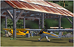
Tongass Remote Airfield v2 - for Tongass Fjords (FS9)
"Tongass Remote Airfield" v2 (RATR) Alaskan bush flying scenery (Fictitious).
This airstrip is for Flight Simulator 2004 and for the "Tongass Fjords" (FS9) addon by Holger Sandmann & Bill Womack; you must have "Tongass Fjords" (FS9) for this to work. Version 2 is a detailed, stand alone, remake of the first version, see PDF file.
Field history and description:
In the early days this area was well known to prospectors and hunters. A small mine was established and later abandoned. Around the late 40s a crew was contracted to clear a small landing area to gain easier access for hunters and campers. Due to the extreme remoteness of this area that clearing took several years. The last phase was the approach, clearing by hand a descending glide slope through just the tops of the tall trees. There is now just enough room for a very experienced pilot to get in and out of this field. The airfield is 26 miles north of Petersburg Alaska (PAPG). This is a tricky narrow approach with a left hand dogleg and then an immediate right hand dogleg turn just before the final approach. Not much time to set up your approach; also, it's a very short runway. For experienced pilots only, and make sure that your life insurance is up to date. Good luck.
| Filename: | Tongass_Remote_Airfield_v2__for_Tongass_Fjords.zip |
| License: | Freeware, limited distribution |
| Added: | 22nd March 2010, 13:16:16 |
| Downloads: | 626 |
| Author: | Jay Langham |
| Size: | 6.18 MB |
| Category: Navigation and ATC - Navigation | |
| Omaha Sectional Chart Chunks for Aerosoft's FSMap |
|
File Description:
Sectional chart chunks made from the August 2009 Sectional charts at the original scale, formatted in the WGS84 lat/long geographic coordinate system for the FSMap, moving map application for flight simulation use. The chart chunks are the full sectional divided by 2 tiles (east/west) and converted to baseline 8bit tiffs with packbits compression applied. The images are about 6,000x6,000 pixels at about 25mb each, also included is the FSMap fsm Calibration file for importing.
| Filename: | Omaha_Sectional_Chart_Chunks_for_Aerosofts_FSMap.zip |
| License: | Freeware |
| Added: | 22nd March 2010, 20:40:14 |
| Downloads: | 323 |
| Author: | David Myers |
| Size: | 29.55 MB |
| Category: Navigation and ATC - Navigation | |
| Chicago Sectional Chart Chunks for Aerosoft's FSMap |
|
File Description:
Sectional chart chunks made from the August 2009 Sectional charts at the original scale, formatted in the WGS84 lat/long geographic coordinate system for the FSMap, moving map application for flight simulation use. The chart chunks are the full sectional divided by 2 tiles (east/west) and converted to baseline 8bit tiffs with packbits compression applied. The images average 6,000x6,000 pixels at about 25mb each, also included is the FSMap fsm Calibration file for importing.
| Filename: | Chicago_Sectional_Chart_Chunks_for_Aerosofts_FSMap.zip |
| License: | Freeware |
| Added: | 22nd March 2010, 20:40:31 |
| Downloads: | 514 |
| Author: | David Myers |
| Size: | 31.9 MB |
| Category: Navigation and ATC - Navigation | |
| Detroit Sectional Chart Chunks for Aerosoft's FSMap |
|
File Description:
Sectional chart chunks made from the August 2009 Sectional charts at the original scale, formatted in the WGS84 lat/long geographic coordinate system for the FSMap, moving map application for flight simulation use. The chart chunks are the full sectional divided by 2 tiles (east/west) and converted to baseline 8bit tiffs with packbits compression applied. The images average 6,000x6,000 pixels at about 25mb each, also included is the FSMap fsm Calibration file for importing.
| Filename: | Detroit_Sectional_Chart_Chunks_for_Aerosofts_FSMap.zip |
| License: | Freeware |
| Added: | 22nd March 2010, 20:40:50 |
| Downloads: | 390 |
| Author: | David Myers |
| Size: | 33.56 MB |


© 2001-2026 AVSIM Online
All Rights Reserved
Privacy Policy |