
Where Flight Simulation Enthusiasts Gather from Around the World!
AVSIM Library - Search Results

| Category: Flight Simulator 2004 - AI Flight Plans | |
| Royal Brunei Airlines Wi08/09 AI Flightplans |

|
File Description:
Here are the Winter 08/09 AI flightplans for Royal Brunei Airlines. All flight data was taken from the .pdf file available on their website. A319, A320 and B763 equipment is used and all are available here on avsim. As always, please read the READ_ME.TXT file included. Enjoy
| Filename: | Royal_Brunei_Airlines_Wi0809_AI_Flightplans.zip |
| License: | Freeware |
| Added: | 26th December 2008, 18:40:00 |
| Downloads: | 518 |
| Author: | Marty Lochmiller |
| Size: | 12.89 KB |
| Category: Flight Simulator X - Scenery | |
| Mesh for Southern Africa, Base Grid 0704 |
|
Images related to this file:
File Description:
Highly detailed 76m SRTM mesh for Africa using the latest release of STRM Data V2.1. This file covers the Africa Area of base file 0704 (S01 and E30), South of the Equator, Mauritius, Madagascar, Comoros, Reunion Island, Tromelin Island included. DO NOT DISABLE THE DEFAULT DEM 704 FILE.
| Filename: | Mesh_for_Southern_Africa_Base_Grid_0704.zip |
| License: | Freeware |
| Added: | 8th February 2014, 08:47:05 |
| Downloads: | 3,230 |
| Author: | Martin du Preez, Hannes Steyn, Aeroworx |
| Size: | 252.42 MB |
| Category: Flight Simulator X - Scenery | |
| Mesh for Northern Africa, Base Grid 0702 |
|
Images related to this file:
File Description: Highly detailed 76m SRTM mesh for Africa using the latest release of STRM
Data V2.1. This file covers the Africa Area of base file 0702 (N23 and E30),
North of the Equator, Arabia is not included, DO NOT DISABLE THE DEFAULT DEM
702 FILE.
| Filename: | Mesh_for_Northern_Africa_Base_Grid_0702.zip |
| License: | Freeware |
| Added: | 11th January 2014, 05:27:05 |
| Downloads: | 1,548 |
| Author: | Martin du Preez, Hannes Steyn, Aeroworx |
| Size: | 33.93 MB |
| Category: Flight Simulator 2004 - Scenery | |
| A set of 8 Korean Airport sceneries |
|
Images related to this file:
File Description:

This is Korea Airport Scenery for FS9. This scenery package includes airport such as Gimpo INTL Airport(RKSS), Gwangju Airport (RKJJ), Gimhae INTL Airport (RKPK), Choengju INTL airport (RKTU), Muan INTL airport (RKJB), Ulsan Airport (RKPU), Mokpo Airport (RKJM), Gunsan Airport (RKJK). Apply newest data to All Airport sceneries.
| Filename: | A_set_of_8_Korean_Airport_sceneries.zip |
| License: | Freeware, limited distribution |
| Added: | 23rd September 2010, 20:36:07 |
| Downloads: | 2,753 |
| Author: | Seongsu Kim |
| Size: | 11.6 MB |
| Category: Flight Simulator X - Utilities | |
| Boeing 737-800 NGX Fuel Planner 1 |
|
Images related to this file:
File Description:
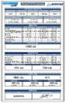
This fuel planner was created from data collected by kACARS_free during flights test, and from the PMDG's tutorial, the result is approximate but corresponds to consumption relative with the consumption of the NGX.
Small modification of the first version and you have now two sheets, pounds and kilogramme.
| Filename: | Boeing_737800_NGX_Fuel_Planner_1.zip |
| License: | Freeware |
| Added: | 6th February 2013, 12:26:34 |
| Downloads: | 6,192 |
| Author: | Frederic Furst |
| Size: | 106.35 KB |
| Category: Flight Simulator X - Utilities | |
| FS2004/FSX/Prepar3D Flight Analyzer/Logbook Utility V6.14 |
|
File Description:
FS2004/FSX/Prepar3D Flight Analyzer/Logbook Utility V6.14 Flight Data Recorder - Logbook. Now a few bugs are fixed. Very easy to use, just make a flight plan in the simulator or in this utility. What this program does: quickly change the settings of P3D/FSX/Fs2004, such as time, date, fuel, weight, traffic etc.; start a failure sytem, such as gear, flaps, engine, etc.; freeze the time, so you can fly in a for everlasting sunset; runway detecting system to see wich runways are in use; flight analyzing/data recording from departure to parking at the gate; When flight analysis is finished you can print a report, the report is automaticly saved as pdf File. By Evander Tholen.
| Filename: | FS2004FSXPrepar3D_Flight_AnalyzerLogbook_Utility_V.zip |
| License: | Shareware, limited functionality |
| Added: | 21st January 2020, 17:43:48 |
| Downloads: | 193 |
| Author: | Evander Tholen |
| Size: | 3.43 MB |
| Category: Flight Simulator 2004 - AFCAD Files | |
| LLMG Meggido, Israel |
|
Images related to this file:
File Description:
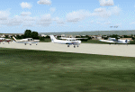
Googlyafcad A&F Data for Meggido, based on Google Earth satellite data.
Unfortunately, Microsoft have provided no facilities at this airport in Flight Simulator 2004 other than a runway and this file will allow you and your "AI" traffic to land, taxi, park and take off in a realistic manner.
Meggidio airfield was built in 1942 by the British Forces and was used by the Israeli Air Force (under the name Shachar 7) until turned over to general aviation, gliding and crop spraying use in the 1970s. There are proposals to transform it into a commercial airport with international flights to develop tourism. [File re-uploaded at request of AVSIM]
| Filename: | LLMG_Meggido_Israel.zip |
| License: | Freeware |
| Added: | 20th June 2010, 10:49:59 |
| Downloads: | 497 |
| Author: | John Hinson |
| Size: | 47.28 KB |
| Category: Flight Simulator 2004 - Scenery | |
| Greece SRTM Mesh Part 1 |
|
File Description:
This terrain mesh scenery covers Greece, including all Aegean sea islands, plus most parts of Albania and Macedonia up to 41°50'N. Some parts of Bulgaria and Turkey are also included in northern and eastern boundaries of the mesh. The greek island of Crete isn't part of this mesh because SRTM data isn't yet released for the whole island.
Based on SRTM Data (3 arcsec, 90m), generated with Matthew Styles's program "SRTM To BGL v1.04", sampled to LOD9 resolution (76m). While only tested with Fs2004, this mesh should also run with FS2002.
This part contains northern parts of the mesh: Greece-N.bgl, Greece-NE1.bgl and Greece-NE2.bgl. See Greece_Mesh_Part1-1.jpg for exact bgl coverage.
| Filename: | Greece_SRTM_Mesh_Part_1.zip |
| License: | Freeware |
| Added: | 10th November 2003, 02:08:20 |
| Downloads: | 10,987 |
| Author: | Yohann Baptiste |
| Size: | 17.75 MB |
| Category: Flight Simulator 2004 - Scenery | |
| Greece SRTM Mesh Part 2 |
|
File Description:
This terrain mesh scenery covers Greece, including all Aegean sea islands, plus most parts of Albania and Macedonia up to 41°50'N. Some parts of Bulgaria and Turkey are also included in northern and eastern boundaries of the mesh. The greek island of Crete isn't part of this mesh because SRTM data isn't yet released for the whole island.
Based on SRTM Data (3 arcsec, 90m), generated with Matthew Styles's program "SRTM To BGL v1.04", sampled to LOD9 resolution (76m). While only tested with Fs2004, this mesh should also run with FS2002.
This part contains all bgl files except Greece-N.bgl, Greece-NE1.bgl and Greece-NE2.bgl. See Greece_Mesh_Part2-1.jpg for details.
| Filename: | Greece_SRTM_Mesh_Part_2.zip |
| License: | Freeware |
| Added: | 10th November 2003, 02:09:45 |
| Downloads: | 10,927 |
| Author: | Yohann Baptiste |
| Size: | 18.54 MB |
| Category: Flight Simulator 2004 - Gauges | |
| Apollo MX20 Multi-Function Display/GPS |
|
File Description:
This gauge is modeled after the Apollo MX20 Multi-Function Display. This gauge is written in XML and is designed to mesh with the default FS9GPS map input data. Compatible with FS2004 (FS9) ONLY!
Although I tried to make this gauge as close to the real Apollo MX20 as possible it is not considered to be an exact replica. It is limited to certain features that the FS9 data will provide. It does however have all the great features that the default FS9GPS offers and offers an alternative to the default GPS.
Size (pixel size) is the same as the FS9 default GPS so placement (or replacement) of the gauge is quick and easy.
| Filename: | Apollo_MX20_MultiFunction_DisplayGPS.zip |
| License: | Freeware |
| Added: | 24th December 2003, 05:29:16 |
| Downloads: | 9,189 |
| Author: | Keith Giveans |
| Size: | 156.91 KB |


© 2001-2026 AVSIM Online
All Rights Reserved
Privacy Policy |