
Where Flight Simulation Enthusiasts Gather from Around the World!
AVSIM Library - Search Results

| Category: Flight Simulator 2004 - Aircraft Repaints, Textures and Modifications | |
| Dash Virtual 747-400 |

|
File Description:
A Repaint of MELJETS 747-400 GE in Dash Virtual Colours. Model included. Very nice dynamic wing views, opening doors, opening cargo doors, and very nice to fly with !
| Filename: | Dash_Virtual_747400.zip |
| License: | Freeware, limited distribution |
| Added: | 18th December 2003, 00:33:41 |
| Downloads: | 163 |
| Author: | Dash Virtual |
| Size: | 1.9 MB |
| Category: Flight Simulator X - Scenery | |
| China International Airports: ZBLA Hulunbeier/Hailar |
|
Images related to this file:
File Description:
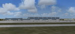
Uptodate representation of Hulunbeier Hailar International Airport. In FSX it was contained under its former name Hailar Dongshan Airport. Airport layout corresponds to satellite images and actual charts, buildings made with GMAX.
| Filename: | China_International_Airports_ZBLA_HulunbeierHailar.zip |
| License: | Freeware, limited distribution |
| Added: | 29th September 2021, 16:33:45 |
| Downloads: | 408 |
| Author: | Winfried Orthmann |
| Size: | 64.33 MB |
| Category: Flight Simulator 2002 - AFCAD Files | |
| EKCH Kopenhagen/Kastrup |
|
File Description:
AFCAD file for the wonderful Kastrup scenery by L&P, available at www.fsnordic.net. Reworked for best performance and reality from real airport charts. Requires AFCAD by Lee Swordy. See Readme.txt for details.
| Filename: | EKCH_KopenhagenKastrup.zip |
| License: | Freeware |
| Added: | 12th July 2004, 22:14:57 |
| Downloads: | 618 |
| Author: | Martin Landmann |
| Size: | 12.76 KB |
| Category: Flight Simulator 2002 - AFCAD Files | |
| EGLL Heathrow Gates and Taxiways |
|
File Description:
Addition of parking spaces using terminal
charts for a total of 172 parking spaces.
Runway 9R/27L is closed for landings and
runway 9L/27R is closed for takeoffs.
Requires AFCAD v1.2.2.
| Filename: | EGLL_Heathrow_Gates_and_Taxiways.zip |
| License: | Freeware |
| Added: | 25th June 2002, 18:01:50 |
| Downloads: | 2,698 |
| Author: | uk_dave_2k |
| Size: | 18.46 KB |
| Category: Flight Simulator 2004 - AFCAD Files | |
| LPPT Lisbon Portela Airport AFCAD 2 |
|
File Description:
LPPT Lisbon Portela Airport AFCAD2 file.
Very realistic with all the gates in the official Airport Charts. Includes approns A, B, D, E, F, J and corrected taxiways (G2, J and W).
| Filename: | LPPT_Lisbon_Portela_Airport_AFCAD_2.zip |
| License: | Freeware |
| Added: | 28th October 2003, 23:10:55 |
| Downloads: | 3,189 |
| Author: | Filipe Cardoso |
| Size: | 4.66 KB |
| Category: Miscellaneous Files - Miscellaneous Files | |
| Thomson Airways First Half Winter Schedules In Excel Format. |
|
File Description:
This small excel sheet shows the correct flight numbers, callsigns, aircraft types, departure and destinations for this winter schedules routes by Thomsonfly/Firstchoice, including positioning and maintenance flights.
Please note these flights will slightly change from end of Decemeber when the Ski Season starts for sat/sun flights to the alps.
The data was painstakingly taken over a week from 1st Nov - 7th Nov from a variety of sources and is 99% accurate.
MS Excel needed and also no reproduction of data please without permission...
If you wish to use this data for any reason please email me..
| Filename: | Thomson_Airways_First_Half_Winter_Schedules_In_Exc.zip |
| License: | Check within download |
| Added: | 8th November 2008, 14:44:02 |
| Downloads: | 268 |
| Author: | Pete King |
| Size: | 49.58 KB |
| Category: Fly! II - TerraScene | |
| Ashtabula (Ohio Project) TerraScene Project Pack |
|
File Description:
This is a TerraScene 2.1 Project pack for northeastern Ohio. It covers all of global tile 198,160 with Ashtabula in the NE. It extends from Cleveland/Cuyahoga in the NW to Youngstown in the SE and from Erie, PA in the NE to Ravenna in the SSW. The far eastern edge extends through Meadville, PA. This pack includes updated Tiger Census (2000) shapefile data, adding new water areas, new highways, and other details. All scenery data files are included: USGS data, shapefiles, and a complete water mask. Requires TerraScene 2.1 and Fly!II patched to v230 or later.
| Filename: | Ashtabula_Ohio_Project_TerraScene_Project_Pack.zip |
| License: | Freeware |
| Added: | 26th May 2010, 00:57:56 |
| Downloads: | 416 |
| Author: | Randall Rocke |
| Size: | 59.19 MB |
| Category: Fly! II - TerraScene | |
| Hilton Head (Carolinas Project) TerraScene Project Pack |
|
Images related to this file:
File Description:
Re-upload. This TerraScene 2.1 Project pack covers all of global tile 198,152, extending the coastline from Charleston to the northern portion of Savannah, GA. Along the coast you will find such beautiful areas as Pritchards Island, Beaufort, and the famous Hilton Head Island. To the north is Walterboro, SC. The Savannah area includes Savannah International Airport. This pack includes updated Tiger Census (2000) shapefile data, adding new water areas, new highways, and other details. All scenery data files are included: USGS data, shapefiles, and a complete custom water mask. Requires TerraScene 2.1 and Fly!II patched to v230 or later.
| Filename: | Hilton_Head_Carolinas_Project_TerraScene_Project_P.zip |
| License: | Freeware |
| Added: | 27th May 2010, 03:02:58 |
| Downloads: | 185 |
| Author: | Randall Rocke |
| Size: | 55.06 MB |
| Category: Fly! II - TerraScene | |
| Rocky Mount (Carolinas Project) TerraScene Project Pack |
|
Images related to this file:
File Description:
Re-upload. This TerraScene 2.1 Project pack covers all of global tile 200,155, adjoining Raleigh to the west and the Edenton area to the east. Rocky Mount is near the center, with Pitt-Greenville near the eastern border. The beautiful John H. Kerr Reservoir runs from Virginia down near Henderson, NC, continuing to the east to Roanoke Rapids Lake. This pack includes updated Tiger Census (2000) shapefile data, adding new water areas, new highways, and other details. All scenery data files are included: USGS data, shapefiles, and a complete water mask. Requires TerraScene 2.1 and Fly!II patched to v230 or later.
| Filename: | Rocky_Mount_Carolinas_Project_TerraScene_Project_P.zip |
| License: | Freeware |
| Added: | 13th June 2010, 01:58:01 |
| Downloads: | 157 |
| Author: | Randall Rocke |
| Size: | 70.19 MB |
| Category: Fly! II - TerraScene | |
| Huntington (Ohio Project) TerraScene Project Pack |
|
File Description:
Re-upload. This is a TerraScene 2.1 Project pack for southern Ohio and portions of adjoining states. It covers all of global tile 197,157 with Ashland, KY in the west and Charleston, WV in the east. Above the Ohio River, you will find a portion of southern Ohio, with rolling hills and small towns like Oak Hill and Gallipolis. This pack includes updated Tiger Census (2000) shapefile data, adding new water areas, new highways, and other details. All scenery data files are included: USGS data, shapefiles, and a complete water mask. Requires TerraScene 2.1 and Fly!II patched to v230 or later.
| Filename: | Huntington_Ohio_Project_TerraScene_Project_Pack.zip |
| License: | Freeware |
| Added: | 13th June 2010, 02:08:20 |
| Downloads: | 181 |
| Author: | Randall Rocke |
| Size: | 55.88 MB |


© 2001-2026 AVSIM Online
All Rights Reserved
Privacy Policy |