
Where Flight Simulation Enthusiasts Gather from Around the World!
AVSIM Library - Search Results

| Category: Fly! II - TerraScene | |
| Raleigh (Carolinas Project) TerraScene Project Pack |

|
Images related to this file:
File Description:
This TerraScene 2.1 Project pack covers all of global tile 199,155. It includes Greenboro, NC in the west, running to the Raleigh metropolitan area on the eastern border. In the south you will find Asheboro - in the north are Roxboro and Danville, VA. This pack includes updated Tiger Census (2000) shapefile data, adding new water areas, new highways, and other details. All scenery data files are included: USGS data, shapefiles, and a complete water mask. Requires TerraScene 2.1 and Fly!II patched to v230 or later.
| Filename: | Raleigh_Carolinas_Project_TerraScene_Project_Pack.zip |
| License: | Freeware |
| Added: | 14th May 2010, 04:39:35 |
| Downloads: | 161 |
| Author: | Randall Rocke |
| Size: | 76.01 MB |
| Category: Fly! II - TerraScene | |
| Defiance (Ohio Project) TerraScene Project Pack |
|
File Description:
This is a TerraScene 2.1 Project pack for the northwestern tip of Ohio and portions of southern Michigan and northeastern Indiana. It covers all of global tile 195,160, including the western portion of Defiance, OH and the northern portion of Fort Wayne, IN. This pack includes updated Tiger Census (2000) shapefile data, adding new water areas, new highways, and other details. All scenery data files are included: USGS data, shapefiles, and a complete water mask. Requires TerraScene 2.1 and Fly!II patched to v230 or later.
| Filename: | Defiance_Ohio_Project_TerraScene_Project_Pack.zip |
| License: | Freeware |
| Added: | 16th May 2010, 23:29:11 |
| Downloads: | 697 |
| Author: | Randall Rocke |
| Size: | 60.79 MB |
| Category: Fly! II - TerraScene | |
| Myrtle Beach (Carolinas Project) TerraScene Project Pack |
|
Images related to this file:
File Description:
This TerraScene 2.1 Project pack covers all of global tile 199,153, continuing the coastline from Georgetown, SC through Myrtle Beach. Inland you will find Conway, Marion and Florence to the west. Hartsville covers the NW, with Lake Moultrie to the SW. This pack includes updated Tiger Census (2000) shapefile data, adding new water areas, new highways, and other details. All scenery data files are included: USGS data, shapefiles, and a complete custom water mask. Requires TerraScene 2.1 and Fly!II patched to v230 or later.
| Filename: | Myrtle_Beach_Carolinas_Project_TerraScene_Project_.zip |
| License: | Freeware |
| Added: | 3rd June 2010, 22:41:45 |
| Downloads: | 176 |
| Author: | Randall Rocke |
| Size: | 51.74 MB |
| Category: Fly! II - TerraScene | |
| Phoenix, AZ Area Project Pack |
|
File Description:
This TerraScene 2.1 Project pack covers all of global tile 176,153, with Phoenix in the SW corner. It extends to the east through a portion of Roosevelt Lake and to the north as far as Payson and part of the Tonto Forest. This pack includes updated Tiger Census (2000) shapefile data, adding new water areas, new highways, and other details. All scenery data files are included: USGS data, shapefiles, and a complete water mask. Requires TerraScene 2.1 and Fly!II patched to v230 or later.
| Filename: | Phoenix_AZ_Area_Project_Pack.zip |
| License: | Freeware |
| Added: | 18th July 2003, 16:15:55 |
| Downloads: | 246 |
| Author: | Randall Rocke |
| Size: | 62.22 MB |
| Category: Flight Simulator 2004 - AFCAD Files | |
| Azerbaijan Main Airports |
|
File Description:
This is Azerbaijan airports AFCAD files for Flight Simulator 2004. UBBB, UBBG, UBBN, etc.
Fourth version. Added new RWY in UBBG. All AFCAD files update on new charts.
| Filename: | Azerbaijan_Main_Airports.zip |
| License: | Check within download |
| Added: | 8th January 2008, 21:46:37 |
| Downloads: | 1,574 |
| Author: | Ruslan Abdulla |
| Size: | 56.13 KB |
| Category: Flight Simulator X - Miscellaneous Files | |
| PMDG Sao Paulo ( Congonhas - SBSP ) Airac 1203/04 |
|
File Description:
PMDG sids/stars latest charts to SBSP with all procedures. It's my first time doing this. I hope you can make it useful. Requires PMDG payware original installed.
| Filename: | PMDG_Sao_Paulo__Congonhas__SBSP__Airac_120304.zip |
| License: | Freeware |
| Added: | 12th April 2012, 03:17:19 |
| Downloads: | 120 |
| Author: | Giorgio Schneider |
| Size: | 4.82 KB |
| Category: Flight Simulator 2004 - AFCAD Files | |
| La Coruna (LECO) - Spain. v1.0 |
|
File Description:
AFCAD2 FILE FOR A CORUNA (LECO) - SPAIN - For FS 2004 standard scenery - Design made following AENA charts - Parking slots reorganised - RWY, Aproach and PAPI lights modified- TWR added.
| Filename: | La_Coruna_LECO__Spain_v10.zip |
| License: | Freeware |
| Added: | 24th November 2003, 21:28:46 |
| Downloads: | 1,445 |
| Author: | Carlos Vigo |
| Size: | 14.32 KB |
| Category: Flight Simulator X - Scenery | |
| Cina International Airports: ZBHH Hohhot |
|
File Description:
Airport of Hohhot (ZBHH) in the province of Inner Mongolia, PR China, in its present state, layout based on satellite images and actual charts, buildings made with GMAX.
| Filename: | Cina_International_Airports_ZBHH_Hohhot.zip |
| License: | Freeware, limited distribution |
| Added: | 28th September 2021, 04:00:12 |
| Downloads: | 527 |
| Author: | Winfried Orthmann |
| Size: | 64.32 MB |
| Category: Flight Simulator 2004 - AFCAD Files | |
| EGAC Belfast City |
|
File Description:
FS2004 AFCAD file for EGAC Belfast City Airport. As a accuarate as possible using latest AERAD charts. Assigned gates for airlines serving EGAC and plenty of GA parking.
| Filename: | EGAC_Belfast_City.zip |
| License: | Freeware |
| Added: | 14th March 2006, 03:42:14 |
| Downloads: | 894 |
| Author: | Craig White |
| Size: | 3.86 KB |
| Category: Flight Simulator 2004 - AFCAD Files | |
| Newark Liberty Int'l Airport (KEWR) with active Crosswind Runway |
|
Images related to this file:
File Description:
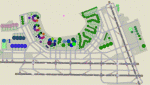
A high spec AFCAD2 for the FS2004 Newark Liberty Int'l Airport (KEWR) scenery by Steve Whalin. This afcad has been built using FAA Charts and information from the Airport Website. All taxiways are named and all aprons are reworked to be as real as possible according to photos. All gates are named as per real life and have airlines assigned to them. The Fedex and UPS aprons are represented and can accomodate many cargo aircraft. The final addition is random GA parking and the CO maintenance area to the north of the airport. Overflow parking is also available for rush hour periods (Ball Park). This airport features a tower view and also night and approach lighting. Finally, by using the crosswind runway technique, runways 04L/22R, 04R/22L and 11/29 can all be used simultaniously for take-off and landing. Runway 11/29 will be mainly used by CO Express flights. Enjoy!!
This afcad works with the Steve Whalin scenery only (Requires: kewr.zip).
| Filename: | Newark_Liberty_Intl_Airport_KEWR_with_active_Cross.zip |
| License: | Freeware |
| Added: | 2nd March 2010, 19:26:13 |
| Downloads: | 1,356 |
| Author: | Lee Brompton |
| Size: | 259.8 KB |


© 2001-2026 AVSIM Online
All Rights Reserved
Privacy Policy |