
Where Flight Simulation Enthusiasts Gather from Around the World!
AVSIM Library - Search Results

| Category: Flight Simulator X - Scenery | |
| Robben Island Airstrip (AX78), Table Bay, South Africa |

|
Images related to this file:
File Description:
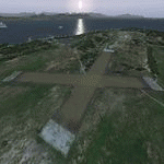
Robben Island is an island in Table Bay, some seven kilometers off the coast
of Cape Town, South Africa. The name is Dutch for "Seal Island". Robben Island
is roughly oval shaped with a disused gravel airstrip. It is of particular note
as it was here that former South African President and Nobel Laureate Nelson
Mandela and former South African President Kgalema Motlanthe, alongside many
other political prisoners were imprisoned. During the Second World War, the
island was fortified and guns were installed as part of the defences for Cape
Town. Please install fsxWorx01, fsxWorx02, and the updates before this
scenery.
| Filename: | Robben_Island_Airstrip_AX78_Table_Bay_South_Africa.zip |
| License: | Freeware, limited distribution |
| Added: | 18th November 2012, 09:56:56 |
| Downloads: | 3,483 |
| Author: | Hannes Steyn, Martin du Preez, Aeroworx |
| Size: | 18.99 MB |
| Category: Flight Simulator X - Scenery | |
| Beaufort West Airfield (FABW), South Africa |
|
Images related to this file:
File Description:
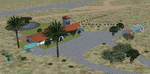
This is an upgrade of the previous release of FABW. Because of its strategically geographical important position, this small Airport is becoming more popular, especially with pilots of smaller aircraft. As a stopover, refuelling point between Cape and the Northern Provinces, East and West, its popularity is growing by the day. The airport Manager and his wife who offers B&B as well as a beautiful night out at "the gateway to the Karoo" as they call it, see to a splendid and enjoyable open and star filled overnight for those who care to call. Runway lights are also available. Please install fsxWorx01.zip, and the updates before this scenery.
| Filename: | Beaufort_West_Airfield_FABW_South_Africa.zip |
| License: | Freeware |
| Added: | 11th December 2012, 22:20:42 |
| Downloads: | 3,010 |
| Author: | Hannes Steyn, Martin du Preez, Aeroworx |
| Size: | 6.88 MB |
| Category: Flight Simulator X - Scenery | |
| Mesh for Southern Africa, Base Grid 0604 |
|
Images related to this file:
File Description:
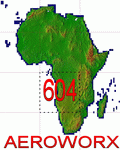
Highly detailed 76m SRTM mesh for Africa using the latest release of STRM Data V2.1. This file covers the Africa Area of base file 0604 (S01 and E00), South of the Equator. DO NOT DISABLE THE DEFAULT DEM 0604 FILE.
| Filename: | Mesh_for_Southern_Africa_Base_Grid_0604.zip |
| License: | Freeware |
| Added: | 31st January 2014, 15:21:39 |
| Downloads: | 2,945 |
| Author: | Martin du Preez, Hannes Steyn, Aeroworx |
| Size: | 397.23 MB |
| Category: Miscellaneous Files - General Utilities | |
| Professional Flight Planner X (PFPX) Boeing 767-300ER Winglets (WL) Performance Profiles Pack Version 1.1 |
|
Images related to this file:
File Description:

PFPX performance profiles for the complete family of wingleted variants of Boeing 767-300ER with winglets with all available engines for real-world operators. Multiple engine out schedules and all engine schedules, mach numbers and cost index data.
For use with Level-D 767-300ER Winglets model.
See Readme.txt for details.
| Filename: | Professional_Flight_Planner_X_PFPX_Boeing_767300ER.zip |
| License: | Freeware |
| Added: | 12th July 2015, 18:06:01 |
| Downloads: | 956 |
| Author: | Mykyta Demydiuk | FlyPrecisely |
| Size: | 1.4 MB |
| Category: Flight Simulator X - Utilities | |
| FS Earth 5.0 for Google Earth |
|
File Description:
This program acts as an interface between Flight Simulator X and Google Earth, letting to follow a flight in real time, over the satellite images generated by Google Earth. Flights can be saved, and many options are available for fine tuning the performance, as well as the map's style (zoom, tilt, orientation). Works on a single computer running FSX and Google Earth all together or, for best experience, can be used on two networked computers running respectively FSX (master) and Google Earth (slave). AI and Multiplayer traffic is also displayed in Google Earth, with course prediction and other information. Requires Flight Simulator X and Google Earth. The program running in trial mode works only around Anchorage, Alaska, (PANC / ANC) for a maximum of five minutes per flight session. Version 5.0 has improved compatibility with latest releases of Google Earth and several additional improvements. A version for FS2004 is available also.
| Filename: | FS_Earth_50_for_Google_Earth.zip |
| License: | Shareware, time limited |
| Added: | 19th July 2007, 00:46:27 |
| Downloads: | 1,104 |
| Author: | Luciano Napolitano |
| Size: | 2.44 MB |
| Category: Flight Simulator 2004 - Original Aircraft | |
| Piaggio PD-808GE |
|
File Description:
NEEDS FS9_pd808rm.ZIP TO WORK. THIS PACKAGE DOES NOT INCLUDE THE NEEDED PANEL, GAUGES AND SOUNDS.
This is a complete simulation of the Piaggio PD-808. It includes advanced engine management, realistic systems, and some failure modeling. The model features a complete 3-D virtual cockpit,and a 2-D panel. The external model features all typical animations plus a load of custom ones. Also incluides all custom special effects, including different selectable floodlights for the virtual cockpit (by simply flicking ON the proper light switch on the cockpit itself). Plus with a fly-on-the-numbers flight dynamics file. Includes full documentation. THIS IS THE FS-2004 RELEASE. IT WILL NOT WORK PROPERLY WITH FS-X. THERE IS ALSO A FS-X RELEASE THAT WILL NOT WORK PROPERLY WITH FS-2004. THis is the "GE" variant of the aircraft and requires the base package "FS9_PD808RM.zip" to work.
| Filename: | Piaggio_PD808GE.zip |
| License: | Freeware |
| Added: | 15th February 2009, 11:53:18 |
| Downloads: | 1,602 |
| Author: | Mario Noriega |
| Size: | 14.19 MB |
| Category: Flight Simulator X - Scenery | |
| Provincetown Municipal Airport (KPVC) |
|
Images related to this file:
File Description:
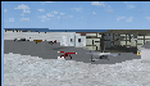
This airport was made using Airport Facilitator X, and Instant Scenery 2. Provincetown Municipal Airport is a small airport located in Provincetown, Massachusetts. Cape Air is the only airline that flies there. I added a more accurate terminal, and an aircraft hangar. I put three fuel trucks on the ramp with a fuel station. I made the taxiways the correct length and width. I also put static aircraft on the ramp and added more gates. I made a parking lot with many cars in it. If you choose to start off from a DOCK gate, you will start off inside the aircraft hanger. Taxiing or starting off inside of the hanger will cause a crash unless you have crashes turned off. This is all based on Google Earth and Bing Maps. Please read the readme for instructions on how to install. This is for Flight Simulator X only.
| Filename: | Provincetown_Municipal_Airport_KPVC.zip |
| License: | Freeware |
| Added: | 21st January 2012, 20:08:09 |
| Downloads: | 607 |
| Author: | Tyler Lawrence |
| Size: | 6.86 MB |
| Category: X-Plane - Aircraft Repaints, Textures and Modifications | |
| Bergamo Aero Club Cessna 172N Skyhawk II (I-CCAP) |
|
Images related to this file:
File Description:

This archive only contains textures for the Carenado 172II V2 aircraft. In order for it to work, you need to own this specific aircraft. Since these are only textures, no further support is necessary, just follow the instructions below.
*** I have included a .obj file that Dan Klaue provided to fix a small problem causing wing registrations to display incorrectly. The filename is TransparentStickers.obj. You must copy this file to the aircraft's main objects folder of the Carenado C172II v2 main folder. You will be asked if you want to replace the existing file, say yes. Make a backup of the original first. This file will enable the under-wing registration of the aircraft.
Then open the zip file and move the whole folder I-CCAP to X-Plane 10 (where you installed X-Plane)--->Aircraft-->Carenado Cessna 172 v2 (where you installed the Carenado package)--->liveries. That's it!
| Filename: | Bergamo_Aero_Club_Cessna_172N_Skyhawk_II_ICCAP.zip |
| License: | Freeware, limited distribution |
| Added: | 16th June 2013, 02:23:15 |
| Downloads: | 98 |
| Author: | Michel Theriault |
| Size: | 14.82 MB |
| Category: Flight Simulator X - AFCAD Files | |
| PASD - Sand Point, Alaska |
|
Images related to this file:
File Description:
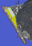
The airport of Sand Point (PASD) has been extended since Microsoft has modeled it and even after the upgrade through Scenery Solution's Ultimate Terrain X Alaska has been produced. This AFCAD is built on the UTX version of the airport and is intended to be used in this environment only.
The file considers the extended runway, VASI4 at both ends with 3.6 deg glideslope and the necessary new water-polygon. Due to the specific coastline bitmaps used by UTX I had to change to Microsoft's default ones being accessible through the wonderful tool Airport Design Editor X. Some additional landclass in the airport's vicinity and three (default) buildings close to the apron are completing the changes. I did not touch the easterly landing stage (or whatever it could have been) even if Google suggests that it disappeared meanwhile except some remaining piles in the water - it's just looking nice. ;-)
| Filename: | PASD__Sand_Point_Alaska.zip |
| License: | Freeware |
| Added: | 17th October 2013, 18:55:00 |
| Downloads: | 377 |
| Author: | Axel Birsul |
| Size: | 646.25 KB |
| Category: Flight Simulator X - Utilities | |
| FS Earth 5.2 for Google Earth and FSX |
|
Images related to this file:
File Description:
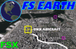
This program acts as a link between Flight Simulator X and Google Earth, letting to follow a flight in real time, over the satellite images generated by Google Earth. Flights can be saved, and many options are available for fine tuning the performance, as well as the map's style (zoom, tilt, orientation). Works on a single computer running FSX and Google Earth all together or, for best experience, can be used on two networked computers running respectively FSX (master) and Google Earth (slave). AI and Multiplayer traffic is also displayed in Google Earth, with course prediction and other information. Requires Flight Simulator X and Google Earth. The program running in trial mode works only around Anchorage, Alaska, (PANC / ANC) for a maximum of five minutes per flight session. Version 5.2 has new aircraft icons & labels and improves the compatibility with Windows Vista. A version for FS2004 is available also.
| Filename: | FS_Earth_52_for_Google_Earth_and_FSX.zip |
| License: | Shareware, time limited |
| Added: | 3rd May 2010, 07:38:23 |
| Downloads: | 2,703 |
| Author: | Luciano Napolitano |
| Size: | 3.46 MB |


© 2001-2026 AVSIM Online
All Rights Reserved
Privacy Policy |