
Where Flight Simulation Enthusiasts Gather from Around the World!
AVSIM Library - Search Results

| Category: Flight Simulator 2004 - AI Flight Plans | |
| Air Uganda Winter 2008 |

|
File Description:
Winter 2008 flightplans for Air Uganda (Entebbe - Uganda).
Fleet is: 2 McDonnell Douglas 87.
Air Uganda operates between cities from Uganda (Entebbe), Kenya (Nairobi), Sudan (Juba) and Tanzania (Dar es Salaam, Kilimanjaro and Zanzibar)
Repaint: (On World of Traffic)
MD87 -> http://martinle3.ma.funpic.de/Traffic/texture.Uganda.zip by Martin Schumacher.
Afcad/Scenery: (Avsim.com)
Look on Avsim.com for afcad files by John Hinson or Florian Kreuzer.
| Filename: | Air_Uganda_Winter_2008.zip |
| License: | Freeware |
| Added: | 2nd March 2009, 00:20:05 |
| Downloads: | 424 |
| Author: | Francois Massin |
| Size: | 7.24 KB |
| Category: Flight Simulator 2004 - Aircraft Repaints, Textures and Modifications | |
| Hellenic Air Force Nord 2501 Noratlas |
|
File Description:
In July 1974, Hellenic Air Force's 354th Sqdr Noratlas wrote a brilliant page of Hellenic aviation history with the air transportation operation of Greek rangers from Crete to Cyprus.This repaint represents one of these heroic "Nike" Noratlas (Nike-1). These textures are intended for the beautyful North 2501 Noratlas of JF Martin (nor105_1.zip/nor105_2.zip) with Benoit Gaurant's panel (suggested, n25bgtv1.zip).
| Filename: | Hellenic_Air_Force_Nord_2501_Noratlas.zip |
| License: | Freeware |
| Added: | 11th July 2006, 13:50:59 |
| Downloads: | 1,055 |
| Author: | Manuele Villa |
| Size: | 1.97 MB |
| Category: Flight Simulator 2004 - Scenery | |
| Middle East SRTM Mesh - Lebanon, Israel and Egypt Part2 |
|
File Description:
Middle East SRTM Mesh - Lebanon, Israel and most of Egypt LOD9 Terrain Mesh in 3 parts, created from SRTM 3arc sec spatial data - this is Part 2. Mesh covers area from N25 - N34 and E29 - E36. It gives You possibility to fly above continuous terrain of Lebanon, Israel and Egypt. Holes were cleared using SRTM/DTED0 merger by Martin Domig, MICRODEM and SRTMFill.
| Filename: | Middle_East_SRTM_Mesh__Lebanon_Israel_and_Egypt_Pa.zip |
| License: | Freeware, limited distribution |
| Added: | 23rd April 2004, 12:55:58 |
| Downloads: | 6,642 |
| Author: | Ryszard Winawer |
| Size: | 21.07 MB |
| Category: Flight Simulator X - AI Aircraft | |
| Turkish Airlines Boeing 737-700/800/900ER |
|
Images related to this file:
File Description:
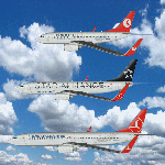
Repaint(s) of 737NG`s used by Turkish Airlines.
There are 7 Aircraft in total. One of the 737-700
and 737-900ER and FIVE of the 737-800 Series. All
files INCLUDING night texture(s) are in DDS format.
Repaint by Jim Martin. Model and Paint Kit(s) by
Erez Werber (FAIB). There is a FS9 version too
jhmthyB73789FS9.zip
| Filename: | Turkish_Airlines_Boeing_737700800900ER.zip |
| License: | Freeware |
| Added: | 18th March 2014, 11:20:23 |
| Downloads: | 618 |
| Author: | Jim Martin, Eerez Werber, & FAIB |
| Size: | 6.93 MB |
| Category: X-Plane - Scenery | |
| BR SP SBGP - Gaviao Peixoto Embraer Airport v1.0.0 |
|
Images related to this file:
File Description:
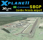
This is an X-Plane 11 and X-Plane 10 scenery package for Embraer Unidade Gavião Peixoto Airport (ICAO: SBGP, no IATA code) is a private airport located in a rural area near Gavião Peixoto and Araraquara, in Brazil. It is owned and operated by Embraer and used as for testing civil and military aircraft. Additionally, this scenery also includes a grass airstrip (SJAW Fazenda Citrica Airfield), a rural citrical farm facility for agricultural aviation. You can try landing there with your favorite prop aircraft. It's located around 1nm or 2nm northeast of SBGP airport. It includes corrected aprons, ramps, gates, taxiways, lighting system, Araraquara city buildings, ortho-photoscenery for the airfield area, and (XP11 only) airport ground services (like push back). This scenery was tested and is operational (as of March 18, 2017) in "X-Plane 11 Public Beta #15 64 bit", Windows 10 Home. It was also tested and is also operational (as of March 18, 2017) in "X-Plane 10.51 64 bit", Windows 10 Home. Only the default X-Plane 11 libraries, by Laminar Research, are needed. No third party libraries are used.
| Filename: | BR_SP_SBGP__Gaviao_Peixoto_Embraer_Airport_v100.zip |
| License: | Freeware |
| Added: | 19th March 2017, 08:13:27 |
| Downloads: | 95 |
| Author: | Rui Mesquita |
| Size: | 21.63 MB |
| Category: X-Plane - Scenery | |
| BR MA SNCW - Alcantara Launch Center v1.0.0 |
|
Images related to this file:
File Description:
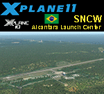
This is an X-Plane 11 and X-Plane 10 scenery package for Alcântara Launch Center Airport, Airbase, and Space Center (ICAO: SNCW, no IATA code), which is a military airport in the city of Alcantara, Maranhao, in Brazil. It includes corrected aprons, ramps, gates, taxiways, lighting system, village buildings, the satellite launching base, ortho-photoscenery for the airfield area, and (XP11 only) airport ground services (like push back). The SNCW airfield is located 16nm (30km) NW of São LuÃs Intl Airport (SBSL/SLZ). The Alcântara Launch Center (Portuguese: Centro de Lançamento de Alcântara - CLA) is a satellite launching base of the Brazilian Space Agency. This scenery was tested and is operational (as of January 11, 2018) in "X-Plane 11.11 64 bit", Windows 10 Home. It was also tested and is also operational (as of January 11, 2018) in "X-Plane 10.51 64 bit", Windows 10 Home. Only the default X-Plane 11 libraries, by Laminar Research, are needed. No third party libraries are used. A few extra objects are used and included in the package, thanks to autor and artist ThePrivateer. They are included in the package, no need to download them.
| Filename: | BR_MA_SNCW__Alcantara_Launch_Center_v100.zip |
| License: | Freeware |
| Added: | 12th January 2018, 00:09:54 |
| Downloads: | 68 |
| Author: | Rui Mesquita |
| Size: | 60.72 MB |
| Category: X-Plane - Scenery | |
| BR CE - SNIG Iguatu Airport v1.0.0 |
|
Images related to this file:
File Description:
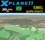
This is an X-Plane 11 and X-Plane 10 scenery package for Tomé da Frota Airport (IATA: IGT, ICAO: SNIG), which is the airport serving the city of Iguatu, state of Ceará, in Brazil.
It includes corrected aprons, ramps, gates, taxiways, lighting system, city buildings, ortho-photoscenery for the airfield area, and (XP11 only) airport ground services (like push back).
With an intense movement of small aircraft Iguatu Airport is of total importance for businessmen who have aircraft or use the air taxi. Sol Aviation flies from/to Fortaleza/SBFZ. Gol and Two airlines announced intention to fly to/from Fortaleza/SBFZ later in 2018.
This scenery was tested and is operational (as of January 26, 2018) in "X-Plane 11.11 64 bit", Windows 10 Home. It was also tested and is also operational (as of January 26, 2018) in "X-Plane 10.51 64 bit", Windows 10 Home.
| Filename: | BR_CE__SNIG_Iguatu_Airport_v100.zip |
| License: | Freeware |
| Added: | 2nd February 2018, 00:11:29 |
| Downloads: | 44 |
| Author: | Rui Mesquita |
| Size: | 8.3 MB |
| Category: X-Plane - Scenery | |
| BR SP SDUB - Ubatuba Airport v1.0.0 |
|
Images related to this file:
File Description:
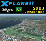
This is an X-Plane 11 and X-Plane 10 scenery package for the Gastão Madeira Airport (IATA: UBT, ICAO: SDUB), which is the airport serving the city of Ubatuba, in the Brazilian state of São Paulo.
It includes corrected aprons, ramps, gates, taxiways, lighting system, city buildings, ortho-photoscenery for the airfield area, and (XP11 only) airport ground services (like push back).
The airport focuses on general aviation, and does not have regular airline flights. It is administered by DAESP. It is a hard approach and take-off airport, especially when landing on runway 27 or taking off on runway 09.
This scenery was tested and is operational (as of January 16, 2018) in "X-Plane 11.11 64 bit", Windows 10 Home. It was also tested and is also operational (as of January 15, 2018) in "X-Plane 10.51 64 bit", Windows 10 Home.
| Filename: | BR_SP_SDUB__Ubatuba_Airport_v100.zip |
| License: | Freeware |
| Added: | 2nd February 2018, 00:12:08 |
| Downloads: | 83 |
| Author: | Rui Mesquita |
| Size: | 60.24 MB |
| Category: X-Plane - Scenery | |
| BR AP SBAM - Amapa Airport v1.0.0 |
|
Images related to this file:
File Description:
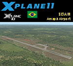
This is an X-Plane 11 and X-Plane 10 scenery package for Amapá Airport (ICAO: SBAM, no IATA code), which is the airport servining the city of Amapá, state Amapá, in Brazil.
It includes corrected aprons, ramps, gates, taxiways, lighting system, ortho-photoscenery for the airfield area, and (XP11 only) airport ground services (like push back).
This is a general aviation airport in the north of the Amazon Rainforest, close to the Brazilian-Frenchg Guyana border. It belongs to the municipality of Amapá, and it is at a distance of 8 km from the city center and 229 km from the state capital, Macapá.
This scenery was tested and is operational (as of January 20, 2018) in "X-Plane 11.11 64 bit", Windows 10 Home. It was also tested and is also operational (as of January 20, 2018) in "X-Plane 10.51 64 bit", Windows 10 Home.
| Filename: | BR_AP_SBAM__Amapa_Airport_v100.zip |
| License: | Freeware |
| Added: | 2nd February 2018, 00:18:13 |
| Downloads: | 56 |
| Author: | Rui Mesquita |
| Size: | 6.55 MB |
| Category: X-Plane - Scenery | |
| BR CE - SNFF Feijo Fortaleza v1.0.0 |
|
Images related to this file:
File Description:
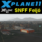
This is an X-Plane 11 & 10 scenery for the Feijo Airfield (SNFF) in Fortaleza, Ceara, Brazil. In this airfield is located the flight school and private air club of Ceará state in Brazil ("Aeroclube do Ceará" in Portuguese), founded back in 1929. The main aircrafts operated in the flight school in late 2016 are AB-115, P-56C, AMT-200, Cessna 150K and Cessna 172C. This scenery was tested and is operational (as of January 23, 2017) in "X-Plane 11 Public Beta #8 64 bit", Windows 10 Home. It was also tested and is operational (as of January 23, 2017) in "X-Plane 10.51 64 bit", Windows 10 Home.
| Filename: | BR_CE__SNFF_Feijo_Fortaleza_v100.zip |
| License: | Freeware |
| Added: | 25th January 2017, 00:33:58 |
| Downloads: | 64 |
| Author: | Rui Mesquita |
| Size: | 1.27 MB |


© 2001-2026 AVSIM Online
All Rights Reserved
Privacy Policy |