
Where Flight Simulation Enthusiasts Gather from Around the World!
AVSIM Library - Search Results

| Category: Flight Simulator X - Scenery | |
| LOWW - Schwechat Airport, Vienna, Austria |

|
Images related to this file:
File Description:
This is a very accurate version for Schwechat Intl Airport to reflect todays situation with two optional files: one version with the Crosswind runway operating where both runways will be used for takeoff/landing and one version as the default airport runway operation: assigned parking at all terminals now as per their website, extra parking including a gate for the A380, start location added to the helipad, all ILS approaches, taxiways and taxi signs updated and corrected to the latest charts, extra fuel trucks, support vehicle roads rebuilt and many other scenery improvements and objects added, airport views are from inside the control tower (when in tower view) please view the readme before installation.
| Filename: | LOWW__Schwechat_Airport_Vienna_Austria.zip |
| License: | Freeware, limited distribution |
| Added: | 19th February 2017, 23:38:40 |
| Downloads: | 41,542 |
| Author: | Ray Smith |
| Size: | 2.33 MB |
| Category: Flight Simulator 2004 - AFCAD Files | |
| Metro Oakland with Active Crosswind Runways |
|
File Description:
A high spec AFCAD2 for the FS2004 Metro Oakland Int'l Airport (KOAK) scenery by the Mach-1 Design Group. This afcad has been built using FAA Charts, various aerial photographs and information from the Airport Website. All taxiways are named and all aprons are reworked to be as real as possible according to photos. All gates are named and have airlines assigned to them. As per real life, only Southwest Airlines will use Terminal 2, all other airlines being allocated to Terminal 1. The Fedex and UPS aprons are represented and can accomodate many cargo aircraft. The final parking area is random GA parking to the north of the airport. Overflow parking is also available for rush hour periods. This airport features a tower view and also night and approach lighting. Finally, by using the crosswind runway technique, runways 9L/27R, 9R/27L and 11/29 can all be used simultaniously for take-off and landing. Runway 15/33 is closed as it is not used in real life. An extra taxiway "Zulu" has been added (not real life) to avoid AI conflicts when using runway 29 for Takeoffs and landings. Enjoy!! Requires that you install m1dg_oak2007.zip from this site.
| Filename: | Metro_Oakland_with_Active_Crosswind_Runways.zip |
| License: | Freeware |
| Added: | 1st June 2007, 17:44:02 |
| Downloads: | 1,461 |
| Author: | Lee Brompton |
| Size: | 203.67 KB |
| Category: Prepar3D V1-4 - Scenery | |
| Wichita 2019 |
|
Images related to this file:
File Description:
Wichita Eisenhower Airport developed and tested with P3D v3 and v4.4. Utilities utilized are Sketchup, ModelConverterX, Instant Scenery and Airport Scenery Designer. MegaScenery Kansas is recommended to use with this scenery. New terminal as well as many new structures added to this airport.
| Filename: | Wichita_2019.zip |
| License: | Freeware |
| Added: | 29th October 2019, 16:58:29 |
| Downloads: | 415 |
| Author: | Mike Eppright |
| Size: | 91.1 MB |
| Category: Flight Simulator X - Scenery | |
| California Central Coast Scenery for FSX with Megascenery Earth (Default Mesh Terrain) |
|
Images related to this file:
File Description:
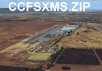
Revised 1/7/10 for upload to Avsim.COM. CCFSXMSFix is incorporated so not required.
This is an earlier version of CCC Megascenery Earth scenery that doesn't require FSGenesis Mesh Terrain. See CCFSXMSG.ZIP for the FSGenesis Mesh version.
This scenery covers the California coastal region from N36���°10' (Coalinga) to N34���°25' (Santa Barbara) and from the coast East to W119���°40'. It is a version of my previous California Central Coast scenery redesigned and expanded to work with MegaScenery Earth from PC Aviator Inc. Many airstrips in the area covered by this scenery have been added or enhanced for a total of 27 airports/airstrips in the area. Several areas of interest such as the Santa Barbara marina, Morro Bay, etc. are also included for a total of 41 points of interest. All airports/airstrips and related structures have been adjusted and realigned to conform to actual positions and dimensions as indicated by the MegaScenery satellite textures. In addition, there are 6 invisible water runways for use by AI floatplane traffic. MegaScenery California-13, -14 and -15 are required for this scenery to make sense. I also used California-12, -28 and -29 when constructing the scenery but they could be considered optional.
| Filename: | California_Central_Coast_Scenery_for_FSX_with_Mega.zip |
| License: | Freeware |
| Added: | 7th January 2010, 21:28:45 |
| Downloads: | 1,561 |
| Author: | Al Wheeler |
| Size: | 8.12 MB |
| Category: X-Plane - Scenery | |
| BR RJ SBBZ - Buzios Airport v1.0.0 |
|
Images related to this file:
File Description:
This is an X-Plane 11 and X-Plane 10 scenery package for Umberto Modiano Airport (IATA: BZC, ICAO: SBBZ), which is the airport serving Armacao dos Buzios, Brazil. It is named after Umberto Modiano, a local businessman who financially supported the emancipation movement of Armação dos Búzios as an independent municipality, which was completed in 1995.
It includes corrected aprons, ramps, gates, taxiways, lighting system, city buildings, ortho-photoscenery for the airfield area, and (XP11 only) airport ground services (like push back).
The airport was inaugurated in 2003 and it is dedicated to general aviation. On July 11, 2012 the facility was temporarily closed to conduct renovation works demanded by the National Civil Aviation Agency of Brazil. However, on May 28, 2016, after completing the renovations and legal procedures, the airport was again opened for general aviation.
This scenery was tested and is operational (as of January 16, 2018) in "X-Plane 11.11 64 bit", Windows 10 Home. It was also tested and is also operational (as of January 16, 2018) in "X-Plane 10.51 64 bit", Windows 10 Home.
| Filename: | BR_RJ_SBBZ__Buzios_Airport_v100.zip |
| License: | Freeware |
| Added: | 2nd February 2018, 00:12:38 |
| Downloads: | 62 |
| Author: | Rui Mesquita |
| Size: | 8.35 MB |
| Category: Flight Simulator X - Scenery | |
| LOWG - Graz airport - Graz, Austria |
|
Images related to this file:
File Description:
Graz Airport, known as Flughafen Graz-Thalerhof in AUSTRIA, is a minor international airport in Graz, the second-largest city in Austria. It is located in the south of the Alps. The airport serves flights to European leisure and some metropolitan destinations. In this version all buildings are landable. New ILS-lights - the tower is new - the area behind the terminal is new - the Heli-Base Christopherus is new and landable.
| Filename: | LOWG__Graz_airport__Graz_Austria.zip |
| License: | Freeware |
| Added: | 20th June 2015, 02:04:46 |
| Downloads: | 1,732 |
| Author: | Manfred Marbler |
| Size: | 257.96 MB |
| Category: Flight Simulator X - Scenery | |
| SVMG |
|
File Description:
Santiago Marino Caribbean International Airport (Spanish: Aeropuerto Internacional del Caribe "Santiago Marino") (IATA: PMV, ICAO: SVMG) is a commercial airport located near Porlamar, the largest city on Isla Margarita, an island in state of Nueva Esparta in Venezuela.
This file has the right coordinates, with the apron and characteristics of the airport plus runway 09 ILS. The runways and taxiways were resized the gates placed on correct location with working jetways.
| Filename: | SVMG.zip |
| License: | Freeware |
| Added: | 21st April 2011, 23:40:59 |
| Downloads: | 1,254 |
| Author: | Anwar Gonzalez |
| Size: | 29.24 KB |
| Category: Flight Simulator X - Scenery | |
| Carrier CVN75_V2 North Sea |
|
File Description:
This is a update version of my scenery DL_CVN75.zip.
Changes in Version 2 of the cenery:
1.The Carrier model is now a private object and no longer part of the standard FSX object lib..
This allows the installation and registration in FSX scenery setting to be done like any
other addon objects.
The registration of the scenery in FSX below " Global, Generic & Vehicle Libraries" is no
longer required !!!!
2.Version 2 has more stuff on deck of the carrier.
3.The Number 75 is more accurate according to the real carrier.
4.The ILS frequencies ( e.g. GS) is more accurat adjusted in relation to the cable zone.
Scenery: Carrier Group North sea. Close to the Island of Sylt The Scenery includes: - The USS Carrier Harry Truman, CVN 75 with full function as an Airport with ILS approach capability.
F18-Fighters and a Navy-Heli on the Carrier. - 2 flying Helicopters over the Carrier. - 4 Navy-Destroyers escorting the Carrier. In addition to the Carrier-Group: - A Oilrig about 30 nm northwest from the Carrier. The Heli-Pat is a landable Platform !! - 2 moving Destroyer based on a "Boats Traffic Plan" which are moving around the group according to the time schedule in the plan.
| Filename: | Carrier_CVN75_V2__North_Sea.zip |
| License: | Freeware |
| Added: | 26th December 2008, 10:44:37 |
| Downloads: | 3,485 |
| Author: | Dietmar Loleit |
| Size: | 4.83 MB |
| Category: Flight Simulator X - AFCAD Files | |
| CYxs Prince Geroge - British Columbia, Canada |
|
File Description:
I have completely reconstructed CYXS using ADE (v1.40), Google Earth satellite images and current airport chart. Runways have been repositioned and runway 15/33 extended from 7400 ft to 11450 ft. ILS has been added to runway 33. Roads, parking areas and new buildings added. Aprons readjusted. Automated jetways added. Parking for AI aircraft and refueling truck added. Additional scenery objects have been added and to view these will require you to install additional files as described below. Airport views are from the roof of the control tower.
Latest News: YXS - The New Transpacific Logisitics Alternative
The Runway Expansion Project has transformed runway 15/33 from 7,400 ft. to 11,450 ft., complete with centre line (LED) lighting, dual ILS navigational systems and a dedicated de-icing refueling pad for wide body aircraft. Once completed, the Runway Expansion Project will allow the PGAA to market the airport as a new transpacific logistics alternative, providing carriers the opportunity to make Prince George a destination of choice for refueling and transshipment of cargo
| Filename: | CYxs_Prince_Geroge__British_Columbia_Canada.zip |
| License: | Freeware |
| Added: | 5th November 2009, 02:16:13 |
| Downloads: | 748 |
| Author: | Robert Catherall |
| Size: | 878.39 KB |
| Category: Flight Simulator 2004 - AFCAD Files | |
| EHAM, EHBK from Netherland 2000 v.2.92 - update |
|
Images related to this file:
File Description:

Reworked using, in the order:
1 - Scenery parking sign.
2 - Airport related chart
3 - Google Earth(r) Airport visualization and airport related internet site(s), where applicable on FS2004 scenery airport areas with changes to parking assignments.
| Filename: | EHAM_EHBK_from_Netherland_2000_v292__update.zip |
| License: | Freeware |
| Added: | 6th September 2010, 18:50:16 |
| Downloads: | 427 |
| Author: | V.Mercolino (genixSoft) |
| Size: | 26.42 KB |


© 2001-2026 AVSIM Online
All Rights Reserved
Privacy Policy |