
Where Flight Simulation Enthusiasts Gather from Around the World!
AVSIM Library - Search Results

| Category: Flight Simulator X - Scenery | |
| JZZ - Koliganek Airport - Alaska, USA |

|
Images related to this file:
File Description:
Koliganek Airport (IATA: KGK, ICAO: PAJZ, FAA LID: JZZ) is a state-owned, public-use airport located one nautical mile (1.85 km) east of the central business district of Koliganek,in the Dillingham Census Area of the U.S. state of Alaska. Scheduled airline service to Dillingham Airport is provided by Peninsula Airways (PenAir).The airport opened in 1997.
Increased length of runway 9/27 from 3,000 feet to 3,300 feet.Added runway 17/35 (3,300 feet and 75 feet wide). Changes were based on 2011 construction plans.
Created with Airport Design Editor 9x by ScruffyDuck Software using current FAA documentation and Google Earth measurements, this package offers a replacement for FSX's stock airport. All these enhancements are as close to the real airport as I can get with stock library objects and custom buildings.
| Filename: | JZZ__Koliganek_Airport__Alaska_USA.zip |
| License: | Freeware |
| Added: | 25th December 2014, 01:15:29 |
| Downloads: | 596 |
| Author: | Wayne Roberts |
| Size: | 214.91 KB |
| Category: Flight Simulator X - Scenery | |
| PABE - Bethel Airport - Alaska, USA |
|
Images related to this file:
File Description:
Bethel Airport is a state owned, public use airport located three nautical miles (6 km) southwest of the central business district of Bethel.
Construction began September 21, 1941, and the airfield was activated July 4, 1942; it is also known as Bethel Air Base. It was used by Air Transport Command as auxiliary airfield for Lend-Lease aircraft being flown to Siberia. The facility was transferred to Eleventh Air Force, then to Alaskan Air Command in 1945; it became the joint-use Bethel Airport. It was used for construction of AC&W Bethel Air Force Station in mid 1950s. Full jurisdiction was turned over to Alaska Government in 1958.
Added and adjusted aprons and buildings. Also added additional parking. Added runway 1R/19L.Re-numbered runways to conform with AirNav data.
Created with Airport Design Editor 9x by ScruffyDuck Software using current FAA documentation and Google Earth measurements, this package offers a replacement for FSX's stock airport. All these enhancements are as close to the real airport as I can get with stock library objects and custom buildings.
| Filename: | PABE__Bethel_Airport__Alaska_USA.zip |
| License: | Freeware |
| Added: | 5th December 2014, 13:35:35 |
| Downloads: | 989 |
| Author: | Wayne Roberts |
| Size: | 94.58 KB |
| Category: Flight Simulator X - Scenery | |
| KUTS - Huntsville Airport - Texas, USA |
|
Images related to this file:
File Description:
FSX Scenery - Bruce Brothers Huntsville Regional Airport, also known as Huntsville Municipal Airport, (IATA: HTV, ICAO: KUTS, FAA LID: UTS), is a city owned, public use airport located two nautical miles (4 km) northwest of the central business district of Huntsville, a city in Walker County, Texas, United States. It is included in the National Plan of Integrated Airport Systems for 2011-2015, which categorized it as a general aviation facility. Although most U.S. airports use the same three-letter location identifier for the Federal Aviation Administration (FAA) and International Air Transport Association (IATA), this airport is assigned UTS by the FAA and HTV by the IATA. For your flying pleasure by John B. Loney, Jr.
| Filename: | KUTS__Huntsville_Airport__Texas_USA.zip |
| License: | Freeware, limited distribution |
| Added: | 7th September 2015, 22:30:00 |
| Downloads: | 459 |
| Author: | John B. Loney, Jr. |
| Size: | 8.64 MB |
| Category: Flight Simulator X - Scenery | |
| KWT - Kwethluk Airport - Alaska, USA |
|
Images related to this file:
File Description:
Kwethluk Airport has one gravel surfaced runway (18/36) measuring 3,198 by 75 ft. (975 by 23 m). The airport was relocated from its former site at coordinates 60°48.26'N 161°26.72'W which had a 1,750 by 35 ft runway (6/24) and a 5,000 x 500 ft seaplane landing area. The construction plans for 2005 moved the aircraft parking area to Runway 18/36 and removed runway 6/24.
Created with Airport Design Editor 9x by ScruffyDuck Software using current FAA documentation and Google Earth measurements, this package offers a replacement for FSX's stock airport. All these enhancements are as close to the real airport as I can get with stock library objects and custom buildings.
| Filename: | KWT__Kwethluk_Airport__Alaska_USA.zip |
| License: | Freeware |
| Added: | 31st December 2014, 01:32:07 |
| Downloads: | 594 |
| Author: | Wayne Roberts |
| Size: | 248.57 KB |
| Category: Flight Simulator X - Scenery | |
| PACK - Chefornak Airport - Alaska, USA |
|
Images related to this file:
File Description:
Chefornak Airport (IATA: CYF, ICAO: PACK, FAA LID: CFK) is a state-owned public-use airport in Chefornak,a city in the Bethel Census Area of the U.S. state of Alaska. The airport is on the Kinia River.
A new airstrip has been built further out from the village due to concerns with the current airstrip being near the school and pedestrian traffic, however, the runway must settle for several years before it is ready to be used. A new runway designated 5/23 was added.
| Filename: | PACK__Chefornak_Airport___Alaska_USA.zip |
| License: | Freeware |
| Added: | 17th October 2014, 01:26:08 |
| Downloads: | 661 |
| Author: | Wayne Roberts |
| Size: | 451.25 KB |
| Category: Flight Simulator X - Scenery | |
| A85 - Kwigillingok Airport - Alaska, USA |
|
Images related to this file:
File Description:
Kwigillingok Airport (IATA: KWK, ICAO: PAGG, FAA LID: GGV, formerly A85) is owned by the Native Village of Kwigillingok and is a public-use airport located one mile (two kilometres) northwest of the central business district of Kwigillingok, in the Bethel Census Area of the U.S. state of Alaska. There is also a nearby seaplane landing area known as Kwigillingok Seaplane Base (FAA LID: KWK).Runway 15/33 was increased from 1,835 feet and 40 feet wide to 3,300 feet and 60 feet wide. Runway 4/22 was added along with custom models. All changes were made based on the 2014 construction plans.
Created with Airport Design Editor 9x by ScruffyDuck Software using current FAA documentation and Google Earth measurements, this package offers a replacement for FSX's stock airport. All these enhancements are as close to the real airport as I can get with stock library objects and custom buildings.
| Filename: | A85__Kwigillingok_Airport__Alaska_USA.zip |
| License: | Freeware |
| Added: | 5th January 2015, 00:26:44 |
| Downloads: | 707 |
| Author: | Wayne Roberts |
| Size: | 358.61 KB |
| Category: Flight Simulator X - Scenery | |
| KCID, Eastern Iowa Airport, USA |
|
Images related to this file:
File Description:
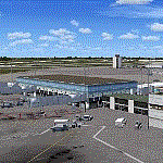
New setup of another airport I came across in one of my virtual flights. It is located 06 miles SW of Cedar Rapids, Iowa.
| Filename: | KCID_Eastern_Iowa_Airport_USA.zip |
| License: | Freeware |
| Added: | 27th April 2018, 00:30:49 |
| Downloads: | 872 |
| Author: | Tim van Ringen |
| Size: | 3.03 MB |
| Category: Flight Simulator 2002 - AFCAD Files | |
| VCBI Afcad , Colombo, Sri Lanka |
|
File Description:
Colombo International Airport.
| Filename: | VCBI__Afcad__Colombo_Sri_Lanka.zip |
| License: | Freeware |
| Added: | 21st November 2002, 20:42:25 |
| Downloads: | 412 |
| Author: | Rajeevan |
| Size: | 2.89 KB |
| Category: Flight Simulator 2004 - AI Flight Plans | |
| Aeromexico - Connect Summer 2013 |
|
Images related to this file:
File Description:

Include Optimize speed version,Season-Summer 2013,Callsign-Costera,ICAO-SLI,IATA-5D,Weekly flights-2738.Hubs-Cancun International Airport-Gen. M. Escobedo Int'l Airport-Miguel Hidalgo Int'l Airport-Mexico City International Airport
| Filename: | Aeromexico__Connect_Summer_2013.zip |
| License: | Freeware, limited distribution |
| Added: | 13th August 2013, 13:26:27 |
| Downloads: | 928 |
| Author: | Michael 'Pushen' Babitskiy.UTT |
| Size: | 773.08 KB |
| Category: Fly! II - Scenery | |
| Angwin-Parrett Field Airport (2O3) |
|
File Description:
TerraModels Scenery Development System by Allen Kriesman, Biber Salsa and Steves models were used to create the scenery for Angwin-Parrett Field Airport (2O3), California. The taxiways were added by Pieter Miller.
| Filename: | AngwinParrett_Field_Airport_2O3.zip |
| License: | Freeware |
| Added: | 30th November 2004, 14:21:48 |
| Downloads: | 79 |
| Author: | Wayne Roberts |
| Size: | 374.23 KB |
© 2001-2026 AVSIM Online
All Rights Reserved
Privacy Policy |