
Where Flight Simulation Enthusiasts Gather from Around the World!
AVSIM Library - Search Results

| Category: Flight Simulator X - Scenery | |
| CYSG - St. Georges Aerodrome - v1.1 |

|
Images related to this file:
File Description:
Saint-Georges Aerodrome, (ICAO: CYSG), is a general aviation aerodrome located 1.5 nautical miles (2.8 km; 1.7 mi) west-southwest of Saint-Georges, Quebec, Canada near the border with Maine. The airport has a long, paved runway, suitable for use by jets. This scenery FSX Airport St-Georges was inspired by the great FS2004 scenery of the late pilot Virtual Hugues Caron img12. It was made very humbly in his memory. This FSX scenery been validated and tested with FSX SP1, SP2 and Acceleration. This is a complete reproduction, more accurate and realistic in Saint-Georges Beauce airport with all the buildings around it. For technical information or assistance contact one of the following email addresses support: [email protected] or [email protected]. Web site : http://imaginairvirtuel.qc.ca
| Filename: | CYSG__St_Georges_Aerodrome___v11.zip |
| License: | Freeware, limited distribution |
| Added: | 26th August 2013, 05:49:28 |
| Downloads: | 761 |
| Author: | Georges Bourgouin |
| Size: | 3.91 MB |
| Category: Flight Simulator X - Miscellaneous Files | |
| FSX.CFG - Hacking Project - V1 |
|
Images related to this file:
File Description:
This file contains all my current knowledge about the Microsoft FSX's fsx.cfg file. I have gathered all publicly known parameters (from internet, through original hacking) categorized and sorted in a crystal clear PDF document. I have documented almost every (known) fsx.cfg parameter in plain English, so that every flightsimmer is fully able to understand and adapt their own fsx.cfg themselves to their own needs. My document includes graphics to explain the complicated "Under-the-hood" FSX features.
My documents also maps most FSX menu choices to the fsx.cfg settings visually, so you can see which FSX Menu setting influences which fsx.cfg parameter. The file also contains an Appendix with six different versions of the fsx.cfg file and a SaveSetting file, for pure documentation purposes.
| Filename: | FSXCFG__Hacking_Project__V1.zip |
| License: | Freeware |
| Added: | 22nd March 2015, 17:55:41 |
| Downloads: | 1,214 |
| Author: | Ronald Vermeij |
| Size: | 11.05 MB |
| Category: Flight Simulator X - Aircraft Repaints, Textures and Modifications | |
| United Airlines Boeing 767-322ER |
|
Images related to this file:
File Description:

FS2004/FSX United Airlines Boeing 767-322ER, registration N671UA. United Airlines livery painted on SkySpirit2010's B767-300/ER v5 aircraft. The textures are saved in 32 bit format for quality graphics and compatible with FSX and FS2004. You can use this texture package with the winglet. Its features are opening doors and cargo doors, detailed textures, accurate paint, dynamic shine and effects, dynamic flexing wings that respond to turbulence, fully independent suspension, trim animation, gear steering, accurate flight dynamics, spoiler animation, crash effects, reflective cockpit windows, transparent navigation light lenses and many more. Download the latest winglet or non-winglet model from SkySpirit2010's update page http://ssp.cyber-ninja.jp/SSP2010Update.html. Includes FSX model, FS2004 model separate. By Gabriel Guzman.
| Filename: | United_Airlines_Boeing_767322ER.zip |
| License: | Freeware |
| Added: | 21st July 2015, 16:29:48 |
| Downloads: | 1,065 |
| Author: | Gabriel Guzman, SkySpirit2010 |
| Size: | 12.99 MB |
| Category: Flight Simulator X - Utilities | |
| FsLaunchpad-2.0 |
|
File Description:
FS2004/FSX/Prepar3D Utility--FsLaunchpad 2.0. Here new features of FSLaunchpad 2.0: Start more rapidly without blinking Launching message; New functionality to create a Google Earth file from flight plan and see airports and your adds-on near from each waypoint. Compatible with FSX, P3D, FS2004 and Plan-G Flight Plans; Select your Addon sceneries from flight plan result search; More than 400 airports for Google Earth Search. All 24490 airports from FSX instead of 24014 airports from FS2004; Each Airport Google Earth popup now includes links for weather from Aviation Digital Data Service (ADDS) and airport information from wikipedia and more. Improve addons source and destination separators; Detect if you run FSL as Administrator. Tested with Windows 7, 8 and 10. By Pierre Legault.
| Filename: | FsLaunchpad20.zip |
| License: | Freeware, limited distribution |
| Added: | 28th August 2015, 02:14:24 |
| Downloads: | 546 |
| Author: | Pierre Legault |
| Size: | 3.28 MB |
| Category: Flight Simulator X - Utilities | |
| FSLauncPad 2.12 |
|
File Description:
FsLaunchpad 2.12 still in life because more than 2000 users appreciate to launch fastly their FS2004/FSX/Prepar3D Flight Simulator. This version correct some bugs and inversion selection in launchpad. FSL have possibility to create a Google Earth file from flight plan and see airports and your adds-on near from each waypoint. Compatible with FSX, P3D, FS2004 and Plan-G Flight Plans; Select your Addon sceneries from flight plan result search. All 24490 airports from FSX. Each Airport Google Earth popup now includes links for weather from Aviation Digital Data Service (ADDS) and airport information from wikipedia and more. Improve addons source and destination separators; Detect if you run FSL as Administrator. Tested with Windows 7, 8 and 10. By Pierre Legault.
| Filename: | FSLauncPad_212.zip |
| License: | Freeware, limited distribution |
| Added: | 9th April 2016, 15:23:13 |
| Downloads: | 298 |
| Author: | Pierre Legault |
| Size: | 3.28 MB |
| Category: Flight Simulator X - Aircraft Repaints, Textures and Modifications | |
| Air Zaire DC-10-30 1983 |
|
Images related to this file:
File Description:
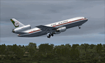
This is a repaint of the McDonnell Douglas DC-10-30 in Air Zaire colors. The freeware native FSX McDonnell Douglas DC-10-30 conversion, with VC, by Eagle Rotorcraft Simulations (George Arana) of Erick Cantu's original design, is needed for this repaint (link provided). Textures are 32 bit dds. This repaint was tested on FSX-SE but should work on P3D v1-3 and FSX.
The first DC-10-30 for Air Zaire entered service in February 1973, with the second, and final one, being received in 1974. This is a repaint of 9Q-CLT, which was the second one received. It was leased to Air Tchad in November 1975, and finally sold to British Caledonian in June 1985.
| Filename: | Air_Zaire_DC1030_1983.zip |
| License: | Freeware |
| Added: | 29th December 2019, 16:54:35 |
| Downloads: | 51 |
| Author: | Ted Giana |
| Size: | 4.74 MB |
| Category: Flight Simulator X - Scenery | |
| French Polynesian Island Tour, Part 1 |
|
File Description:
This is Part 1 of a 2 Part 45 leg mostly VFR "tour" of a geographical area of the South Pacific where the FSX default island airports even with
the addition of add-ons such as Orbx LC and Vector are typically not rendered very well. All the French Polynesian airports of these 2 packages
have tested successfully in FSX Acceleration with Orbx Vector and Orbx LC installed by 2 FSX users. They may also be compatible with the early
(32 bit) versions of P3D; up to, but not including P3Dv4. ADE, Ver 1.78 was primarily used as the tool for airport modification and creation,
with the help of Google Earth, Google Maps, and several online airport information and flight planning utilities.
| Filename: | French_Polynesian_Island_Tour__Part_1.zip |
| License: | Freeware |
| Added: | 8th June 2024, 17:41:42 |
| Downloads: | 57 |
| Author: | Ken Boardman |
| Size: | 347.01 KB |
| Category: Flight Simulator X - Scenery | |
| French Polynesian Island Tour, Part 2 |
|
Images related to this file:
File Description:
This is Part 2 of a 2 Part mostly VFR "tour" of a geographical area of the South Pacific where the FSX default island airports even with
the addition of add-ons such as Orbx LC and Vector are typically not rendered very well. All the French Polynesian airports of these 2 packages
have tested successfully in FSX Acceleration with Orbx Vector and Orbx LC installed by 2 FSX users. They may also be compatible with the early
(32 bit) versions of P3D; up to, but not including P3Dv4. ADE, Ver 1.78 was primarily used as the tool for airport modification and creation,
with the help of Google Earth, Google Maps, and several online airport information and flight planning utilities.
| Filename: | French_Polynesian_Island_Tour_Part_2.zip |
| License: | Freeware |
| Added: | 8th June 2024, 17:41:50 |
| Downloads: | 59 |
| Author: | Ken Boardman |
| Size: | 342.47 KB |
| Category: Flight Simulator X - Scenery | |
| EDHO - Airfield Ahrenlohe, Schleswig-Holstein, North Germany |
|
File Description:
FSX-Scenery of Airfield Ahrenlohe, Schleswig-Holstein, North Germany
Small landing place NE of the mostly better known Uetersen/EDHE
Photorealistic underground from Google Earth mit Winter season and autogen.
| Filename: | EDHO__Airfield_Ahrenlohe_SchleswigHolstein_North_G.zip |
| License: | Freeware |
| Added: | 6th March 2008, 21:56:23 |
| Downloads: | 2,094 |
| Author: | Uwe Schweitzer |
| Size: | 2.25 MB |
| Category: Flight Simulator X - Scenery | |
| ETNT - Wittmund, Germany (GAF Base) |
|
File Description:
FSX - SCENERY
ETNT - Wittmundhafen, GAF, Germany
by Uwe Schweitzer
Wittmund (ETNT) is located northwest of Hamburg in East Frisia, Northwest Germany. It is the home base of Jagdgeschwader 71 "Richthofen"
| Filename: | ETNT___Wittmund_Germany_GAF_Base.zip |
| License: | Freeware |
| Added: | 9th March 2008, 14:59:10 |
| Downloads: | 3,258 |
| Author: | Uwe Schweitzer |
| Size: | 2.62 MB |


© 2001-2026 AVSIM Online
All Rights Reserved
Privacy Policy |