
Where Flight Simulation Enthusiasts Gather from Around the World!
AVSIM Library - Search Results

| Category: Flight Simulator X - Aircraft Repaints, Textures and Modifications | |
| North American P-51B 23rd FG #27 "Rose's Raider" |

|
Images related to this file:
File Description:

This folder contains a repaint for the Warbirdsim P-51B Mustang, representing North American P-51B Mustang #27 "Rose's Raider" of Lt Ed Beethoven, 74th FS, Tushan, China, autumn 1944.
Repaint by Jan Kees Blom based on the paintkit by warbirdsim.
| Filename: | North_American_P51B_23rd_FG_27_Roses_Raider.zip |
| License: | Freeware |
| Added: | 2nd August 2018, 18:18:34 |
| Downloads: | 72 |
| Author: | Jan Kees Blom |
| Size: | 5.43 MB |
| Category: Flight Simulator X - Aircraft Repaints, Textures and Modifications | |
| North American P-51B 363rd FG A9-X "It sends me" |
|
Images related to this file:
File Description:
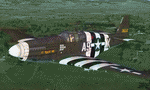
A repaint for the Warbirdsim P-51B in the colors of 43-6512 A9-X "It Sends Me", the aircraft of Lt Merle Kellogg of the 380th FS, 363rd FG. Repaint by Jan Kees Blom, based on the paintkit by Warbirdsim.
| Filename: | North_American_P51B_363rd_FG_A9X_It_sends_me.zip |
| License: | Freeware |
| Added: | 7th August 2018, 12:49:58 |
| Downloads: | 57 |
| Author: | Jan Kees Blom |
| Size: | 5.72 MB |
| Category: Prepar3D V1-4 - Aircraft Repaints, Textures and Modifications | |
| North American P-51D 55th FG (CL-Z) 'Mick #5' |
|
Images related to this file:
File Description:

This folder contains a repaint for the A2A WoP3 P-51D Mustang, in the colors of P-51D-15-NA 44-14121 CL-Z was the assigned aircraft of Capt Darrel S.Cramer, from Ogden in Utah. He had done a tour with the 339th FS/ 347th FG in the Pacific, where he claimed two victories.He joined the 338th FS/ 55th FG in july 1944 and flew with them till february 1945, after which he served with HQ. He claimed 5.5 Bf109's and 1 FW190 in the air. Repaint by Jan Kees Blom, based on the A2A paintkit.
| Filename: | North_American_P51D_55th_FG_CLZ_Mick_5.zip |
| License: | Freeware |
| Added: | 10th November 2018, 16:36:52 |
| Downloads: | 54 |
| Author: | Jan Kees Blom |
| Size: | 13.68 MB |
| Category: Flight Simulator 2002 - Miscellaneous Files | |
| KeyDirect |
|
File Description:
keyDirect Keyboard keypress to Application mapper will allow you to map keystrokes to applications. For example, 2 apps require F1 to do something. If you run the apps on the same machine you have to switch between them and hit F1. With KeyDirect, you can map the "a" key to F1 in App1, and the "b" key to F1 in App2. No switching needed!
Very useful for those who run multiple apps on the same machine. I'm using it with a hacked keyboard and a home-cockpit to map keypresses to functions in FS and other FS addons.
| Filename: | KeyDirect.zip |
| License: | Freeware, limited distribution |
| Added: | 1st July 2002, 15:51:49 |
| Downloads: | 403 |
| Author: | Dave T |
| Size: | 2.01 MB |
| Category: Flight Simulator 2004 - Scenery Design | |
| Caribbean Islands of Antigua and Barbuda |
|
File Description:
This package DOES NOT contain finished FS scenery products! Instead, the two bitmaps (N16.9-17.8 W61.5-62.0) are meant to be used for FS landscape scenery design with Ground2K4 (by Christian Fumey) or similar utilities. Source data are public domain Landsat 7 ETM+ satellite images, at 15-m and 30-m ground resolution. I used professional GIS software for the geographic transformation to lat/long-WGS84 projection, and photo processing software for channel merging and image enhancements. Each image has been tested in Ground2K4 for accurate placement. Note: these images have been ECW-compressed and need special (free) software for decompressing (instructions included).
| Filename: | Caribbean_Islands_of_Antigua_and_Barbuda.zip |
| License: | Freeware, limited distribution |
| Added: | 28th February 2004, 00:15:03 |
| Downloads: | 596 |
| Author: | Holger Sandmann |
| Size: | 899.3 KB |
| Category: Flight Simulator 2004 - Scenery Design | |
| Caribbean Islands of Saint Kitts, Nevis, and Saint Eustatius |
|
File Description:
This package DOES NOT contain finished FS scenery products!!! Instead, the two bitmaps (N17.0-17.6 W62.5-63.1) are meant to be used for FS landscape scenery design with Ground2K4 (by Christian Fumey) or similar utilities. Source data are public domain Landsat 7 ETM+ satellite images, at 15-m and 30-m ground resolution. I used professional GIS software for the geographic transformation to lat/long-WGS84 projection, and photo processing software for channel merging and image enhancements. Each image has been tested in Ground2K4 for accurate placement. Note: these images have been ECW-compressed and need special (free) software for decompressing (instructions included).
| Filename: | Caribbean_Islands_of_Saint_Kitts_Nevis_and_Saint_E.zip |
| License: | Freeware, limited distribution |
| Added: | 28th February 2004, 00:15:17 |
| Downloads: | 604 |
| Author: | Holger Sandmann |
| Size: | 525.63 KB |
| Category: Flight Simulator 2004 - Scenery Design | |
| Jordan, North of Beirut |
|
File Description:
This package DOES NOT contain finished FS scenery products! Instead, the three bitmaps (N33.7-35.0 E35.4-36.5) are meant to be used for FS landscape scenery design with Ground2K4 (by Christian Fumey) or similar utilities. Source data are public domain Landsat 7 ETM+ satellite images, at 15-m and 30-m ground resolution. I used professional GIS software for the geographic transformation to lat/long-WGS84 projection, and photo processing software for channel merging and image enhancements. Each image has been tested in Ground2K4 for accurate placement. Note: these images have been ECW-compressed and need special (free) software for decompression (instructions included).
| Filename: | Jordan_North_of_Beirut.zip |
| License: | Freeware, limited distribution |
| Added: | 4th March 2004, 23:58:58 |
| Downloads: | 462 |
| Author: | Holger Sandmann |
| Size: | 12.7 MB |
| Category: Flight Simulator 2004 - Scenery Design | |
| Saint Barthelemy and Saint Martin Caribbean Islands (partial) |
|
File Description:
This package DOES NOT contain finished FS scenery products! Instead, the two bitmaps (N17.8-18.2 W62.7-63.1) are meant to be used for FS landscape scenery design with Ground2K4 (by Christian Fumey) or similar utilities. Source data are public domain Landsat 7 ETM+ satellite images, at 15-m and 30-m ground resolution. I used professional GIS software for the geographic transformation to lat/long-WGS84 projection, and photo processing software for channel merging and image enhancements. Each image has been tested in Ground2K4 for accurate placement. Note: these images have been ECW-compressed and need special (free) software for decompressing (instructions included).
| Filename: | Saint_Barthelemy_and_Saint_Martin_Caribbean_Island.zip |
| License: | Freeware, limited distribution |
| Added: | 8th March 2004, 13:54:05 |
| Downloads: | 702 |
| Author: | Holger Sandmann |
| Size: | 404.02 KB |
| Category: Flight Simulator 2004 - Scenery Design | |
| Ketchikan and Revillagigedo Island, Alaska |
|
File Description:
This package DOES NOT contain finished FS scenery products! Instead, the three bitmaps (N55.2-56.1 W130.6-131.9) are meant to be used for FS landscape scenery design with Ground2K4 (by Christian Fumey) or similar utilities. Source data are public domain Landsat 7 TM satellite images, at 15-m and 30-m ground resolution. I used professional GIS software for the geographic transformation to lat/long-WGS84 projection, and photo processing software for channel merging and image enhancements. Each image has been tested in Ground2K4 for accurate placement. Note: these images have been ECW-compressed and need special (free) software for decompressing (instructions included).
| Filename: | Ketchikan_and_Revillagigedo_Island_Alaska.zip |
| License: | Freeware, limited distribution |
| Added: | 8th March 2004, 13:55:52 |
| Downloads: | 257 |
| Author: | Holger Sandmann |
| Size: | 16.13 MB |
| Category: Flight Simulator 2004 - Scenery Design | |
| Ketchikan and Annette Island, Southeast Alaska Background Bitmaps |
|
File Description:
This package DOES NOT contain finished FS scenery products! Instead, the three bitmaps (N54.3-55.4 W130.6-131.9) are meant to be used for FS landscape scenery design with Ground2K4 (by Christian Fumey) or similar utilities. Source data are public domain Landsat 7 TM satellite images, at 15-m and 30-m ground resolution. I used professional GIS software for the geographic transformation to lat/long-WGS84 projection, and photo processing software for channel merging and image enhancements. Each image has been tested in Ground2K4 for accurate placement. Note: these images have been ECW-compressed and need special (free) software for decompressing (instructions included).
| Filename: | Ketchikan_and_Annette_Island_Southeast_Alaska__Background_Bitmaps.zip |
| License: | Freeware, limited distribution |
| Added: | 8th March 2004, 16:00:20 |
| Downloads: | 375 |
| Author: | Holger Sandmann |
| Size: | 14.92 MB |


© 2001-2026 AVSIM Online
All Rights Reserved
Privacy Policy |