
Where Flight Simulation Enthusiasts Gather from Around the World!
AVSIM Library - Search Results

| Category: Flight Simulator X - Scenery | |
| EDDT TXL Berlin-Tegel light |

|
Images related to this file:
File Description:
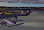
Light FS-X freeware scenery for EDDT, TXL (Berlin Tegel). Custom terminal, tower, cargo and so on, and RWY 12 objects. This is the FSX version only, for FS9 see file 'eddt-light.zip' (available at AVSIM).
| Filename: | EDDT_TXL_BerlinTegel_light.zip |
| License: | Freeware |
| Added: | 10th January 2010, 22:32:53 |
| Downloads: | 12,505 |
| Author: | Gernot Zander |
| Size: | 4.18 MB |
| Category: Flight Simulator X - Scenery | |
| South America Mesh Scenery, MeshX_D1 |
|
File Description:
Mesh terrain scenery for the whole continental South America, based on SRTM 90m
dem geotiff files,resampled to 76 meter of horizontal resolution (LOD 9). The new files have
improved the vertical resolution from 16m to 10m, resulting in more details
and accuracy over previous versions. There are 50 files, compatible with FS 9
and FS X, identified in a map by column letter and line number, covering the
contiguous countries and states. Boundaries: N = 11º 15' N; S = 5º 37.5' N;
E = 48º 45' W; W = 56º 15' W.
| Filename: | South_America_Mesh_Scenery_MeshX_D1.zip |
| License: | Freeware |
| Added: | 28th October 2006, 19:48:20 |
| Downloads: | 1,408 |
| Author: | Oséas Dourado and José Lôbo |
| Size: | 2.89 MB |
| Category: Flight Simulator X - Scenery | |
| South America Mesh Scenery, MeshX_D3 |
|
File Description:
Mesh terrain scenery for the whole continental South America, based on SRTM 90m
dem geotiff files resampled to 76 meter of horizontal resolution (LOD 9). The new files have
improved the vertical resolution from 16m to 10m, resulting in more details
and accuracy over previous versions. There are 50 files, compatible with FS 9
and FS X, identified in a map by column letter and line number, covering the
contiguous countries and states. Boundaries: N = 0º 0' S; S = 5º 37.5' S;
E = 48º 45' W; W = 56º 15' W.
| Filename: | South_America_Mesh_Scenery_MeshX_D3.zip |
| License: | Freeware |
| Added: | 28th October 2006, 19:50:25 |
| Downloads: | 1,478 |
| Author: | Oséas Dourado and José Lôbo |
| Size: | 38.77 MB |
| Category: Flight Simulator X - Scenery | |
| South America Mesh Scenery, MeshX_C5 |
|
File Description:
Mesh terrain scenery for the whole continental South America, based on SRTM 90m
dem geotiff files resampled to 76 meter of horizontal resolution (LOD 9). The new files have
improved the vertical resolution from 16m to 10m, resulting in more details
and accuracy over previous versions. There are 50 files, compatible with FS 9
and FS X, identified in a map by column letter and line number, covering the
contiguous countries and states. Boundaries: N = 11º 15' S; S = 16º 52.5' S;
E = 56º 15' W; W = 63º 45' W.
| Filename: | South_America_Mesh_Scenery_MeshX_C5.zip |
| License: | Freeware |
| Added: | 28th October 2006, 23:27:21 |
| Downloads: | 1,457 |
| Author: | Oséas Dourado and José Lôbo |
| Size: | 35.44 MB |
| Category: Flight Simulator X - Scenery | |
| South America Mesh Scenery, MeshX_C4 |
|
File Description:
Mesh terrain scenery for the whole continental South America, based on SRTM 90m
dem geotiff files resampled to 76 meter of horizontal resolution (LOD 9). The new files have
improved the vertical resolution from 16m to 10m, resulting in more details
and accuracy over previous versions. There are 50 files, compatible with FS 9
and FS X, identified in a map by column letter and line number, covering the
contiguous countries and states. Boundaries: N = 5º 37.5' S; S = 11º 15' S;
E = 56º 15' W; W = 63º 45' W.
| Filename: | South_America_Mesh_Scenery_MeshX_C4.zip |
| License: | Freeware |
| Added: | 28th October 2006, 23:27:57 |
| Downloads: | 1,442 |
| Author: | Oséas Dourado and José Lôbo |
| Size: | 39.66 MB |
| Category: Flight Simulator X - Scenery | |
| South America Mesh Scenery, MeshX_Z234 |
|
File Description:
Mesh terrain scenery for the whole continental South America, based on SRTM 90m
dem geotiff files resampled to 76 meter of horizontal resolution (LOD 9). The new files have
improved the vertical resolution from 16m to 10m, resulting in more details
and accuracy over previous versions. There are 50 files, compatible with FS 9
and FS X, identified in a map by column letter and line number, covering the
contiguous countries and states. Boundaries: N = 1º 24.375' N; S = 8º 26.25' S;
E = 78º 45' W; W = 82º 30' W.
| Filename: | South_America_Mesh_Scenery_MeshX_Z234.zip |
| License: | Freeware |
| Added: | 29th October 2006, 10:41:03 |
| Downloads: | 1,658 |
| Author: | Oséas Dourado and José Lôbo |
| Size: | 19.95 MB |
| Category: Flight Simulator X - Scenery | |
| South America Mesh Scenery MeshX_A9 |
|
File Description:
Mesh terrain scenery for the whole continental South America, based on SRTM 90m
dem geotiff files resampled to 76 meter of horizontal resolution (LOD 9). The new files have
improved the vertical resolution from 16m to 10m, resulting in more details
and accuracy over previous versions. There are 50 files, compatible with FS 9
and FS X, identified in a map by column letter and line number, covering the
contiguous countries and states. Boundaries: N = 33º 45' S; S = 39º 22.5' S;
E = 71º 15' W; W = 78º 45' W.
| Filename: | South_America_Mesh_Scenery_MeshX_A9.zip |
| License: | Freeware |
| Added: | 30th October 2006, 00:33:36 |
| Downloads: | 2,132 |
| Author: | Oséas Dourado and José Lôbo |
| Size: | 12.6 MB |
| Category: Flight Simulator X - Scenery | |
| South America Mesh Scenery MeshX_A10 |
|
File Description:
Mesh terrain scenery for the whole continental South America, based on SRTM 90m
dem geotiff files resampled to 76 meter of horizontal resolution (LOD 9). The new files have
improved the vertical resolution from 16m to 10m, resulting in more details
and accuracy over previous versions. There are 50 files, compatible with FS 9
and FS X, identified in a map by column letter and line number, covering the
contiguous countries and states. Boundaries: N = 39º 22.5' S; S = 45º 0' S;
E = 71º 15' W; W = 78º 45' W.
| Filename: | South_America_Mesh_Scenery_MeshX_A10.zip |
| License: | Freeware |
| Added: | 30th October 2006, 00:49:28 |
| Downloads: | 2,803 |
| Author: | Oséas Dourado and José Lôbo |
| Size: | 17.38 MB |
| Category: Flight Simulator X - Scenery | |
| South America Mesh, MeshX_B10 |
|
File Description:
Mesh terrain scenery for the whole continental South America, based on SRTM 90m
dem geotiff files,
resampled to 76 meter of horizontal resolution (LOD 9). The new files have
improved the vertical resolution from 16m to 10m, resulting in more details
and accuracy over previous versions. There are 50 files, compatible with FS 9
and FS X, identified in a map by column letter and line number, covering the
contiguous countries and states. Boundaries: N = 39º 22.5' S; S = 45º 0' S;
E = 63º 45' W; W = 71º 15' W.
| Filename: | South_America_Mesh_MeshX_B10.zip |
| License: | Freeware |
| Added: | 30th October 2006, 01:47:45 |
| Downloads: | 2,208 |
| Author: | Oséas Dourado, José Lôbo |
| Size: | 32.13 MB |
| Category: Flight Simulator 2004 - AI Flight Plans | |
| Luxair Winter 2007/2008 |
|
File Description:
AIG (Alpha-India Group) presents high quality flightplan packages, this time it's Luxair as a Valentines gift to the FS AI community. The AIG team is dedicated to develop, produce and contribute high quality AI products for the freeware FS community. Every product has been researched and tested extensively by the team and all available ressources, and represents the most accurate possible representation. Thank you for downloading and we hope you'll enjoy this work. For support and requests please visit our website and forum under: http://www.alpha-india.net/
| Filename: | Luxair_Winter_20072008.zip |
| License: | Freeware, limited distribution |
| Added: | 14th February 2008, 13:03:30 |
| Downloads: | 1,117 |
| Author: | Oliver Richter & AIG Alpha-India Group |
| Size: | 22.77 KB |


© 2001-2026 AVSIM Online
All Rights Reserved
Privacy Policy |