
Where Flight Simulation Enthusiasts Gather from Around the World!
AVSIM Library - Search Results

| Category: Flight Simulator 2004 - AI Flight Plans | |
| Wizz Air Summer 2004 FP |

|
File Description:
Wizz Air is a low cost airline, hubs are Katowice and Budapest, they and fly to: Athens, Dortmund, Stockholm, Gdansk, Prague, Girona, Paris, Brussels, London, Rome, Milan, and Warsaw. I have included a text file for those who like to install flightplans with TTools, and also a 4 zip files to be used with MRAI's great installer.I have included 4 diferent FP, for the following periods: 01-14 July, 15-19 July, 20-31 July and 10 August-30 September.
| Filename: | Wizz_Air_Summer_2004_FP.zip |
| License: | Freeware, limited distribution |
| Added: | 1st July 2004, 04:37:18 |
| Downloads: | 1,033 |
| Author: | Jaime Correa |
| Size: | 22.68 KB |
| Category: Flight Simulator 2004 - Scenery Design | |
| A Peaked Roof With FS Design Studio |
|
File Description:
This is a silent video of how to make a peaked three sided roof out of a tube part and add a texture to it. After you make your own save it as a part for later use.
FS Design Studio was used in this video to make this part.
| Filename: | A_Peaked_Roof_With_FS_Design_Studio.zip |
| License: | Freeware |
| Added: | 3rd April 2004, 05:09:42 |
| Downloads: | 1,426 |
| Author: | Frank Betts |
| Size: | 3.49 MB |
| Category: Flight Simulator 2004 - Miscellaneous Files | |
| Tutorial: Exhaust Flame Effects for the default DC-3 Part 3 |
|
File Description:
Tutorial: Exhaust Flame Effects for the default DC-3 Part 3.
Or How I Changed the flame effects, that we added to the default DC-3 in Part 1, (Exaustut.zip or Exaustu1.zip) and Part 2 (Exaus2ut.zip)
This is a .pdf only document. Made With Open Office and converted to pdf.
| Filename: | Tutorial_Exhaust_Flame_Effects_for_the_default_DC3.zip |
| License: | Freeware |
| Added: | 19th March 2007, 19:34:54 |
| Downloads: | 407 |
| Author: | Mike Basford (spad007) |
| Size: | 1.66 MB |
| Category: Flight Simulator 2004 - AI Flight Plans | |
| Airborne Express |
|
File Description:
First part of AirborneExpress Flight plans
| Filename: | Airborne_Express.zip |
| License: | Freeware |
| Added: | 31st July 2004, 21:49:18 |
| Downloads: | 2,056 |
| Author: | Patrick Kämpf |
| Size: | 3.83 KB |
| Category: Flight Simulator X - Miscellaneous Files | |
| US & Canadian Coast Guard AI Boat Traffic V1 |
|
Images related to this file:
File Description:
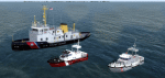
This is a paint and traffic file addition to go along with Henrik Nielsen's Global AI Ship Traffic.
These files have been tested to operate properly in FSX and P3Dv3. The textures are in .dds format for FSX and P3D.
The routes have been made with the consideration of using ORBX Vector, ORBX NA landclass and Pilots 2008 mesh products.
9 of the US Coast Guard's Bay Class icebreaker tugs are represented.
21 Canadian Coast Guard 47 foot motor life boats from the Quebec\Atlantic sectors and the British Columbia sector, along with 13 motor life boats of the US Coast Guard First District (New England) are represented.
4 ship traffic files allow all vessels to appear in the scenery.
Hendrik Nielsen's USCG Bay Class model and Jean-Pierre Fillion's Motor Life Boat model are included. Both Hendrik Nielsen and Jean-Pierre Fillion have given permission to include their ship/boat models with the project and I thank them greatly.
Four ship traffic files allow all vessels to appear in the scenery.
Please see the 'ReadMe' file first.
| Filename: | US__Canadian_Coast_Guard_AI__Boat_Traffic_V1.zip |
| License: | Freeware |
| Added: | 12th February 2019, 22:27:55 |
| Downloads: | 925 |
| Author: | Joe Bowers |
| Size: | 11.07 MB |
| Category: Flight Simulator X - Scenery | |
| NZOP- Opotiki Aerodrome (VectorLandClass, New Zealand) |
|
Images related to this file:
File Description:
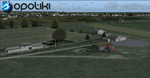
Opotiki aerodrome (ICAO: NZOP) is a small airstrip outside the township of of Opotiki, the gateway to the beautiful East coast of the North Island of New Zealand. Opotiki itself sits at the confluence of the Waioeka and Otara rivers and is surrounded by dairy farmland and Kiwifruit orchards with large areas of native bush to the south and east.
This scenery accompanies Tim Barnes'�� series of other small Bay of Plenty aerodromes (Whakatane,
Galatea, Waihi Beach) for use with VectorLandClass- It features custom modelled and textured buildings, large coverage of beautiful 0.5m aerial photography (fully auto-genned and including seasonal and night variations) and extensive use of high quality objects from the free VLC library. Installation of the library V1.1+ is required for this scenery to work properly and can be downloaded from the VectorLandClass website (www.vectorlandclass.co.nz)
This release, although not requiring it, works best with VectorLandClass topographic mesh and landclass addon covering all 268676 square kilometers of New Zealand. If you'��re not a VLC customer, you'��ll notice when the photoreal coverage runs out!
| Filename: | NZOP_Opotiki_Aerodrome_VectorLandClass_New_Zealand.zip |
| License: | Freeware, limited distribution |
| Added: | 21st February 2013, 13:52:47 |
| Downloads: | 969 |
| Author: | Tim Barnes |
| Size: | 146.68 MB |
| Category: Flight Simulator X - AFCAD Files | |
| PAOT - Wien Meml - Kotzebue, Alaska |
|
Images related to this file:
File Description:
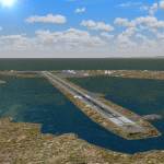
This AFCAD of the airport Wien Meml - Kotzebue (PAOT), Alaska, fixes some issues for Scenery Solution's UTX Alaska users who want to use mesh and texture resolutions better than 38 m and 1 m, respectively. Unfortunately this discloses some additional problems with lagoons surrounding runway 09/27. Some of the ponds had been elevated over apron level, the fence Microsoft had drawn around the airport ran through (elevated) water and so on. Runway 27 has no direct connection to the mainland like it is realized by UTX and furthermore a lot of water polygons (including the lagoons) had 'forgotten' shore line vectors. Included corrections are: fixed main waterpolygons around the airport (according to Google Maps), fixed airport layout, including aprons, GA parking, additional airport buildings (default FSX objects), fixed Runway designators (now 09/27 resp. 18/36 instead of 08/26 and 17/37, Nov. 2013), added shoreline vectors (compatible to UTX textures) and some more.
Again, THIS AFCAD IS INTENDED FOR USERS OF UTX ALASKA ONLY and will likely look horrible in other environments as it partially amends missing features only.
| Filename: | PAOT__Wien_Meml__Kotzebue_Alaska.zip |
| License: | Freeware, limited distribution |
| Added: | 3rd February 2014, 14:30:10 |
| Downloads: | 410 |
| Author: | Axel Birsul |
| Size: | 1.09 MB |
| Category: Flight Simulator X - AFCAD Files | |
| Coombs Airport (7NJ7), NJ |
|
File Description:
Located 04 miles NE of Elmer, New Jersey, Coombs Airport is a private turf field 2000' in length wilth clear 20:1 approach and departure at each end of the runway. You'll find some surrounding buildings but they are all located several hundred yards from the runway. This is a good strip to keep in mind for emergencies if you're in the area. You will be landing on terrain so having your mesh complexity set as high as possible is recommended. This airport is not lit at night, daytime VFR operations only are suggested. There are no transient services offered.
Scenery constructed with use of satellite images/streetview/aerial photos - the author has not been there in person.
This scenery is meant to be used in conjunction with MegaScenery Earth New Jersey/Delaware 004. It is not required, but apron use is minimized to allow satellite scenery to show through as much as possible, and objects are placed based on the MSE textures - lack of it may make scenery look out of place.
| Filename: | Coombs_Airport_7NJ7_NJ.zip |
| License: | Freeware |
| Added: | 16th February 2011, 00:03:55 |
| Downloads: | 191 |
| Author: | Drew Sikora |
| Size: | 756.22 KB |
| Category: Flight Simulator X - AFCAD Files | |
| Rainbow's End Airport (JY39), NJ |
|
File Description:
Located 07 miles S of Salem, New Jersey on 20 acres of land, Rainbow's End Airport is a private turf strip 2200' in length. There are no services for transient aircraft and the airport is not lit at night, so daytime VFR operations only are recommended. If you have an aircraft with 40' or less of wingspan you can start at one of the parking spaces east or west of the runway by the hangars. Otherwise it is suggested you start on the runway. There is no hard surfaced runway so set your terrain mesh as high as possible.
Scenery constructed with use of satellite images/streetview/aerial photos - the author has not been there in person.
This scenery is meant to be used in conjunction with MegaScenery Earth New Jersey/Delaware 005 & New Jersey/Delaware 004. It is not required, but apron use is minimized to allow satellite scenery to show through as much as possible, and objects are placed based on the MSE textures - lack of it may make scenery look out of place.
| Filename: | Rainbows_End_Airport_JY39_NJ.zip |
| License: | Freeware |
| Added: | 12th May 2011, 00:58:29 |
| Downloads: | 173 |
| Author: | Drew Sikora |
| Size: | 626.46 KB |
| Category: Flight Simulator 2004 - AI Aircraft | |
| RAF Boscombe Down BAe Hawk |
|
File Description:
Replacement ETPS,RAFCAM and Qinetiq textures for the MAIW UK Hawks part 2 package for the aircraft at MOD Boscombe Down. MAIW UK Hawks part 2 package is required.
| Filename: | RAF_Boscombe_Down_BAe_Hawk.zip |
| License: | Freeware |
| Added: | 6th July 2013, 19:15:51 |
| Downloads: | 344 |
| Author: | Kev Bell |
| Size: | 1.38 MB |


© 2001-2026 AVSIM Online
All Rights Reserved
Privacy Policy |