
Where Flight Simulation Enthusiasts Gather from Around the World!
AVSIM Library - Search Results

| Category: Flight Simulator 2002 - Scenery | |
| Rodos Scenery Update |

|
File Description:
Scenery for the popular greek holiday island of Rodos (Rhodes), and Rodos Diagoras (Paradisi) Airport. The island of Rodos is located deep in the heart of the Mediterranean Sea. Designed with Lago's FSSE and Landclass Assistant. Adds Houses, Villas, and Hotels, Airport Buildings, Vehicles, and Objects, Boats, Palm Trees and all things essential to provide the atmosphere of a package holiday destination!! Lago's FSSE (payware) is ideally required, however the landclass update will work regardless. FSSE users, please make sure you have upgraded to version 1.51 to get the most out of this scenery. Dedicated to all the crazy gang I met in Faliraki :o)!! Thumbnail by DJ Shocky.
| Filename: | Rodos_Scenery_Update.zip |
| License: | Freeware |
| Added: | 30th September 2002, 00:47:28 |
| Downloads: | 2,198 |
| Author: | DJ Prev |
| Size: | 18.24 KB |
| Category: Flight Simulator 2002 - Flight Plans | |
| 39RTWest |
|
File Description:
An FS2002 GPS flight Plan. The 39th in a series of Round the World flight plans for the FS2002 default scenery. Depart Kabul (OAKB) runway 29, Afghanistan and arrive 1 hour 10 minutes later at Herat (OAHR) runway 19, Afghanistan. A flight entirely within Afghanistan that skims mountain tops and travels through valleys. Set January textures and see for yourself the wild and rugged nature of this country. A VFR finals is featured (hand holding instructions given). The flight briefing (Word and text) is for a B737-400, it contains climb, cruise, top of descent and fuel loading details, waypoint timings and destination details.
| Filename: | 39RTWest.zip |
| License: | Freeware |
| Added: | 18th August 2002, 21:02:44 |
| Downloads: | 737 |
| Author: | The Ancient Brit |
| Size: | 25.02 KB |
| Category: Flight Simulator 2002 - Flight Plans | |
| 37RTWest |
|
File Description:
An FS2002 GPS flight Plan. The 37th in a series of Round the World flight plans for the FS2002 default scenery. Depart Nepalgunj (VNNG) runway 27, Nepal and arrive 1 hour 41 minutes later at Thoise (Z13Q) runway 29, India. Soon after takeoff you will be heading towards the hills and a climb into the snow capped peaks of the Himalayas. Vertical clearances are minimal; parts of this flight still scare me! A VFR finals is featured (hand holding instructions given). The flight briefing (Word and text) is for a B737-400, it contains climb, cruise, top of descent and fuel loading details, waypoint timings and destination details.
| Filename: | 37RTWest.zip |
| License: | Freeware |
| Added: | 30th July 2002, 21:50:57 |
| Downloads: | 808 |
| Author: | The Ancient Brit |
| Size: | 29.29 KB |
| Category: Flight Simulator 2002 - Utilities | |
| Royal Europe Airlines Viritual Airline Simulation |
|
File Description:
Royal Europe Airlines. For use with ALL flightsimulators! This program is like online VA. Because I don't have the possibility to be online that much, I created my own viritual airline program. Get your destination and fly the passengers safly to there. You make your own wage, and all flightdata get saved to a file. Review the log anytime you want. For use with all Aircrafts, all flightsimulators. Start with this program, it will tell you when to start your flightsimulator, after you got your assignment. Airports: Brussels, Paris, Dusseldorf, New-York, Maastricht, Madrid, Zurich, etc.. Included readme.txt for help and more information. A must have for all viritual commercial pilots!
| Filename: | Royal_Europe_Airlines_Viritual_Airline_Simulation.zip |
| License: | Freeware |
| Added: | 8th December 2002, 19:02:00 |
| Downloads: | 745 |
| Author: | M.Heuts |
| Size: | 303.71 KB |
| Category: Flight Simulator 2002 - Flight Plans | |
| 46RTWest |
|
File Description:
An FS2002 GPS flight Plan by The Ancient Brit. The 46th in a series of Round the World flight plans for the FS2002 default scenery. Depart Athens (LGAT) runway 16C, Greece and arrive 1 hour 55 minutes later at Zurich (LSZH) runway 14, Switzerland. A low level departure takes over the Holy City. A climb to FL280 is followed by a descent to skim the Alps and a further descent is made for the approach along an Alpine valley. The flight briefing (Word and text) is for the default B737-400; it contains climb, cruise, top of descent and fuel loading details, waypoint timings and destination details.
| Filename: | 46RTWest.zip |
| License: | Freeware |
| Added: | 12th January 2003, 21:34:35 |
| Downloads: | 827 |
| Author: | Denis Egan |
| Size: | 26.31 KB |
| Category: Flight Simulator 2004 - Flight Plans | |
| KSFO-KBIH-KSFO-01 |
|
File Description:
Two FS2004 GPS flight plans by the Ancient Brit in association with the Team (these plans are incompatible with FS2002). The plans are for KSFO-KBIH and KBIH-KSFO and are of 51 minutes and 1 hour 18 minutes duration respectively. Both plans feature my unique curved flight tracks. They are eye candy flights as unreal as it gets. Both flights feature views of the Bay and the Sierra Nevada's. The plans are fully flight briefed (Word and text) containing climb, cruise, and top of descent and fuel loading details, waypoint timings and destination details and are for the FS2K4 default scenery and B737-400.
| Filename: | KSFOKBIHKSFO01.zip |
| License: | Freeware |
| Added: | 17th August 2003, 22:20:18 |
| Downloads: | 1,110 |
| Author: | Denis Egan |
| Size: | 35.32 KB |
| Category: Flight Simulator 2002 - Scenery | |
| Big Cypress Swamp Airstrips |
|
File Description:
A package of 3 'bush-style' airstrips set in Big Cypress National Preserve, Florida - something of a rare destination for most FS2002 bush pilots! They're not to
be confused with the nearby 5600ft paved runway owned by the Seminole Indian tribe: these are all just very rudimentary dirt or grass strips in the middle of a
swamp. The airstrips do exist in reality, however based on recent satellite imagery I think they're now disused. A second cluster of Big Cypress airstrips can be found further south (across Alligator Alley) although these being very slightly more developed are part of the default FS2002 scenery library.
| Filename: | Big_Cypress_Swamp_Airstrips.zip |
| License: | Freeware, limited distribution |
| Added: | 28th May 2003, 21:32:27 |
| Downloads: | 681 |
| Author: | James Belk |
| Size: | 2.24 MB |
| Category: Flight Simulator 2004 - Flight Plans | |
| TEAL - the Coral Route - 1952 |
|
File Description:
TEAL introduced this service in 1951, ferrying passengers, mail and small freight items between Auckland (NZ), Suva (Fiji), Faleolo (Samoa), Motu Akaiami (Cook Islands) and Papeete (Tahiti, French Polynesia).
Service was initially monthly but after six months became fortnightly as its appeal spread world-wide. After all, who wouldn’t like to spend a holiday in a tropical paradise, conveyed to your destination aboard a flying boat, landing in tranquil lagoons fringed by white sandy beaches and palm trees?
Now you can relive those idyllic times by flying your Short Solent IV from Auckland to Tahiti in early May, 1952.
Please read the enclosed INSTALL.txt first and and coral52.doc files for essential information.
| Filename: | TEAL__the_Coral_Route__1952.zip |
| License: | Freeware |
| Added: | 4th January 2006, 14:40:37 |
| Downloads: | 691 |
| Author: | Bruce Kennewell |
| Size: | 70.23 KB |
| Category: Flight Simulator X - Scenery | |
| Quebec Jean Lesage Int'l Airport CYQB - ver 3.0 |
|
Images related to this file:
File Description:
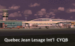
This high quality scenery is the third edition of the Quebec Jean Lesage Int'l airport (CYQB) for FSX which includes the new terminal extension for regional flights, new buildings, numerous additions and modifications to make this scenery exceptionally accurate. This scenery was designed entirely with Gmax including accurate AFCAD, animations, night lighting and real-world textures. Unique animated panels displaying images of Quebec City area main features are visible inside terminal from gate 28,29,30 and at the rear of terminal taxing from ramp #3. The weather station also has animated anemometer. Whether you fly GA aircrafts or airliners it is certain you will enjoy visiting CYQB and make it your favorite destination.
| Filename: | Quebec_Jean_Lesage_Intl_Airport_CYQB__ver_30.zip |
| License: | Freeware |
| Added: | 3rd June 2012, 19:45:29 |
| Downloads: | 15,287 |
| Author: | Gilles Boily |
| Size: | 33.24 MB |
| Category: Flight Simulator 2002 - Flight Plans | |
| 38RTWest |
|
File Description:
An FS2002 GPS flight Plan. The 38th in a series of Round the World flight plans for the FS2002 default scenery. Depart Thoise (Z13Q) runway 29, India and arrive 1 hour 24 minutes later at Kabul (OAKB) runway 29, Afghanistan. A very scenic flight. A climb up a valley followed by a tour between the mountain peaks and descent into a valley for the approach is featured. Keep a sharp lookout for you know who, there is a substantial reward still on offer. A VFR finals is featured (hand holding instructions given). The flight briefing (Word and text) is for a B737-400, it contains climb, cruise, top of descent and fuel loading details, waypoint timings and destination details.
| Filename: | 38RTWest.zip |
| License: | Freeware |
| Added: | 10th August 2002, 15:47:22 |
| Downloads: | 784 |
| Author: | The Ancient Brit |
| Size: | 26.97 KB |


© 2001-2026 AVSIM Online
All Rights Reserved
Privacy Policy |