
Where Flight Simulation Enthusiasts Gather from Around the World!
AVSIM Library - Search Results

| Category: Flight Simulator 2004 - AI Flight Plans | |
| Myanmar Airways International - Summer 2007 |

|
File Description:
Myanmar Airways International took off in August 1993, the result of a joint venture between Myanma Airways and Singapore interests with the support of Royal Brunei Airlines. In October 1998 that original joint venture was terminated with Myanma Airways taking total ownership. Subsequently in January 2001 a new joint venture was formed and a new aircraft livery was rolled out. Operating from Yangon (VYYY) to Kuala Lumpur (WMKK) and Bangkok (VTBS) using their single MD-82, Myanmar Airways International also participate in a number of code share agreements, most notably being their flights to Singapore (WSSS) operated by Jetstar Asia. As FS9 does not include VTBS by default, if you have not installed an AFCAD or scenery for this new airport install the alternate flightplan set included instead.
| Filename: | Myanmar_Airways_International__Summer_2007.zip |
| License: | Freeware, limited distribution |
| Added: | 24th April 2007, 09:17:48 |
| Downloads: | 1,286 |
| Author: | Ben Clark |
| Size: | 155.39 KB |
| Category: Flight Simulator 2004 - AI Flight Plans | |
| PB Air - Winter 2007 |
|
File Description:
PB Air were established in 1990 by Dr. Piya BhiromBhakdi, the president of the Boonrawd Brewery, the biggest in Thailand. It was originally used for flights by brewery staff only but in 1995 it received its license to offer charter flights and started operations in 1997. In February 1999 they started scheduled flights in alliance with Thai Airways International and Air Andaman. With their fleet of 2 Embraer 145's they operate a large number of domestic routes throughout Thailand from their base at Bangkok's brand new Suvarnabhumi Airport (VTBS) and also operate a service to Danang (VVDN) in Vietnam. As FS9 does not include VTBS by default, if you have not installed an AFCAD or scenery for this new airport install the alternate flightplan set included instead.
| Filename: | PB_Air__Winter_2007.zip |
| License: | Freeware, limited distribution |
| Added: | 22nd December 2007, 01:29:16 |
| Downloads: | 661 |
| Author: | Ben Clark |
| Size: | 194.94 KB |
| Category: Flight Simulator X - AFCAD Files | |
| OPSD Skardu Airport Pakistan |
|
File Description:
This is an airport layout file (AFCAD) for the default OPSD Airport at Skardu in the heart of the Kashmir (administered by Pakistan). This file adds aprons, three GA gates, and three commercial gates of medium size. As the default does not include any parking, without this file, you will not see any AI traffic parked at OPSD. Skardu is a popular base for trekkers and climbers in the Karakoram range, featuring absolutely stunning scenery. The narrow valley of the Indus river is surrounded by some of the highest mountains on earth. OPSD is served by PIA and private charters from Islamabad (OPRN - see my separate AFCAD). I have inclosed a flightplan for the offical route from OPRN to OPSD in standard MS FS format. Tested with WoAI only.
| Filename: | OPSD_Skardu_Airport_Pakistan.zip |
| License: | Freeware, limited distribution |
| Added: | 11th February 2008, 15:44:43 |
| Downloads: | 1,314 |
| Author: | Marten Weber |
| Size: | 702.77 KB |
| Category: Flight Simulator 2004 - AI Aircraft | |
| Doren Air Congo (Democratic Republic of Congo) - Package No 140 |
|
Images related to this file:
File Description:

The Freightshifters 2013 brings you yet another rare and wonderful AI Package
for FS2004.
The FS2004 Doren Air Congo (Democratic Republic of Congo) - Package No 140 -
Included in this Package are repaints for Let L-410UVP 9Q-CQZ & 9Q-CZA a special
version Let L-410FG with glass nose, Includes Custom Light Map - AI Model By
Makc-Sim , Flightplan Info in the Readme. This is one of many AI Packages being
released aimed at bringing locally based AI Traffic to the African Subcontinent.
Requires AFCAD Packages:
Democratic Republic Of Congo AFCADs (available: HERE)
Republic Of Congo AFCADs (available: HERE)
| Filename: | Doren_Air_Congo_Democratic_Republic_of_Congo__Pack.zip |
| License: | Freeware, limited distribution |
| Added: | 11th October 2013, 17:57:23 |
| Downloads: | 394 |
| Author: | Kevin McCarthy, Freightshifters 2013 |
| Size: | 1.1 MB |
| Category: Flight Simulator X - Utilities | |
| FSX/FS2004 Flight Analyzer Utility |
|
Images related to this file:
File Description:
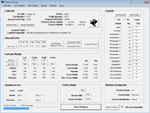
This utility can do the following:
- analyzing your flight from departure to your destination, and the landing with a graphical landingchart.
- when flight analysis is finished you can print a report, the report is automaticly saved as pdf File.
- quickly change the settings of FSX, such as time, date, fuel, weight, traffic etc.
- start a failure sytem, such as gear, flaps, engine, etc.
- runway detecting system to see wich runways are in use.
- load a existing flight or flightplan.
- quickly look to your CFG (settings) files and change them even before the flight simulator is running.
- after a flight is finished FsQC saves your flight automaticly as 'FsQC last Flight', so you can continue the next day or hour.
- and lots of more.
- see also http://www.fsqc.eu for more info.
- FSUIPC required
| Filename: | FSXFS2004_Flight_Analyzer_Utility.zip |
| License: | Check within download |
| Added: | 15th February 2018, 00:57:20 |
| Downloads: | 178 |
| Author: | Evander Tholen |
| Size: | 831 KB |
| Category: Flight Simulator 2002 - Flight Plans | |
| Gliding: Swiss Sky Soar |
|
File Description:
"The engine is the heart of an airplane but the pilot is its soul." If that's true than without the engine this experience is about your soul, what many like to call a real sense of flying. Launching the flight will immediately place you behind the controls of your airborne Schleicher ASW28, 7000ft over the city of Thun, Switzerland. With your flightplan loaded on your GPS you got a highway of canyons stretching ahead for 60.9nm to destination. Weather conditions ( wind and thermals) are favourable and will help even the less experienced stay clear of the pretty but dangerous terrain below. Enough push and lift to soar gracefully the Swiss Alps for 40-80 minutes. Enjoy the flight!( Thermal scenery included. Recommended add-on: Schleicher ASW28 By Peter Franke, Roland Stuck, Max Roodveldt, filename:asw28.zip ).
| Filename: | Gliding_Swiss_Sky_Soar.zip |
| License: | Freeware |
| Added: | 19th August 2002, 20:11:53 |
| Downloads: | 1,196 |
| Author: | Fs-Icarus Crew |
| Size: | 23.81 KB |
| Category: Flight Simulator X - Missions | |
| Direct Fly 2: Orbit (QX) 2609 - CRJ700 |
|
File Description:
Fly the second mission of the serie Direct Fly and bring the passengers of flight Orbit (QX) 2609 saftely to Oakland. Test your skill by landing the CRJ-700 in pure weather conditions, only by using the instruments. The Mission based on the original fly of Horizon Air 2609 from Portland to Oakland International. As a new feature, the mission including a simulation of a ground alert system if you land at Oakland and a altitute alert system if you reach the different altitutes by climbing and descending. Requires only the Flight Simulator X with Service Pack 2. This file also including modified files for "Direct Fly 1" to correct the path of the flightplan and giving the mission the correct ID for the category of a airliner mission.
| Filename: | Direct_Fly_2_Orbit_QX_2609__CRJ700.zip |
| License: | Freeware |
| Added: | 17th October 2008, 10:00:02 |
| Downloads: | 3,345 |
| Author: | Carsten Wanzelius |
| Size: | 16.36 MB |
| Category: Flight Simulator 2004 - AI Aircraft | |
| Swala Aviation (Democratic Republic of Congo) - Package No 147 |
|
Images related to this file:
File Description:

The Freightshifters 2013 brings you yet another rare and wonderful AI Package for FS2004 -
The FS2004 Swala Aviation (Democratic Republic of Congo) - Package No 147 - Included in this Package are repaints for Shorts Skyvan SC-7 9Q-CST & 9Q-CXF - Dornier 228-200 9Q-CSL, Original Models by Dan Watkins, Rick Piper, Ken Mitchell, Aaron Swindle & Dornier Model by Fernando Martinez, Flightplan Info in the Readme. This is one of many AI Packages being released aimed at bringing locally based AI Traffic to the African Subcontinent.
Requires AFCAD Packages:
Democratic Republic Of Congo AFCADs (available: HERE)
Republic Of Congo AFCADs (available: HERE)
| Filename: | Swala_Aviation_Democratic_Republic_of_Congo__Packa.zip |
| License: | Freeware, limited distribution |
| Added: | 22nd October 2013, 22:34:47 |
| Downloads: | 444 |
| Author: | Kevin McCarthy - Freightshifters 2013 |
| Size: | 2.92 MB |
| Category: Prepar3D V1-4 - Scenery | |
| Lamb Holm Airfield and Churchill Barriers |
|
File Description:
P3D v4.5 Scenery - SCO3_Lamb Holm Airfield and the Churchill Barriers, Orkney, Scotland.
This scenery needs OrbxTENorth product to be installed and offers an enhancement to the airfield in that product. The Churchill Barriers are missing from the Orbx product. Also included is the Italian Chapel, a popular tourist attraction on the island. This building was built by Italian prisoners of war during World War ll. They also built the barriers. Road traffic has been re-aligned to roads and barriers and also has reduced density built in. The main runway is able to accomodate AI traffic and a flightplan for flights from Lamb Holm to other local airfields is included. This is the first of a series of airfield packages to add to and enhance the airfields included in TENorth and TECentral.
| Filename: | Lamb_Holm_Airfield_and_Churchill_Barriers.zip |
| License: | Freeware |
| Added: | 30th March 2020, 01:44:11 |
| Downloads: | 141 |
| Author: | Scotflight Freeware |
| Size: | 31.35 MB |
| Category: Flight Simulator X - Scenery Design | |
| (Version 2.0) KEFD -Ellington 2025 Refresh FSX (Circa 2006-2010)- Johnson Space Center Houston |
|
Images related to this file:
File Description:
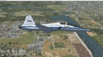
Version 2.0 covers landclass across the entire greater Houston area, with a large increase in LOD. This version significantly tightens up and improves the landclass from version 1.0, and adds a vast amount of scenery objects that brings the Bay Area-KEFD area into the modern era. This improves and adds a highly accurate runway 17 approach with accurate placement of buildings and scenery around the year 2011-modern day. In addition, includes several new files including a new airport/helipad via Houston Clear lake regional airport, T41 La Porte Municipal and surrounding shipping ports, Kemah Boardwalk, and a giant improvement to Johnson Space Center Houston. Rundway 35 and Runway 22 landclass is significantly increased, and more accurate as well. You can fly an accurate VFR approach or set up an ILS for any one of KEFD's runways with ease with this improvement.List of Version 2.0 additions and changes: - I added a ton of scenery objects and tightened up the landclass at Johnson Space Center Houston- NASA Control Center--- Added Talon Park with T38s (via static objects)--- Added Gemeni V rocket and 747 for the shuttle transporter--- And a whole bunch of vegetation, new buildings, and tour buses.- Added Kemah boardwalk and several boat docks- Removed a TON of highrise textures and replaced with medium and large city suburb landclass.- Added Clear Lake regional Hospital with helipad and surrounding scenery by Walter Reed Park- Added El Jardin or "Bayport Container port" with several scenery objects and significantly tightened up landclass.-- Looks great when setting up ILS approach for RWY 22- Tightened up Bay Area BLVD landclass, "adding" University of Houston Clear Lake"-- UHCL was semi already present, just made it more pronounced.- Made Red Bluff road landclass super recognizable!-- Red Bluff road is used to set up VFR approach and or field break for RWY 22 and RWY 17 R.----- Its common to see private jets and the USAF doing a break along Red Bluff road.- Added First Baptist Church, and water tower to Pasadena Convention center- Made Fairmont Parkway pronounced with landclass- Added Houston Port Authority at Morgan's Point--- Another Landmark for the RWY 22 ILS approach, NASA religiously uses this to line up the 10 mile ILS.- Tightened up landclass at Village Grove East and along Fairmont Parkway- Added a TON of scenery objects and landclass corrections for approach of RWY 17 L and 17 R.---- Added Home Depot, Lowes, Walmart Super center, Guitar center etc.---- added South Main Baptist Church--- Bondy Jr High, Turner Elementary, and Pasadena Memorial High School--- Added Saint Luke's Hospital--- Added Hampton Inn Suites and HCA rehab hospital--- Added a ton to the container facility behind best buy and storage facility--- Added smaller churches on RWY 17 approach--- Added a ton of scenery at the base of RWY 17 R, i.e., concrete plant, containers, trucks-- Added gas stations on the corner of beltway 8 and genoa red bluff-- Significantly changed and tightened up landclass at the base of RWY 22 and RWY 17 L and 17 R-- Made several roads and Beltway pronounced------ This decision looks AWESOME at night, really adds demarcation to the roads.**All of this makes the RWY 17 approach super recognizable** RWY 22 approach landclass is much more accurate.- Significantly changed and tightened up landclass near southbelt ellington and interstate 45.- Added Grace Church-- I wanted to do San Jacinto College south, but seemed over kill at that point.- SIGNIFICANTLY tightened up landclass for RWY 35 approach and near baybrook mall.-- Along I45- Added TDECU stadium at the University of Houston Main Campus---- So you can practice flybys for Cougar games!- Added the Battleship at San Jacinto Monument- I also "borrowed" T41 La Porte Municipal's tower camera to make a SWEET view of KEFD.- I included landclass for Sealy Texas this time, as well as my significant enhancements of Austin, Texas greater area as well (optional, but recommended!)---------------------------------------------------------------------------Version 1.0 originally added:- Added the Johnson Space Center Houston, which is now greatly enhanced and blended.- San Jacinto Community College-Central- Pasadena Convention Center- Pasadena Water Treatment Facility- NASA Bouncy Lab- Pasadena Shopping center, now greatly enhanced and blended.- Baybrook Mall and other shopping spots.- Significant Landclass improvements across the entire greater Houston Area File also includes landclass and scenery improvements for the greater Austin, Texas Area (optional), KIAH, KDWH, and Sealy, Texas. Each of these projects combined covers roughly 15,000 square miles of landclass improvement. Allowing you to fly entirely from Houston to Austin, or Houston to San Antonio in accurate landclass. -Enjoy!DJN
| Filename: | Version_20_KEFD_Ellington_2025_Refresh_FSX_Circa_2.zip |
| License: | Freeware |
| Added: | 12th October 2025, 16:15:47 |
| Downloads: | 79 |
| Author: | Dan Nelson |
| Size: | 277.28 MB |


© 2001-2026 AVSIM Online
All Rights Reserved
Privacy Policy |