
Where Flight Simulation Enthusiasts Gather from Around the World!
AVSIM Library - Search Results

| Category: Flight Simulator X - Scenery | |
| LFLJ - Courchevel, France |

|
File Description:
This FSX scenery package contains the LFLJ Courchevel airport in the French Alps. The airport has a very short, upslope runway of only 525 m (1,722 ft). The airport is considered one of the seven most dangerous in the world. It has a difficult approach, a 300 foot upslope runway and is adjacent to the Courchevel ski runs. The Courchevel airport altitude is the highest in Europe, with a mean elevation of 6,520 feet. This airport is intended to be used with FSX and the free addon - TileProxy. TileProxy provides real-time photorealistic satellite imagery in place of the stock auto generated FSX scenery or any other scenery package. The Courchevel airport was originally released as part of an FSX airport scenery package containing 15 airports, located in the French Alps. The link to the original 15 French Alps Airport package is shown below. This file is not required, but allows you to download 15 related French Alps airports. The LFLJ, Courchevel airport in the original 15 airport package was missing a required scenery file which corrects the airport altitude (from 6420 ft. to 6520 ft.) due to the mis-location of the stock FSX airport. This download provides all three of the required .bgl scenery files.
related download:
http://library.avsim.net/search.php?SearchTerm=french+alps+airports&CatID=root&Go=Search
| Filename: | LFLJ__Courchevel_France.zip |
| License: | Freeware |
| Added: | 30th November 2013, 20:20:07 |
| Downloads: | 6,045 |
| Author: | John Greenwood |
| Size: | 655.63 KB |
| Category: Orbiter - Distribution Files | |
| Mesh Viewer 5.0 |
|
File Description:
This is my Mesh Viewer version 5 compiled and fixed by Kev33. Most of knowns bugs has been removed. It displays Orbiter mesh files. Good to check your mesh.
| Filename: | Mesh_Viewer_50.zip |
| License: | Freeware, limited distribution |
| Added: | 14th April 2004, 16:36:23 |
| Downloads: | 1,439 |
| Author: | Pawel Stiasny and Kev33 |
| Size: | 7.23 KB |
| Category: Flight Simulator X - Scenery | |
| Drop Zone des Bois |
|
Images related to this file:
File Description:
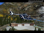
This scenery is the drop zone for French rescuers of the Mont blanc (PGHM). Located next to Chamonix Mont Blanc in the North French Alps. They use EC145 to accomplish their missions.
| Filename: | Drop_Zone_des_Bois.zip |
| License: | Freeware |
| Added: | 1st February 2013, 23:56:22 |
| Downloads: | 1,522 |
| Author: | Manolo Dobrazil |
| Size: | 4.32 MB |
| Category: Flight Simulator 2002 - Scenery | |
| X Lakes Region Chile Mesh |
|
File Description:
This new mesh in 76.4 M for X Lake Region of Chile is part of the newly mesh Package for all Latin america mesh (Southamerica, caribean and Central america. This Package covers 39S to 42S and 74W to 71W. For more Mesh Scenery details contact http://colombiamesh.tripod.com/.
| Filename: | X_Lakes_Region_Chile_Mesh.zip |
| License: | Freeware |
| Added: | 9th June 2003, 12:43:01 |
| Downloads: | 813 |
| Author: | Alvaro Romero Vargas |
| Size: | 9.55 MB |
| Category: Flight Simulator X - Aircraft Repaints, Textures and Modifications | |
| The Helicopter Line - Default Bell Jetranger 206B |
|
File Description:
Skin for the default FSX Bell 206b depicting The Helicopter Line. The New Zealand based Helicopter Line operates an extensive fleet taking tourists primarily on aerial tours of the southern alps in New Zealand.
| Filename: | The_Helicopter_Line__Default_Bell_Jetranger_206B.zip |
| License: | Freeware |
| Added: | 28th June 2007, 16:30:59 |
| Downloads: | 719 |
| Author: | Jon Murchison |
| Size: | 1.88 MB |
| Category: Flight Simulator X - AFCAD Files | |
| LOKL - Lienz Nikolsdorf - Lienz - Austria |
|
File Description:
Lienz Nikolsdorf airfield (LOKL) is a small airfield in a narrow valley in the Austrian Alps. The runway is only 550 x 12 meters. It does not exist in FSX, so I made it.
| Filename: | LOKL__Lienz_Nikolsdorf__Lienz__Austria.zip |
| License: | Freeware |
| Added: | 19th February 2013, 23:06:42 |
| Downloads: | 411 |
| Author: | Wolfgang Wassmann |
| Size: | 81.5 KB |
| Category: Flight Simulator X - AFCAD Files | |
| LOGO - Niederoeblarn - Niederblarn, Austria |
|
File Description:
Niederoeblarn airfield (LOGO) is an airfield in a valley of the Austrian Alps near Schladming surrounded by beautiful mountains. A paradise for sail planes. It does not exist in FSX, so I made it.
| Filename: | LOGO__Niederoeblarn__Niederblarn_Austria.zip |
| License: | Freeware |
| Added: | 19th February 2013, 23:11:26 |
| Downloads: | 297 |
| Author: | Wolfgang Wassmann |
| Size: | 57.49 KB |
| Category: Flight Simulator 2004 - Flight Plans | |
| Tour de France 2013 |
|
Images related to this file:
File Description:
On 29 June 2013, the Tour de France 2013 started in Porto-Vecchio on the island of Corse, France.You may like or dislike cycling, but it's always fun to fly around France!The 21 VFR flight plans, for the default Cessna 172, follow the stages to a large extent.The stages in the French Alps are a real challenge! The interval stages are IFR flights for the Douglas DC-3. The stages in the French Alps require the installation of Guy Nemoz's scenery fraltpts.zip (merci beaucoup, Guy!).
| Filename: | Tour_de_France_2013.zip |
| License: | Freeware |
| Added: | 1st July 2013, 18:04:58 |
| Downloads: | 156 |
| Author: | Nis Verkijk |
| Size: | 41.71 KB |
| Category: Flight Simulator X - Scenery | |
| USA East 10 metre mesh, Batch 1, Part 1 / N. Dakota, Minnesota |
|
File Description:
USA EAST USGS 10 metre mesh terrain - FSX only.
This constitutes 10 metre terrain mesh for a section of the USA, The whole USA East mesh files will abutt the US West Coast 10m mesh already available elsewhere, that was made by: Raimondo Taburet. Make sure you have your scenery terrain settings at about 5 metres in the FSX display dialogue for the mesh to show properly!
| Filename: | USA_East_10_metre_mesh_Batch_1_Part_1___N_Dakota_M.zip |
| License: | Freeware |
| Added: | 27th March 2009, 10:46:09 |
| Downloads: | 1,205 |
| Author: | Wayne Evans |
| Size: | 68.67 MB |
| Category: Flight Simulator X - Scenery | |
| USA East 10 metre mesh, Batch 1, Part 2 / N. Dakota, Minnesota |
|
File Description:
USA EAST USGS 10 metre mesh terrain - FSX only.
This constitutes 10 metre terrain mesh for a section of the USA, The whole USA East mesh files will abutt the US West Coast 10m mesh already available elsewhere, that was made by: Raimondo Taburet. Make sure you have your scenery terrain settings at about 5 metres in the FSX display dialogue for the mesh to show properly!
| Filename: | USA_East_10_metre_mesh_Batch_1_Part_2___N_Dakota_M.zip |
| License: | Freeware |
| Added: | 27th March 2009, 14:21:50 |
| Downloads: | 964 |
| Author: | Wayne Evans |
| Size: | 45.29 MB |


© 2001-2026 AVSIM Online
All Rights Reserved
Privacy Policy |