
Where Flight Simulation Enthusiasts Gather from Around the World!
AVSIM Library - Search Results

| Category: Flight Simulator X - AFCAD Files | |
| PAWI - Wainwright Airport | Wainwright, AK |

|
File Description:
PAWI - Wainwright Airport | Wainwright, AK. The amount of parking, as well as AI-Traffic handling efficiency is now double what it was before at this airport. Day & Night visual effects and performance have also been considerably enhanced. This was designed using Flight 1's excellent "Airport Facilitator X" program.
| Filename: | PAWI__Wainwright_Airport_____Wainwright_AK.zip |
| License: | Freeware |
| Added: | 23rd January 2009, 10:31:35 |
| Downloads: | 266 |
| Author: | Dakota Smith / Smith Graphics |
| Size: | 86.74 KB |
| Category: Flight Simulator X - Scenery | |
| KFKN - Franklin Municipal / John Beverly Rose Airport - Virginia, USA |
|
File Description:
Also known as Franklin Municipal Airport or John Beverly Rose Field (IATA: FKN, ICAO: KFKN, FAA LID: FKN) is a public airport in Isle of Wight County, Virginia, United States. The airport is owned by the City of Franklin and is located at 32470 John Beverly Rose Drive, two nautical miles (4 km) northeast of the city's central business district.
Added aircraft parkng and custom buildings. Created with Airport Design Editor by ScruffyDuck Software using current FAA documentation and Google Earth measurements, this package offers a replacement for FSX's stock airport. All these enhancements are as close to the real airport as I can get with stock library objects and custom buildings.
| Filename: | KFKN__Franklin_Municipal__John_Beverly_Rose_Airpor.zip |
| License: | Freeware |
| Added: | 10th November 2014, 01:11:40 |
| Downloads: | 302 |
| Author: | Wayne Roberts |
| Size: | 344.67 KB |
| Category: Flight Simulator X - Scenery | |
| Land's End SeaPlanes; West Coast Travels |
|
File Description:
Part III in the four part scenery series of Land's End SeaPlanes. Part III, West Coast Travel covers the United States West Coast from Seattle Washington to San Diago, California. This scenery pack requaires Lands End SeaPlanes Part I and Part II. Part III includes, KAST - Astoria Regional Airport, KONP - Newport Municipal Airport, Newport, Oregon; KOTH - North Bend Airport, North Bend Oregon; KBOK - Brookings State Airport, Brookings Oregon; KACV - Arcata-Eureka Airport, Arcata, California; OQ5 - Shelter Cove Airport, Shelter Cove, Ca; CA51 - The Sea Ranch, Ca; KHAF - Half Moon Bay, Ca; O62 - Carmel Valley Vintage; L52 - Oceano County; and more. Package includes hundreds of custom models, effects, textures. Includes both day and night textures.
| Filename: | Lands_End_SeaPlanes_West_Coast_Travels.zip |
| License: | Freeware, limited distribution |
| Added: | 21st November 2008, 19:06:05 |
| Downloads: | 2,617 |
| Author: | Chris Carel |
| Size: | 42.47 MB |
| Category: Flight Simulator 2002 - Scenery | |
| El Toro International Airport V3 |
|
File Description:
This is my proposed version of what a new large state of the art airport would look like on the former El Toro Marine base. It has been completely reworked and laid out to make the best use of the site for a commercial airport. It is comparable to LAX in size, and is still expandable. It has 91 gates, two luxury airport hotels, an airport office complex, a cargo area, hangar area, and the Irvine Spectrum entertainment complex. It also has a park running through the center of the airport with parking structures, and some unique building designs. Eye candy abounds here, and there are thirteen removable static aircraft located throughout the airport.
| Filename: | El_Toro_International_Airport_V3.zip |
| License: | Freeware |
| Added: | 2nd March 2003, 13:19:31 |
| Downloads: | 1,075 |
| Author: | Bill Melichar |
| Size: | 4.59 MB |
| Category: Flight Simulator X - AFCAD Files | |
| EKVG - Vagar Airport - Faroe Islands - Denmark |
|
File Description:
This is a rework of the default Vagar Airport which represents the airport close to its current state. Vagar Airport is the only airport in the Faroe Islands and is the home base of Atlantic Airways.
- Added gates and helipads
- Aprons and taxiways moved/adjusted to match aerial views
- Runway 13/31 extended to 1779 m / 5902 ft
- Turning circles added to the ends of Runway 13/31
- Control tower and fire station added
- Fuel truck added
- Runway lighting updated
- Airport views are from the roof of the control tower when in tower view
Made with the latest version of ADE (Airport Design Editor).
| Filename: | EKVG__Vagar_Airport__Faroe_Islands__Denmark.zip |
| License: | Freeware, limited distribution |
| Added: | 13th August 2014, 21:17:35 |
| Downloads: | 1,012 |
| Author: | Joseph Friesen |
| Size: | 1.45 MB |
| Category: Flight Simulator X - AFCAD Files | |
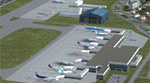
| KMCI - Kansas City Inl - Kansas City, USA |
|
Images related to this file:
File Description:
Kansas City International Airport, originally named Mid-Continent International Airport, is an American public airport located 15 miles North West of the central business district of Kansas City, in Platte County, Missouri, United States. It has consistently ranked in the top-five airports in the North America Airport Satisfaction Study by J. D. Power and Associates. In February 2010, the airport was the highest-rated medium-sized airport receiving five stars in all categories. Its largest carriers are Southwest Airlines and Delta Air Lines, which both operate a large number of daily flights in Terminal B.
Using ADEx 1.55, aeronautical maps and Google Earth the default AFCAD has been updated to reflect today's situation.
| Filename: | KMCI__Kansas_City_Inl__Kansas_City_USA.zip |
| License: | Freeware |
| Added: | 16th May 2013, 18:14:24 |
| Downloads: | 2,006 |
| Author: | Menno C. Robert |
| Size: | 580.54 KB |
| Category: Flight Simulator X - Scenery | |
| Uyuni - Bolivia - Joya Andina Airport (SLUY) and Uyuni City Photoreal |
|
File Description:
Uyuni Airport (IATA: UYU, ICAO: SLUY), aka Joya Andina Airport, is a public use airport located slightly northwest of Uyuni, in the southwestern Potosi Department of Bolivia. It is close to the Salar de Uyuni, the world's largest salt flat. It was opened by the Bolivian president Evo Morales on July 11, 2011.
Currently the airport is served by two airlines: Amaszonas and TAM Transporte Aereo Militar, which offer regular flights to and from Sucre, La Paz and Rurrenabaque.
Uyuni Airport features a 4,000 meters (13,000 ft) long and 45 meters (148 ft) wide paved runway, making it the airport with Bolivia's second longest runway.
Compatible with both FSX and P3D.
| Filename: | Uyuni__Bolivia__Joya_Andina_Airport_SLUY_and_Uyuni.zip |
| License: | Freeware |
| Added: | 10th July 2015, 12:13:26 |
| Downloads: | 868 |
| Author: | Marcos A. Rivas Torrez |
| Size: | 39.81 MB |
| Category: Flight Simulator X - Scenery | |
| SEGU - Jose Joaquin de Olmedo International Airport - Guayaquil, Ecuador |
|
Images related to this file:
File Description:
Building upon Menno Robert's original SEGU airport as a starting point, this project updates the coordinates of the airport, adds more visual detail, further expands aprons and the new terminal, and optimizes the scenery to fit seamlessly with FTX Global/Vector. This airport should also be fully functional in all FSX configurations. The airport is updated to reflect current satellite imagery and positioning. Scenery was created using Airport Design Editor X v1.61.5298, SBuilderX 3.13, and the FSX Object Placement Tool. Scenery objects were added and modified from stock FSX scenery to resemble as closely as possible the actual airport.
Thank you to Menno Robert for granting permission to edit his original SEGU file.
| Filename: | SEGU__Jose_Joaquin_de_Olmedo_International_Airport.zip |
| License: | Freeware |
| Added: | 4th July 2015, 18:22:13 |
| Downloads: | 4,206 |
| Author: | Carlyle Sharpe |
| Size: | 2.79 MB |
| Category: Flight Simulator X - Scenery | |
| TGPY |
|
File Description:
Maurice Bishop International Airport (IATA: GND, ICAO: TGPY), formerly known as Point Salines International Airport, is located in the parish of St. George's. The town of St. George's is about 5 miles (8.0 km) north of the airport and is the capital of the island nation of Grenada. The airport is located on Point Salines, the most southwestern point of the island. It is the most important airport in terms of infrastructure in the northern part of the country and the first in terms of cargo movements.
This file has the right coordenates, with the apron and characteristics of the airport. The runways were resized the gates placed on correct location and number.
| Filename: | TGPY.zip |
| License: | Freeware |
| Added: | 30th April 2011, 00:18:46 |
| Downloads: | 1,952 |
| Author: | Anwar Gonzalez |
| Size: | 7.85 KB |
| Category: Prepar3D V5 - Scenery | |
| VISR_P3Dv5 |
|
File Description:
Sheikh ul-Alam International Airport (IATA: SXR, ICAO: VISR) also known as Srinagar Airport or Budgam airbase is a military airbase that serves Srinagar, the summer capital of the union territory of Jammu and Kashmir, India. It is owned by the Indian Air Force, and the Airports Authority of India operates a civil enclave at the airport. Although designated an international airport in 2005, the Srinagar airport does not receive scheduled international flights as of April 2020, but has seen Hajj flights. It has an integrated terminal and one asphalt runway which is capable of handling large passenger jets like the Boeing 747 and Airbus A380. The airport is actually located in Budgam, which is 4 km from Srinagar.
| Filename: | VISR_P3Dv5.zip |
| License: | Freeware |
| Added: | 19th November 2020, 19:41:06 |
| Downloads: | 481 |
| Author: | Abhishek Banerjee |
| Size: | 23.32 MB |
© 2001-2026 AVSIM Online
All Rights Reserved
Privacy Policy |