
Where Flight Simulation Enthusiasts Gather from Around the World!
AVSIM Library - Search Results

| Category: Flight Simulator 2002 - Miscellaneous Files | |
| Los Angeles Terminal Area Chart |

|
File Description:
The rendition of Los Angeles´ KLAX airport is one of the most detailed in FS2002 and a great starting point to explore the West Coast. The library hosts a few awesome landclass and mesh files for this area that offer an "as real as it gets" VFR experience if used with this chart. The 1:250.000 scaled chart is scanned in high resolution (8400*4700 pixel). It covers a much smaller area, but offers considerably more detail than the LA sectional. You may use this chart "as is" without any other software, but it will develop its full potential if used as moving map with SimSystem´s FSFlightMax or FSGarmin. It wouldn´t have been possible to offer this chart without Richard Harvey and his love to flightsimming, so please consider this file to be "donationware" and make a however small contribution to the Richard Harvey Endowed Scholarship.
| Filename: | Los_Angeles_Terminal_Area_Chart.zip |
| License: | Check within download |
| Added: | 30th March 2003, 15:27:19 |
| Downloads: | 1,472 |
| Author: | Uwe Rademacher |
| Size: | 28.03 MB |
| Category: Flight Simulator 2004 - Scenery Design | |
| Kijik Lake_AFCAD2_update to Version 2 only |
|
File Description:
This updated bgl is for those that have already installed the original Kijik Lake and would like 'just' the updated AFCAD2 bgl.
You must have already installed "Kijik Lake" by Brent Hricziscse. filename: kijik.zip in the avsim library. The complete scenery containing the update can also be downloaded_filename: kijik_v2.zip
This allows FS9 to list Kijik Lake in the Go to Airport's list with its available starting points, allows Kijik Lake to be viewable in the GPS and the map feature as well as installing the local NDB for navigation purposes. A tower view is also included.
In addition to the above, this updated bgl adds local radio communications for Kijik Lake airspace (ATC) and the start/approach points for Rwy's 01 and 19. Also, local Boy Scout troops donated their time and labor to groom the shoreline, resulting in a very nice airstrip.
| Filename: | Kijik_Lake_AFCAD2_update_to_Version_2_only.zip |
| License: | Freeware, limited distribution |
| Added: | 21st March 2004, 23:17:56 |
| Downloads: | 203 |
| Author: | Brent Hricziscse |
| Size: | 2.12 KB |
| Category: Flight Simulator 2002 - Utilities | |
| FlightSim Manager v0.9.9 |
|
File Description:
FlightSim Manager is a great tool for managing addons to Microsoft Flight Simulator 2002. You may easily import your existing Aircraft, Panels, Sounds and Scenery. FlightSim Manager can also to install new aircraft and scenery directly from distribution ZIP files you may have downloaded. While installing new aircraft/scenery FlightSim Manager will automatically copy the required files and repair it if necessary. You may even add or remove aircraft variants as you wish. The comprehensive Hangar management allows you to manage and configure your addons off your live FS2002 installation. You can mass add scenery, clean gauges and fly from anywhere in the world using an map view.
From version 0.9.7, you can create Texture Sets - i.e.. different Tree Sets, and you can install the texture with a single click.
You can also capture screenshots from Flight Simulator, and launch it with random Splash Screens.
| Filename: | FlightSim_Manager_v099.zip |
| License: | Freeware |
| Added: | 8th June 2004, 03:49:34 |
| Downloads: | 1,033 |
| Author: | Rana Hossain |
| Size: | 2.49 MB |
| Category: Flight Simulator 2004 - Utilities | |
| Courseplanner 3.D.3, Flight Planner |
|
File Description:
FS2004/FSCOF/FS2002/FS2000 Courseplanner 3.D.3, stand alone flight planner.
Complete flight management on a realistic world map. Over +30000 SID/STAR as well as +60000 waypoints.
Use YOUR own scenery, (airports, Navaids, etc), and all the planes in your hangar.
Monitor your progress, all the AI traffics, (and multiplayer), real time on the internet and intranet, this includes altitude, speed and more.
Great to use when flying with VATSIM or IVAO.
Use Courseplanner over the network, (CP on one machine and FS on another), or both on the same machine.
Runs independently to FS, (you do not even need to have FS running).
Import/Export FS flight plans and/or adventures.
Create printable maps, (en route, departure, airport, ILS etc), as well as the briefing files.
Courseplanner will fly the aircraft for you and even 'pause' the flight near the airport, or any point for that matter.
| Filename: | Courseplanner_3D3_Flight_Planner.zip |
| License: | Shareware, time limited |
| Added: | 23rd December 2005, 12:45:50 |
| Downloads: | 8,062 |
| Author: | MyOddweb.com Team |
| Size: | 26.35 MB |
| Category: Flight Simulator X - Scenery | |
| Carrier Tracks Volumes 1 and 2 |
|
Images related to this file:
File Description:
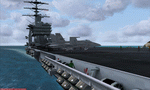
FSX Carrier Tracks Volumes 1 And 2. Volume 1 places Nimitz-class carrier models as moving AI boat traffic in Hawaii and four coastal locations, situated by Marine Corps and Naval air stations. Note: Volume 1 has been updated since the first release. If you have the original version, delete it; this one has everything you need. Volume 2 adds Nimitz-class carriers in more locations: near Naval air stations in the United States, around the Hawaiian islands of Kauai and Maui, and Tokyo Bay. It also includes two tracks for the French carrier "Clemenceau": one in the Mediterranean, the other in the Caribbean. For each track, a map is provided as well as a sample flight that starts on the carrier. Requires: freeware "USS Nimitz and Eisenhower" by Javier Fernandez, available here. Instructions for downloading the French "Clemenceau" are provided in the readme.
| Filename: | Carrier_Tracks_Volumes_1_and_2.zip |
| License: | Freeware |
| Added: | 6th December 2009, 18:11:18 |
| Downloads: | 14,820 |
| Author: | David Wilson-Okamura |
| Size: | 3.99 MB |
| Category: Flight Simulator X - Scenery | |
| Mesh South America / MeSA Islands |
|
File Description:
FSX Mesh South America Project:
This terrain mesh file is a part of a whole project covering all the Continent of South America and some islands, divided in tiles identified in a map by its column (letters) and rows (numbers).
Those files were multi-LOD compiled from 90m SRTM2 source data, reprocessed with 3DEM to remove voids and spikes, providing a 76.4m (LOD9) horizontal resolution topography intended for use only in FSX updated with SP1.
Although not well documented, to improve performance, the updated FSX loads DEM files in threads and only the closer terrain (about 5 NM from the point of view) is rendered in high detail, while at far distances FSX shows up its default low resolution mesh, when there is not a third part terrain mesh compiled in all others intermediate level of details (multi-LOD).
THIS FILE: FSX_MeSA_Islands (Ascencion, Georgia, Gough and Trindade)
| Filename: | Mesh_South_America__MeSA_Islands.zip |
| License: | Freeware |
| Added: | 10th June 2007, 23:59:44 |
| Downloads: | 1,141 |
| Author: | Hely Heck Junior and José Lôbo |
| Size: | 2.75 MB |
| Category: Flight Simulator 2004 - Utilities | |
| Get Tower View V1.1 |
|
File Description:
After landing it would be fine to have an external view (like the tower view) available for the instant replay function.
Unfortunately Microsoft FS leaves the tower where it is after starting the flight and it is a nasty job to locate the tower somewhere in the map view and move it to the desired position.
GetTowerView is a simple tool to adjust the tower view relative to the current aircraft position after landing.
It uses the freeware tool FDSConnection by Flight Deck Software (www.flightdecksoftware.com) (included) and the Delphi-SDK for FDSConnection by Alan Chan ([email protected]).
FDSConnection.PDF is also inluded.
The program was tested with FS2004 but may also work with FS2002.
New features of version 1.1:
- Added storage of custom tower view positions after landing in a drop-down list.
- Fixed bug: Current settings were not stored in version 1.0, when shut down via FSUIPC.
| Filename: | Get_Tower_View_V11.zip |
| License: | Freeware, limited distribution |
| Added: | 6th February 2005, 19:42:09 |
| Downloads: | 3,561 |
| Author: | Wolfgang Meininghaus |
| Size: | 330.49 KB |
| Category: Prepar3D V1-4 - Scenery | |
| KPIT- Pittsburgh Pennsylvania USA International Airport |
|
Images related to this file:
File Description:
An enhancement of the default P3Dv4 airport. Aircraft gates have been correctly coded using Airport Design Editor 1.76.6715, according to the latest terminal map information; a new airport vehicle network has been built; extra fuel trucks have been added throughout the airport; the tower view has been changed to display from the roof of the control tower; all taxiway designators are correct and all taxiway signs are correctly placed and named; there is the option to open all runways to AI traffic; Cargo ramps for UPS and FedEx are displayed, as well as the area for the 171st Refueling Wing of the Pennsylvania Air National Guard; and Jim Dhaenen's excellent ramp lights are also included. This airport has only been tested in P3Dv4, and is not guaranteed to work in earlier versions. Please refer to the README FIRST.txt file to insure proper installation of all files.
| Filename: | KPIT_Pittsburgh_Pennsylvania_USA_International_Air.zip |
| License: | Freeware, limited distribution |
| Added: | 3rd August 2018, 23:46:00 |
| Downloads: | 1,326 |
| Author: | Patrick Finch |
| Size: | 4.89 MB |
| Category: Flight Simulator X - AI Aircraft | |
| American Airlines OC Boeing 737-293 N462AC |
|
Images related to this file:
File Description:

Flightplans may be available on AVSIM/Flightsim.com.
This works for both FS9 and FSX. Tested in FSX. FSX & FS9 model used.
For FSX users make sure you have UNCHECKED "Aircraft casts shadows on the ground" under the Aircraft - Exterior Settings in FSX to make any FS9-based model visible during the day!
Texture quality; FSX Native: DDS DXT5 with alpha. FS9 Native: BMP DXT3 with alpha.
FSX Light Fix included in the DDS night texture.
Custom Light Map. Custom Shadows, Highs, Weathering as usual...
Included repaint is for the following model; FAIB_B737-200_N from FAIB, this is the N normal model, no logo light no winglet model. Both quality is included; 2048x2048 for FSX and 1024x1024 for FS9!
Model is available on AVSIM, FlightSim.com or on the author/developers site.
You need the basekit for this to work!!
Do make sure you copy the texture folder(s) in the respective folder.
| Filename: | American_Airlines_OC_Boeing_737293_N462AC.zip |
| License: | Freeware, limited distribution |
| Added: | 12th August 2012, 14:49:01 |
| Downloads: | 278 |
| Author: | Stephan Faessler / ImpulseAI |
| Size: | 2.25 MB |
| Category: Flight Simulator 2004 - AI Aircraft | |
| AirTran Ryan International OC A320-232 N381LF |
|
Images related to this file:
File Description:

AirTran Ryan International OC A320-232 N381LF - djc_a320 IAE model //
Flightplans may be available on AVSIM/Flightsim.com.
This works for both FS9 and FSX. Tested in FSX. FS9 model used.
For FSX users make sure you have UNCHECKED "Aircraft casts shadows on the ground" under the Aircraft - Exterior Settings in FSX to make any FS9-based model visible during the day!
Texture quality; FSX Native: DDS DXT5 with alpha. FS9 Native: BMP DXT3 with alpha.
FSX Light Fix included in the DDS night texture.
Custom Light Map. Custom Shadows, Highs, Weathering as usual...
Included repaint is for the following model; djc_a320 from DJC. This livery is for the IAE engine model!
Model is available on AVSIM, FlightSim.com or on the author/developers site.
You need the basekit for this to work!!
Do make sure you copy the texture folder(s) in the respective folder.
| Filename: | AirTran_Ryan_International_OC_A320232_N381LF.zip |
| License: | Freeware, limited distribution |
| Added: | 26th August 2012, 14:31:26 |
| Downloads: | 153 |
| Author: | Stephan Faessler / ImpulseAI |
| Size: | 1.51 MB |


© 2001-2026 AVSIM Online
All Rights Reserved
Privacy Policy |