
Where Flight Simulation Enthusiasts Gather from Around the World!
AVSIM Library - Search Results

| Category: Flight Simulator 2004 - Utilities | |
| Curtiss Jenny Smoke Add-on Utility |

|
File Description:
This simple EXE can add red or white smoke (depending on the user's choice) to the default FS2004 Curtiss Jenny.
| Filename: | Curtiss_Jenny_Smoke_Addon_Utility.zip |
| License: | Freeware, limited distribution |
| Added: | 24th August 2003, 03:06:29 |
| Downloads: | 1,415 |
| Author: | Tim Pinkawa |
| Size: | 77.54 KB |
| Category: Orbiter - Spaceships | |
| Pioneer 4 Add-on for Orbiter |
|
File Description:
Pioneer 3 and 4 were early satellites designed to be lofted toward Earth's Moon. They were equipped with Geiger counters to measure radiation in space. Pioneer 3 was launched from Cape Canaveral, Florida, on December 6, 1958.
Because of a slight error in the satellite's velocity and angle after burnout of the Juno II rocket, it did not reach the Moon; instead it achieved a peak altitude of 102,320 kilometers (63,580 miles). The satellite did, however, discover a second radiation belt around Earth during its flight. Pioneer 3 reentered Earth's atmosphere over equatorial Africa a day after launch.
Pioneer 4 was launched March 3, 1959, and successfully passed within 60,000 kilometers (37,300 miles) of the Moon the following day. The satellite was tracked for 82 hours to a distance of 655,000 kilometers (407,000 miles) from Earth, a record at that time. Pioneer 4 is now orbiting the Sun, the first U.S. spacecraft placed in solar orbit.
The Orbiter version will do a little better than get you within 60,000 kilometers like the real one achieved. The flight profile included usually will get you to within 8,000 kilometers, and sometimes, depending on the mood of your copy of Orbiter, may even impact the moon! However since installations may vary, your distance to the moon on arrival, or even impacting the moon, is not guaranteed. Just like the real thing!
| Filename: | Pioneer_4_Addon_for_Orbiter.zip |
| License: | Freeware |
| Added: | 19th October 2004, 19:59:22 |
| Downloads: | 682 |
| Author: | Jim Williams |
| Size: | 530.42 KB |
| Category: Orbiter - Spaceships | |
| Explorer 1 Add-on for Orbiter |
|
File Description:
Explorer 1 was the first satellite launched by the United States when it was sent into space on January 31, 1958. Following the launch of the Soviet Union's Sputnik 1 on October 4, 1957, the U.S. Army Ballistic Missile Agency was directed to launch a satellite using its Jupiter C rocket developed under the direction of Dr. Wernher von Braun. The Jet Propulsion Laboratory received the assignment to design, build and operate the artificial satellite that would serve as the rocket's payload. JPL completed this job in less than three months.
The primary science instrument on Explorer 1 was a cosmic ray detector designed to measure the radiation environment in Earth orbit. Once in space this experiment, provided by Dr. James Van Allen of the State University of Iowa, revealed a much lower cosmic ray count than expected. Van Allen theorized that the instrument may have been saturated by very strong radiation from a belt of charged particles trapped in space by Earth's magnetic field. The existence of these radiation belts was confirmed by another U.S. satellite launched two months later, and they became known as the Van Allen Belts in honor of their discoverer.
Explorer 1 revolved around Earth in a looping orbit that took it as close as 354 kilometers (220 miles) to Earth and as far as 2,515 kilometers (1,563 miles). It made one orbit every 114.8 minutes, or a total of 12.54 orbits per day. The satellite itself was 203 centimeters (80 inches) long and 15.9 centimeters (6.25 inches) in diameter. Explorer 1 made its final transmission on May 23, 1958. It entered Earth's atmosphere and burned up on March 31, 1970, after more than 58,000 orbits. The satellite weighed 14 kilograms (30.8 pounds).
| Filename: | Explorer_1_Addon_for_Orbiter.zip |
| License: | Freeware |
| Added: | 27th September 2004, 16:24:14 |
| Downloads: | 1,258 |
| Author: | Jim Williams |
| Size: | 565.57 KB |
| Category: Fly! II - Navigation | |
| KCMX (Hancock, MI) ILS Add-on |
|
File Description:
This database update adds the missing ILS Rwy 31 Approach for Houghton County Memorial Airport in Hancock, Michigan. It also makes it possible to shoot the LOC/DME BC Rwy 13 Approach. I highly recommend Wayne Roberts' great TerraModels rendition of this far northen Michigan airport. Requires Frank Racis' DexImport 1.2 or later.
| Filename: | KCMX_Hancock_MI_ILS_Addon.zip |
| License: | Freeware |
| Added: | 19th December 2004, 14:39:21 |
| Downloads: | 70 |
| Author: | Randall Rocke |
| Size: | 1.46 KB |
| Category: Flight Simulator X - Utilities | |
| Flight Simulation Add-On Tracker V1.0 |
|
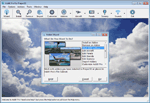
Images related to this file:
File Description:
This little tool helps you keep a list of your favourite airports with the option to export this list to Google Earth. Easily choose an airport for today's flight and access additional airport data through Sam High's fsxdb.com. Requires: Microsoft .Net Framework 2.0 or higher.
EDIT 20-DEC-2015Unfortunately fsxdb.com is down. I cannot get in touch with the developer Sam High.
Therefore the Autofill option in the program does not work. You can still use the program if you enter airport data and location manually. The export to Google Earth is still functional.
| Filename: | Flight_Simulation_AddOn_Tracker_V10.zip |
| License: | Freeware |
| Added: | 27th May 2013, 23:09:19 |
| Downloads: | 445 |
| Author: | Tobias Wagner |
| Size: | 419.19 KB |
| Category: Miscellaneous Files - General Utilities | |
| V8.0.2 Addit! Pro Add-on Manager |
|
Images related to this file:
File Description:
Addit! Pro is a comprehensive addon manager for Lockheed Martin's Prepar3D. Easily install, manage and remove aircraft, adventures, flights, flight plans, gauges, missions, panels, A.I. airport and facilities data, scenery, sounds, textures, videos, weather and more!
Simple wizard-based interface makes installing and removing addons a breeze. Comprehensive addon management allows you to archive, rebuild and remove addons. Addit! Pro is fast and easy--no unzipping or file copying is necessary. Modify all aircraft, panels, sounds and scenery. Let Addit! Pro tackle the tough chores and spend your time flying! Requires Prepar3D.
Shareware: $29.95 registration. By Joseph Stearns. [email protected].
| Filename: | V802_Addit_Pro_Addon_Manager.zip |
| License: | Shareware, limited functionality |
| Added: | 7th June 2013, 16:31:07 |
| Downloads: | 152 |
| Author: | Joseph Stearns |
| Size: | 15.31 MB |
| Category: Orbiter - Spaceships | |
| Vanguard 1 Add-on for Orbiter |
|
File Description:
Originally a simple nose cone was to be carried aloft, but in July of 1957 it was decided that a small 1.47 kilogram (3.25 pound) test satellite would be used instead to exercise the tracking stations. This test satellite would consist of a simple 16 centimeter (6.4 inch) polished aluminum alloy sphere equipped with two transmitters operating at frequencies around 108 MHz, 6 small solar panels, and 6 dowel like antennas.
The satellite was Vanguard I, in which its successes set the pattern for a multitude of other space ventures in this country and abroad. Vanguard also served as a springboard for scientists to launch several series of space probes to study various aspects of radiation phenomena.
Vanguard I introduced much of the technology that has been applied in other U.S. satellite programs. For example, it proved that solar cells could be used for several years to power radio transmitters. Vanguard's solar cells operated for about seven years, while conventional batteries used to power another onboard transmitter lasted only 20 days.
Now the oldest man-made satellite still in orbit to this day, Vanguard I has been 100 percent successful in meeting all its scientific objectives.
Now you can fly this historical satellite in orbit. Unlike all the US Navy failed attempts, the Orbiter version will always get you there.
| Filename: | Vanguard_1_Addon_for_Orbiter.zip |
| License: | Freeware |
| Added: | 27th September 2004, 16:23:56 |
| Downloads: | 507 |
| Author: | Jim Williams |
| Size: | 1.25 MB |
| Category: Flight Simulator 2004 - Utilities | |
| V6.6.3 Addit! Pro Add-on Manager |
|
File Description:
Addit! Pro is a comprehensive addon manager for Flight Simulator 2004. Easily install, manage and remove aircraft, adventures, flights, flight plans, panels, A.I. flight plans, A.I. airport and facilities data, scenery, sounds, textures, videos, weather and more! Archive add-ons to Addit! Pro's File Cabinet or recreate them in zip files. Modify your aircraft, panels and sounds. Automatically update FS's Scenery Library. Includes A.I. traffic manager, complete scenery library editor and more! See Readme.htm for details.
Shareware--please register to install an unlimited number of add-ons. See Register.htm. Requires Flight Simulator 2004: A Century of Flight. By Joseph Stearns. [email protected].
| Filename: | V663_Addit_Pro_Addon_Manager.zip |
| License: | Shareware, limited functionality |
| Added: | 4th March 2009, 22:42:22 |
| Downloads: | 1,930 |
| Author: | Joseph Stearns |
| Size: | 9.21 MB |
| Category: Flight Simulator X - Utilities | |
| V7.3.3 Addit! Pro Add-on Manager |
|
Images related to this file:
File Description:
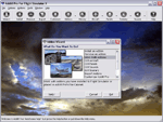
Addit! Pro is a comprehensive addon manager for Flight Simulator X. Easily install, manage and remove aircraft, adventures, flights, flight plans, gauges, missions, panels, A.I. airport and facilities data, scenery, sounds, textures, videos, weather and more! Archive add-ons to Addit! Pro's File Cabinet or recreate them in zip files. Modify your aircraft, panels and sounds. Automatically update FS's Scenery Library. Includes FS Configuration Manager, complete scenery library editor, ZIP/RAR support and much more! See Readme.htm for details. Requires Flight Simulator X: Standard or Deluxe Edition. By Joseph Stearns. [email protected]. Shareware--please register to install an unlimited number of add-ons. See Register.htm.
| Filename: | V733_Addit_Pro_Addon_Manager.zip |
| License: | Shareware, limited functionality |
| Added: | 2nd December 2011, 01:22:41 |
| Downloads: | 757 |
| Author: | Joseph Stearns |
| Size: | 10.8 MB |
| Category: X-Plane - Utilities | |
| Addit! Pro Add-on Manager V1.1.5 |
|
Images related to this file:
File Description:

Addit! Pro is a comprehensive add-on manager for Laminar Research's X-Plane 11. Easily install, manage and remove aircraft, liveries, scenery, libraries for scenery, plugins, flight plans, sounds, textures, videos and more! Automatically update and arrange X-Plane's scenery library (scenery_packs.ini). A powerful aircraft editor lets you tweak your fleet, assign pictures to planes and panels, and even hide aircraft. Rearrange scenery layers, set priorities, and manage entries with the scenery library editor. Full-featured add-on management lets you import, archive, recreate, and remove add-ons. Check an add-on's health to reveal configuration problems and missing files. Shareware, please register to install an unlimited number of add-ons. See Readme.htm for details. Requires X-Plane 11 by Laminar Research. By Joseph Stearns.
| Filename: | Addit_Pro_Addon_Manager_V115.zip |
| License: | Shareware, limited functionality |
| Added: | 6th March 2020, 04:14:39 |
| Downloads: | 219 |
| Author: | Joseph Stearns |
| Size: | 33.77 MB |
© 2001-2026 AVSIM Online
All Rights Reserved
Privacy Policy |