
Where Flight Simulation Enthusiasts Gather from Around the World!
AVSIM Library - Search Results

| Category: Flight Simulator X - Scenery | |
| Northeast New Jersey 5 Meter Mesh Terrain |

|
Images related to this file:
File Description:
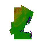
High Resolution Northeast New Jersey 5 Meter Mesh Terrain by Wally-Bob represents a significant improvement over FSX default 38 meter mesh terrain. The results are also dramatic compared to 10 meter compressed payware mesh as lossless compression compilation (read no data loss) is used. Lossless compiling produces renderings that have the Crispness of the Real World Terrain. Fly the Hudson River and view the Palisades as they are in real life, see the screen shots enclosed. High Quality 5 meter mesh terrain is a must have for mountainous areas especially where photo scenery is also used to render the virtual world. Manual includes FSX configuration and scenery installation tips. USGS LiDAR 1/9 Arc-Second source data.
| Filename: | Northeast_New_Jersey_5_Meter_Mesh_Terrain.zip |
| License: | Freeware, limited distribution |
| Added: | 26th February 2011, 21:35:52 |
| Downloads: | 1,100 |
| Author: | Walter Roberts |
| Size: | 135.89 MB |
| Category: Flight Simulator 2004 - Scenery | |
| Fort Resolution CYFR in the Northwest Territories, Canada |
|
Images related to this file:
File Description:
Fort Resolution is on the south side of Great Slave Lake, 75 miles east of Hay River and just west of where the Slave River flows into the lake from Fort Smith. Fort Resolution, the oldest community in the Territories and once a vital link in the fur trade business, is a small town with a population of around 500. It was not included in the original FS9 or Ultimate Terrain so I have added it here.
The airfield is next to the town on the lakeshore. The runway is 4,000 feet of gravel with a displaced threshold at the southern (town) end; it is lit and there is PAPI. There are no scheduled flights to Fort Resolution, just occasional charters; the AI includes a stock FS9 Cessna and a Wasaya Airways PC12.
| Filename: | Fort_Resolution_CYFR_in_the_Northwest_Territories_.zip |
| License: | Freeware, limited distribution |
| Added: | 4th October 2013, 22:11:26 |
| Downloads: | 294 |
| Author: | Roger Wensley |
| Size: | 2.31 MB |
| Category: Navigation and ATC - Navigation | |
| High Resolution Western Aleutian Islands East Sectional Chart |
|
File Description:
Very high resolution georeferenced Sectional Chart. Converted to JPG format to reduce size of download. However, very little compression artifacts are visible to keep high image quality. Includes projection files if you want to use with GIS software.
| Filename: | High_Resolution_Western_Aleutian_Islands_East_Sect.zip |
| License: | Freeware |
| Added: | 23rd August 2004, 04:16:28 |
| Downloads: | 1,075 |
| Author: | Matt Fox |
| Size: | 1.55 MB |
| Category: Orbiter - Miscellaneous Files | |
| Delta Serpemtis Planetary System High Resolution Pack 1.0 |
|
File Description:
A high resolution pack for the Delta Serpemtis Planetary System 1.01 addon for Orbiter. Delta4 is now in Level 8 texture. Check out the screenshots for a "before" and "after" look. Includes a 2nd bonus Earthlike planet also in level 8 texturing. No screenshots for that one, you'll just have to fly to it and colonize it.
| Filename: | Delta_Serpemtis_Planetary_System_High_Resolution_P.zip |
| License: | Freeware |
| Added: | 18th November 2003, 05:24:58 |
| Downloads: | 760 |
| Author: | Jim Williams |
| Size: | 28.79 MB |
| Category: Fly! II - Scenery | |
| Italian scenery: Relief (90m resolution) of Western Alpes |
|
File Description:
Coverage area in attached jpg image.
| Filename: | Italian_scenery_Relief_90m_resolution_of_Western_A.zip |
| License: | Freeware |
| Added: | 21st February 2003, 13:22:56 |
| Downloads: | 572 |
| Author: | daniele tona |
| Size: | 1013.14 KB |
| Category: Fly! II - Scenery | |
| Italian scenery: Relief (90m resolution) of Genova Gulf |
|
File Description:
Coverage area in attached jpg image.
| Filename: | Italian_scenery_Relief_90m_resolution_of_Genova_Gu.zip |
| License: | Freeware |
| Added: | 21st February 2003, 13:23:21 |
| Downloads: | 421 |
| Author: | daniele tona |
| Size: | 885.51 KB |
| Category: Fly! II - Scenery | |
| Italian Scenery: Relief (90m resolution) of Dolomiti Zone |
|
File Description:
The Dolomiti scenery comprises: The Marmolade, Civetta, Tofane, Sella, Catinaccio and Tre Cime di Lavaredo groups
| Filename: | Italian_Scenery_Relief_90m_resolution_of_Dolomiti_.zip |
| License: | Freeware |
| Added: | 10th January 2003, 14:51:01 |
| Downloads: | 493 |
| Author: | daniele tona |
| Size: | 1.12 MB |
| Category: Fly! II - Scenery | |
| Italian scenery: Relief (90m resolution) of Naples Gulf |
|
File Description:
Coverage area in attached jpg image.
| Filename: | Italian_scenery_Relief_90m_resolution_of_Naples_Gu.zip |
| License: | Freeware |
| Added: | 23rd January 2003, 13:23:09 |
| Downloads: | 381 |
| Author: | daniele tona |
| Size: | 197.12 KB |
| Category: Fly! II - Scenery | |
| Italian scenery: Relief (90m resolution) of Etna zone |
|
File Description:
Coverage area in attached jpg image.
| Filename: | Italian_scenery_Relief_90m_resolution_of_Etna_zone.zip |
| License: | Freeware |
| Added: | 23rd January 2003, 13:23:32 |
| Downloads: | 425 |
| Author: | daniele tona |
| Size: | 472.13 KB |
| Category: Navigation and ATC - Navigation | |
| High Resolution Dallas - Ft. Worth Terminal Area Chart |
|
File Description:
Very high resolution georeferenced Terminal Area Chart.
Converted to JPG format to reduce size of download.
However, very little compression artifacts are visible
to keep high image quality. Includes projection files
if you want to use with GIS software.
| Filename: | High_Resolution_Dallas__Ft_Worth_Terminal_Area_Cha.zip |
| License: | Freeware |
| Added: | 16th January 2004, 14:50:10 |
| Downloads: | 1,388 |
| Author: | Matt Fox |
| Size: | 3.57 MB |
© 2001-2026 AVSIM Online
All Rights Reserved
Privacy Policy |