
Where Flight Simulation Enthusiasts Gather from Around the World!
AVSIM Library - Search Results

| Category: Navigation and ATC - Navigation | |
| Omaha Chart Chunks Optimized For Moving Map Application |

|
File Description:
Sectional chart chunks made from the August 2009 Sectional charts at the original scale, formatted in the WGS84 lat/lon geographic coordinate system for GPS, moving map application for flight simulation use.
These chart chunks were converted to the JPEG format for compatibility and size. Coverage is the full Sectional area North and South divided into 8 JPEG tiles. They are about 3k x 3k pixels at 7mb with coverage of 90nm x 130nm per tile. Included is also the projection files and world files.
| Filename: | Omaha_Chart_Chunks_Optimized_For_Moving_Map_Applic.zip |
| License: | Freeware |
| Added: | 20th February 2010, 14:49:06 |
| Downloads: | 102 |
| Author: | David Myers |
| Size: | 20.15 MB |
| Category: Navigation and ATC - Navigation | |
| New York Chart Chunks Optimized For Moving Map Application |
|
File Description:
Sectional chart chunks made from the August 2009 Sectional charts at the original scale, formatted in the WGS84 lat/lon geographic coordinate system for GPS, moving map application for flight simulation use.
These chart chunks were converted to the JPEG format for compatibility and size. Coverage is the full Sectional area North and South divided into 8 JPEG tiles. They are about 3k x 3k pixels at 7mb with coverage of 90nm x 130nm per tile. Included is also the projection files and world files.
| Filename: | New_York_Chart_Chunks_Optimized_For_Moving_Map_App.zip |
| License: | Freeware |
| Added: | 20th February 2010, 14:49:14 |
| Downloads: | 215 |
| Author: | David Myers |
| Size: | 20.88 MB |
| Category: Navigation and ATC - Navigation | |
| New Orleans Chart Chunks Optimized For Moving Map Application |
|
File Description:
Sectional chart chunks made from the August 2009 Sectional charts at the original scale, formatted in the WGS84 lat/lon geographic coordinate system for GPS, moving map application for flight simulation use.
These chart chunks were converted to the JPEG format for compatibility and size. Coverage is the full Sectional area North and South divided into 8 JPEG tiles. They are about 3k x 3k pixels at 2.5mb with coverage of 90nm x 130nm per tile. Included is also the projection files and world files.
| Filename: | New_Orleans_Chart_Chunks_Optimized_For_Moving_Map_.zip |
| License: | Freeware |
| Added: | 20th February 2010, 14:49:21 |
| Downloads: | 129 |
| Author: | David Myers |
| Size: | 13.97 MB |
| Category: Navigation and ATC - Navigation | |
| Montreal Chart Chunks Optimized For Moving Map Application |
|
File Description:
Sectional chart chunks made from the August 2009 Sectional charts at the original scale, formatted in the WGS84 lat/lon geographic coordinate system for GPS, moving map application for flight simulation use.
These chart chunks were converted to the JPEG format for compatibility and size. Coverage is the full Sectional area North and South divided into 8 JPEG tiles. They are about 3k x 3k pixels at 2.5mb with coverage of 90nm x 130nm per tile. Included is also the projection files and world files.
| Filename: | Montreal_Chart_Chunks_Optimized_For_Moving_Map_Application.zip |
| License: | Freeware |
| Added: | 20th February 2010, 14:49:28 |
| Downloads: | 152 |
| Author: | David Myers |
| Size: | 22.48 MB |
| Category: Navigation and ATC - Navigation | |
| Miami Chart Chunks Optimized For Moving Map Application |
|
File Description:
Sectional chart chunks made from the August 2009 Sectional charts at the original scale, formatted in the WGS84 lat/lon geographic coordinate system for GPS, moving map application for flight simulation use.
These chart chunks were converted to the JPEG format for compatibility and size. Coverage is the full Sectional area North and South divided into 8 JPEG tiles. They are about 3k x 3k pixels at 2.5mb with coverage of 90nm x 130nm per tile. Included is also the projection files and world files.
| Filename: | Miami_Chart_Chunks_Optimized_For_Moving_Map_Applic.zip |
| License: | Freeware |
| Added: | 20th February 2010, 14:49:36 |
| Downloads: | 167 |
| Author: | David Myers |
| Size: | 11.17 MB |
| Category: Navigation and ATC - Navigation | |
| Memphis Chart Chunks Optimized For Moving Map Application |
|
File Description:
Sectional chart chunks made from the August 2009 Sectional charts at the original scale, formatted in the WGS84 lat/lon geographic coordinate system for GPS, moving map application for flight simulation use.
These chart chunks were converted to the JPEG format for compatibility and size. Coverage is the full Sectional area North and South divided into 8 JPEG tiles. They are about 3k x 3k pixels at 2.5mb with coverage of 90nm x 130nm per tile. Included is also the projection files and world files.
| Filename: | Memphis_Chart_Chunks_Optimized_For_Moving_Map_Appl.zip |
| License: | Freeware |
| Added: | 20th February 2010, 14:49:44 |
| Downloads: | 132 |
| Author: | David Myers |
| Size: | 19.54 MB |
| Category: Navigation and ATC - Navigation | |
| Los Angeles Chart Chunks Optimized For Moving Map Application |
|
File Description:
Sectional chart chunks made from the August 2009 Sectional charts at the original scale, formatted in the WGS84 lat/lon geographic coordinate system for GPS, moving map application for flight simulation use.
These chart chunks were converted to the JPEG format for compatibility and size. Coverage is the full Sectional area North and South divided into 8 JPEG tiles. They are about 3k x 3k pixels at 2.5mb with coverage of 90nm x 130nm per tile. Included is also the projection files and world files.
| Filename: | Los_Angeles_Chart_Chunks_Optimized_For_Moving_Map_.zip |
| License: | Freeware |
| Added: | 20th February 2010, 14:49:52 |
| Downloads: | 171 |
| Author: | David Myers |
| Size: | 15.92 MB |
| Category: Navigation and ATC - Navigation | |
| Las Vegas Chart Chunks Optimized For Moving Map Application |
|
File Description:
Sectional chart chunks made from the August 2009 Sectional charts at the original scale, formatted in the WGS84 lat/lon geographic coordinate system for GPS, moving map application for flight simulation use.
These chart chunks were converted to the JPEG format for compatibility and size. Coverage is the full Sectional area North and South divided into 8 JPEG tiles. They are about 3k x 3k pixels at 2.5mb with coverage of 90nm x 130nm per tile. Included is also the projection files and world files.
| Filename: | Las_Vegas_Chart_Chunks_Optimized_For_Moving_Map_Ap.zip |
| License: | Freeware |
| Added: | 20th February 2010, 14:50:02 |
| Downloads: | 163 |
| Author: | David Myers |
| Size: | 19.36 MB |
| Category: X-Plane - Scenery | |
| BR AM SWMK - Maturaca Airfield v1.0.0 |
|
Images related to this file:
File Description:
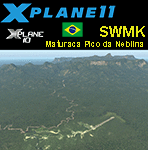
This is an X-Plane 11 and X-Plane 10 scenery package for Maturaca Airport (ICAO: SWMK, no IATA code) which is an airport serving Maturaca village, in São Gabriel da Cachoeira, Amazonas, Brazil, located in the vicinity of "Pico da Neblina" (Peak of the Haze, in English), the highest mountain in Brazil, 2,995.3 metres (9,827 ft) above sea level, in the Serra da Neblina, part of the Serra do Imeri, a section of the Guiana Highlands on the Brazil–Venezuela border, in the middle of the Amazon rainforest. It includes corrected aprons, ramps, gates, taxiways, lighting system, village buildings, ortho-photoscenery for the airfield area, and (XP11 only) airport ground services (like push back). This scenery was tested and is operational (as of April 14, 2017) in "X-Plane 11.00 RC #1 64 bit", Windows 10 Home. It was also tested and is also operational (as of April 14, 2017) in "X-Plane 10.51 64 bit", Windows 10 Home. Only the default X-Plane 11 libraries, by Laminar Research, are needed. No third party libraries are used.
A few extra objects are used and included in the package, thanks to artist Paulmort (Hangar 24, Hangar House, Ranch House, Deluxe Log Cabin, Hangar Barn) and to artist Capnsully (Grow Grass for Xplane). They are included in the package, no need to download them.
| Filename: | BR_AM_SWMK__Maturaca_Airfield_v100.zip |
| License: | Freeware |
| Added: | 15th April 2017, 06:23:29 |
| Downloads: | 132 |
| Author: | Rui Mesquita |
| Size: | 35.57 MB |
| Category: Flight Simulator X - Scenery | |
| Bad Voeslau LOAV |
|
Images related to this file:
File Description:
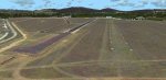
Bad Voeslau is one of the biggest Airports in the VFR Austria Airfield X Series. The Airport is located in Lower Austria. (FSX Only)
| Filename: | Bad_Voeslau_LOAV.zip |
| License: | Freeware, limited distribution |
| Added: | 15th October 2011, 20:15:32 |
| Downloads: | 3,400 |
| Author: | Fabio Trojan | ESC |
| Size: | 29.74 MB |


© 2001-2026 AVSIM Online
All Rights Reserved
Privacy Policy |