
Where Flight Simulation Enthusiasts Gather from Around the World!
AVSIM Library - Search Results

| Category: Flight Simulator X - Scenery | |
| South America Mesh Scenery, MeshX_D9 |

|
File Description:
Mesh terrain scenery for the whole continental South America, based on SRTM 90m
dem geotiff files (at: ftp://ftp.glcf.umiacs.umd.edu/glcf/SRTM/Degree_Tiles/),
resampled to 76 meter of horizontal resolution (LOD 9). The new files have
improved the vertical resolution from 16m to 10m, resulting in more details
and accuracy over previous versions. There are 50 files, compatible with FS 9
and FS X, identified in a map by column letter and line number, covering the
contiguous countries and states. Boundaries: N = 33º 45' S; S = 39º 22.5' S;
E = 48º 45' W; W = 56º 15' W.
| Filename: | South_America_Mesh_Scenery_MeshX_D9.zip |
| License: | Freeware |
| Added: | 28th October 2006, 15:08:16 |
| Downloads: | 1,877 |
| Author: | Oséas Dourado and José Lôbo |
| Size: | 4.69 MB |
| Category: Flight Simulator X - Scenery | |
| South America Mesh Scenery, MeshX_E7 |
|
File Description:
Mesh terrain scenery for the whole continental South America, based on SRTM 90m
dem geotiff files (at: ftp://ftp.glcf.umiacs.umd.edu/glcf/SRTM/Degree_Tiles/),
resampled to 76 meter of horizontal resolution (LOD 9). The new files have
improved the vertical resolution from 16m to 10m, resulting in more details
and accuracy over previous versions. There are 50 files, compatible with FS 9
and FS X, identified in a map by column letter and line number, covering the
contiguous countries and states. Boundaries: N = 22º 30' S; S = 28º 7.5' S;
E = 41º 15' W; W = 48º 45' W.
| Filename: | South_America_Mesh_Scenery_MeshX_E7.zip |
| License: | Freeware |
| Added: | 28th October 2006, 15:08:43 |
| Downloads: | 1,803 |
| Author: | Oséas Dourado and José Lôbo |
| Size: | 12.69 MB |
| Category: Flight Simulator X - Scenery | |
| South America Mesh Scenery, MeshX_C9 |
|
File Description:
Mesh terrain scenery for the whole continental South America, based on SRTM 90m
dem geotiff files (at: ftp://ftp.glcf.umiacs.umd.edu/glcf/SRTM/Degree_Tiles/),
resampled to 76 meter of horizontal resolution (LOD 9). The new files have
improved the vertical resolution from 16m to 10m, resulting in more details
and accuracy over previous versions. There are 50 files, compatible with FS 9
and FS X, identified in a map by column letter and line number, covering the
contiguous countries and states. Boundaries: N = 33º 45' S; S = 39º 22.5' S;
E = 56º 15' W; W = 63º 45' W.
| Filename: | South_America_Mesh_Scenery_MeshX_C9.zip |
| License: | Freeware |
| Added: | 29th October 2006, 03:13:28 |
| Downloads: | 3,582 |
| Author: | Oséas Dourado and José Lôbo |
| Size: | 19.76 MB |
| Category: Flight Simulator X - Scenery | |
| South America Mesh Scenery, MeshX_C10 |
|
File Description:
Mesh terrain scenery for the whole continental South America, based on SRTM 90m
dem geotiff files (at: ftp://ftp.glcf.umiacs.umd.edu/glcf/SRTM/Degree_Tiles/),
resampled to 76 meter of horizontal resolution (LOD 9). The new files have
improved the vertical resolution from 16m to 10m, resulting in more details
and accuracy over previous versions. There are 50 files, compatible with FS 9
and FS X, identified in a map by column letter and line number, covering the
contiguous countries and states. Boundaries: N = 39º 22.5' S; S = 45º 0' S;
E = 56º 15' W; W = 63º 45' W.
| Filename: | South_America_Mesh_Scenery_MeshX_C10.zip |
| License: | Freeware |
| Added: | 29th October 2006, 03:14:25 |
| Downloads: | 1,724 |
| Author: | Oséas Dourado and José Lôbo |
| Size: | 3.74 MB |
| Category: Flight Simulator X - Scenery | |
| South America Mesh Scenery, MeshX_A3 |
|
File Description:
Mesh terrain scenery for the whole continental South America, based on SRTM 90m
dem geotiff files (at: ftp://ftp.glcf.umiacs.umd.edu/glcf/SRTM/Degree_Tiles/),
resampled to 76 meter of horizontal resolution (LOD 9). The new files have
improved the vertical resolution from 16m to 10m, resulting in more details
and accuracy over previous versions. There are 50 files, compatible with FS 9
and FS X, identified in a map by column letter and line number, covering the
contiguous countries and states. Boundaries: N = 0º 0' S; S = 5º 37.5' S;
E = 71º 15' W; W = 78º 45' W.
| Filename: | South_America_Mesh_Scenery_MeshX_A3.zip |
| License: | Freeware |
| Added: | 29th October 2006, 15:43:18 |
| Downloads: | 1,980 |
| Author: | Oséas Dourado and José Lôbo |
| Size: | 37.85 MB |
| Category: Flight Simulator X - Scenery | |
| South America Mesh Scenery, MeshX_B11 |
|
File Description:
Mesh terrain scenery for the whole continental South America, based on SRTM 90m
dem geotiff files (at: ftp://ftp.glcf.umiacs.umd.edu/glcf/SRTM/Degree_Tiles/),
resampled to 76 meter of horizontal resolution (LOD 9). The new files have
improved the vertical resolution from 16m to 10m, resulting in more details
and accuracy over previous versions. There are 50 files, compatible with FS 9
and FS X, identified in a map by column letter and line number, covering the
contiguous countries and states. Boundaries: N = 45º 0' S; S = 50º 37.5' S;
E = 63º 45' W; W = 71º 15' W.
| Filename: | South_America_Mesh_Scenery_MeshX_B11.zip |
| License: | Freeware |
| Added: | 30th October 2006, 05:44:41 |
| Downloads: | 1,843 |
| Author: | Oséas Dourado, José Lôbo |
| Size: | 19.15 MB |
| Category: Flight Simulator X - Scenery | |
| South America Mesh Scenery, MeshX_A12 |
|
File Description:
Mesh terrain scenery for the whole continental South America, based on SRTM 90m
dem geotiff files (at: ftp://ftp.glcf.umiacs.umd.edu/glcf/SRTM/Degree_Tiles/),
resampled to 76 meter of horizontal resolution (LOD 9). The new files have
improved the vertical resolution from 16m to 10m, resulting in more details
and accuracy over previous versions. There are 50 files, compatible with FS 9
and FS X, identified in a map by column letter and line number, covering the
contiguous countries and states. Boundaries: N = 50º 37.5' S; S = 56º 15' S;
E = 71º 15' W; W = 78º 45' W.
| Filename: | South_America_Mesh_Scenery_MeshX_A12.zip |
| License: | Freeware |
| Added: | 30th October 2006, 05:45:01 |
| Downloads: | 1,955 |
| Author: | Oséas Dourado and José Lôbo |
| Size: | 13.36 MB |
| Category: X-Plane - Scenery | |
| xTreme Trees Demo - Florida and Puerto Rico |
|
Images related to this file:
File Description:
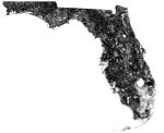
Welcome to a new age of immersion, Presenting X-Treme Trees for X-Plane! Current USGS Treeline data has been handwritten into custom overlays to give proper representation of treelines and vegetation to another level!
This fully functional demo includes Florida, Puerto Rico and slices of bordering Georgia. See included readme for details regarding volume 1 of the 2 volume series!
SYSTEM REQUIREMENTS:
- OS: Windows, Mac OS X or Linux
- X-Plane version: 10.25 or higher
- Architectures: 32 and 64-bit
| Filename: | xTreme_Trees_Demo__Florida_and_Puerto_Rico.zip |
| License: | Freeware |
| Added: | 26th March 2018, 17:10:44 |
| Downloads: | 64 |
| Author: | Brian Bash |
| Size: | 66.18 MB |
| Category: Flight Simulator X - Utilities | |
| FSX_4096 |
|
Images related to this file:
File Description:
FSX_4096 is a launch pad for MS Flight Simulator X. Utilizing it before each flight, the user can do the following:
- Activate DEP/DEST aerodromes (plus ALTN(s)) in the Scenery Library;
- Set required Global Texture Resolution (1K x 1K, 2K x 2K, 4K x 4K);
- Set AI Traffic Density;
- Launch FSX process with High priority for OS.
This application was built on Windows 10 1903. It should also work on Windows 7 SP1 with .Net Framework updated to v4.8.
| Filename: | FSX_4096.zip |
| License: | Freeware |
| Added: | 14th July 2019, 16:14:38 |
| Downloads: | 185 |
| Author: | Stas Neznamov |
| Size: | 1.61 MB |
| Category: Flight Simulator X - AFCAD Files | |
| EPKW - Bielsko Biala, SL, Poland |
|
Images related to this file:
File Description:
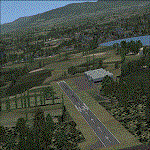
EPKW - Ladowisko Bielsko-Biala Kaniow (Bielski Park Technologiczny Lotnictwa) is a small airstrip in Southern Poland, Silesian Voivodeship. It lies approximately 12 km (7 mi) north of Bielsko-Biala, and 36 km (22 mi) south of the regional capital Katowice. It has one asphalt runway 13/31, 700m x 24m. Includes 4 large hangars and a small control tower. Mainly GA and flying school use. Made with ADE and Instant Scenery! Enjoy
| Filename: | EPKW__Bielsko_Biala_SL_Poland.zip |
| License: | Freeware |
| Added: | 7th July 2013, 09:01:39 |
| Downloads: | 341 |
| Author: | Remi Jasek |
| Size: | 750.51 KB |


© 2001-2026 AVSIM Online
All Rights Reserved
Privacy Policy |