
Where Flight Simulation Enthusiasts Gather from Around the World!
AVSIM Library - Search Results

| Category: Flight Simulator 2004 - Flight Plans | |
| KBOS-RKSI Flighplan Pack |

|
File Description:
The package for the FSW Server Multiplayer flight. These are the files for the flight departing Boston Logan Airport to Incheon International Airport. Contact me for support.
'[email protected]'. Thankyou, and enjoy your flight :)
| Filename: | KBOSRKSI_Flighplan_Pack.zip |
| License: | Freeware |
| Added: | 20th April 2009, 20:13:16 |
| Downloads: | 219 |
| Author: | Jordan Clark |
| Size: | 6.8 KB |
| Category: Flight Simulator X - Missions | |
| The Concorde 1 |
|
Images related to this file:
File Description:
This is a historic flight created with various input from the internet to make the flight as real as possible. You are a captain of the famous Concorde registered in Air France colours. The flight is a routine flight from Charles-de-Gaulle to John F. Kennedy that was on the daily flight schedule in the peak of the Concorde�s life before all the problems started.
| Filename: | The_Concorde_1.zip |
| License: | Freeware |
| Added: | 4th November 2009, 10:38:47 |
| Downloads: | 783 |
| Author: | Robbie Albers |
| Size: | 1.25 MB |
| Category: Flight Simulator X - Utilities | |
| FS Earth 4.2 for Google Earth |
|
File Description:
This program acts as an interface between Flight Simulator X and Google Earth, letting to follow a flight in real time, over the satellite images generated by Google Earth. Flights can be saved, and many options are available for fine tuning the performance, as well as the map's style (zoom, tilt, orientation). Works on a single computer running FSX and Google Earth all together or, for best experience, can be used on two networked computers running respectively FSX (master) and Google Earth (slave). AI and Multiplayer traffic is also displayed in Google Earth, with course prediction and other information. Requires Flight Simulator X and Google Earth. The program running in trial mode works only around Anchorage, Alaska, (PANC / ANC) for a maximum of five minutes per flight session. Version 4.2 has improved compatibility with Windows Vista and minor bug fixes. A version for FS2004 is available also. By Luciano Napolitano.
| Filename: | FS_Earth_42_for_Google_Earth.zip |
| License: | Shareware, time limited |
| Added: | 9th March 2007, 13:39:05 |
| Downloads: | 2,213 |
| Author: | Luciano Napolitano |
| Size: | 2.44 MB |
| Category: Flight Simulator X - Utilities | |
| FS Earth 5.0 for Google Earth |
|
File Description:
This program acts as an interface between Flight Simulator X and Google Earth, letting to follow a flight in real time, over the satellite images generated by Google Earth. Flights can be saved, and many options are available for fine tuning the performance, as well as the map's style (zoom, tilt, orientation). Works on a single computer running FSX and Google Earth all together or, for best experience, can be used on two networked computers running respectively FSX (master) and Google Earth (slave). AI and Multiplayer traffic is also displayed in Google Earth, with course prediction and other information. Requires Flight Simulator X and Google Earth. The program running in trial mode works only around Anchorage, Alaska, (PANC / ANC) for a maximum of five minutes per flight session. Version 5.0 has improved compatibility with latest releases of Google Earth and several additional improvements. A version for FS2004 is available also.
| Filename: | FS_Earth_50_for_Google_Earth.zip |
| License: | Shareware, time limited |
| Added: | 19th July 2007, 00:46:27 |
| Downloads: | 1,104 |
| Author: | Luciano Napolitano |
| Size: | 2.44 MB |
| Category: Flight Simulator 2004 - Utilities | |
| FS Earth 5.2 for Google Earth and FS2004 |
|
File Description:
This program acts as a link between Flight Simulator 2004 and Google Earth, letting to follow a flight in real time, over the satellite images generated by Google Earth. Flights can be saved, and many options are available for fine tuning the performance, as well as the map's style (zoom, tilt, orientation). Works on a single computer running FS2004 and Google Earth all together or, for best experience, can be used on two networked computers running respectively FS2004 (master) and Google Earth (slave). AI and Multiplayer traffic is also displayed in Google Earth, with course prediction and other information. Requires Flight Simulator 2004 and Google Earth. The program running in trial mode works only around Anchorage, Alaska, (PANC / ANC) for a maximum of five minutes per flight session. Version 5.2 has new aircraft icons & labels and improves the compatibility with Windows Vista. A version for FSX is available also.
| Filename: | FS_Earth_52_for_Google_Earth_and_FS2004.zip |
| License: | Shareware, time limited |
| Added: | 4th September 2008, 19:11:30 |
| Downloads: | 1,241 |
| Author: | Luciano Napolitano |
| Size: | 3.59 MB |
| Category: Flight Simulator X - Utilities | |
| FS Earth 5.2 for Google Earth and FSX |
|
Images related to this file:
File Description:
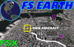
This program acts as a link between Flight Simulator X and Google Earth, letting to follow a flight in real time, over the satellite images generated by Google Earth. Flights can be saved, and many options are available for fine tuning the performance, as well as the map's style (zoom, tilt, orientation). Works on a single computer running FSX and Google Earth all together or, for best experience, can be used on two networked computers running respectively FSX (master) and Google Earth (slave). AI and Multiplayer traffic is also displayed in Google Earth, with course prediction and other information. Requires Flight Simulator X and Google Earth. The program running in trial mode works only around Anchorage, Alaska, (PANC / ANC) for a maximum of five minutes per flight session. Version 5.2 has new aircraft icons & labels and improves the compatibility with Windows Vista. A version for FS2004 is available also.
| Filename: | FS_Earth_52_for_Google_Earth_and_FSX.zip |
| License: | Shareware, time limited |
| Added: | 3rd May 2010, 07:38:23 |
| Downloads: | 2,702 |
| Author: | Luciano Napolitano |
| Size: | 3.46 MB |
| Category: Flight Simulator 2004 - Flight Plans | |
| RTW-K4-04 |
|
File Description:
An FS2K4 GPS flight and plan by the Ancient Brit and the RTW-K4 Team for the FS2K4 default aircraft (B737-400) and scenery. Depart Flesland, (ENBR) runway 33, Bergen, Norway and arrive 1 hour 07 minutes later at Kvernberget (ENKB) runway 07, Kristiansund, Norway. The plan is fully flight briefed with Word and text briefings and kneeboard in-flight briefing. A start-up flight that loads the plan, weather and kneeboard flight briefing is included; also a short Finals practise flight is included. The first 30 minutes of this flight is spent at low level (500 ft) skimming islands at treetop level before turning inland via a twisting steep sided fjord. This flight is not recommended to pilots of a nervous disposition.
| Filename: | RTWK404.zip |
| License: | Freeware |
| Added: | 28th September 2003, 09:20:05 |
| Downloads: | 896 |
| Author: | Denis Egan |
| Size: | 81.69 KB |
| Category: Flight Simulator X - AI Aircraft | |
| Alaska Airlines ''GO DAWGS'' (Horizon Air) Embraer 175NW (Raven FS Labs E175NW Revision 3) |
|
Images related to this file:
File Description:

Alaska Airlines ''GO DAWGS'' (Horizon Air). There are 2 separate texture for FSX and FS9. To be used with The Raven FS Labs E175NW Revision 3 model available separately. This is an AI only aircraft. If you are looking for a topic about painting airplanes, preview, flight plan, go to www.aitraffic.ch By Kamil Fryzol
| Filename: | Alaska_Airlines_GO_DAWGS_Horizon_Air_Embraer_175NW.zip |
| License: | Freeware |
| Added: | 29th October 2023, 12:03:10 |
| Downloads: | 191 |
| Author: | Kamil Fryzol |
| Size: | 1.45 MB |
| Category: Flight Simulator 2004 - AI Aircraft | |
| USAF Pavehawks complete pack |
|
File Description:
Textures and flight plans for the 93 AI HH-60G Pavehawks for both FS9 and FSX. Along with the base pack, this will put every operational HH-60G in the sim. Master Paint by John Young. You will need either John Young's "JYAI_Blackhawk_Family_FSX_1.zip" or John Young's "JYAI_Blackhawk_Family_FS9_1.zip" depending on your install.
| Filename: | USAF_Pavehawks_complete_pack.zip |
| License: | Freeware |
| Added: | 1st August 2015, 02:45:19 |
| Downloads: | 806 |
| Author: | Brent Newman & John Young |
| Size: | 56.11 MB |
| Category: Flight Simulator 2004 - Aircraft Repaints, Textures and Modifications | |
| Aer Lingus Boeing 767-300ER |
|
File Description:
This 767-300ER texture files are for IFDG's brilliant 767-300. Works in FS2002/2004.
Part of my Project Shamrock, where I have created paint jobs for Aerlingus in its old colours, you can download AI and flight plans from my site:
www.freewebs.com/projectshamrock.
Many other OLD SCHOOL Aerlingus paint jobs available here in Avsim.
| Filename: | Aer_Lingus_Boeing_767300ER.zip |
| License: | Freeware |
| Added: | 4th May 2004, 17:40:24 |
| Downloads: | 480 |
| Author: | René Bruun |
| Size: | 3.73 MB |


© 2001-2026 AVSIM Online
All Rights Reserved
Privacy Policy |