
Where Flight Simulation Enthusiasts Gather from Around the World!
AVSIM Library - Search Results

| Category: Flight Simulator 2004 - Aircraft Repaints, Textures and Modifications | |
| KLM Lockheed C-60A Lodestar |

|
Images related to this file:
File Description:
Throughout World War Two KLM operated in the Caribbean and South America with a number of Lockheed model 14 Super Electras, with two brand new Lockheed C-60A Lodestars added to its fleet when scheduled services to Miami began on 17 August 1943. On 30 July 1945 Douglas C-53's followed by C-47's began to replace the Lockheed Super Electras and Lodestars. On 1 August 1948 the Lodestars PJ-AKA and PJ-AKB were written from use at Willemstad-Hato. Exactly one year later they were disposed off into the Caribbean Sea. In those days "pollution" and "environmental protection" were almost certainly non-existant expressions.This repaint has been made for both the FS2004 and FSX versions of the Lockheed Lodestar by Milton Shupe & Team (lodestar.zip respectively fsxlodestar.zip). It features KLM Lodestar PJ-AKB. Repaint by Maarten Brouwer.
| Filename: | KLM_Lockheed_C60A_Lodestar.zip |
| License: | Freeware, limited distribution |
| Added: | 18th September 2015, 15:55:27 |
| Downloads: | 197 |
| Author: | Maarten Brouwer |
| Size: | 13.37 MB |
| Category: X-Plane - Scenery | |
| BR RS SBPA - Salgado Filho Intl v1.1.0 |
|
Images related to this file:
File Description:
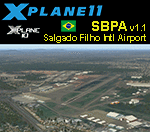
This is an X-Plane 11 and X-Plane 10 scenery package for Salgado Filho International Airport (IATA: POA, ICAO: SBPA), the main airport serving Porto Alegre, in Brazil. It includes corrected aprons, ramps, gates, taxiways, lighting system, city buildings, ortho pohoto scenery for the airport area, and (XP11 only) airport ground services (like push back). This scenery was tested and is operational (as of March 30, 2017) in "X-Plane 11.00 RC #1 64 bit", Windows 10 Home. It was also tested and is also operational (as of March 30, 2017) in "X-Plane 10.51 64 bit", Windows 10 Home. Only the default X-Plane 11 libraries, by Laminar Research, are needed. No third party libraries are used. v1.1.0 adds ortho pohoto scenery for the airport area, and it also adds the Gremio Arena stadium reference for the scenery.
| Filename: | BR_RS_SBPA__Salgado_Filho_Intl_v110.zip |
| License: | Freeware |
| Added: | 1st April 2017, 17:55:29 |
| Downloads: | 99 |
| Author: | Rui Mesquita |
| Size: | 22.87 MB |
| Category: X-Plane - Scenery | |
| BR AC SBRB - Rio Branco Intl Airport v1.0.0 |
|
Images related to this file:
File Description:
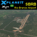
This is an X-Plane 11 and X-Plane 10 scenery package for Rio Branco-Plácido de Castro International Airport (IATA: RBR, ICAO: SBRB) is the airport serving Rio Branco, Brazil. It includes corrected aprons, ramps, gates, taxiways, lighting system, city buildings, ortho-photoscenery for the airfield area, and (XP11 only) airport ground services (like push back). The airport was opened on November 22, 1999 as a replacement to Presidente Médici International Airport, which was then closed. This scenery was tested and is operational (as of April 05, 2017) in "X-Plane 11.00 RC #1 64 bit", Windows 10 Home. It was also tested and is also operational (as of April 05, 2017) in "X-Plane 10.51 64 bit", Windows 10 Home. Only the default X-Plane 11 libraries, by Laminar Research, are needed. No third party libraries are used.
| Filename: | BR_AC_SBRB__Rio_Branco_Intl_Airport_v100.zip |
| License: | Freeware |
| Added: | 6th April 2017, 08:16:03 |
| Downloads: | 185 |
| Author: | Rui Mesquita |
| Size: | 12.93 MB |
| Category: X-Plane - Scenery | |
| BR RR SJKQ - Caramambatai Monte Roraima v1.0.0 |
|
Images related to this file:
File Description:
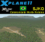
This is an X-Plane 11 and X-Plane 10 scenery package for Caramambatai Monte Rorraima Airport (ICAO: SJKQ, no IATA code) which is an airport serving Uiramuta, Roraima, Brazil, located in the vicinity of "Monte Rorraima" (or Mount Roraima), the highest of the Pakaraima chain of tepui plateaus in South America. It includes corrected aprons, ramps, gates, taxiways, lighting system, village buildings, ortho-photoscenery for the airfield area, and (XP11 only) airport ground services (like push back). This scenery was tested and is operational (as of April 15, 2017) in "X-Plane 11.00 RC #1 64 bit", Windows 10 Home. It was also tested and is also operational (as of April 15, 2017) in "X-Plane 10.51 64 bit", Windows 10 Home. Only the default X-Plane 11 libraries, by Laminar Research, are needed. No third party libraries are used.
| Filename: | BR_RR_SJKQ__Caramambatai_Monte_Roraima_v100.zip |
| License: | Freeware |
| Added: | 15th April 2017, 19:10:33 |
| Downloads: | 93 |
| Author: | Rui Mesquita |
| Size: | 14.71 MB |
| Category: Flight Simulator 2002 - Flight Plans | |
| 35RTWest |
|
File Description:
An FS2002 GPS flight Plan. The 35th in a series of Round the World flight plans for the FS2002 default scenery. Depart Paro (VQPR) runway 33, Bhutan and arrive 1 hour 02 minutes later at Tribhuvan International (VNKT) runway 02, Nepal. A steep takeoff to avoid the banking around the runway is followed by a climb up a valley before passing through a gap in the snow capped mountain peaks at FLl90. An optional flight situation file is provided to assist inexperienced pilots with this very tricky departure. At the highest point in the flight, FL280, you will still be overlooked as you pass the snow capped peak of Everest. The flight briefing (Word and text) is for a B737-400, it contains climb, cruise, top of descent and fuel loading details, waypoint timings and destination details.
| Filename: | 35RTWest.zip |
| License: | Freeware |
| Added: | 13th July 2002, 18:23:40 |
| Downloads: | 1,390 |
| Author: | The Ancient Brit |
| Size: | 56.92 KB |
| Category: Navigation and ATC - Navigation | |
| VSpeedCalculator 1.0 International English MacOS X |
|
File Description:
Vertical Speed Calculator software usable for virtual or real flights.
| Filename: | VSpeedCalculator_10_International_English_MacOS_X.zip |
| License: | Freeware |
| Added: | 25th March 2003, 01:43:00 |
| Downloads: | 229 |
| Author: | Franck KRIEGER |
| Size: | 2.09 MB |
| Category: Flight Simulator 2002 - AFCAD Files | |
| Greenville-Spartanburg International Airport KGSP Single-Layer AFCAD |
|
File Description:
This single-layer AFCAD file, named KGSPBB.txt, is an FS2002 facility file for the Greenville-Spartanburg International Airport located between the cities of Greenville and Spartanburg in South Carolina. It adds as many gates as possible to the airport. The gates are logically labeled, but may not reflect their real-world equivalent. My goal was to add 'life' to the airport, not recreate an exact replica of the real thing. All runways are available for FS2K2 to select the active. The file ID is KGSP and has the following gate distribution: Heavy-0, Medium-1, Small-7, Express-7, GA-13. I have included Lee Swordy's AF Installer along with this file. It automatically installs it into FS2002. To use the installer, simply click on the file KGSPBB.txt and drag it onto the AF Installer icon.
| Filename: | GreenvilleSpartanburg_International_Airport_KGSP_S.zip |
| License: | Freeware |
| Added: | 30th December 2002, 15:53:46 |
| Downloads: | 514 |
| Author: | Boyd Barker |
| Size: | 52 KB |
| Category: Flight Simulator 2002 - Utilities | |
| Weather Center 2 Novice |
|
File Description:
Weather Center 2.0 is an advanced weather generation add-on module for Microsoft Flight Simulator 2000/2002. Weather Center 2.0 features a completely re-engineered weather generation core that produces some of the most realistic, generated weather environments ever seen in Flight Simulator! The new, unique "I-Field" algorithm translates automatically downloaded Internet data into a dynamic weather environment based not only on the data from the nearest reporting airport (like Weather Center 1), but on all nearby airports, which all provide some piece of the overall weather scene generated around the aircraft!
The Novice edition includes a 15-minute demo period each time it is started, during which all the Expert features are enabled. After the demo period expires, the Novice edition continues to function indefinitely with an obsolete weather generation algorithm with most new core features disabled.
| Filename: | Weather_Center_2_Novice.zip |
| License: | Commercial demo |
| Added: | 30th May 2003, 09:45:26 |
| Downloads: | 3,434 |
| Author: | Keith Kile |
| Size: | 2.15 MB |
| Category: Flight Simulator 2004 - Flight Plans | |
| A CYZT-KPDX-01 |
|
File Description:
An FS2K4 GPS flight and plan by the Ancient Brit and the Team for the FS2K4 default aircraft (B737-400) and scenery. Depart Port Hardy (CYZT) runway 11, British Columbia, Canada and arrive 1 hour 33 minutes later at Portland International (KPDX) runway 10R, Oregon, USA. The plan is fully flight briefed with Word and text briefings and also with a kneeboard in-flight briefing. The Briefings contain climb, cruise, and top of descent and fuel loading details, waypoint timings and destination details. A start-up flight that loads the plan, weather and kneeboard flight briefing is included. A low level departure through valleys and mountains with a spectacular climb to cruise; followed by the close passing of Mount Hood and St. Helens concluding with a sweeping turn into the sunset for alignment for finals are features of this flight.
| Filename: | A_CYZTKPDX01.zip |
| License: | Freeware |
| Added: | 5th September 2003, 23:25:23 |
| Downloads: | 2,807 |
| Author: | Denis Egan |
| Size: | 50.6 KB |
| Category: Flight Simulator 2004 - Miscellaneous Files | |
| Emma Field Sightseeing Tour Release II |
|
File Description:
Fly a VFR-tour in the area east of Seattle, Washington. You will need some skills of
bush-flying. Included in this package are a detailed tour-description, maps (one per stage), situation- and WX-files (also per stage).
You will leave from Emma Field and visit the following airfields: Elma (4W8), Flying M Ranch (OR05), Mount St. Helens Aero Ranch (WN10), Sultan Field (39P), Packwood (55S), Ranger Creek (21W), Cashmere-Dryden (8S2), Chelan (6S9),Stehekin State (1S2), Twisp Muni (2S0), Darrington Muni (1S2), Sky Harbor (S86), Harvey Field (S43), Diamond Point(2WA1), Lost Valley (KLVY), Forks (S18) and Washabamaggie Lake, before you return to Emma Field.
This tour is based on the products Emma Field, GeoRender 1, GeoRender 3, GeoRender 4, GeoRender 5 and GeoRender 6 (all Lago) and freely downloadable scenery, but can also be flown without (one of) these.
Enjoy.
| Filename: | Emma_Field_Sightseeing_Tour_Release_II.zip |
| License: | Freeware |
| Added: | 18th December 2003, 23:37:29 |
| Downloads: | 2,238 |
| Author: | J. van Hees |
| Size: | 5.07 MB |


© 2001-2026 AVSIM Online
All Rights Reserved
Privacy Policy |