
Where Flight Simulation Enthusiasts Gather from Around the World!
AVSIM Library - Search Results

| Category: Prepar3D V1-4 - Scenery | |
| YWST Westmead Hospital |

|
File Description:
LBAus Westmead Hospital for P3D V4 and V5.
Westmead Hospital is situated 22 kilometres west of Sydney's CBD.
Mainly used by Toll Rescue, Westmead Hospital is the home of the Sydney Careflight Base
| Filename: | YWST_Westmead_Hospital.zip |
| License: | Freeware |
| Added: | 5th August 2021, 00:24:11 |
| Downloads: | 32 |
| Author: | Lachlan Boyd |
| Size: | 8.21 MB |
| Category: Prepar3D V1-4 - Scenery | |
| Regional NSW Hospitals Pack |
|
File Description:
LBAus New South Wales Hospitals pack for P3D V4 and V5, this pack features 9 hospitals: Albury, Bega, Forbes, Lithgow, Narrabri, Parkes, Port Macquarie, Shellharbour and Wagga Wagga
| Filename: | Regional_NSW_Hospitals_Pack.zip |
| License: | Freeware |
| Added: | 5th August 2021, 00:24:34 |
| Downloads: | 28 |
| Author: | Lachlan Boyd |
| Size: | 6.87 MB |
| Category: Prepar3D V1-4 - Scenery | |
| VIC hospital pack |
|
File Description:
LBAus Victoria Hospital pack for P3D V4 and V5 this pack features 4 hospitals: Ararat, Bairnsdale, Ballarat and Leongatha
| Filename: | VIC_hospital_pack.zip |
| License: | Freeware |
| Added: | 5th August 2021, 00:25:39 |
| Downloads: | 32 |
| Author: | Lachlan Boyd |
| Size: | 2.58 MB |
| Category: Prepar3D V1-4 - Scenery | |
| VA1J - Dhana Airport |
|
File Description:
The Dhana Airstrip is located in Dhana, in Sagar District, Madhya Pradesh and is near to Sagar, Damoh, Khurai and Bina. Dhana airport is the home base of Chimes Aviation Academy. It has a 3000-foot asphalt runway with runway lights installed by CAA. The apron area can accommodate 10–12 small aircraft.
| Filename: | VA1J__Dhana_Airport.zip |
| License: | Freeware |
| Added: | 15th October 2021, 03:47:32 |
| Downloads: | 81 |
| Author: | Sankar Raman Sridhar |
| Size: | 4.67 MB |
| Category: Prepar3D V1-4 - Scenery | |
| LPMO - Montargil Airfield |
|
Images related to this file:
File Description:
P3Dv4.5 - Montargil Airfield, ICAO: LPMO. Montargil Airfield (ICAO: LPMO) is a recreational aerodrome serving Montargil and Mora, Portugal.
| Filename: | LPMO__Montargil_Airfield.zip |
| License: | Freeware |
| Added: | 10th March 2023, 02:42:19 |
| Downloads: | 25 |
| Author: | Eduardo Puelker |
| Size: | 10.9 MB |
| Category: Prepar3D V1-4 - Scenery | |
| LMPO - Montargil Airfield - Portugal |
|
File Description:
Montargil Airfield (ICAO: LPMO) is a recreational aerodrome serving Montargil and Mora, Portugal.
It is sometimes called Morargil, which is a portmanteau of the names of the nearest localities, Mora and Montargil.
Runway length includes approximately 120 metres (394 ft) displaced thresholds at each end.
The Montargil VOR-DME is 5.5 nautical miles (10.2 km) northwest of the airport.
History - fron Wikipedia.com
This scenario was only tested on P3Dv4.5.
| Filename: | LMPO__Montargil_Airfield__Portugal.zip |
| License: | Freeware |
| Added: | 11th March 2023, 02:27:52 |
| Downloads: | 66 |
| Author: | Eduardo Puelker |
| Size: | 10.9 MB |
| Category: Prepar3D V1-4 - Scenery | |
| LPCO - Aerodromo Municipal Bissaya Barreto ou Aerodromo de Coimbra |
|
Images related to this file:
File Description:
P3Dv4.5 - Aeródromo Municipal Bissaya Barreto ou Aeródromo de Coimbra (ICAO: LPCO; IATA: CBP)
It is a Portuguese airfield, located next to the city of Coimbra.
It has a runway (16/34) in asphalt, measuring 920m x 30m and located at an altitude of 174m (570 feet).
| Filename: | LPCO__Aerodromo_Municipal_Bissaya_Barreto_ou_Aerod.zip |
| License: | Freeware |
| Added: | 17th March 2023, 21:57:45 |
| Downloads: | 56 |
| Author: | Eduardo Puelker |
| Size: | 17.6 MB |
| Category: Prepar3D V1-4 - Scenery | |
| P3Dv4 King Mswati III Airport (FDSK) |
|
File Description:
This airport was missing in P3Dv4 as it was only completed in 2014 with help from Taiwanese government. Location, naviads, etc are as at February 2023. This is an ADE built original to allow access at a popular airport. Tested in P3Dv4 only, using default scenery.
| Filename: | P3Dv4_King_Mswati_III_Airport_FDSK.zip |
| License: | Freeware |
| Added: | 13th February 2023, 01:36:50 |
| Downloads: | 55 |
| Author: | Sean Harrison |
| Size: | 5.33 KB |
| Category: Prepar3D V1-4 - Scenery | |
| Mount Diablo Summit Museum |
|
Images related to this file:
File Description:
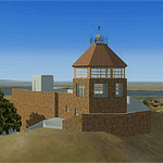
The museum and visitor center house a diorama of the parks ecosystems, complete with the sounds found in nature, and a topographic model of the mountain. On one wall, an instructional video and lighted display case describes the geologic forces that created the mountain. On anther wall, cultural history is chronicled with splendid photographs. The lower level of the summit building contains panels describing the Native American history of the region and an audio-visual room. Rotating displays of art and photography complement the permanent exhibits. In addition to the exhibits, there is a small gift center within the building.
| Filename: | Mount_Diablo_Summit_Museum.zip |
| License: | Freeware, limited distribution |
| Added: | 13th June 2016, 20:46:13 |
| Downloads: | 185 |
| Author: | Rick Keller |
| Size: | 1.08 MB |
| Category: Prepar3D V1-4 - Scenery | |
| Loreto Marche Italy N 43.26.27 E 13.36.36 |
|
File Description:
Loreto Marche Italy (N 43.26.27 E 13.36.36) Loreto is an Italian town in the province of Ancona in the Marche region
and is famous for being the headquarters of the Basilica of the Santa Casa, one of the most important and ancient places
of Marian pilgrimage in the Catholic world. The city rises on the top of a gentle hill, with a wide countryside around
characterized by the cultivation of the olive tree. The shape of the dome and the bell tower of the Basilica, whose
top is the figure of the Madonna, stands out for its height and majesty. The Basilica houses the famous relic of the
"Holy House" of Nazareth where, according to tradition, the Virgin Mary was born and lived where he received the
announcement of the miraculous birth of Jesus. The panorama that can be enjoyed ranges from the Adriatic Sea to Monte
Conero, up to the Umbrian-Marche Apennines. Important VFR point for approaching airport Ancona Falconara. Within the
downloaded package you will find readme files for scenery installation. Good fly VFR. Pasquale Marrulli.
| Filename: | Loreto_Marche_Italy_N_432627_E_133636.zip |
| License: | Freeware |
| Added: | 4th May 2018, 04:42:54 |
| Downloads: | 163 |
| Author: | Pasquale Marrulli |
| Size: | 19.22 KB |
© 2001-2026 AVSIM Online
All Rights Reserved
Privacy Policy |