
Where Flight Simulation Enthusiasts Gather from Around the World!
AVSIM Library - Search Results

| Category: Flight Simulator X - Utilities | |
| FS Earth 5.0 for Google Earth |

|
File Description:
This program acts as an interface between Flight Simulator X and Google Earth, letting to follow a flight in real time, over the satellite images generated by Google Earth. Flights can be saved, and many options are available for fine tuning the performance, as well as the map's style (zoom, tilt, orientation). Works on a single computer running FSX and Google Earth all together or, for best experience, can be used on two networked computers running respectively FSX (master) and Google Earth (slave). AI and Multiplayer traffic is also displayed in Google Earth, with course prediction and other information. Requires Flight Simulator X and Google Earth. The program running in trial mode works only around Anchorage, Alaska, (PANC / ANC) for a maximum of five minutes per flight session. Version 5.0 has improved compatibility with latest releases of Google Earth and several additional improvements. A version for FS2004 is available also.
| Filename: | FS_Earth_50_for_Google_Earth.zip |
| License: | Shareware, time limited |
| Added: | 19th July 2007, 00:46:27 |
| Downloads: | 1,104 |
| Author: | Luciano Napolitano |
| Size: | 2.44 MB |
| Category: Flight Simulator X - Utilities | |
| FSXAIS - Update 1.1.62 |
|
Images related to this file:
File Description:

FSX AI Spotter is a program that is able to schedule AI Aircraft flights (departure and arrivals) for a certain airport using both manual and "live" traffic information.
In the manual mode, the user is able to populate the airport using a simple formatted text file while in the live mode, using geniXsoft "connector", is possible to connect to flightaware.com to get real-time information. FSXAIS then will automatically visualize aircrafts and assigns them flightplan accordings to the scheduled received from the Web.
This update is able to assigns - for the same aircraft type and airline - different aircraft variation if they are available from FSX (i.e. if more than one kind of B738 of Ryanair are available in FSX, each of them will be used for the schedule). A video for such situation is available at http://youtu.be/7FhvtbTaL_A
Necessary a 1.0 full setup of FSXAIS
| Filename: | FSXAIS__Update_1162.zip |
| License: | Shareware, limited functionality |
| Added: | 21st November 2011, 17:18:43 |
| Downloads: | 924 |
| Author: | Vincenzo Mercolino |
| Size: | 1.48 MB |
| Category: Flight Simulator X - Utilities | |
| FS Earth 5.2 for Google Earth and FSX |
|
Images related to this file:
File Description:

This program acts as a link between Flight Simulator X and Google Earth, letting to follow a flight in real time, over the satellite images generated by Google Earth. Flights can be saved, and many options are available for fine tuning the performance, as well as the map's style (zoom, tilt, orientation). Works on a single computer running FSX and Google Earth all together or, for best experience, can be used on two networked computers running respectively FSX (master) and Google Earth (slave). AI and Multiplayer traffic is also displayed in Google Earth, with course prediction and other information. Requires Flight Simulator X and Google Earth. The program running in trial mode works only around Anchorage, Alaska, (PANC / ANC) for a maximum of five minutes per flight session. Version 5.2 has new aircraft icons & labels and improves the compatibility with Windows Vista. A version for FS2004 is available also.
| Filename: | FS_Earth_52_for_Google_Earth_and_FSX.zip |
| License: | Shareware, time limited |
| Added: | 3rd May 2010, 07:38:23 |
| Downloads: | 2,701 |
| Author: | Luciano Napolitano |
| Size: | 3.46 MB |
| Category: Flight Simulator X - Utilities | |
| FS Earth 4.2 for Google Earth |
|
File Description:
This program acts as an interface between Flight Simulator X and Google Earth, letting to follow a flight in real time, over the satellite images generated by Google Earth. Flights can be saved, and many options are available for fine tuning the performance, as well as the map's style (zoom, tilt, orientation). Works on a single computer running FSX and Google Earth all together or, for best experience, can be used on two networked computers running respectively FSX (master) and Google Earth (slave). AI and Multiplayer traffic is also displayed in Google Earth, with course prediction and other information. Requires Flight Simulator X and Google Earth. The program running in trial mode works only around Anchorage, Alaska, (PANC / ANC) for a maximum of five minutes per flight session. Version 4.2 has improved compatibility with Windows Vista and minor bug fixes. A version for FS2004 is available also. By Luciano Napolitano.
| Filename: | FS_Earth_42_for_Google_Earth.zip |
| License: | Shareware, time limited |
| Added: | 9th March 2007, 13:39:05 |
| Downloads: | 2,213 |
| Author: | Luciano Napolitano |
| Size: | 2.44 MB |
| Category: Flight Simulator X - Utilities | |
| FS2004/FSX Flight Analyzer Utility V3.05 |
|
Images related to this file:
File Description:
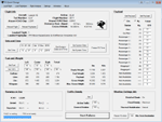
Flight Data Recorder, now with a Pilot Logbook. This utility can do the following: analyze your flight from departure to your destination, and the landing with a graphical landing chart; when flight analysis is finished you can print a report, the report is automaticly saved as a pdf file; quickly change the settings of FSX, such as time, date, fuel, weight, traffic etc.; start a failure sytem, such as gear, flaps, engine, etc.; runway detecting system to see which runways are in use; load an existing flight or flight plan; quickly look to your CFG (settings) files and change them even before the flight simulator is running; after a flight is finished FsQC saves your flight automaticly as 'FsQC last Flight', so you can continue the next day or hour; and lots of more. Require FSUIPC. Note: requires paid activation for use of flight analyzer, landing analysis and pilot logbook. Register and you have 1 month free. By Evander Tholen.
| Filename: | FS2004FSX_Flight_Analyzer_Utility_V305.zip |
| License: | Shareware, limited functionality |
| Added: | 25th December 2018, 21:09:17 |
| Downloads: | 156 |
| Author: | Evander Tholen |
| Size: | 3.01 MB |
| Category: Flight Simulator X - Utilities | |
| FS2004/FSX Flight Analyzer Utility V2.04 |
|
Images related to this file:
File Description:

NOW ALSO WORKING WITH FS2004
What this program do:
- quickly change the settings of FSX/Fs2004, such as time, date, fuel, weight, traffic etc.
- start a failure sytem, such as gear, flaps, engine, etc.
- freeze the time, so you can fly in a for everlasting sunset.
- runway detecting system to see wich runways are in use.
- a flight analysis system, this is automaticly started when you start FsQC.
- When flight analysis is finished you can print a report, the report is automaticly saved as pdf File.
- flight analysis is finished when you parked your aicraft with the parking brakes set for more then 5 seconds.
- graphical landingchart.
- load a existing flight or flightplan.
- quickly look to your CFG (settings) files (only FSX) and change them even before the flight simulator is running.
- After a flight is finished FsQC saves your flight automaticly as 'FsQC last Flight', so you can continue the next day or hour.
- for properly working, flight analysis require a fsx/fs2004 flightplan.
Flight analysis:
Flight analysis start recording at the moment when you begin taxiing.
It gives you huge information such as:
- takeoff- and landing-weight
- takeoff roll in m. or ft.
- separate fuel consumption in taxi, climb, cruise and descent.
- maximum banking in flight
- which speed you using the flaps and gear
- when autopilot on or off
- vertical speed on touchdown
- reverser set after landing
- wich speed you cancel reverser
- bouncing at landing
- graphical landingchart.
- and lots of more
You can better look the example of the pdf document located in the 'Flight Reports' folder.
Failures:
In the settings menu you can select the kind of failures you want to occur and when they must occur.
At this moment 10 failures are possible:
-altitude
-attitude
-heading
-airspeed
-vertical speed
-pitot
-fuelleak
-flaps
-engine
-gear
Recommended:
For more easy use, run this program on a second monitor or much better on a second computer(laptop) where FSUIPC-client is running in the same network where FSX/FS2000 is running and FSUIPC WideFs is registered.
See also the pdf Manual.
Also look at www.FsQC.eu for more information.
If you have a problem look first on www.fsqc.eu/faq.html
If you have questions please contact [email protected]
| Filename: | FS2004FSX_Flight_Analyzer_Utility_V204.zip |
| License: | Check within download |
| Added: | 5th March 2018, 22:40:20 |
| Downloads: | 330 |
| Author: | Evander Tholen |
| Size: | 2.45 MB |
| Category: Flight Simulator X - Utilities | |
| FS2004/FSX Flight Analyzer, Logbook Utility V4.09 |
|
Images related to this file:
File Description:

FS2004/FSX Flight Analyzer Utility V4.09
Flight Data Recorder - Logbook.
NOW WITH STATISTICS TOP 5 AIRPORTS, CITIES AND COUNTRIES.
Very easy to use, just make a flight plan in the simulator or in this utility.
What this program do:
- quickly change the settings of FSX/Fs2004, such as time, date, fuel, weight, traffic etc.
- start a failure sytem, such as gear, flaps, engine, etc.
- freeze the time, so you can fly in a for everlasting sunset.
- runway detecting system to see wich runways are in use.
- flight analyzing/data recording from departure to parking at the gate.
- When flight analysis is finished you can print a report, the report is automaticly saved as pdf File.
- graphical landingchart.
- record all your flights
- quickly look to your FSX display settings (only FSX) and change them even before the flight simulator is running.
- After a flight is finished FsQC saves your flight automaticly as 'FsQC last Flight', so you can continue the next day or hour.
Flight analysis start recording at the moment when you begin taxiing.
It gives you huge information such as:
- takeoff- and landing-weight.
- takeoff- and landing-roll in m. and ft.
- separate fuel consumption in taxi, climb, cruise and descent.
- maximum banking in flight.
- which speed you using the flaps and gear.
- when autopilot on or off.
- vertical speed on touchdown.
- reverser set after landing.
- wich speed you cancel reverser.
- bouncing at landing.
- graphical landingchart.
- and lots of more.
You can better look the example of the pdf document located in the 'Flight Reports' folder.
Logbook records:
- fuel consumption.
- payload.
- distance.
- number of different airports.
- flight hours.
- landings.
- flaps.
- speed.
- and lots of more.
- quickly show touchdown wind information in a picture.
- quickly show the graphical landing chart.
- Now with statistics: top 5 Countries, Cities and Airports
Requirements:
Computer with vista or higher and internet access.
Microsoft .net framework 4.6 or higher.(free download on microsft.com)
Flightsimulator FSX or 2004 and FSUIPC installed.
Note: requires paid activation for full use.
Register and you have 1 month free.
Program fully works without registration at airport Athens and Iraklion (Greece)
| Filename: | FS2004FSX_Flight_Analyzer_Logbook_Utility_V409.zip |
| License: | Shareware, time limited |
| Added: | 3rd March 2019, 00:20:37 |
| Downloads: | 249 |
| Author: | Evander Tholen |
| Size: | 3.35 MB |
© 2001-2026 AVSIM Online
All Rights Reserved
Privacy Policy |