
Where Flight Simulation Enthusiasts Gather from Around the World!
AVSIM Library - Search Results

| Category: Flight Simulator X - Utilities | |
| FS2004/FSX Flight Analyzer, Logbook Utility V4.09 |

|
Images related to this file:
File Description:
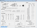
FS2004/FSX Flight Analyzer Utility V4.09
Flight Data Recorder - Logbook.
NOW WITH STATISTICS TOP 5 AIRPORTS, CITIES AND COUNTRIES.
Very easy to use, just make a flight plan in the simulator or in this utility.
What this program do:
- quickly change the settings of FSX/Fs2004, such as time, date, fuel, weight, traffic etc.
- start a failure sytem, such as gear, flaps, engine, etc.
- freeze the time, so you can fly in a for everlasting sunset.
- runway detecting system to see wich runways are in use.
- flight analyzing/data recording from departure to parking at the gate.
- When flight analysis is finished you can print a report, the report is automaticly saved as pdf File.
- graphical landingchart.
- record all your flights
- quickly look to your FSX display settings (only FSX) and change them even before the flight simulator is running.
- After a flight is finished FsQC saves your flight automaticly as 'FsQC last Flight', so you can continue the next day or hour.
Flight analysis start recording at the moment when you begin taxiing.
It gives you huge information such as:
- takeoff- and landing-weight.
- takeoff- and landing-roll in m. and ft.
- separate fuel consumption in taxi, climb, cruise and descent.
- maximum banking in flight.
- which speed you using the flaps and gear.
- when autopilot on or off.
- vertical speed on touchdown.
- reverser set after landing.
- wich speed you cancel reverser.
- bouncing at landing.
- graphical landingchart.
- and lots of more.
You can better look the example of the pdf document located in the 'Flight Reports' folder.
Logbook records:
- fuel consumption.
- payload.
- distance.
- number of different airports.
- flight hours.
- landings.
- flaps.
- speed.
- and lots of more.
- quickly show touchdown wind information in a picture.
- quickly show the graphical landing chart.
- Now with statistics: top 5 Countries, Cities and Airports
Requirements:
Computer with vista or higher and internet access.
Microsoft .net framework 4.6 or higher.(free download on microsft.com)
Flightsimulator FSX or 2004 and FSUIPC installed.
Note: requires paid activation for full use.
Register and you have 1 month free.
Program fully works without registration at airport Athens and Iraklion (Greece)
| Filename: | FS2004FSX_Flight_Analyzer_Logbook_Utility_V409.zip |
| License: | Shareware, time limited |
| Added: | 3rd March 2019, 00:20:37 |
| Downloads: | 249 |
| Author: | Evander Tholen |
| Size: | 3.35 MB |
| Category: Flight Simulator X - Utilities | |
| FSX AI Spotter FlightStats® connector rel. 1.0 |
|
Images related to this file:
File Description:
geniX Software - Connector for FlightStat FlexAPI rel.1.0 to be used in conjunction with FSX AI Spotter.
The use of this connector is subject to having a FlightStats API App-Id and App-Key; the grant could be requested at https://www.flightstats.com at a very good price.
| Filename: | FSX_AI_Spotter_FlightStats_connector_rel_10.zip |
| License: | Freeware |
| Added: | 19th February 2020, 03:17:33 |
| Downloads: | 37 |
| Author: | V.Mercolino - geniX soft |
| Size: | 268.12 KB |
| Category: Flight Simulator X - Utilities | |
| FS2Crew FS9 and FSX Start Center (May 2008) |
|
File Description:
FS2Crew FSX and FS9 Start Center. This is the most current version of the (frequently updated) FS2Crew Start Center for FSX and FS9 as of May 2008. It replaces any pre-existing versions of the Start Center on your system. While intended for FS2Crew users, non-FS2Crew users may also install and use the Start Center. Please read the PDF file enclosed in the download for further information.
| Filename: | FS2Crew_FS9_and_FSX_Start_Center_May_2008.zip |
| License: | Freeware |
| Added: | 30th May 2008, 12:12:06 |
| Downloads: | 1,425 |
| Author: | Bryan York | FS2Crew |
| Size: | 3.8 MB |
| Category: Flight Simulator X - Utilities | |
| AI Time Table 2 - release 1.5.8 for FSX |
|
Images related to this file:
File Description:

AI TimeTable is a software simulation of an airport time table for MS-FSX; starting from the rel.1.5.5, it is completed with a TTS for speaking flights announcements.
Requires MS-FSX SP1 and Simconnect.dll. - Requires AITT2FSX rel 1.5.6 full setup
| Filename: | AI_Time_Table_2__release_158_for_FSX.zip |
| License: | Shareware, limited functionality |
| Added: | 21st July 2012, 02:35:03 |
| Downloads: | 711 |
| Author: | V.Mercolino - geniX |
| Size: | 2.12 MB |
| Category: Flight Simulator X - Utilities | |
| FSX/P3D Quick ILS Utility Ver 3.1.5 **UPDATE ** |
|
Images related to this file:
File Description:
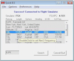
This utility was written to simplify the process of finding the ILS frequency when ATC assigns an ILS approach. Operation is simple. Enter the ICAO, click the Search button and a list of all runways, runway lengths and runway ILS frequencies for that ICAO are displayed. Here's the quick part... Just double click on a runway and the ILS frequency will instantly be set in the Nav1 radio. You can also start Flight Simulator, load a flightplan and then start Quick ILS. It will automatically read the flightplan and then display the destination airport's runway data. Again, just double click on the assigned runway to set the Nav1 radio for the ILS approach. ILS data aside, General Aviation fans may want to use Quick ILS to get information about possible destination airports. Enter an ICAO and you can quickly view the runways available, their length, the surface (ie grass, gravel, paved...) and the runway headings. Version 3.1.5 adds the ILS ID to the display. Freeware by Dave Westbury.
| Filename: | FSXP3D_Quick_ILS_Utility_Ver_315_UPDATE_.zip |
| License: | Freeware |
| Added: | 12th August 2014, 10:25:51 |
| Downloads: | 3,575 |
| Author: | Dave Westbury |
| Size: | 457.35 KB |
| Category: Flight Simulator X - Utilities | |
| FS Earth 5.1 for Google Earth and FSX |
|
File Description:
This program acts as an interface link between Flight Simulator X and Google Earth, letting to follow a flight in real time, over the satellite images generated by Google Earth. Flights can be saved, and many options are available for fine tuning the performance, as well as the map's style (zoom, tilt, orientation). Works on a single computer running FSX and Google Earth all together or, for best experience, can be used on two networked computers running respectively FSX (master) and Google Earth (slave). AI and Multiplayer traffic is also displayed in Google Earth, with course prediction and other information. Requires Flight Simulator X and Google Earth. The program running in trial mode works only around Anchorage, Alaska, (PANC / ANC) for a maximum of five minutes per flight session. Version 5.1 has much improved smoothness. A version for FS2004 is available also.
| Filename: | FS_Earth_51_for_Google_Earth_and_FSX.zip |
| License: | Shareware, time limited |
| Added: | 12th November 2007, 23:08:31 |
| Downloads: | 1,587 |
| Author: | Luciano Napolitano |
| Size: | 2.44 MB |
| Category: Flight Simulator X - Utilities | |
| FS Earth 5.2 for Google Earth and FSX |
|
Images related to this file:
File Description:

This program acts as a link between Flight Simulator X and Google Earth, letting to follow a flight in real time, over the satellite images generated by Google Earth. Flights can be saved, and many options are available for fine tuning the performance, as well as the map's style (zoom, tilt, orientation). Works on a single computer running FSX and Google Earth all together or, for best experience, can be used on two networked computers running respectively FSX (master) and Google Earth (slave). AI and Multiplayer traffic is also displayed in Google Earth, with course prediction and other information. Requires Flight Simulator X and Google Earth. The program running in trial mode works only around Anchorage, Alaska, (PANC / ANC) for a maximum of five minutes per flight session. Version 5.2 has new aircraft icons & labels and improves the compatibility with Windows Vista. A version for FS2004 is available also.
| Filename: | FS_Earth_52_for_Google_Earth_and_FSX.zip |
| License: | Shareware, time limited |
| Added: | 3rd May 2010, 07:38:23 |
| Downloads: | 2,701 |
| Author: | Luciano Napolitano |
| Size: | 3.46 MB |
| Category: Flight Simulator X - Utilities | |
| FS2004/FSX/Prepar3D Flight Analyzer/Logbook Utility V6.14 |
|
File Description:
FS2004/FSX/Prepar3D Flight Analyzer/Logbook Utility V6.14 Flight Data Recorder - Logbook. Now a few bugs are fixed. Very easy to use, just make a flight plan in the simulator or in this utility. What this program does: quickly change the settings of P3D/FSX/Fs2004, such as time, date, fuel, weight, traffic etc.; start a failure sytem, such as gear, flaps, engine, etc.; freeze the time, so you can fly in a for everlasting sunset; runway detecting system to see wich runways are in use; flight analyzing/data recording from departure to parking at the gate; When flight analysis is finished you can print a report, the report is automaticly saved as pdf File. By Evander Tholen.
| Filename: | FS2004FSXPrepar3D_Flight_AnalyzerLogbook_Utility_V.zip |
| License: | Shareware, limited functionality |
| Added: | 21st January 2020, 17:43:48 |
| Downloads: | 193 |
| Author: | Evander Tholen |
| Size: | 3.43 MB |
| Category: Flight Simulator X - Utilities | |
| Port Simmer's Sky / Overland airliners into FSX - Version 2 |
|
File Description:
Porting Simmer's Sky (Overland) Airliners to FSX - Version 2
By Dave Nunez ([email protected])
This DOC file explains how to port some of Simmer's Sky (Overland) airliners into FSX (with working panels, sound, pushback trucks, jetways & baggage carts, and camera definitions). You must have some of these airliners installed for this to make any sense!
This version includes instructions for porting the following:
SMS_777-200_W (Being 777-200)
SMS_777-200ER_W (Being 777-200ER)
SMS_777-300_W (Being 777-300)
SMS_A380-800 (Airbus A380-800)
SMS_MD11_V2 (McDonnal Douglas MD-11)
SMS_A300-600R_W (Airbus A300-600)
SMS_A319_W (Airbus A319)
SMS_A320_W (Airbus A320)
SMS_A321_W (Airbus A321)
SMS_767-300ER_W (Boeing 767-300ER)
| Filename: | Port_Simmers_Sky__Overland_airliners_into_FSX___Ve.zip |
| License: | Freeware |
| Added: | 25th October 2006, 20:04:40 |
| Downloads: | 3,539 |
| Author: | Dave Nunez |
| Size: | 24.41 KB |
| Category: Flight Simulator X - Utilities | |
| Taxi Navigation (+Destination Weather Reporter) for FSX/FS9 V1.0 |
|
Images related to this file:
File Description:

Do you prepare airport charts of every airport you visit, or just follow the progressive taxi to do taxiing?
This utility will make taxiing easy and realistic by providing simple taxi navigation information in text.
While taxiing, press "Ctrl + Shift + X", then taxi navigation information will be displayed.
It includes current taxiway name, intersecting taxiways' name and distance
(e.g. "On R7 : R2 (250m), R1 (643m), A (748m), A7 (748m)").
And one more thing, it also provides destination weather report.
It can be very helpful to set up exact T/D(Top of Descent), by assuming expected runway with wind information.
Enter destination airport before flight, and press "Ctrl + Shift + W" while flying,
then destination weather information will be displayed.
It looks like METAR and includes wind direction and speed, visibility, temperature, dew point and pressure
(e.g. "RKPK 29403KT 47SM 32/23 1010mb").
| Filename: | Taxi_Navigation_Destination_Weather_Reporter_for_F.zip |
| License: | Freeware |
| Added: | 3rd August 2012, 06:47:24 |
| Downloads: | 2,940 |
| Author: | Dongjin Shin |
| Size: | 4.88 MB |
© 2001-2026 AVSIM Online
All Rights Reserved
Privacy Policy |