
Where Flight Simulation Enthusiasts Gather from Around the World!
AVSIM Library - Search Results

| Category: Flight Simulator X - Scenery | |
| ValparaÃso Provincia, Litoral 2016. Chile. For FSX |

|
Images related to this file:
File Description:
Scenery of ValparaÃso Province from North (Quintero) to South (Laguna Verde valley). About 2.000 km2 intervention that brings up to fsx the current urban density, neighborhoods, forests and the most important iconic 3d objects you can recognize from a real VFR flight. This project uses FTX Vector as it main complement (only for the shapes of the coast). Also uses satellite background DAY/NIGHT, SPRING/ FALL / WINTER Photoscenery for Ritoque, Aconcagua, Concon, Embalse Los Aromos, Salinas, Borde Costero de Viña del Mar, Tranque La Luz, Peñuelas. Recomended to use (as an option) with my airport projects. SCVM, SCER, SCRD, SCSN, SCCV, SCIR, SCEL.
| Filename: | Valparaso_Provincia_Litoral_2016_Chile_For_FSX.zip |
| License: | Freeware |
| Added: | 4th November 2016, 04:59:42 |
| Downloads: | 1,097 |
| Author: | Orlando Veas |
| Size: | 180.36 MB |
| Category: Flight Simulator X - Scenery | |
| KAUS - Austin-Bergstrom International Airport, Austin TX (PhotoReal) |
|
Images related to this file:
File Description:
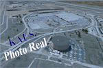
This Photo Real scenery is a complete rebuild for the FSX Default KAUS airport using the latest version of ADE, SBuilderX scenery design tool,& Google SketchUp.
This scenery includes new parking garage, cargo buildings, realistic Google Earth buildings, and Photo Real ground textures that give the airport a more realistic feeling. I constructed this scenery using all FSX textures and imported Google Earth Buildings via Google SketchUp. I have also added new approach lights, parking lot lamps, terminal gate assignments, and several other nice scenery enhancements. The runways and airport aprons are aligned to match Google & Yahoo satellite imagery.
| Filename: | KAUS__AustinBergstrom_International_Airport_Austin.zip |
| License: | Freeware |
| Added: | 23rd December 2012, 22:36:34 |
| Downloads: | 4,243 |
| Author: | Glenn Johnson |
| Size: | 73.27 MB |
| Category: Flight Simulator X - Scenery | |
| FSX - Augusta State Airport KAUG |
|
Images related to this file:
File Description:
FSX Scenery - Augusta State Airport (IATA: AUG, ICAO: KAUG, FAA LID: AUG) is a public use airport located one nautical mile (2 km) northwest of the central business district of the state capital of Augusta, a city in Kennebec County, Maine, United States. The airport is owned by the state of Maine, but managed and operated by the city of Augusta. It is served by one commercial airline, with scheduled passenger service subsidized by the Essential Air Service program. For your flying pleasure by John B. Loney, Jr.
| Filename: | FSX__Augusta_State_Airport_KAUG.zip |
| License: | Freeware, limited distribution |
| Added: | 7th October 2016, 19:33:16 |
| Downloads: | 923 |
| Author: | John B. Loney, Jr. |
| Size: | 69.41 MB |
| Category: Flight Simulator X - Scenery | |
| KBWG, Bowling Green-Warren County Regional Airport |
|
Images related to this file:
File Description:
An ADE upgrade of the FSX stock airport with photoreal background. Tested in FSX but may also work for P3D.
| Filename: | KBWG_Bowling_GreenWarren_County_Regional_Airport.zip |
| License: | Freeware |
| Added: | 1st April 2017, 17:49:48 |
| Downloads: | 470 |
| Author: | Tim van Ringen |
| Size: | 7.2 MB |
| Category: Flight Simulator X - Scenery | |
| Bryant Field |
|
Images related to this file:
File Description:

Bryant Field (O57) is a small field in Bridgeport, California nestled in the mountains at about 6,500 feet. The scenery includes ground polygons, seasonal aerial imagery, autogen, and AI.
| Filename: | Bryant_Field.zip |
| License: | Freeware |
| Added: | 20th December 2011, 19:26:53 |
| Downloads: | 633 |
| Author: | Kobbe Farwick |
| Size: | 78.64 MB |
| Category: Flight Simulator X - Scenery | |
| P15 - Brokenstraw Airport - Pittsfield, Pennsylvania - USA |
|
Images related to this file:
File Description:
FSX Scenery - Brokenstraw Airport (P15) is located in Pittsfield Pennsylvania and is the only public airport in Warren County. Two flying clubs, Warren Aviation Club and Brokenstraw Soaring Club, make their home at Brokenstraw as well as Valair Flying Service, who provides instruction and aircraft rentals. Fuel and oil sales, hangar rental and aircraft maintenance are provided by Bill Holder as part of the airport services. The airport was originally built by John Teconchuk in 1970 from a part of his family farm which is located on the southern bank of Brokenstraw Creek, hence the name Brokenstraw Airport. For your flying pleasure by John B. Loney, Jr.
| Filename: | P15__Brokenstraw_Airport__Pittsfield_Pennsylvania_.zip |
| License: | Freeware, limited distribution |
| Added: | 16th December 2014, 22:48:59 |
| Downloads: | 439 |
| Author: | John B. Loney, Jr. |
| Size: | 18.21 MB |
| Category: Flight Simulator X - Scenery | |
| KGRI, Central Nebraska Regional Airport USA |
|
Images related to this file:
File Description:
New setup of this airport I came across in one of my virtual flights. It is located three miles northeast of Grand Island, in Hall County, Nebraska.
| Filename: | KGRI_Central_Nebraska_Regional_Airport_USA.zip |
| License: | Freeware |
| Added: | 20th February 2018, 17:49:25 |
| Downloads: | 403 |
| Author: | Tim van Ringen |
| Size: | 3.29 MB |
| Category: Flight Simulator X - Scenery | |
| KCID, Eastern Iowa Airport, USA |
|
Images related to this file:
File Description:
New setup of another airport I came across in one of my virtual flights. It is located 06 miles SW of Cedar Rapids, Iowa.
| Filename: | KCID_Eastern_Iowa_Airport_USA.zip |
| License: | Freeware |
| Added: | 27th April 2018, 00:30:49 |
| Downloads: | 872 |
| Author: | Tim van Ringen |
| Size: | 3.03 MB |
| Category: Flight Simulator X - Scenery | |
| Columbia Regional Airport KCOU FSX |
|
Images related to this file:
File Description:
FSX Scenery - Columbia Regional Airport (IATA: COU, ICAO: KCOU, FAA LID: COU) is a city owned, public use airport located 10 nautical miles (12 mi, 19 km) southeast of the central business district of Columbia, a city in Boone County, Missouri, United States. The airport is served by one commercial airline and also provides general aviation services. This scenery is complete with no additional downloads, however, if you wish to see the one commercial airline serving Cloumbia in the AI flight plans, you must download the file woa_americaneagle_v2.zip by World of AI. Created for your flying pleasure by John B. Loney, Jr.
| Filename: | Columbia_Regional_Airport_KCOU_FSX.zip |
| License: | Freeware, limited distribution |
| Added: | 17th November 2016, 05:51:18 |
| Downloads: | 715 |
| Author: | John B. Loney, Jr. |
| Size: | 20.41 MB |
| Category: Flight Simulator X - Scenery | |
| Choctaw NOLF (KNFJ) |
|
File Description:
One of several Naval Outlying Landing Fields (NOLF's) in the Pensacola area, Choctaw NOLF is currently the only NOLF capable of supporting the newest US Navy primary training aircraft, the T-6B Texan II. Choctaw NOLF is located in Milton, FL just 13nm South of NAS Whiting Field. Designed for FSX, Choctaw NOLF features working IFLOLS trailers designed by Sylvain Parouty. The trailers have a functioning "meatball" to help with Field Carrier Landing Practice. Buildings and other objects were placed using default FSX objects as well as a couple of add-on libraries. You will need rwy_mark.zip by Lance Tucker and fsx_lts.zip by Jim Dhaenens. Both files are available at flightsim.com. View the readme file for more info and acknowledgments. The goal of this scenery is the same as in the real world...to provide a secondary landing field for Virtual Student Naval Aviators to practice pattern work, touch and go's, and Carrier Landing Practice. It's a great place for your FSX T-6A or T-34C!
| Filename: | Choctaw_NOLF_KNFJ.zip |
| License: | Freeware, limited distribution |
| Added: | 11th March 2010, 04:02:17 |
| Downloads: | 1,451 |
| Author: | Brandon Thetford |
| Size: | 13.53 MB |
© 2001-2026 AVSIM Online
All Rights Reserved
Privacy Policy |