
Where Flight Simulation Enthusiasts Gather from Around the World!
AVSIM Library - Search Results

| Category: Flight Simulator X - Scenery | |
| Ridge Soaring 79N Julian PA |

|
Images related to this file:
File Description:
Ridge Soaring Gliderport (79N) is a public-use glider airport located two nautical miles (4 km) southwest of the central business district of Unionville, in Centre County, Pennsylvania, United States. It is privately owned by Knauff & Grove, Inc. Tom Knauff and Doris grove are among the whos who in American and International soaring community.
Portions of the 1999 movie The Thomas Crown Affair were filmed here.
Co-owner Thomas L. Knauff set five FAI world records, and over 50 NAA national records flying from this airport.
Co-owner Doris Grove set three FAI feminine world records flying from this airport, and was the first woman to fly a glider more than 1000 km.
This FBO airport is world famous for ridge, thermal and wave soaring. It is located on U.S. Route 220 (alternate) 8 miles south of Interstate 80, between Unionville and Julian, at the base of the Bald Eagle Mountain ridge. It is approximately 10 miles from State College and approximately midway between Altoona and Lock Haven in the Bald Eagle Valley. Visitors can look at an entire wall of U.S. National and World records that have been set from this airfield.
Sadly as with so many small airports, Ridge Soaring is in risk of disappearing. for sale for many years, with no takers it may be sold to developers and disappear forever.
In FSX the airport was on the wrong side of the highway and cut into a mountain, I moved it to its proper location and heading, made the runway the correct size and heading, and added all the current buildings.
| Filename: | Ridge_Soaring_79N_Julian_PA.zip |
| License: | Freeware |
| Added: | 11th June 2014, 16:24:59 |
| Downloads: | 292 |
| Author: | Jon Davidson |
| Size: | 16.52 MB |
| Category: Flight Simulator X - Scenery | |
| Eagle Field - Port Matilda, PA |
|
Images related to this file:
File Description:
Eagle field- 09PA Port Matilda PA.
Private Glider field Owned by Karl Striedieck. Karl is a world record setting glider pilot and a member of the U.S. Soaring Hall of Fame. He was an early pioneer of ridge soaring in the Ridge-and-valley Appalachians in the 1960s, ultimately setting nine world records flying gliders there. He was selected for the U.S. national soaring team 12 times, and won a silver medal in the world championships in 1978 and 1983.
Mr. Striedieck was a U.S. Air Force pilot from 1959 to 1962, flying the F-86 Sabre and F-102 Delta Dagger, then continued his military service until 1981 in the Pennsylvania Air National Guard, where he transitioned to the A-7 Corsair II. A year before graduating from Pennsylvania State University in 1965, he started flying gliders when he and Bill Clark co-founded the Nittany Soaring Club, flying out of the former State College Air Depot. He has over 15,000 flying hours, with nearly half of that total in gliders.
Mr. Striedieck moved his home to the Eagle Field private airport on top of Bald Eagle Mountain, near State College, Pennsylvania in 1966, and now lives there with his second wife, Iris.
Basically a manicured farm field, this private glider field offers access to the famous ridge lift of central Pennsylvania.Nearby Ridge Soaring is another one of my airfields available.
| Filename: | Eagle_Field__Port_Matilda_PA.zip |
| License: | Freeware |
| Added: | 11th June 2014, 16:30:28 |
| Downloads: | 324 |
| Author: | Jon Davidson |
| Size: | 16.52 MB |
| Category: Flight Simulator X - Scenery | |
| Helicopter test at Chittagong |
|
Images related to this file:
File Description:

Chittagong, in Bangladesh, is known for its ship dismantling industry. The scenery is a piloting test, but also a way to make aware of the workers conditions. Even if some building have been added to VGEG, it is not an airport scenery.
| Filename: | Helicopter_test_at_Chittagong.zip |
| License: | Freeware |
| Added: | 20th June 2014, 11:49:42 |
| Downloads: | 333 |
| Author: | Jean-Pierre Fillion |
| Size: | 1.77 MB |
| Category: Flight Simulator X - Scenery | |
| CYCD (2012) Version 3 for FS9, FSX and Prepar3D |
|
Images related to this file:
File Description:
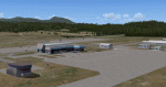
CYCD (2012) is an update to Ken Peter's CYCD Nanaimo-Collishaw Airport (Vancouver Island, British Columbia, Canada). The airport has recently completed a major runway
extension and installed an ILS for Rwy 16. The five flashing-red beacons that guide the way on a night approach to Rwy 34 are included. To the extent possible, this update
reuses Ken's custom buildings and objects (but you don't need to have Ken's version installed). As well, a selection of SAMM-generated static aircraft are scattered around the
aprons supplemented by a number of AI aircraft that do touch 'n gos from time to time. CYCD (2012) is compatible with ORBX FTX USA Canada Pacific Northwest and both versions
of Ultimate Terrain.
Generally, this new version is visually identical to its predecessor - even though quite different internally. As well, to the extent possible, it is compatible with
Prepar3Dv2. (v3.03 fixes a vehicle texture issue in 3.02)
| Filename: | CYCD_2012_Version_3_for_FS9_FSX_and_Prepar3D.zip |
| License: | Freeware |
| Added: | 22nd June 2014, 17:18:09 |
| Downloads: | 3,988 |
| Author: | Don Grovestine |
| Size: | 64 MB |
| Category: Flight Simulator X - Scenery | |
| Monaco Heliport |
|
Images related to this file:
File Description:
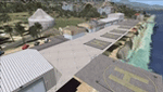
That freeware FSX scenery is adding the Monaco heliport to the Monaco Principalty. Complete with coms. Comes with a French readme too.
| Filename: | Monaco_Heliport.zip |
| License: | Freeware |
| Added: | 16th July 2014, 16:34:25 |
| Downloads: | 329 |
| Author: | Gerard Guichard |
| Size: | 237.86 KB |
| Category: Flight Simulator X - Scenery | |
| Patches for Lighthouses of Annaba and Bejaia, Algeria and Corrected Faulty Terrain in Annaba and Oran |
|
Images related to this file:
File Description:
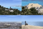
Those patches are setting into FSX the lighthouse of the Cap de Garde, in Annaba, Algeria and the ones of Bejaia. They also flatten two inaccuracies of terrain which are seen in Annaba, on the route to the airport and in Oran, East of the harbour.
| Filename: | Patches_for_Lighthouses_of_Annaba_and_Bejaia_Alger.zip |
| License: | Freeware |
| Added: | 16th July 2014, 16:36:40 |
| Downloads: | 313 |
| Author: | Gerard Guichard |
| Size: | 273.54 KB |
| Category: Flight Simulator X - Scenery | |
| Improved and/or New terrains around Dijon, France |
|
Images related to this file:
File Description:
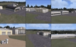
That FSX freeware is adding or improving terrains around Dijon, France, with Beaune-Challanges (LFGF), Dijon-Darois (LFGI), Nuits-Saint-Georges-La Berchere (LFGZ), Pouilly-en-Auxois-Maconge (LFEP), and Til-Chatel (LFET).**NOTE: A better and easier choice is to install the latest, stand-alone 3.0 version, at "dijonnais_terrains_3.0.zip"!
| Filename: | Improved_andor_New_terrains_around_Dijon_France.zip |
| License: | Freeware |
| Added: | 16th July 2014, 16:37:20 |
| Downloads: | 290 |
| Author: | Gerard Guichard |
| Size: | 272.13 KB |
| Category: Flight Simulator X - Scenery | |
| Improved and/or New terrains around Dijon, France - Version 2.0 |
|
Images related to this file:
File Description:
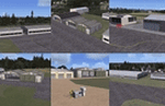
That is our version 2.0 to our FSX freeware adding or improving terrains around Dijon, France, with Beaune-Challanges (LFGF), Dijon-Darois (LFGI), Nuits-Saint-Georges-La Berchere (LFGZ), Pouilly-en-Auxois-Maconge (LFEP), and Til-Chatel (LFET) (dijonnais_terrains.zip). Comes with a French readme too. By G. Guichard.
Note: version 2.0 is a stand-alone version, it does not require version 1.0 to work. A better and easier choice is to install the latest, stand-alone 3.0 version, at "dijonnais_terrains_3.0.zip"!
| Filename: | Improved_andor_New_terrains_around_Dijon_France__V.zip |
| License: | Freeware |
| Added: | 16th July 2014, 16:37:55 |
| Downloads: | 689 |
| Author: | Gerard Guichard |
| Size: | 301.77 KB |
| Category: Flight Simulator X - Scenery | |
| NY3C - Taylor Field - Hammondsport, New York (Fictional ICAO) |
|
Images related to this file:
File Description:
The airport named Taylor Field (on 1970's sectional charts) is a small 1800' strip not shown in the stock FSX list of airports. There is no ICAO code or other designator I could find with extensive research. I used my own code of NY3C.
This is a part reality part historic scenery as it represents the modern day airport, the Glenn Curtiss Museum, and adjacent to the Airport a facsimile of the original horse racetrack that was used by Glenn Curtiss to fly his June Bug on July 4th 1908. It is a close As I can determine to the original spot using archival photos and conversations with the Director of the Curtiss Museum, Traff Doherty. Extensive use of new land class is also employed to give a better representation of the geographic area.
This will work with FSX stock scenery, but is designed with UTX (Flight One Software) in mind. It will work with ORBX Global and Global Vector as well. With these latter two there may be some missing roads but it won't affect the scenery.
| Filename: | NY3C__Taylor_Field__Hammondsport_New_York_Fictiona.zip |
| License: | Freeware |
| Added: | 24th July 2014, 07:46:29 |
| Downloads: | 343 |
| Author: | Jon Davidson |
| Size: | 9.79 MB |
| Category: Flight Simulator X - Scenery | |
| X5SB - Sutton Bank Yorkshire Soaring Club - North Yorkshire, England |
|
Images related to this file:
File Description: For ORBX England only.
This is a departure for me. away from Appalachia across the pond to Merry
England. This will be the first in a small series of English Glider fields, and
WW2 airfields.
All buildings are made using sketchup. These are exactly sized as all original
buildings and properly located. Improved the area around Hangars.
Sutton Bank, also known as Roulston Scar, is a hill in the Hambleton District of
North Yorkshire in England. The Yorkshire Gliding Club is based at the top of
the hill. A popular slope soaring site since the 1930's, it now is a major site
for aerotowing as well as winch launching sailplanes.
This scenery will appear nicely in the stock FSX, BUT, the field will not be
very flat, use at your own discretion.
| Filename: | X5SB__Sutton_Bank_Yorkshire_Soaring_Club__North_Yo.zip |
| License: | Freeware |
| Added: | 24th July 2014, 08:06:56 |
| Downloads: | 662 |
| Author: | Jon Davidson |
| Size: | 38.16 MB |


© 2001-2026 AVSIM Online
All Rights Reserved
Privacy Policy |