
Where Flight Simulation Enthusiasts Gather from Around the World!
AVSIM Library - Search Results

| Category: Flight Simulator X - Scenery | |
| Auckland Seaplanes 2016 |

|
Images related to this file:
File Description:

Auckland Seaplanes base, Sealink Ferry terminal and North Wharf cafe scenery area. To work with
Orbx.
| Filename: | Auckland_Seaplanes_2016.zip |
| License: | Freeware |
| Added: | 1st June 2016, 16:14:41 |
| Downloads: | 1,283 |
| Author: | Godfrey Tier |
| Size: | 1.89 MB |
| Category: Flight Simulator X - Scenery | |
| Chatham Islands for Vector Land Class New Zealand |
|
Images related to this file:
File Description:
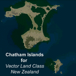
This project is a modified version of the Chatham_Islands.zip project which allows my landclass and airports to work seamlessly with the free Chatham Islands scenery available from Vector Land Class New Zealand. This package allows the user to switch back and forth easily between the different scenery combinations and also provides standalone Chatham and Pitt Island airports which can be used with the Vector Land Class (VLC) scenery on its own. It also allows the user to take advantage of the 15m terrain mesh and added water detail that comes with the VLC scenery. A modified Pitt Island AI runway is also included that is compatible with the 15m mesh. Chatham Islands/Tuuta Airport (NZCI), Napier (NZNR), and the Pitt Island Airstrip (NZPI) are included here. Scenery was created using Airport Design Editor X v1.47.07, SBuilderX 3.13, and the FSX Object Placement Tool. Scenery objects were added and modified from stock FSX scenery to resemble as closely as possible the actual airports.
| Filename: | Chatham_Islands_for_Vector_Land_Class_New_Zealand.zip |
| License: | Freeware |
| Added: | 15th July 2011, 21:54:43 |
| Downloads: | 931 |
| Author: | Carlyle Sharpe |
| Size: | 3.78 MB |
| Category: Flight Simulator X - Scenery | |
| Chatham Islands: Updated Airports, Landclass, Water Data, and Flight Plans |
|
Images related to this file:
File Description:
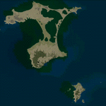
This project significantly updates New Zealand's Chatham Islands and includes more accurate coastlines, lakes, road and river data, as well as corrected landclass and a fully updated Chatham Islands/Tuuta Airport (NZCI). Napier (NZNR) aprons and terminal are also updated to more closely reflect the actual airport and accommodate Air Chathams, and the Pitt Island Airstrip (NZPI) is added to FSX. All updates were done in a manner which carefully aligned airport data with current satellite imagery. These airports are served by Air Chathams. Scenery was created using Airport Design Editor X v1.47.07, SBuilderX 3.13, and the FSX Object Placement Tool. Scenery objects were added and modified from stock FSX scenery to resemble as closely as possible the actual airports.
| Filename: | Chatham_Islands_Updated_Airports_Landclass_Water_D.zip |
| License: | Freeware |
| Added: | 8th July 2011, 21:44:02 |
| Downloads: | 1,674 |
| Author: | Carlyle Sharpe |
| Size: | 17.78 MB |
| Category: Flight Simulator X - Scenery | |
| Hokitika Regional Airport (NZHK) and township, NZ |
|
Images related to this file:
File Description:
Updated 9 March 2014, based on new aerial image background. FSX/Prepar3D dual installer.
Hokitika is a small West Coast township serviced by the regional Hokitika Airport (NZHK). This scenery includes an accurate model of the airport, plus a photoreal township, including a number of photo-textured buildings which give a glimpse of small-town New Zealand. The scenery is part of the Vector Land Class series of airfields, although you can use it with the default FSX, or any other landclass base such as FTX NZSI. It requires the VectorLandClass Libraries, but these are included in this installation.
| Filename: | Hokitika_Regional_Airport_NZHK_and_township_NZ.zip |
| License: | Freeware, limited distribution |
| Added: | 9th March 2014, 22:43:18 |
| Downloads: | 5,557 |
| Author: | Robin Corn |
| Size: | 174.09 MB |
| Category: Flight Simulator X - Scenery | |
| Hamilton International Airport (NZHN) |
|
File Description:
This is just a relatively brief update to the standard airport within FSX. The taxiways have been updated (including with the CTC Aviation aprons) and both runways 25R and 25L have been included. All buildings are from within the FSX scenery library so therefore just generic in there appearance.
| Filename: | Hamilton_International_Airport_NZHN.zip |
| License: | Freeware |
| Added: | 15th December 2008, 02:18:04 |
| Downloads: | 1,795 |
| Author: | Matt Craven |
| Size: | 104.6 KB |
| Category: Flight Simulator X - Scenery | |
| Virac Airport RPUV with Photoreal Scenery |
|
Images related to this file:
File Description:

This is my reworked version of RPUV Airport. Now with Photorealistic Scenery, latest colors and updated terminal.
Virac Airport (IATA: VRC, ICAO: RPUV) is the only airport serving the island province of Catanduanes in the Philippines. It is located in the capital, Virac. The airport is classified as a Class 1 principal (major domestic) airport by the Civil Aviation Authority of the Philippines, a body of the Department of Transportation and Communications that is responsible for the operations of not only this airport but also of all other airports in the Philippines except the major international airports.
On October 27, 2013, Cebu Pacific launched the first ever Airbus flight in Virac.
| Filename: | Virac_Airport_RPUV_with_Photoreal_Scenery.zip |
| License: | Freeware |
| Added: | 26th November 2018, 16:20:24 |
| Downloads: | 828 |
| Author: | Aeron M. Tumanut |
| Size: | 35.35 MB |
| Category: Flight Simulator X - Scenery | |
| Coro Airport (SVCR) - Venezuela |
|
Images related to this file:
File Description:
National airport located in the city of Coro, capital of Falcon state,
in western Venezuela.
With photo-terrain scenery from satellite imagery in Google Earth.
Not compatible with versions prior to FSX.
This scenery includes terminal building and hangars with realistic
textures from images obtained from Internet.
Also includes a friendly Auto-Install.
| Filename: | Coro_Airport_SVCR__Venezuela.zip |
| License: | Freeware |
| Added: | 8th August 2011, 21:56:00 |
| Downloads: | 727 |
| Author: | David Maldonado |
| Size: | 39.83 MB |
| Category: Flight Simulator X - Scenery | |
| Project OTHH - Hamad International Airport (altitude fix) |
|
Images related to this file:
File Description:

This file will fix the altitude issue reported by some users.
| Filename: | Project_OTHH__Hamad_International_Airport_altitude.zip |
| License: | Freeware, limited distribution |
| Added: | 6th October 2013, 17:07:04 |
| Downloads: | 15,819 |
| Author: | Christophe Bouville |
| Size: | 912 B |
| Category: Flight Simulator X - Scenery | |
| Dolly's Grove Airfield EIDG, Ireland |
|
File Description:
Dolly's Grove (EIDG) scenery for FSX, should also work in P3D (not tested) by Brian Salmeron.
Dolly's Grove is a private airstrip located around 20km west of Dublin airport EIDW. It's runway is paved asphalt 08/26 and 650m long with no lighting. The airfield is owned by a Dublin property developer who also operates a TBM700 from the strip. The owner also has a few historic aircraft parked on the property such as an AV-8B Harrier, L39 and an Antonov AN2.
| Filename: | Dollys_Grove_Airfield_EIDG_Ireland.zip |
| License: | Freeware |
| Added: | 3rd February 2021, 20:08:22 |
| Downloads: | 264 |
| Author: | Brian Salmeron |
| Size: | 3.74 MB |
| Category: Flight Simulator X - Scenery | |
| Iguassu Falls - Save The Planet |
|
Images related to this file:
File Description:
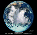
The Iguassu Falls, Itaipu Hydroelectric Power Plant, Foz do Iguassu City and Land Class Package for FSX
Save The Planet is my version of the Iguassu Falls, Itaipu Dam, bridges and landclass scenery for FSX.
Differently from my other version for MSFS 2004, I created a mesh of 5 meter resolution for Iguassu Falls area
to give me some idea how I could proceed. So, I decided to use on this addon
an image background avaliable at server (VirtualEarthSatellite). Thanks Microsoft.
Non-Airport Scenery - ICAO (SBFI). coming soon at www.Terra-Brasilis.org
Portuguese: Cataratas do Iguassu,
Spanish: Cataratas del Iguazu are waterfalls of the Iguassu River located on the border of the Brazilian state of Parana (in the Southern
Region) and the Argentinian Province of Misiones.
The Falls are shared between the Iguazu National Park (Argentina) and Iguacu
National Park (Brazil). The parks were designated UNESCO World Heritage Sites.
The Itaipu Hydroelectric Power Plant is located in the Parana River, in the stretch of the frontier between Brazil and Paraguay, 14 km north of the Friendship Bridge.
The area of the project extends from Foz do Iguassu, in Brazil, and Ciudad del Este, in Paraguay, in the south, up to Guaira (Brazil) and the Guaira Falls (Paraguay), in the north.
Enjoy FSX Iguassu Falls Scenery!
| Filename: | Iguassu_Falls__Save_The_Planet.zip |
| License: | Freeware |
| Added: | 9th December 2010, 01:57:00 |
| Downloads: | 2,845 |
| Author: | Cicero Costa |
| Size: | 31.71 MB |
© 2001-2026 AVSIM Online
All Rights Reserved
Privacy Policy |