
Where Flight Simulation Enthusiasts Gather from Around the World!
AVSIM Library - Search Results

| Category: Flight Simulator X - Scenery | |
| Everglades Airpark Florida U.S.A |

|
Images related to this file:
File Description:
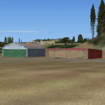
This is Everglades airpark in Florida U.S.A.It is freeware and made from custom designed hangars and buildings.I also used default FSX scenery librarys.Everglades Airpark is situated in the Everglades region (Colier County) in Florida U.S.A.Immediately outside the environs of this 29-acre airpark are a number of environmentally sensitive, protected lands. The airpark is situated immediately southwest of the Big Cypress National Preserve, and is surrounded on three sides by the waters of Everglades National Park.
| Filename: | Everglades_Airpark_Florida_USA.zip |
| License: | Freeware |
| Added: | 26th December 2009, 02:14:05 |
| Downloads: | 1,029 |
| Author: | Jacques Botha |
| Size: | 301.37 KB |
| Category: Flight Simulator X - Scenery | |
| Springhill Aerodrome (New Zealand) |
|
Images related to this file:
File Description:
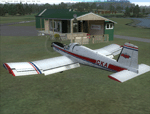
SpringHill (ICAO: NZSL) is a small airstrip between Warkworth and Wellsford, north of Auckland in New Zealand. It is privately owned tarseal strip with offset thresholds giving usable landing lengths of 680m and 700m for RWY 16 and 34 respectively, a width of 10m and a group rating of 5. The runway is aligned 16/34. The tar seal strip is supplemented by a grass strip of the same length but 30m wide. No night lighting or fuel is available.
I decided to model it after doing a roadtrip north of Auckland and taking lots of reference photos of the smaller airfields suitable for the size of aircraft I fly in real life. I am also planning to model Parakai aerodrome in the near future and Kaipara flats has already been modelled.
It contains fully custom Gmax buildings and phototextures.
| Filename: | Springhill_Aerodrome_New_Zealand.zip |
| License: | Freeware, limited distribution |
| Added: | 28th December 2009, 11:49:01 |
| Downloads: | 1,142 |
| Author: | Tim Barnes (Visualise IT) |
| Size: | 1.11 MB |
| Category: Flight Simulator X - Scenery | |
| Meigs Field KCGX |
|
File Description:
FSX Scenery- Meigs Field (KCGX) Chicago. Merrill C. Meigs Field Airport (IATA: CGX, ICAO: KCGX), was a single strip airport built on Northerly Island, the man-made island originally created to house the 1933-1934 Century of Progress in Chicago, Illinois. The airport opened on December 10, 1948, and became the country's busiest single-strip airport by 1955. The latest air traffic tower was built in 1952 and the terminal was dedicated in 1961. The airfield was named for Merrill C. Meigs, publisher of the Chicago Herald and Examiner and an aviation booster. Meigs no longer exists. Created with FSDS3 and EZ Scenery. The textures for the FSDS3 element is included. You must download the EZ Scenery Libraries for the EZS element. PLEASE READ README FILE!!! By John B. Loney, Jr.
| Filename: | Meigs_Field_KCGX.zip |
| License: | Freeware, limited distribution |
| Added: | 28th December 2009, 20:16:10 |
| Downloads: | 5,939 |
| Author: | John B. Loney, Jr. |
| Size: | 685.06 KB |
| Category: Flight Simulator X - Scenery | |
| Astor Column JJAC |
|
File Description:
The Astoria Column was erected in 1926 at an elevation of 600 feet atop Coxcomb Hill, the location of the first permanent American Settlement west of the Rockies. It has been listed in the National Register of Historic Places since 1974, and was refurbished in 1995. This impressive Oregon Coast historical monument is the only one of its kind in the world!
JJAC will place you at the foot of the tower. You can also reach it, of course, from Astoria, OR. Enjoy. e-mail is in astor.txt if you wish to contact me. Bob
| Filename: | Astor_Column_JJAC.zip |
| License: | Freeware |
| Added: | 29th December 2009, 01:24:12 |
| Downloads: | 401 |
| Author: | Robert Lacy |
| Size: | 4.57 MB |
| Category: Flight Simulator X - Scenery | |
| Enhanced Shore waves for FSX and FS2004 |
|
Images related to this file:
File Description:
The default waves are too small, not random enough, they flicker like a tadpole tail, and move about 100 mph. These new ones are slower, more randon in shape and size, and move eventually into shore for a more realistic effect and not as cartoony.
| Filename: | Enhanced_Shore_waves_for_FSX_and_FS2004.zip |
| License: | Freeware |
| Added: | 29th December 2009, 14:26:37 |
| Downloads: | 4,420 |
| Author: | David Cotton |
| Size: | 76.72 KB |
| Category: Flight Simulator X - Scenery | |
| CTH3 Canada, Quebec, Les Grandes-Bergeronnes |
|
Images related to this file:
File Description:
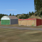
This is the scenery Les Grandes Bergeronnes ( CTH3 ) which represents the reality. Les Grandes Bergeronnes is a small village located on Northern bank of the St-Laurent river of Quebec at Canada. This scenery is design with FSDS and it accepts Mesh of Gilles Gauthier.This scenery has the function for FS-X.
| Filename: | CTH3_Canada_Quebec_Les_GrandesBergeronnes.zip |
| License: | Freeware |
| Added: | 31st December 2009, 04:53:04 |
| Downloads: | 567 |
| Author: | Regis Dassylva |
| Size: | 725.14 KB |
| Category: Flight Simulator X - Scenery | |
| CYLP Canada, Quebec, Longue-Pointe de Mingan |
|
Images related to this file:
File Description:
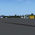
This scenery represents real the airport of Longue-Pointe of Mingan (CYLP).I carried out this scenery with FSDS. Longue-Pointe of Mingan is localised on northern bank of the St-Laurent river in Quebec, Canada. This scenery is built for FS-X.
| Filename: | CYLP_Canada_Quebec_LonguePointe_de_Mingan.zip |
| License: | Freeware |
| Added: | 31st December 2009, 04:53:13 |
| Downloads: | 2,295 |
| Author: | Regis Dassylva |
| Size: | 4.86 MB |
| Category: Flight Simulator X - Scenery | |
| CYNA Canada, Quebec, Natashquan |
|
Images related to this file:
File Description:
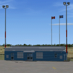
This scenery represents as much as possible the airport of Natashquan (CYNA). However, certain frontages of the buildings can farier, not having had the authorization to take photographs on the ground. This scene was built with FSDS and it is compatible for FS-X. Natashquan is located at Quebec, Canada on banks of the St-Laurent river. It is a small village of the Cote-Nord.
| Filename: | CYNA_Canada_Quebec_Natashquan.zip |
| License: | Freeware |
| Added: | 31st December 2009, 04:53:21 |
| Downloads: | 1,250 |
| Author: | Regis Dassylva |
| Size: | 4.53 MB |
| Category: Flight Simulator X - Scenery | |
| CTH3 Canada, Quebec, Les Grandes-Bergeronnes |
|
Images related to this file:
File Description:
This is the scenery Les Grandes Bergeronnes ( CTH3 ) which represents the reality. Les Grandes Bergeronnes is a small village located on Northern bank of the St-Laurent river of Quebec at Canada. This scenery is design with FSDS and it accepts Mesh of Gilles Gauthier.This scenery has the function for FS-X.
| Filename: | CTH3_Canada_Quebec_Les_GrandesBergeronnes.zip |
| License: | Freeware |
| Added: | 2nd January 2010, 04:37:53 |
| Downloads: | 849 |
| Author: | Regis Dassylva |
| Size: | 1.62 MB |
| Category: Flight Simulator X - Scenery | |
| Antigua |
|
File Description:
Scenery of Antigua
with inside
Redisign more accurate of all coasts and land class;
V.C. Bird International Airport (TAPA);
Citys :St. John's;
Roads and traffic adjust with land class.
| Filename: | Antigua.zip |
| License: | Freeware |
| Added: | 19th January 2010, 09:47:57 |
| Downloads: | 4,781 |
| Author: | valladier Jean Louis |
| Size: | 7.26 MB |


© 2001-2026 AVSIM Online
All Rights Reserved
Privacy Policy |