
Where Flight Simulation Enthusiasts Gather from Around the World!
AVSIM Library - Search Results

| Category: Flight Simulator X - Scenery | |
| Leconfield EGXV RAF Air Sea Rescue Airbase in the UK |

|
File Description:
Leconfield was an operational RAF base until the 70's and is now home to the Defence School of Transport and E Flight 202 Sqdn Air Sea Rescue, using Sea King Helicopters.
The scenery was created purely for my own interest and is not designed to be totally accurate. The idea is simply because it is my nearest airport and I like to fly from there.
| Filename: | Leconfield_EGXV_RAF_Air_Sea_Rescue_Airbase_in_the_.zip |
| License: | Freeware, limited distribution |
| Added: | 7th June 2008, 15:24:49 |
| Downloads: | 1,491 |
| Author: | Stewart W Allen |
| Size: | 464.97 KB |
| Category: Flight Simulator X - Scenery | |
| Termopoli Grecia |
|
File Description:
A flight in the history of ancient Greece have realized the scenario of Thermopylae where today you can see a monument that recalls the exploits of the Spartans against the Persian Empire The Battle of Thermopylae was fought by the Greek city-states, united in an alliance and guided by King Leonidas I of Sparta against the Persian empire ruled by Xerxes in September of 480 BC.
The VFR flight is to take off with a single propeller touring from LG53 (Lamia Greece) from the runway 13 and taking runway heading to reach 2500Ft coordinates N 38.47.15 E 22:30:37 to admire the scenery and return to the departure airport . In the package you will find a Termopoli.zip Termopoli_City.bgl files you will put in the folder scenery addon scenery folder and the scenario will be automatically activated. Good Flight
We accept criticism and advice [email protected]
| Filename: | Termopoli_Grecia.zip |
| License: | Freeware |
| Added: | 7th September 2016, 21:58:14 |
| Downloads: | 278 |
| Author: | Pasquale Marrulli |
| Size: | 1.67 KB |
| Category: Flight Simulator X - Scenery | |
| King Seaaero Seaplane Base - FL42 |
|
Images related to this file:
File Description:
King Seaaero Seaplane Base (FL42) is Located 02 miles NW of Winter Haven, Florida, business district. It is a private seaplane Base on 2 acres of LAKE Cannon. The scenery was made with Airport Facilitator X and Instant Scenery. I added Seaplane docks, static seaplane and land vehicles, and a small marina to make landing here more interesting. The real Seaplane base does not have docking for seaplanes/float planes.
| Filename: | King_Seaaero_Seaplane_Base__FL42.zip |
| License: | Freeware |
| Added: | 13th October 2011, 21:38:52 |
| Downloads: | 312 |
| Author: | Bruce Bouley |
| Size: | 5.95 MB |
| Category: Flight Simulator X - Scenery | |
| KMSP - Minneapolis-St Paul |
|
Images related to this file:
File Description:
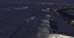
FSX Scenery KMSP
Ramp lights, moving airport
traffic, people, vehicles.
| Filename: | KMSP__MinneapolisSt_Paul.zip |
| License: | Freeware |
| Added: | 27th January 2011, 01:46:46 |
| Downloads: | 2,466 |
| Author: | Jimmy R. Martin |
| Size: | 1007.23 KB |
| Category: Flight Simulator X - Scenery | |
| FSX Default Lukla (VNLK) Airport Adjusted To its Real World Location |
|
Images related to this file:
File Description:

That is a adjustment of FSX default Lukla (VNLK) airport, the gateway to Everest climbing, in Nepal to its actual location! That freeware through its simplicity will mostly be useful. Freeware. Comes with a French readme too. by G. Guichard
| Filename: | FSX_Default_Lukla_VNLK_Airport_Adjusted_To_its_Rea.zip |
| License: | Freeware |
| Added: | 1st October 2018, 18:47:48 |
| Downloads: | 1,953 |
| Author: | G. Guichard |
| Size: | 477.01 KB |
| Category: Flight Simulator X - Scenery | |
| Aurora Muni - Greater Kankakee |
|
File Description:
FSX Scenery - Aurora Municipal Airport serves Chicago/Aurora and Kane County and is owned by the City Of Aurora. The airport has more than one runway. The longest is a paved runway extending 6500 feet. The facility is at an elevation of 706 feet at a distance of about 38 miles from Chicago. Greater Kankakee Airport serves Kankakee and Kankakee County and is owned by Kankakee Valley Arpt Auth. The airport has more than one runway. The longest is a paved runway extending 5979 feet. The facility is at an elevation of 629 feet at a distance of about 3 miles from Kankakee. Created with Instant Scenery. By John B. Loney, Jr.
| Filename: | Aurora_Muni__Greater_Kankakee.zip |
| License: | Freeware, limited distribution |
| Added: | 2nd November 2009, 20:05:32 |
| Downloads: | 500 |
| Author: | John B. Loney, Jr. |
| Size: | 1.11 MB |
| Category: Flight Simulator X - Scenery | |
| Sumter Municipal Airport KSMS |
|
Images related to this file:
File Description:
FSX Scenery - Sumter Municipal Airport (IATA: SMS, ICAO: KSMS, FAA LID: SMS) Sumter, South Carolina, United States, serves Sumter and Sumter County and is owned by the City & County Of Sumter. The airport has more than one runway. The longest is a paved runway extending 5500 feet. The facility is at an elevation of 183 feet at a distance of about 4 miles from Sumter. Created with Instant Scenery. For FS9 version, see ksms_fs9.zip. By John B. Loney, Jr.
| Filename: | Sumter_Municipal_Airport_KSMS.zip |
| License: | Freeware, limited distribution |
| Added: | 2nd November 2009, 20:05:22 |
| Downloads: | 351 |
| Author: | John B. Loney, Jr. |
| Size: | 439.12 KB |
| Category: Flight Simulator X - Scenery | |
| Ryan Field (KRYN) Update |
|
Images related to this file:
File Description:
FSX Scenery - This is an update of the Ryan Field (KRYN), Tucson, AZ designed by the author a little over two years ago for FS9. This file will make it compatible with FSX. The original scenery is required (kryn_v1.zip). By John B. Loney, Jr.
| Filename: | Ryan_Field_KRYN__Update.zip |
| License: | Freeware, limited distribution |
| Added: | 13th August 2010, 22:31:48 |
| Downloads: | 471 |
| Author: | John B. Loney, Jr. |
| Size: | 112.63 KB |
| Category: Flight Simulator X - Scenery | |
| McMinnville Municipal Airport (KMMV) - Update |
|
Images related to this file:
File Description:
FSX Scenery - This is an update of the McMinnville Municipal Airport (KMMV) designed by David "Opa" Marshall and myself a little less then 4 years ago for FS9. This is the scenery that features the Evergreen Aviation Museum across the road from the airport where Howard Hughes' Spruce Goose is on display. This file will make it compatible with FSX. Scenery tested with FSX SP2 only. The original scenery is required (kmmv_v1.zip). By John B. Loney, Jr.
| Filename: | McMinnville_Municipal_Airport_KMMV__Update.zip |
| License: | Freeware, limited distribution |
| Added: | 16th August 2010, 08:39:57 |
| Downloads: | 816 |
| Author: | John B. Loney, Jr. |
| Size: | 151.87 KB |
| Category: Flight Simulator X - Scenery | |
| Pocono Mountains Municipal Airport |
|
Images related to this file:
File Description:
FSX Scenery - Pocono Mountains Municipal Airport (KMPO) serves Mount Pocono and Monroe County, PA and is owned by Pocono Mtns Muni Arpt Auth. The airport has more than one runway. The longest is a paved runway extending 5001 feet. The facility is at an elevation of 1916 feet at a distance of about 2 miles from Mount Pocono. Includes the runway 13/31 which was extended to 5,001 ft x 75 ft. By John B. Loney, Jr.
| Filename: | Pocono_Mountains_Municipal_Airport.zip |
| License: | Freeware, limited distribution |
| Added: | 22nd February 2011, 23:05:51 |
| Downloads: | 594 |
| Author: | John B. Loney, Jr. |
| Size: | 738.21 KB |
© 2001-2026 AVSIM Online
All Rights Reserved
Privacy Policy |