
Where Flight Simulation Enthusiasts Gather from Around the World!
AVSIM Library - Search Results

| Category: Flight Simulator X - Scenery | |
| Alderney X-HD |

|
Images related to this file:
File Description:

Alderney is the smallest populated island in the cluster of Channel Islands, Again winds, fog and plenty of short runway makes for a very nice challenge. This scenery is perfect for VFR operations as it features the entire island of Alderney recreated in Photo-scenery. Also included are all the usual bells and whistles. This Scenery is perfect when joined with our other Channel Island products
| Filename: | Alderney_XHD.zip |
| License: | Freeware, limited distribution |
| Added: | 5th February 2017, 19:23:39 |
| Downloads: | 1,914 |
| Author: | Mark Piccolo - Soarfly Concepts |
| Size: | 127.09 MB |
| Category: Flight Simulator X - Scenery | |
| RAF Keevil |
|
File Description:
The airfield was built on a site previously ear-marked for the purpose in the mid-1930s. Consisting of 3 long concrete
runways the airfield was used by the Royal Air Force and the United States Army Air Forces Eighth and Ninth Air
Forces.
In 1942 Keevil airfield was provided to the USAAF and it was assigned USAAF designation 471 (KV). Squadrons based at
the unit transported military freight and supplies using C-47 and C-53 aircraft.
RAF Fighter Command use
Short Stirlings of Nos. 196 and 299 Squadrons RAF lining the runway at RAF Keevil on the evening of 5 June 1944 before
emplaning paratroops of the 5th Parachute Brigade Group for the invasion of Normandy With the departure of the
Americans, the RAF used Keevil beginning in March 1944 for 196 and 299 Squadron Short Stirling glider tugs of No. 38
Group RAF arrived followed by a large number of Horsa gliders, crewed by Army pilots of the Glider Pilot Regiment.
The RAF Stirling aircraft were crewed by RAF, RCAF, RAAF, RNZAF and SAAF personnel and were engaged in SOE and SAS
drops. largely in France, and in glider towing. Their involvement in the Normandy invasion of France and Operation
Market-Garden is well remembered by Keevil and Steeple Ashton villagers. Casualties of army and air force personnel
were heavy and a number of aircraft were lost.
With the end of military control, Keevil airfield is virtually complete with all of its runways, perimeter track and
many of the hardstands still in place. It is used occasionally for British Army and RAF exercises. The airfield is
still frequently used by the RAF for training purposes such as air drops and parachuting, the gate is always locked
and access is restricted to authorized key holders only. Ref ~ http://www.wdrcfc.org.uk/wp/about-2/clubrules/
Since 1992 it has been home to the Bannerdown Gliding Club, an RAF Gliding and Soaring Association Club, affiliated to
RAF Brize Norton since the closure of nearby RAF station at Lyneham. The airfield is also used as a motorsport circuit
for various events. It is also the home of the Warminster and District Radio Control flying club.
In September 1994 the Keevil Society, organised by Paul Vingoe, held a Commemorative Day to mark the 50th anniversary
of the D-Day and Arnhem operations and to dedicate a memorial to all who served at Keevil, especially those who flew
from there and lost their lives.
Source:Wikipedia
| Filename: | RAF_Keevil.zip |
| License: | Freeware |
| Added: | 5th February 2017, 19:55:43 |
| Downloads: | 174 |
| Author: | Terry Boissel |
| Size: | 24.39 KB |
| Category: Flight Simulator X - Scenery | |
| RAF Atcham |
|
File Description:
Royal Air Force Atcham or more simply RAF Atcham is a former Royal Air Force station located 5.0 miles (8.0 km) east of Shrewsbury, Shropshire, England, on the north eastern boundary of Attingham Park.
Initially built for RAF Fighter Command, during the Second World War its primary use was by the United States Army Air Forces (USAAF) Eighth Air Force. It was mainly the home of the 495th Fighter Training Group, where pilots were trained to fly Republic P-47 Thunderbolts although a few also were trained to fly twin-engined Lockheed P-38 Lightnings for both Eighth and Ninth Air Force units. Atcham continued to see use as a training base until it was returned to the RAF in March 1945.
Source:Wikipedia
| Filename: | RAF_Atcham.zip |
| License: | Freeware |
| Added: | 7th February 2017, 21:22:53 |
| Downloads: | 139 |
| Author: | Terry Boissel |
| Size: | 82.57 MB |
| Category: Flight Simulator X - Scenery | |
| RNAS Henstridge (HMS Dipper) |
|
File Description:
Royal Naval Air Station Henstridge or RNAS Henstridge (HMS Dipper) is a former Fleet Air Arm base located 7 miles (11 km) west of Shaftesbury, Dorset (Now Somerset) and 12.4 miles (20.0 km) east of Yeovil, Somerset in South West England.
The main part of the land (355 acres) was purchased in August 1941, after which building of the airfield and the marsh lane accommodation site commenced, it was commissioned on April 1, 1943 as HMS Dipper, principally as number 2 naval fighter school, on the 11th September 1942, another 18 acres was acquired at the adjoining gibbs marsh area for an aircraft repair and maintenance site. The design and lay-out of the airfield was quite unique, having 5 runways, 2 of these being east west lay-out (07-25) both 1000 yards long, the northern runway incorporated a dummy deck landing strip, complete with under-ground arresting gear with four above ground arrestor wires, which was a duplicate of that installed on HMS Implacable for training of aircraft carrier landings, these mainly being carried out with the Seafire, a naval version of the spitfire with folding wings. The site also had its own cinema and stage hall
March 1952 the airfield became inactive and was placed under care and maintenance, during 1953 Air whaling (now Bristow group) used the facilities for repairs to the whaling fleet of helicopters until moving out in June 1958.June 1957 it was finally closed as a naval establishment, from 1958-1960 the entire site was sold off. 27 June 1980 the BBC purchased the whole site and applied for planning permission to erect at the airfield a shortwave radio station consisting of 21 self-supporting towers holding aerial arrays and ancillary buildings on a 300-acre site. The station would transmit overseas radio services to Eastern Europe, the Soviet Union and perhaps South America the application failed and the BBC sold the land during January 1987 The airfield is also the home of the wessex strut, a general aviation club formed in January 1977, which holds an annual fly in and other events their first fly-in was on 17 April 1977 and attracted 107 aircraft. As of today the only usable runway is the north 07-25 runway, extant with the concrete dummy deck, and the underground machinery chamber, it is also the home to a large number of light aviation enthusiasts aircraft as well as the Yakolevs aerobatic display team and the Dorset and Somerset air ambulance
The current airfield is operated by EGHS and is an unlicensed airfield. The only usable runway is 07/25 tarmac/concrete 750 mts long x 6 mtr wide. Henstridge radio can be contacted on 130.250 MHz, it can be found at the south eastern stub of the Yeovilton MATZ
Source:Wikipedia
| Filename: | RNAS_Henstridge_HMS_Dipper.zip |
| License: | Freeware |
| Added: | 9th February 2017, 22:14:54 |
| Downloads: | 165 |
| Author: | Terry Boissel |
| Size: | 4.53 MB |
| Category: Flight Simulator X - Scenery | |
| TSTC Waco Airport (KCNW) v1.0 |
|
File Description:
Updated KCNW from Default Scenery to current specifications.
| Filename: | TSTC_Waco_Airport_KCNW_v10.zip |
| License: | Freeware |
| Added: | 11th February 2017, 03:23:37 |
| Downloads: | 193 |
| Author: | Matt Dupree |
| Size: | 634.44 KB |
| Category: Flight Simulator X - Scenery | |
| Frunze Tsentralny Aerodrome at Moscow's Khodynka field |
|
Images related to this file:
File Description:
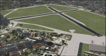
Frunze Tsentralny Aerodrome was Moscow's first airport and location of several aircraft constructors, e. g. Ilyushin.
The airport was finally closed in 2003 so in default FSX it is not present.
| Filename: | Frunze_Tsentralny_Aerodrome_at_Moscows_Khodynka_fi.zip |
| License: | Freeware |
| Added: | 11th February 2017, 15:07:43 |
| Downloads: | 273 |
| Author: | Mario Kassmann |
| Size: | 823.35 KB |
| Category: Flight Simulator X - Scenery | |
| FSX/Prepar3D Scenery--EGPH Edinburgh Airport |
|
Images related to this file:
File Description:
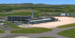
FSX/Prepar3D Scenery--EGPH Edinburgh Airport, Scotland, UK. A detailed version of the airport and surrounds. Requires ORBX EU Scotland scenery. Works with FSX, FSX Steam or Prepar3D. Works with or without Scotflight for ORBX. Auto-installing freeware by Scotflight Scenery (Iain Gallacher and Iain Murray).
| Filename: | FSXPrepar3D_SceneryEGPH_Edinburgh_Airport.zip |
| License: | Freeware |
| Added: | 11th February 2017, 19:03:17 |
| Downloads: | 428 |
| Author: | Scotflight (Iain Gallacher & Iain Murray) |
| Size: | 60.62 MB |
| Category: Flight Simulator X - Scenery | |
| RAF Catterick |
|
File Description:
RAF Catterick is located alongside the A1 on the outskirts of Catterick Village. Operationally it falls under the command of Catterick Garrison. It currently houses 5th Regiment Royal Artillery and 32 Engineer Regiment.
Catterick airfield first opened in 1914 as a Royal Flying Corps aerodrome with the role of training pilots and to assist in the defence of the North East of England. It came under RAF administration in 1918 and housed Number 49 Training Depot.
In 1927, it temporarily came under the administration of the British Army, under the Army Air Co-Operation Command which would supply the army with any air support needs that would be required. This continued until 1939 when the station was handed back to the RAF.
During the Second World War, the airfield operated a small satellite station called RAF Scorton near the village of Scorton.
Catterick's runway could not be extended from its existing 3,350 ft (1,020 m) for the jet age due to the perimeter being bounded by the Great North Road (A1) and the River Swale. Therefore, Catterick's importance declined after the Second World War, though it still housed training institutes for many years.
Source:Wikipedia
| Filename: | RAF_Catterick.zip |
| License: | Freeware |
| Added: | 18th February 2017, 19:17:37 |
| Downloads: | 128 |
| Author: | Terry Boissel |
| Size: | 1.91 MB |
| Category: Flight Simulator X - Scenery | |
| EKHV Haderslev FSX/P3D |
|
Images related to this file:
File Description:
Haderslev airport (EKHV) is a small private airport in southern Jutland.
This scenery covers the airport area and surrounding countryside, complete with detailed airport layout, a considerable number of added 3-D objects, hand placed autogen vegetation and an 80cm/pixel ortophoto ground map with full season support.
Among the functional improvements over the stock airport is a more realistic taxi and parking layout, not least the addition of parking spots of which there are none in the stock airport.
I have attempted to keep size to a minimum by using nothing but stock objects. So it's not photoreal, but probably about as good as it gets in 5½ megabytes. :)
| Filename: | EKHV_Haderslev_FSXP3D.zip |
| License: | Freeware |
| Added: | 19th February 2017, 20:55:10 |
| Downloads: | 654 |
| Author: | Jens Peter Pedersen |
| Size: | 4.81 MB |
| Category: Flight Simulator X - Scenery | |
| RAF Catfoss |
|
File Description:
RAF Catfoss was a Royal Air Force station during the Second World War. The airfield was opened in 1932 for an Armament Training Camp. A small number of fighters were posted there at the start of the Second World War, before the airfield was rebuilt as a bomber station. It closed in November 1945. The site was re-opened in 1959 as the site for the PGM-17 Thor ballistic missile. It closed again in 1963.
| Filename: | RAF_Catfoss.zip |
| License: | Freeware |
| Added: | 20th February 2017, 14:40:40 |
| Downloads: | 116 |
| Author: | Terry Boissel |
| Size: | 1.78 MB |


© 2001-2026 AVSIM Online
All Rights Reserved
Privacy Policy |